|
HNLMS Gelderland (1898)
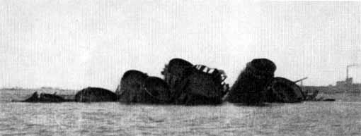
HNLMS ''Gelderland'' ( nl, Hr.Ms. Gelderland) was a protected cruiser of the Royal Netherlands Navy. During its career in the Dutch Navy it was most notable for being the ship Queen Wilhelmina sent to Portuguese East Africa to transport Paul Kruger to Europe during the Second Boer War. The ship was taken over by the Germans during World War II, rebuilt as an anti-aircraft cruiser and renamed ''Niobe''. Commissioned into the German navy on 1 March 1944, she was sunk in Kotka harbour in Finland on 16 July 1944. Service history The ship was built at the ''Maatschappij voor Scheeps- en Werktuigbouw Fijenoord'' in Rotterdam and launched on 28 September 1898. The ship was commissioned on 15 July 1900. On 22 November that year she arrived in Marseille with Paul Kruger who she had picked up in Lourenço Marques by order of the Dutch Government. After dropping Kruger off she left for the Dutch East Indies. During this trip while entering the harbor of Port Said she collided with the Brit ... [...More Info...] [...Related Items...] OR: [Wikipedia] [Google] [Baidu] |
Gelderland
Gelderland (), also known as Guelders () in English, is a province of the Netherlands, occupying the centre-east of the country. With a total area of of which is water, it is the largest province of the Netherlands by land area, and second by total area. Gelderland shares borders with six other provinces ( Flevoland, Limburg, North Brabant, Overijssel, South Holland and Utrecht) and the German state of North Rhine-Westphalia. The capital is Arnhem (pop. 159,265); however, Nijmegen (pop. 176,731) and Apeldoorn (pop. 162,445) are both larger municipalities. Other major regional centres in Gelderland are Ede, Doetinchem, Zutphen, Harderwijk, Tiel, Wageningen, Zevenaar, and Winterswijk. Gelderland had a population of 2,084,478 as of November 2019. It contains the Netherlands's largest forest region (the Veluwe), the Rhine and other major rivers, and a significant amount of orchards in the south ( Betuwe). History Historically, the province dates from states of the Holy Roman ... [...More Info...] [...Related Items...] OR: [Wikipedia] [Google] [Baidu] |
Marseille
Marseille ( , , ; also spelled in English as Marseilles; oc, Marselha ) is the prefecture of the French department of Bouches-du-Rhône and capital of the Provence-Alpes-Côte d'Azur region. Situated in the camargue region of southern France, it is located on the coast of the Gulf of Lion, part of the Mediterranean Sea, near the mouth of the Rhône river. Its inhabitants are called ''Marseillais''. Marseille is the second most populous city in France, with 870,731 inhabitants in 2019 (Jan. census) over a municipal territory of . Together with its suburbs and exurbs, the Marseille metropolitan area, which extends over , had a population of 1,873,270 at the Jan. 2019 census, the third most populated in France after those of Paris and Lyon. The cities of Marseille, Aix-en-Provence, and 90 suburban municipalities have formed since 2016 the Aix-Marseille-Provence Metropolis, an Indirect election, indirectly elected Métropole, metropolitan authority now in charge of wider metropo ... [...More Info...] [...Related Items...] OR: [Wikipedia] [Google] [Baidu] |
Cipriano Castro
José Cipriano Castro Ruiz (12 October 1858 – 4 December 1924) was a high-ranking member of the Venezuelan military, politician and the president of Venezuela from 1899 to 1908. He was the first man from the Andes to rule the country, and was the first of four military strongmen from the Andean state of Táchira to rule the country over the next 46 years. Early life Cipriano Castro was the son of José Carmen Castro and Pelagia Ruiz. He was born on 12 October 1858 in Capacho, Táchira. Castro's father was a mid-level farmer and he received an education typical of the tachirense middle-class. His family had significant mercantile and family relations with Colombia, in particular with Cúcuta and Puerto Santander. After studying in his native town and the city of San Cristóbal, he continued his studies at a seminary school in Pamplona, Colombia (1872–1873). He left those studies to return to San Cristóbal, where he began work as employee of a company called Van Dissel, T ... [...More Info...] [...Related Items...] OR: [Wikipedia] [Google] [Baidu] |
Den Helder
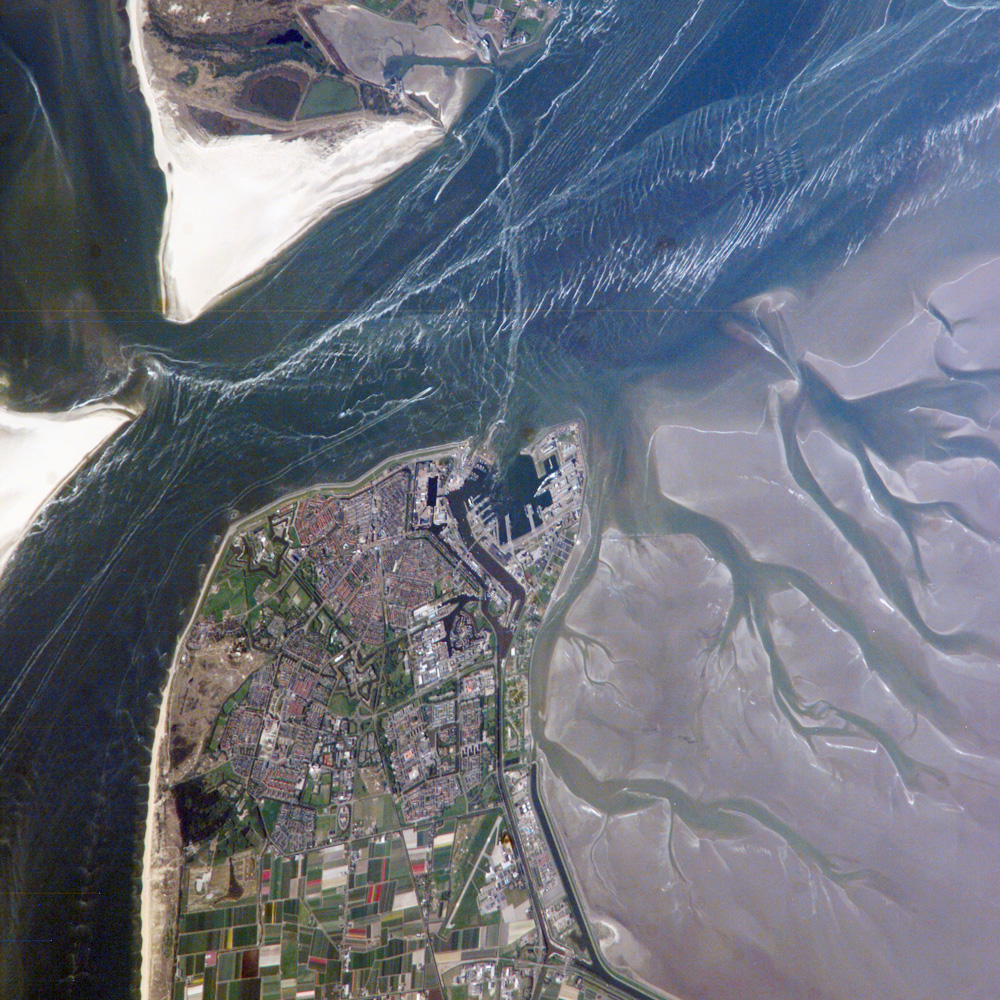
Den Helder () is a municipality and a city in the Netherlands, in the province of North Holland. Den Helder occupies the northernmost point of the North Holland peninsula. It is home to the country's main naval base. From here the Royal TESO ferryboat service operates the transportation link between Den Helder and the nearby Dutch Wadden island of Texel to the north. Etymology Before the year 1928 the official name of Den Helder was Helder. The origin of the name Helder is not entirely clear. The name Helder may have come from ''Helle/Helde'', which means "hill" or "hilly grounds", or from ''Helre'', which means a sandy ridge. Another explanation is that the name derived from ''Helsdeur'' (Hell's Door), likely because in the water between Den Helder and Texel (called Marsdiep) the current was so strong that many ships were lost. History Huisduinen was the original older part of the city, whereas Helder itself was a nearby smaller hamlet. When a harbour was built near Hel ... [...More Info...] [...Related Items...] OR: [Wikipedia] [Google] [Baidu] |
Tangier
Tangier ( ; ; ar, طنجة, Ṭanja) is a city in northwestern Morocco. It is on the Moroccan coast at the western entrance to the Strait of Gibraltar, where the Mediterranean Sea meets the Atlantic Ocean off Cape Spartel. The town is the capital of the Tanger-Tetouan-Al Hoceima region, as well as the Ṭanja-Aẓila Prefecture of Morocco. Many civilisations and cultures have influenced the history of Tangier, starting from before the 10th centuryBCE. Between the period of being a strategic Berber town and then a Phoenician trading centre to Morocco's independence era around the 1950s, Tangier was a nexus for many cultures. In 1923, it was considered as having international status by foreign colonial powers and became a destination for many European and American diplomats, spies, bohemians, writers and businessmen. The city is undergoing rapid development and modernisation. Projects include tourism projects along the bay, a modern business district called Tangier City Cent ... [...More Info...] [...Related Items...] OR: [Wikipedia] [Google] [Baidu] |
Algiers
Algiers ( ; ar, الجزائر, al-Jazāʾir; ber, Dzayer, script=Latn; french: Alger, ) is the capital and largest city of Algeria. The city's population at the 2008 Census was 2,988,145Census 14 April 2008: Office National des Statistiques de l'Algérie (web). and in 2020 was estimated to be around 4,500,000. Algiers is located on the Mediterranean Sea and in the north-central portion of Algeria. Algiers is situated on the west side of a bay of the Mediterranean Sea. The modern part of the city is built on the level ground by the seashore; the old part, the ancient city of the deys, climbs the steep hill behind the modern town and is crowned by the Casbah or citadel (a UNESCO World Heritage Site), above the sea. The casbah and the two quays form a triangle. Names The city's name is derived via French and Catalan ''Origins of Algiers'' by Louis Leschi, speech delivered June 16, 1941, published in ''El Djezair Sheets'', July 194History of Algeria . from the Arabic name '' ... [...More Info...] [...Related Items...] OR: [Wikipedia] [Google] [Baidu] |
Perim
Perim ( ar, بريم 'Barīm'', also called Mayyun in Arabic, is a volcanic island in the Strait of Mandeb at the south entrance into the Red Sea, off the south-west coast of Yemen and belonging to Yemen. It administratively belongs to Dhubab District or Bab al-Mandab District, Taiz Governorate. The island of Perim divides the strait of Mandeb into two channels. The island, as a dependency of Aden, was a part of the British Empire between 1857 and 1967. Name In ancient time, it was called "the island of Diodorus" ( el, Διοδώρου νῆσος, la, Diodori insula). It is mentioned by Pliny the Elder, by the author of the ''Periplus of the Erythraean Sea'' and in Ptolemy's Geography. ''Perim'' possibly derives from the Arab term ''Barim'' (chain) associated with the history of the Straits and one of its Arab names, the other Arab name being Mayyun. The Portuguese called it Majun or Meho (from Mayyun), although Albuquerque had solemnly named the island ''Vera Cruz'' in 1 ... [...More Info...] [...Related Items...] OR: [Wikipedia] [Google] [Baidu] |
Mahé, India
Mahé, also known as Mayyazhi, is a small town in the Mahé district of the Puducherry Union Territory. It is situated at the mouth of the Mahé River and is surrounded by the State of Kerala. The Kannur District surrounds Mahé on three sides and Kozhikode District from one side. Formerly part of French India, Mahé now forms a municipality in Mahé district, one of the four districts of the Union Territory of Puducherry. Mahé has one representative in the Puducherry Legislative Assembly. Etymology The name ''Mahé'' derives from ''Mayyazhi'', the name given to the local river and region in the Malayalam language.The original spelling found on French documents from the early 1720s is ''Mayé'', with ''Mahé'' and ''Mahié'' also found on documents, maps and geographical dictionaries until the early 19th century when the spelling Mahé became the norm. Therefore, the belief that the name of the town was given in honour of Bertrand François Mahé de La Bourdonnais (1699– ... [...More Info...] [...Related Items...] OR: [Wikipedia] [Google] [Baidu] |
Tanjung Priok
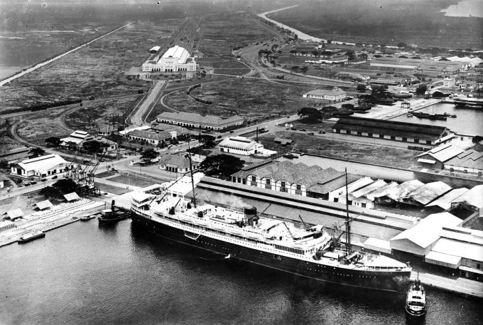
Tanjung Priok is a district of North Jakarta, Indonesia. It hosts the western part of the city's main harbor, the Port of Tanjung Priok (located in Tanjung Priok District and Koja District). The district of Tanjung Priok is bounded by Laksamana Yos Sudarso Tollway and Sunter River canal to the east, by Kali Japat, Kali Ancol, and the former Kemayoran Airport to the southwest, by Sunter Jaya Road and Sunter Kemayoran Road to the south, and by Jakarta Bay to the north. History Before human development, the coastal area of what is now Tanjung Priok was an area of brackish water with swamp and mangrove forest. The old harbor of Jakarta During the colonial era, Batavia at first relied on the Sunda Kelapa harbor area. This meant that Batavia had a harbor system like many others cities. I.e. an anchorage at sea at some distance from the city, and a city harbor where smaller ships could attach to a quay. It meant that big ships like the Dutch East Indiamen and later ships safely anc ... [...More Info...] [...Related Items...] OR: [Wikipedia] [Google] [Baidu] |
Sumatra
Sumatra is one of the Sunda Islands of western Indonesia. It is the largest island that is fully within Indonesian territory, as well as the sixth-largest island in the world at 473,481 km2 (182,812 mi.2), not including adjacent islands such as the Simeulue, Nias, Mentawai, Enggano, Riau Islands, Bangka Belitung and Krakatoa archipelago. Sumatra is an elongated landmass spanning a diagonal northwest–southeast axis. The Indian Ocean borders the northwest, west, and southwest coasts of Sumatra, with the island chain of Simeulue, Nias, Mentawai, and Enggano off the western coast. In the northeast, the narrow Strait of Malacca separates the island from the Malay Peninsula, which is an extension of the Eurasian continent. In the southeast, the narrow Sunda Strait, containing the Krakatoa Archipelago, separates Sumatra from Java. The northern tip of Sumatra is near the Andaman Islands, while off the southeastern coast lie the islands of Bangka and Belitung, Karim ... [...More Info...] [...Related Items...] OR: [Wikipedia] [Google] [Baidu] |
Surabaya
Surabaya ( jv, ꦱꦸꦫꦧꦪ or jv, ꦯꦹꦫꦨꦪ; ; ) is the capital city of the Provinces of Indonesia, Indonesian province of East Java and the List of Indonesian cities by population, second-largest city in Indonesia, after Jakarta. Located on the northeastern border of Java island, on the Madura Strait, it is one of the earliest port cities in Southeast Asia. According to the Government of Indonesia, National Development Planning Agency, Surabaya is one of the Regions of Indonesia#Development regions, four main central cities of Indonesia, alongside Jakarta, Medan, and Makassar. The city has a population of 2.87 million within its city limits at the 2020 census and 9.5 million in the extended Surabaya metropolitan area, making it the List of metropolitan areas in Indonesia, second-largest metropolitan area in Indonesia. The city was settled in the 10th century by the Janggala, Kingdom of Janggala, one of the two Javanese kingdoms that was formed in 1045 when ... [...More Info...] [...Related Items...] OR: [Wikipedia] [Google] [Baidu] |
Suez
Suez ( ar, السويس '; ) is a seaport city (population of about 750,000 ) in north-eastern Egypt, located on the north coast of the Gulf of Suez (a branch of the Red Sea), near the southern terminus of the Suez Canal, having the same boundaries as Suez Governorate. It has three harbours, Adabiya, Ain Sokhna and Port Tawfiq, and extensive port facilities. Together they form a metropolitan area, located mostly in Africa with a small portion in Asia. Railway lines and highways connect the city with Cairo, Port Said, and Ismailia. Suez has a petrochemical plant, and its oil refineries have pipelines carrying the finished product to Cairo. These are represented in the flag of the governorate: the blue background refers to the sea, the gear refers to Suez's status as an industrial governorate, and the flame refers to the petroleum firms of Suez. The modern city of Suez is a successor of the ancient city of Clysma (, meaning "surf, waves that break"; ; ), a major Red Sea por ... [...More Info...] [...Related Items...] OR: [Wikipedia] [Google] [Baidu] |


