|
Sarangesa Seineri
''Sarangesa seineri'', the dusted elfin or dark elfin, is a butterfly of the family Hesperiidae. It is found in Natal, the former Transvaal and Botswana and from Zimbabwe to Kenya and the DRC. The wingspan is 36–38 mm for males and 38–40 mm for females. Adults are on wing year-round, although they are scarcer in winter and the dry season. The larvae feed on '' Peristrophe hensii''. Subspecies *''Sarangesa seineri seineri'' – Kenya to Malawi, Zambia, DRC: Katanga, Angola, Mozambique, Zimbabwe, Botswana, northern Namibia, South Africa: north of Soutpansberg in Limpopo to northern Gauteng and northern Mpumalanga *''Sarangesa seineri durbana'' Evans, 1937 – Eswatini, KwaZulu-Natal and Mpumalanga Mpumalanga () is a province of South Africa. The name means "East", or literally "The Place Where the Sun Rises" in the Swazi, Xhosa, Ndebele and Zulu languages. Mpumalanga lies in eastern South Africa, bordering Eswatini and Mozambique. It ... References ... [...More Info...] [...Related Items...] OR: [Wikipedia] [Google] [Baidu] |
Embrik Strand
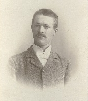
Embrik Strand (2 June 1876 – 3 November 1947) was an entomologist and arachnologist who classified many insect and spider species including the greenbottle blue tarantula. Life and career Strand was born in Ål, Norway. He studied at the University of Kristiania (now University of Oslo). Around 1900 he focused on collecting insect specimens from Norway. These are now deposited at the university's museum, where he worked as a curator from 1901 to 1903. After studying at the University of Oslo Strand traveled in Norway from 1898 to 1903 collecting a great number of insects. For part of this time (1901–1903) he was a conservator in the museum of zoology of the university. He then left for Germany where he continued his studies of zoology at the University of Marburg (1903), then he worked with State Museum of Natural History Stuttgart (1905) and, later, that of Tübingen and then with Senckenberg Museum in Frankfurt. From 1907, he worked with Natural History Museum, Ber ... [...More Info...] [...Related Items...] OR: [Wikipedia] [Google] [Baidu] |
Katanga Province
Katanga was one of the four large provinces created in the Belgian Congo in 1914. It was one of the eleven provinces of the Democratic Republic of the Congo between 1966 and 2015, when it was split into the Tanganyika Province, Tanganyika, Haut-Lomami, Lualaba Province, Lualaba, and Haut-Katanga provinces. Between 1971 and 1997 (during the rule of Mobutu Sese Seko when Congo was known as Zaire), its official name was Shaba Province. Katanga's area encompassed . Farming and ranching are carried out on the Katanga Plateau. The eastern part of the province is considered to be a rich mining region, which supplies cobalt, copper, tin, radium, uranium, and diamonds. The region's former capital, Lubumbashi, is the second-largest city in the Congo. History Copper mining in Katanga dates back over 1,000 years, and mines in the region were producing standard-sized ingots of copper for international transport by the end of the 10th century CE. In the 1890s, the province was beleaguered ... [...More Info...] [...Related Items...] OR: [Wikipedia] [Google] [Baidu] |
KwaZulu-Natal
KwaZulu-Natal (, also referred to as KZN and known as "the garden province") is a province of South Africa that was created in 1994 when the Zulu bantustan of KwaZulu ("Place of the Zulu" in Zulu) and Natal Province were merged. It is located in the southeast of the country, with a long shoreline on the Indian Ocean and sharing borders with three other provinces and the countries of Mozambique, Eswatini and Lesotho. Its capital is Pietermaritzburg, and its largest city is Durban. It is the second-most populous province in South Africa, with slightly fewer residents than Gauteng. Two areas in KwaZulu-Natal have been declared UNESCO World Heritage Sites: the iSimangaliso Wetland Park and the uKhahlamba Drakensberg Park. These areas are extremely scenic as well as important to the surrounding ecosystems. During the 1830s and early 1840s, the northern part of what is now KwaZulu-Natal was established as the Zulu Kingdom while the southern part was, briefly, the Boer Natalia Repu ... [...More Info...] [...Related Items...] OR: [Wikipedia] [Google] [Baidu] |
Eswatini
Eswatini ( ; ss, eSwatini ), officially the Kingdom of Eswatini and formerly named Swaziland ( ; officially renamed in 2018), is a landlocked country in Southern Africa. It is bordered by Mozambique to its northeast and South Africa to its north, west, south, and southeast. At no more than north to south and east to west, Eswatini is one of the smallest countries in Africa; despite this, its climate and topography are diverse, ranging from a cool and mountainous highveld to a hot and dry lowveld. The population is composed primarily of ethnic Swazis. The prevalent language is Swazi (''siSwati'' in native form). The Swazis established their kingdom in the mid-18th century under the leadership of Ngwane III. The country and the Swazi take their names from Mswati II, the 19th-century king under whose rule the country was expanded and unified; its boundaries were drawn up in 1881 in the midst of the Scramble for Africa. After the Second Boer War, the kingdom, under the name of ... [...More Info...] [...Related Items...] OR: [Wikipedia] [Google] [Baidu] |
Mpumalanga
Mpumalanga () is a province of South Africa. The name means "East", or literally "The Place Where the Sun Rises" in the Swazi, Xhosa, Ndebele and Zulu languages. Mpumalanga lies in eastern South Africa, bordering Eswatini and Mozambique. It constitutes 6.5% of South Africa's land area. It shares borders with the South African provinces of Limpopo to the north, Gauteng to the west, the Free State to the southwest, and KwaZulu-Natal to the south. The capital is Mbombela. Mpumalanga was formed in 1994, when the area that was the Eastern Transvaal was merged with the former bantustans KaNgwane, KwaNdebele and parts of Lebowa and Gazankulu. Although the contemporary borders of the province were only formed at the end of apartheid, the region and its surroundings has a history that extends back thousands of years. Much of its history, and current significance is as a region of trade. History Precolonial Era Archeological sites in the Mpumalanga region indicate settlement b ... [...More Info...] [...Related Items...] OR: [Wikipedia] [Google] [Baidu] |
Gauteng
Gauteng ( ) is one of the nine provinces of South Africa. The name in Sotho-Tswana languages means 'place of gold'. Situated on the Highveld, Gauteng is the smallest province by land area in South Africa. Although Gauteng accounts for only 1.5% of the country's land area, it is home to more than a quarter of its population (26%). Highly urbanised, the province contains the country's largest city, Johannesburg, which is also one of the largest cities in the world. Gauteng is the wealthiest province in South Africa and is considered as the financial hub of not only South Africa but the entire African continent, mostly concentrated in Johannesburg. It also contains the administrative capital, Pretoria, and other large areas such as Midrand, Vanderbijlpark, Ekurhuleni and the affluent Sandton. Gauteng is the most populous province in South Africa with a population of approximately 16.1 million people according to mid year 2022 estimates. Etymology The name ''Gauteng'' is derived ... [...More Info...] [...Related Items...] OR: [Wikipedia] [Google] [Baidu] |
Limpopo
Limpopo is the northernmost province of South Africa. It is named after the Limpopo River, which forms the province's western and northern borders. The capital and largest city in the province is Polokwane, while the provincial legislature is situated in Lebowakgomo. The province is made up of 3 former homelands of Lebowa, Gazankulu and Venda and the former parts of the Transvaal province. The Limpopo province was established as one of the new nine provinces after South Africa's first democratic election on the 27th of April 1994. The province's name was first "Northern Transvaal", later changed to "Northern Province" on the 28th of June 1995, together with two other provinces. The name was later changed again in 2002 to the Limpopo province. Limpopo is made up of 3 main ethnic groups namely; Pedi people, Tsonga and Venda people. Traditional leaders and chiefs still form a strong backbone of the province's political landscape. Established in terms of the Limpopo House of Tr ... [...More Info...] [...Related Items...] OR: [Wikipedia] [Google] [Baidu] |
Soutpansberg
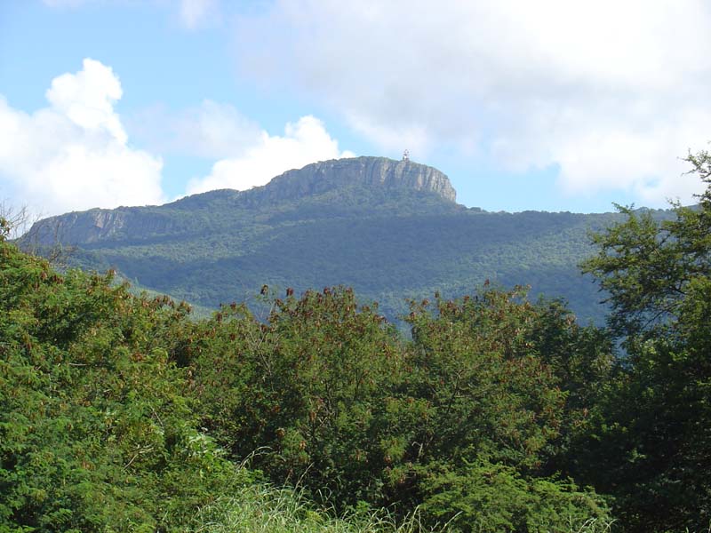
The Soutpansberg, (formerly ''Zoutpansberg'') meaning "Salt Pan Mountain" in Afrikaans, is a Mountain range, range of mountains in far northern South Africa. It is located in Vhembe District Municipality, Vhembe District, Limpopo. It is named for the Salt pan (geology), salt pan ( ve, Thavha ya muno, or "place of salt") located at its western end. The mountain range reaches the opposite extremity in the Matikwa Nature Reserve, some due east. The range as a whole had no Venda language, Venda name, as it was instead known by its sub-ranges which include Dzanani, Hanglip, Songozwi and others. Of late it is however known as Tha vhani ya muno, meaning "mountain of salt". The Soutpansberg forms part of the 'Vhembe Biosphere Reserve', which was designated as a biosphere reserve by UNESCO in 2009. The latter reserve also includes the Blouberg Range, Kruger National Park, Makgabeng Plateau, Makuleke Wetlands and the Mapungubwe Cultural Landscape. Geography The mountain is intersected by t ... [...More Info...] [...Related Items...] OR: [Wikipedia] [Google] [Baidu] |
South Africa
South Africa, officially the Republic of South Africa (RSA), is the southernmost country in Africa. It is bounded to the south by of coastline that stretch along the South Atlantic and Indian Oceans; to the north by the neighbouring countries of Namibia, Botswana, and Zimbabwe; and to the east and northeast by Mozambique and Eswatini. It also completely enclaves the country Lesotho. It is the southernmost country on the mainland of the Old World, and the second-most populous country located entirely south of the equator, after Tanzania. South Africa is a biodiversity hotspot, with unique biomes, plant and animal life. With over 60 million people, the country is the world's 24th-most populous nation and covers an area of . South Africa has three capital cities, with the executive, judicial and legislative branches of government based in Pretoria, Bloemfontein, and Cape Town respectively. The largest city is Johannesburg. About 80% of the population are Black South Afri ... [...More Info...] [...Related Items...] OR: [Wikipedia] [Google] [Baidu] |
Namibia
Namibia (, ), officially the Republic of Namibia, is a country in Southern Africa. Its western border is the Atlantic Ocean. It shares land borders with Zambia and Angola to the north, Botswana to the east and South Africa to the south and east. Although Kazungula, it does not border Zimbabwe, less than 200 metres (660 feet) of the Botswanan right bank of the Zambezi, Zambezi River separates the two countries. Namibia gained independence from South Africa on 21 March 1990, following the Namibian War of Independence. Its capital and largest city is Windhoek. Namibia is a member state of the United Nations (UN), the Southern African Development Community (SADC), the African Union (AU) and the Commonwealth of Nations. The driest country in sub-Saharan Africa, Namibia has been inhabited since pre-historic times by the San people, San, Damara people, Damara and Nama people. Around the 14th century, immigration, immigrating Bantu peoples arrived as part of the Bantu expansion. Since ... [...More Info...] [...Related Items...] OR: [Wikipedia] [Google] [Baidu] |
Mozambique
Mozambique (), officially the Republic of Mozambique ( pt, Moçambique or , ; ny, Mozambiki; sw, Msumbiji; ts, Muzambhiki), is a country located in southeastern Africa bordered by the Indian Ocean to the east, Tanzania to the north, Malawi and Zambia to the northwest, Zimbabwe to the west, and Eswatini and South Africa to the southwest. The sovereign state is separated from the Comoros, Mayotte and Madagascar by the Mozambique Channel to the east. The capital and largest city is Maputo. Notably Northern Mozambique lies within the monsoon trade winds of the Indian Ocean and is frequentely affected by disruptive weather. Between the 7th and 11th centuries, a series of Swahili port towns developed on that area, which contributed to the development of a distinct Swahili culture and language. In the late medieval period, these towns were frequented by traders from Somalia, Ethiopia, Egypt, Arabia, Persia, and India. The voyage of Vasco da Gama in 1498 marked the arrival of t ... [...More Info...] [...Related Items...] OR: [Wikipedia] [Google] [Baidu] |
Angola
, national_anthem = " Angola Avante"() , image_map = , map_caption = , capital = Luanda , religion = , religion_year = 2020 , religion_ref = , coordinates = , largest_city = capital , official_languages = Portuguese , languages2_type = National languages , languages2 = , ethnic_groups = , ethnic_groups_ref = , ethnic_groups_year = 2000 , demonym = , government_type = Unitary dominant-party presidential republic , leader_title1 = President , leader_name1 = João Lourenço , leader_title2 = Vice President , leader_name2 = Esperança da CostaInvestidura do Pr ... [...More Info...] [...Related Items...] OR: [Wikipedia] [Google] [Baidu] |


