|
Michaelson Road Bridge
Michaelson Road Bridge is a road bridge connecting Central Barrow to Barrow Island in south Cumbria, England. The original high-level bridge was a swing bridge and then replaced by a pair of lift and roll bridges constructed between 1800 and 1884 then superseded by a more modern pair of bascule bridges in the mid 1960s. It was built at a time when Barrow Island was actually an island and there was strong call for road access between mainland Barrow at the shipyard on Barrow Island. Traffic on the bridge was soon relieved when an old Victorian dock was filled in and space was created for the huge Devonshire Dock Hall complex, traffic now runs along the north side of the building on the A590. Trams formerly operated across the bridge, but now it solely used for vehicles and pedestrians. A second Devonshire Dock footbridge is planned in the multimillion-pound Waterfront Barrow-in-Furness development. See also * Barrow-in-Furness * Barrow Island * Port of Barrow The Port of ... [...More Info...] [...Related Items...] OR: [Wikipedia] [Google] [Baidu] |
Barrow-in-Furness
Barrow-in-Furness is a port town in Cumbria, England. Historic counties of England, Historically in Lancashire, it was incorporated as a municipal borough in 1867 and merged with Dalton-in-Furness Urban District in 1974 to form the Borough of Barrow-in-Furness. In 2023 the borough will merge with Eden and South Lakeland districts to form a new unitary authority; Westmorland and Furness. At the tip of the Furness, Furness peninsula, close to the Lake District, it is bordered by Morecambe Bay, the Duddon Estuary and the Irish Sea. In 2011, Barrow's population was 56,745, making it the second largest urban area in Cumbria after Carlisle, Cumbria, Carlisle. Natives of Barrow, as well as the local dialect, are known as Barrovian. In the Middle Ages, Barrow was a small hamlet (place), hamlet within the parish of Dalton-in-Furness with Furness Abbey, now on the outskirts of the town, controlling the local economy before its Dissolution of the Monasteries, dissolution in 1537. The iron ... [...More Info...] [...Related Items...] OR: [Wikipedia] [Google] [Baidu] |
Bascule Bridge
A bascule bridge (also referred to as a drawbridge or a lifting bridge) is a moveable bridge with a counterweight that continuously balances a span, or leaf, throughout its upward swing to provide clearance for boat traffic. It may be single- or double-leafed. The name comes from the French term for balance scale, which employs the same principle. Bascule bridges are the most common type of movable span because they open quickly and require relatively little energy to operate, while providing the possibility for unlimited vertical clearance for marine traffic. History Bascule bridges have been in use since ancient times, but until the adoption of steam power in the 1850s, very long, heavy spans could not be moved quickly enough for practical application. Types There are three types of bascule bridge and the counterweights to the span may be located above or below the bridge deck. The fixed- trunnion (sometimes a "Chicago" bascule) rotates around a large axle that raises th ... [...More Info...] [...Related Items...] OR: [Wikipedia] [Google] [Baidu] |
Central Barrow
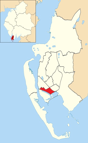
Central Barrow refers both to the town centre of Barrow-in-Furness, Cumbria, England and to the electoral ward that roughly covers the eastern part of that town centre. In 2001 5,584 ( ranking 5th out of 13) lived in the Central ward. The population density was 55.96 per hectare, which was well above the local average of 9.24, and England average, 3.77. The population of Central ward had reduced to 4,583 at the 2011 Census. Central Barrow is amongst the 3% most deprived areas in the country and households have an average weekly income around £100 lower than the region's average, however the area being the central business district of the town is also home to many of Barrow's retail outlets, as well as a large amount of offices, restaurants and governmental buildings. Part of the £200 million Waterfront Barrow-in-Furness project is being constructed in the southern part of Central Barrow (including the new Marina Village). The ward itself will be combined with Barrow Island a ... [...More Info...] [...Related Items...] OR: [Wikipedia] [Google] [Baidu] |
Barrow Island, Barrow-in-Furness
Barrow Island is an area and electoral ward of Barrow-in-Furness, Cumbria, England. Originally separate from the British mainland, land reclamation in the 1860s saw the northern fringes of the island connected to Central Barrow. Barrow Island is also bound to the south and east by the town's dock system and to the west by Walney Channel. The Ward population taken at the 2011 census was 2,616. The ward itself will be combined with Central and Hindpool wards in April 2023 following formation of the new Westmorland and Furness Local Authority and be named 'Old Barrow'. Background and history The name of the town of Barrow-in-Furness is believed to derive from the Norse word ''Barrae'', meaning ''Bare Island'', which actually referred to Barrow Island. Since the 1860s the island has been connected to the mainland as its channel was modified to form two docks, the Buccleuch Dock and the Devonshire Dock. The remainder of its channel has also now been developed as part of the do ... [...More Info...] [...Related Items...] OR: [Wikipedia] [Google] [Baidu] |
Cumbria
Cumbria ( ) is a ceremonial and non-metropolitan county in North West England, bordering Scotland. The county and Cumbria County Council, its local government, came into existence in 1974 after the passage of the Local Government Act 1972. Cumbria's county town is Carlisle, in the north of the county. Other major settlements include Barrow-in-Furness, Kendal, Whitehaven and Workington. The administrative county of Cumbria consists of six districts ( Allerdale, Barrow-in-Furness, Carlisle, Copeland, Eden and South Lakeland) and, in 2019, had a population of 500,012. Cumbria is one of the most sparsely populated counties in England, with 73.4 people per km2 (190/sq mi). On 1 April 2023, the administrative county of Cumbria will be abolished and replaced with two new unitary authorities: Westmorland and Furness ( Barrow-in-Furness, Eden, South Lakeland) and Cumberland ( Allerdale, Carlisle, Copeland). Cumbria is the third largest ceremonial county in England by ... [...More Info...] [...Related Items...] OR: [Wikipedia] [Google] [Baidu] |
England
England is a country that is part of the United Kingdom. It shares land borders with Wales to its west and Scotland to its north. The Irish Sea lies northwest and the Celtic Sea to the southwest. It is separated from continental Europe by the North Sea to the east and the English Channel to the south. The country covers five-eighths of the island of Great Britain, which lies in the North Atlantic, and includes over 100 smaller islands, such as the Isles of Scilly and the Isle of Wight. The area now called England was first inhabited by modern humans during the Upper Paleolithic period, but takes its name from the Angles, a Germanic tribe deriving its name from the Anglia peninsula, who settled during the 5th and 6th centuries. England became a unified state in the 10th century and has had a significant cultural and legal impact on the wider world since the Age of Discovery, which began during the 15th century. The English language, the Anglican Church, and Engli ... [...More Info...] [...Related Items...] OR: [Wikipedia] [Google] [Baidu] |
Island
An island (or isle) is an isolated piece of habitat that is surrounded by a dramatically different habitat, such as water. Very small islands such as emergent land features on atolls can be called islets, skerries, cays or keys. An island in a river or a lake island may be called an eyot or ait, and a small island off the coast may be called a holm. Sedimentary islands in the Ganges delta are called chars. A grouping of geographically or geologically related islands, such as the Philippines, is referred to as an archipelago. There are two main types of islands in the sea: continental and oceanic. There are also artificial islands, which are man-made. Etymology The word ''island'' derives from Middle English ''iland'', from Old English ''igland'' (from ''ig'' or ''ieg'', similarly meaning 'island' when used independently, and -land carrying its contemporary meaning; cf. Dutch ''eiland'' ("island"), German ''Eiland'' ("small island")). However, the spelling of the ... [...More Info...] [...Related Items...] OR: [Wikipedia] [Google] [Baidu] |
Port Of Barrow
The Port of Barrow refers to the enclosed dock system within the town of Barrow-in-Furness, England. Morecambe Bay is to the east of the port and the Irish Sea surrounds it to the south and west. The port is currently owned and operated by Associated British Ports Holdings, but some land is shared with BAE Systems Submarine Solutions. Currently consisting of four large docks, the Port of Barrow is one of North West England's most important ports. The docks are as follows: Buccleuch Dock, Cavendish Dock, Devonshire Dock and Ramsden Dock. The port of Barrow is the only deep water port between the Mersey and the Clyde. Barrow shipyard is one of the largest in the United Kingdom (it has built well over 800 vessels in its history), rivalled only by those in Belfast, Birkenhead and Govan. It is also home to the country's only submarine production facility. The port is heavily involved with the transportation of natural gases and other forms of energy from local sites such a ... [...More Info...] [...Related Items...] OR: [Wikipedia] [Google] [Baidu] |
Devonshire Dock Hall
Devonshire Dock Hall (often abbreviated to ''DDH'') is a large indoor shipbuilding and assembly complex that forms part of the BAE Systems shipyard in the Barrow Island area of Barrow-in-Furness, Cumbria, England. History Constructed between 1982 and 1986 by Alfred McAlpine plc for Vickers Shipbuilding and Engineering, DDH was built on land that was created by infilling part of Devonshire Dock with 2.4 million tonnes of sand pumped from nearby Roosecote Sands. The purpose of the indoor shipbuilding facility was to protect vessels from external weather conditions and prevent satellites from photographing secret technologies involved. DDH provides a controlled environment for ship and submarine assembly, and avoids the difficulties caused by building on the slope of traditional slipways. Outside the hall, a 24,300-tonne capacity shiplift allows completed vessels to be lowered into the water independently of the tide. Vessels can also be lifted out of the water and transferred to ... [...More Info...] [...Related Items...] OR: [Wikipedia] [Google] [Baidu] |
A590 Road
The A590 is a trunk road in southern Cumbria, in the north-west of England. It runs north-east to south-west from M6 junction 36, through the towns of Ulverston and Barrow-in-Furness to terminate at Biggar Bank on Walney Island.A590: M6 J36 (Crooklands) – Walney Island SABRE; retrieved 07-05-08 The road is a mixture of and , with the section east of |
The Waterfront Barrow-in-Furness
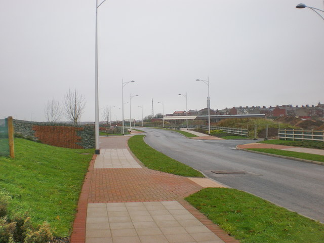
The Waterfront Barrow-in-Furness is a £200 million development under construction in and around the Port of Barrow, England. The site covers an area of some and was due for completion in 2020. The internal road network is already complete, with construction of a large business park complex ongoing and work on a 400-berth marina and 650 home Marina Village due to start thereafter. In 2010, The Waterfront Barrow-in-Furness ranked as the ninetieth most costly regeneration project in the United Kingdom by Regeneration & Renewal. Progress on the project stalled between 2010 and 2016 due to complications with funding following the disabandonment of the North West Regional Development Agency. BAE Systems opened a large logistics warehouse named the Resolution Building on Dova Way within the designated Business Park Area in October 2016, while and construction of a new access road from Salthouse Road to the Marina Village commenced in May 2017. Background and history A 400-berth ... [...More Info...] [...Related Items...] OR: [Wikipedia] [Google] [Baidu] |
Bridges In Cumbria
A bridge is a structure built to span a physical obstacle (such as a body of water, valley, road, or rail) without blocking the way underneath. It is constructed for the purpose of providing passage over the obstacle, which is usually something that is otherwise difficult or impossible to cross. There are many different designs of bridges, each serving a particular purpose and applicable to different situations. Designs of bridges vary depending on factors such as the function of the bridge, the nature of the terrain where the bridge is constructed and anchored, and the material used to make it, and the funds available to build it. The earliest bridges were likely made with fallen trees and stepping stones. The Neolithic people built boardwalk bridges across marshland. The Arkadiko Bridge (dating from the 13th century BC, in the Peloponnese) is one of the oldest arch bridges still in existence and use. Etymology The ''Oxford English Dictionary'' traces the origin of the ... [...More Info...] [...Related Items...] OR: [Wikipedia] [Google] [Baidu] |


_-_geograph.org.uk_-_872779.jpg)
