|
Central Barrow
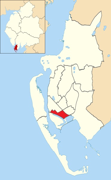
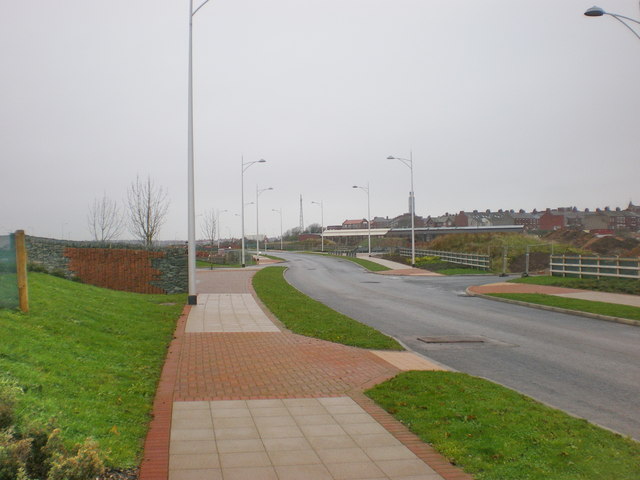
Central Barrow refers both to the town centre of Barrow-in-Furness, Cumbria, England and to the electoral ward that roughly covers the eastern part of that town centre. In 2001 5,584 ( ranking 5th out of 13) lived in the Central ward. The population density was 55.96 per hectare, which was well above the local average of 9.24, and England average, 3.77. The population of Central ward had reduced to 4,583 at the 2011 Census. Central Barrow is amongst the 3% most deprived areas in the country and households have an average weekly income around £100 lower than the region's average, however the area being the central business district of the town is also home to many of Barrow's retail outlets, as well as a large amount of offices, restaurants and governmental buildings. Part of the £200 million Waterfront Barrow-in-Furness project is being constructed in the southern part of Central Barrow (including the new Marina Village). The ward itself will be combined with Barrow Island a ... [...More Info...] [...Related Items...] OR: [Wikipedia] [Google] [Baidu] |
Barrow-in-Furness (borough)
Barrow-in-Furness is a local government district with borough status in Cumbria, England. It is named after its main town, Barrow-in-Furness. Other settlements include Dalton-in-Furness and Askam-in-Furness. It is the smallest district in the county, but is the most densely populated, with 924 people per square kilometre. The population was 71,980 in 2001, reducing to 69,087 at the 2011 Census. In July 2021 the Ministry of Housing, Communities and Local Government announced that in April 2023, Cumbria will be reorganised into two unitary authorities. Barrow-in-Furness Borough Council is to be abolished and its functions transferred to a new authority, to be known as Westmorland and Furness, which will cover the current districts of Barrow-in-Furness, Eden and South Lakeland. In April 2022 Gareth Davies became the first person to run every single street in the Borough of Barrow-In-Furness. Covering all 1,026 streets over an end to end distance of 201 miles. Background The ... [...More Info...] [...Related Items...] OR: [Wikipedia] [Google] [Baidu] |
Cumbria
Cumbria ( ) is a ceremonial and non-metropolitan county in North West England, bordering Scotland. The county and Cumbria County Council, its local government, came into existence in 1974 after the passage of the Local Government Act 1972. Cumbria's county town is Carlisle, in the north of the county. Other major settlements include Barrow-in-Furness, Kendal, Whitehaven and Workington. The administrative county of Cumbria consists of six districts (Allerdale, Barrow-in-Furness, Carlisle, Copeland, Eden and South Lakeland) and, in 2019, had a population of 500,012. Cumbria is one of the most sparsely populated counties in England, with 73.4 people per km2 (190/sq mi). On 1 April 2023, the administrative county of Cumbria will be abolished and replaced with two new unitary authorities: Westmorland and Furness (Barrow-in-Furness, Eden, South Lakeland) and Cumberland (Allerdale, Carlisle, Copeland). Cumbria is the third largest ceremonial county in England by area. It is ... [...More Info...] [...Related Items...] OR: [Wikipedia] [Google] [Baidu] |
Barrow And Furness (UK Parliament Constituency)
Barrow and Furness, formerly known as Barrow-in-Furness, is a constituency in Cumbria which has been represented in the House of Commons of the UK Parliament by Simon Fell of the Conservative Party since 2019. History and profile The seat of was established by the Redistribution of Seats Act 1885 and covers the southwest part of Cumbria. The largest town in the constituency, Barrow-in-Furness, grew on the back of the shipbuilding industry and is now the site of the BAE Systems nuclear submarine and shipbuilding operation. This reliance on the industry aligns many of its columnists and in its community with strong nuclear deterrents, from which Labour has recoiled since its involvement in the Iraq War that removed dictator Saddam Hussain. Labour Cabinet member Albert Booth represented Barrow from 1966 for many years but was defeated in 1983, in the aftermath of the Falklands War, by a Manchester lawyer, Cecil Franks of the Conservative Party, who retained the seat until 19 ... [...More Info...] [...Related Items...] OR: [Wikipedia] [Google] [Baidu] |
Barrow-in-Furness
Barrow-in-Furness is a port town in Cumbria, England. Historically in Lancashire, it was incorporated as a municipal borough in 1867 and merged with Dalton-in-Furness Urban District in 1974 to form the Borough of Barrow-in-Furness. In 2023 the borough will merge with Eden and South Lakeland districts to form a new unitary authority; Westmorland and Furness. At the tip of the Furness peninsula, close to the Lake District, it is bordered by Morecambe Bay, the Duddon Estuary and the Irish Sea. In 2011, Barrow's population was 56,745, making it the second largest urban area in Cumbria after Carlisle. Natives of Barrow, as well as the local dialect, are known as Barrovian. In the Middle Ages, Barrow was a small hamlet within the parish of Dalton-in-Furness with Furness Abbey, now on the outskirts of the town, controlling the local economy before its dissolution in 1537. The iron prospector Henry Schneider arrived in Furness in 1839 and, with other investors, opened th ... [...More Info...] [...Related Items...] OR: [Wikipedia] [Google] [Baidu] |
England
England is a country that is part of the United Kingdom. It shares land borders with Wales to its west and Scotland to its north. The Irish Sea lies northwest and the Celtic Sea to the southwest. It is separated from continental Europe by the North Sea to the east and the English Channel to the south. The country covers five-eighths of the island of Great Britain, which lies in the North Atlantic, and includes over 100 smaller islands, such as the Isles of Scilly and the Isle of Wight. The area now called England was first inhabited by modern humans during the Upper Paleolithic period, but takes its name from the Angles, a Germanic tribe deriving its name from the Anglia peninsula, who settled during the 5th and 6th centuries. England became a unified state in the 10th century and has had a significant cultural and legal impact on the wider world since the Age of Discovery, which began during the 15th century. The English language, the Anglican Church, and Eng ... [...More Info...] [...Related Items...] OR: [Wikipedia] [Google] [Baidu] |
Wards Of The United Kingdom
The wards and electoral divisions in the United Kingdom are electoral districts at sub-national level, represented by one or more councillors. The ward is the primary unit of English electoral geography for civil parishes and borough and district councils, the electoral ward is the unit used by Welsh principal councils, while the electoral division is the unit used by English county councils and some unitary authorities. Each ward/division has an average electorate of about 5,500 people, but ward population counts can vary substantially. As of 2021 there are 8,694 electoral wards/divisions in the UK. England The London boroughs, metropolitan boroughs and non-metropolitan districts (including most unitary authorities) are divided into wards for local elections. However, county council elections (as well as those for several unitary councils which were formerly county councils, such as the Isle of Wight and Shropshire Councils) instead use the term ''electoral division''. ... [...More Info...] [...Related Items...] OR: [Wikipedia] [Google] [Baidu] |
Hectare
The hectare (; SI symbol: ha) is a non-SI metric unit of area equal to a square with 100- metre sides (1 hm2), or 10,000 m2, and is primarily used in the measurement of land. There are 100 hectares in one square kilometre. An acre is about and one hectare contains about . In 1795, when the metric system was introduced, the ''are'' was defined as 100 square metres, or one square decametre, and the hectare (" hecto-" + "are") was thus 100 ''ares'' or km2 (10,000 square metres). When the metric system was further rationalised in 1960, resulting in the International System of Units (), the ''are'' was not included as a recognised unit. The hectare, however, remains as a non-SI unit accepted for use with the SI and whose use is "expected to continue indefinitely". Though the dekare/decare daa (1,000 m2) and are (100 m2) are not officially "accepted for use", they are still used in some contexts. Description The hectare (), although not a unit of SI, ... [...More Info...] [...Related Items...] OR: [Wikipedia] [Google] [Baidu] |
North West England
North West England is one of nine official regions of England and consists of the ceremonial counties of England, administrative counties of Cheshire, Cumbria, Greater Manchester, Lancashire and Merseyside. The North West had a population of 7,052,000 in 2011. It is the Countries of the United Kingdom by population, third-most-populated region in the United Kingdom, after the South East England, South East and Greater London. The largest settlements are Manchester and Liverpool. Subdivisions The official Regions of England, region consists of the following Subdivisions of England, subdivisions: After abolition of the Greater Manchester and Merseyside County Councils in 1986, power was transferred to the metropolitan boroughs, making them equivalent to unitary authorities. In April 2011, Greater Manchester gained a top-tier administrative body in the form of the Greater Manchester Combined Authority, which means the 10 Greater Manchester boroughs are once again second-ti ... [...More Info...] [...Related Items...] OR: [Wikipedia] [Google] [Baidu] |
Central Business District
A central business district (CBD) is the commercial and business centre of a city. It contains commercial space and offices, and in larger cities will often be described as a financial district. Geographically, it often coincides with the " city centre" or " downtown". However, these concepts are not necessarily synonymous: many cities have a central ''business'' district located away from its commercial and or cultural centre and or downtown/city centre, and there may be multiple CBDs within a single urban area. The CBD will often be characterised by a high degree of accessibility as well as a large variety and concentration of specialised goods and services compared to other parts of the city. For instance, Midtown Manhattan, New York City, is the largest central business district in the city and in the United States. London's city centre is usually regarded as encompassing the historic City of London and the medieval City of Westminster, while the City of London and the trans ... [...More Info...] [...Related Items...] OR: [Wikipedia] [Google] [Baidu] |
The Waterfront Barrow-in-Furness
The Waterfront Barrow-in-Furness is a £200 million development under construction in and around the Port of Barrow, England. The site covers an area of some and was due for completion in 2020. The internal road network is already complete, with construction of a large business park complex ongoing and work on a 400-berth marina and 650 home Marina Village due to start thereafter. In 2010, The Waterfront Barrow-in-Furness ranked as the ninetieth most costly regeneration project in the United Kingdom by Regeneration & Renewal. Progress on the project stalled between 2010 and 2016 due to complications with funding following the disabandonment of the North West Regional Development Agency. BAE Systems opened a large logistics warehouse named the Resolution Building on Dova Way within the designated Business Park Area in October 2016, while and construction of a new access road from Salthouse Road to the Marina Village commenced in May 2017. Background and history A 400-berth m ... [...More Info...] [...Related Items...] OR: [Wikipedia] [Google] [Baidu] |
Westmorland And Furness
Westmorland and Furness is a future unitary authority area in north-west England, which will come into being on 1 April 2023 on the abolition of Cumbria County Council, together with Cumberland. The council will cover the areas currently served by the districts of Barrow-in-Furness, Eden and South Lakeland, which will also cease to function. It will include all of the area of the historic county of Westmorland as well as the Furness district of historic Lancashire. It will also incorporate a very small part of historic Yorkshire together with about a quarter of the area of the historic county of Cumberland. The district will sit within the ceremonial county of Cumbria, which will no longer have any administrative function. The first elections to the new authority took place in May 2022, with the Westmorland and Furness Council acting as a 'shadow authority' until the abolition of the three former districts and Cumbria County Council on 1 April 2023. Background Elections t ... [...More Info...] [...Related Items...] OR: [Wikipedia] [Google] [Baidu] |


.jpg)
