|
Mamirauá Sustainable Development Reserve
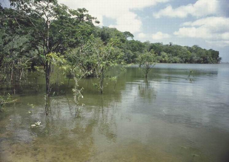
The Mamirauá Sustainable Development Reserve ( pt, Reserva de Desenvolvimento Sustentável Mamirauá) in the Brazilian state of Amazonas, near the city of Tefé, is a reserve near the village of Boca do Mamirauá. It includes mostly Amazonian flooded forest and wetlands. The ribeirinhos are native to the area. Location The Mamirauá Sustainable Development Reserve is divided between the municipalities of Uarini (18.68%), Tonantins (1.24%), Maraã (26.74%), Japurá (1.33%) and Fonte Boa (52.01%) in the state of Amazonas. It has an area of . It covers the elongated triangle between the Solimões River (Upper Amazon) to the south, the Auati-Paraná Canal, which leaves the Solimões and meanders in a generally eastward direction to join the Japurá River to the north, and the Japurá from the junction with the Auati-Paraná to the point where it joins the Solimões. It adjoins the Auatí-Paraná Extractive Reserve to the north. The Amanã Sustainable Development Reserve l ... [...More Info...] [...Related Items...] OR: [Wikipedia] [Google] [Baidu] |
Brazil
Brazil ( pt, Brasil; ), officially the Federative Republic of Brazil (Portuguese: ), is the largest country in both South America and Latin America. At and with over 217 million people, Brazil is the world's fifth-largest country by area and the seventh most populous. Its capital is Brasília, and its most populous city is São Paulo. The federation is composed of the union of the 26 states and the Federal District. It is the largest country to have Portuguese as an official language and the only one in the Americas; one of the most multicultural and ethnically diverse nations, due to over a century of mass immigration from around the world; and the most populous Roman Catholic-majority country. Bounded by the Atlantic Ocean on the east, Brazil has a coastline of . It borders all other countries and territories in South America except Ecuador and Chile and covers roughly half of the continent's land area. Its Amazon basin includes a vast tropical forest, ho ... [...More Info...] [...Related Items...] OR: [Wikipedia] [Google] [Baidu] |
Amanã Sustainable Development Reserve
Amanã Sustainable Development Reserve ( pt, Reserva de Desenvolvimento Sustentável Amanã) is a sustainable development reserve in the state of Amazonas, Brazil. Location The Amanã Sustainable Development Reserve (RDS) covers in the north-central part of Amazonas. It covers parts of the municipalities of Maraã, Codajás, Barcelos and Coari. It partly overlaps with the Jaú National Park to its east. To the north the RDS adjoins the Rio Unini Extractive Reserve. To the west it is bounded by the Japurá River and the Mamirauá Sustainable Development Reserve on the other side of the river. The reserve is in the area of the middle course of the Solimões River, near the point where it is joined by the Japurá River, and is about west of Manaus. It contains Amanã Lake, , the largest lake in the Amazon region. The reserve connects the Mamirauá Sustainable Development Reserve to its south west with the Jaú National Park. The three form one of the largest contiguous ... [...More Info...] [...Related Items...] OR: [Wikipedia] [Google] [Baidu] |
Purus Várzea
The Purus várzea (NT0156) is an ecoregion of seasonally flooded várzea forest in the central Amazon basin. It is part of the Amazon biome. The ecoregion is home to a vegetation adapted to floods of up to that may last for eight months. There is a great variety of fish and birds, but relatively fewer mammals. Ground-dwelling mammals must migrate to higher ground during the flood season. Threats include logging, cattle farming, over-fishing and mercury pollution from gold mining. Location The Purus várzea is a low-lying region of the central Amazon basin that is seasonally flooded. It covers of eastern Colombia and western Brazil. It extends along most of the Juruá, central Purus, and Caquetá ( Japurá) rivers and their tributaries. In the east it reaches the confluence of the Japurá and Solimões Rivers. Urban centers in or around the region are Tefé, Tabatinga and Carauarí. To the southeast the varzea adjoins the Purus–Madeira moist forests, and to the northeast ... [...More Info...] [...Related Items...] OR: [Wikipedia] [Google] [Baidu] |
Saimiri Vanzolinii Mamiraua
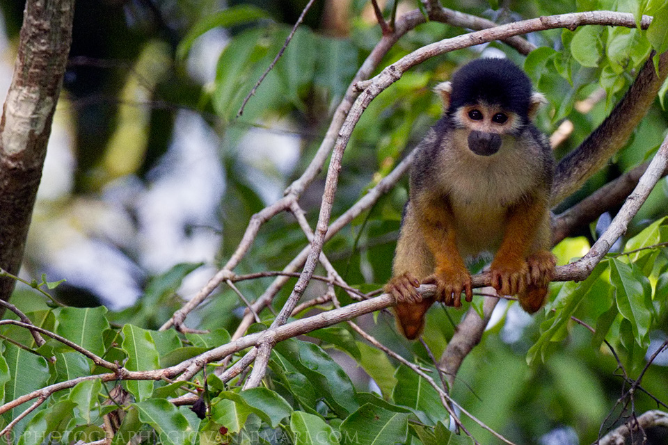
Squirrel monkeys are New World monkeys of the genus ''Saimiri''. ''Saimiri'' is the only genus in the subfamily Saimirinae. The name of the genus is of Tupi origin (''sai-mirím'' or ''çai-mbirín'', with ''sai'' meaning 'monkey' and ''mirím'' meaning 'small') and was also used as an English name by early researchers. Squirrel monkeys live in the tropical forests of Central and South America in the canopy layer. Most species have parapatric or allopatric ranges in the Amazon, while ''S. oerstedii'' is found disjunctly in Costa Rica and Panama. There are two main groups of squirrel monkeys recognized. They are differentiated based on the shape of the white coloration above the eyes. In total there are 5 recognized species. Squirrel monkeys have short and close fur colored black at the shoulders, yellow or orange fur along the back and extremities, and white on the face. Squirrel monkeys have determined breeding seasons which involve large fluctuations in hormones and there i ... [...More Info...] [...Related Items...] OR: [Wikipedia] [Google] [Baidu] |
Kokama People
The Kokama (also spelled Cocama, ) are an indigenous ethnic group of the Amazon that historically spoke the Cocama language Cocama (Kokáma) is a language spoken by thousands of people in western South America. It is spoken along the banks of the Northeastern lower Ucayali, lower Marañón, and Huallaga rivers and in neighboring areas of Brazil and an isolated .... Today, the Kokama live in Peru, Brazil, and Colombia. References Indigenous peoples of the Amazon {{SouthAm-ethno-group-stub ... [...More Info...] [...Related Items...] OR: [Wikipedia] [Google] [Baidu] |
Cambeba
The Omagua people (also known as the Umana, Cambeba, and Kambeba) are an indigenous people in Brazil's Amazon Basin. Their territory, when first in contact with Spanish explorers in the 16th century, was on the Amazon River upstream from the present-day city of Manaus extending into Peru. They speak the Omagua language. The Omagua exist today in small numbers, but they were a populous, organized society in the late Pre-Columbian era. Their population suffered steep decline, mostly from infectious diseases, in the early years of the Columbian Exchange. During the 18th century, the Omagua largely abandoned their indigenous identity in response to prejudice and racism that marginalized aboriginal peoples in Brazil and Peru. More tolerant attitudes led to a renewed tribal identity starting in the 1980s. The name ''Cambeba'' seems to have been applied by other neighboring tribes and refers to the Omagua custom of flattening their children's heads by binding a piece of wood to the for ... [...More Info...] [...Related Items...] OR: [Wikipedia] [Google] [Baidu] |
Ticuna
The Ticuna (also Magüta, Tucuna, Tikuna, or Tukuna) are an indigenous people of Brazil (36,000'')'', Colombia (6,000), and Peru (7,000). They are the most numerous tribe in the Brazilian Amazon. History The Ticuna were originally a tribe that lived far away from the rivers and whose expansion was kept in check by neighboring people. Their historical lack of access to waterways and their practice of endogamy has led to the Ticuna being culturally and genetically distinct from other Amazonian tribes. The first contact with outsiders occurred on the colonization of Brazil when a Portuguese fleet exploring the Amazon came into contact with the Ticuna. Sustained contact with the Portuguese and other outsiders began in 1649. Since the Ticuna lived relatively inland compared to other tribes they were less affected by the diseases and violence caused by colonialism, hence why the Ticuna today have the largest population of any Amazonian people. When the Europeans initiated warfare wit ... [...More Info...] [...Related Items...] OR: [Wikipedia] [Google] [Baidu] |
Caboclo
A caboclo () is a person of mixed Indigenous Brazilian and European ancestry, or, less commonly, a culturally assimilated or detribalized person of full Amerindian descent. In Brazil, a ''caboclo'' generally refers to this specific type of '' mestiço''. The term, also pronounced "caboco", is from Brazilian Portuguese, and perhaps ultimately from the Tupi ''kaa'boc''. It means a "person having copper-coloured skin" A person of mixed Indigenous Brazilian and sub-Saharan black ancestry is known as a "'' cafuzo''." In the 1872 and 1890 censuses, 3.90% and 9.04% of the population self-identified as caboclos, respectively. Since then, caboclos are counted as pardos, along with mulattoes (mixed Black-White) and cafuzos (mixed Amerindian-Black). A survey performed in Rio de Janeiro showed that 14% of Whites and 6% of Pardos reported a mixed Amerindian and White ancestry. According to the Mexican researcher Lizcano, based on a non genetic based estimation, caboclos (''mestizo ... [...More Info...] [...Related Items...] OR: [Wikipedia] [Google] [Baidu] |
José Márcio Ayres
José Márcio Corrêa Ayres (February 21, 1954 – March 7, 2003) was a Brazilian primatologist and conservationist who founded the Mamirauá Sustainable Development Reserve in 1996, followed by the Amanã Sustainable Development Reserve in 1998. The two reserves are located in the central region of the Brazilian state of Amazonas, and are joined to adjacent Jaú National Park to form a corridor spanning over of protected rainforest. Ayres devoted his life to the preservation of the unique biota and ecosystems of the Amazon, as well as to developing a method by which rural dwellers would benefit from the conservation of natural resources. He realized that the uakari monkeys he had been studying for his doctoral thesis would stand no chance of survival unless new community-based models of natural resource management were applied to the much exploited Amazon river basin. Ayres' doctorate in primatology at Sidney Sussex College, Cambridge in 1986 was for his thesis ''Uakaris and ... [...More Info...] [...Related Items...] OR: [Wikipedia] [Google] [Baidu] |
Anavilhanas National Park
Anavilhanas National Park ( pt, Parque Nacional de Anavilhanas) is a national park that encompasses a huge river archipelago in the Rio Negro in the state of Amazonas, Brazil. It is part of a World Heritage Site. Location The park is in the municipalities of Manaus and Novo Airão. It is managed by the Chico Mendes Institute for Biodiversity Conservation. The fluvial part of the park, 60% of the total, has more than 400 islands. It is about long and on average wide, with a total area of . The park is bounded to the north and east by the Rio Negro Left Bank Environmental Protection Area, a sustainable use conservation area created in 1995. The fluvial section extends to the west shore of the Rio Negro, which is mainly protected by the Rio Negro Right Bank Environmental Protection Area and the Rio Negro Sustainable Development Reserve. The terrain ranges in altitude from above sea level. Average annual rainfall is . Temperatures range from . The park contains a variety of ... [...More Info...] [...Related Items...] OR: [Wikipedia] [Google] [Baidu] |
Central Amazon Ecological Corridor
The Central Amazon Ecological Corridor ( pt, Corredor Ecológico Central da Amazônia) is an ecological corridor in the state of Amazonas, Brazil, that connects a number of conservation units in the Amazon rainforest. The objective is to maintain genetic connectivity between the protected areas without penalizing the local people, where possible using participatory planning that involves all affected actors. Location The Central Amazon Ecological Corridor connects a number of conservation units in the central Amazon region with a combined area of . The corridor covers parts of the Solimões and Negro river basins, mostly in the state of Amazonas but with a small portion in the state of Pará. The main urban centers in the corridor are the cities of Manaus, Manacapuru and Tefé. If indigenous territories are included, over 70% of the corridor was contained in protected areas in 2005. The corridor is of great ecological importance. It includes parts of several major rivers wi ... [...More Info...] [...Related Items...] OR: [Wikipedia] [Google] [Baidu] |


