|
Kushan Pass
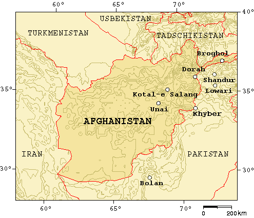
The Kushan Pass or Kaoshan Pass (el. about 4,370 m or 14,340 ft) is a mountain pass just west of the famous Salang Pass (3,878 m. or 12,723 ft.) in the Hindu Kush mountain range of northern Afghanistan. These two passes provided the most direct, if difficult, routes across the imposing east–west wall of the Hindu Kush mountains which divide northern Afghanistan or Tokharistan from Kabul province, which is closely connected to southern Afghanistan and Pakistan. Nowadays, the Salang tunnel constructed by the Soviets in the 1960s, and the paved road through it make it by far the easiest route through the Hindu Kush Mountains. Vincent Smith states that Alexander the Great took his troops across both the Khawak Pass and the Kaoshān or Kushan Pass."Towards the close of spring in the year 327 B.C. when the sun had sufficiently melted the snows, he lexander the Greatled his army, including perhaps fifty or sixty thousand Europeans, across the lofty Khāwak and Kaoshān passes ... [...More Info...] [...Related Items...] OR: [Wikipedia] [Google] [Baidu] |
Afghanistan
Afghanistan, officially the Islamic Emirate of Afghanistan,; prs, امارت اسلامی افغانستان is a landlocked country located at the crossroads of Central Asia and South Asia. Referred to as the Heart of Asia, it is bordered by Pakistan to the Durand Line, east and south, Iran to the Afghanistan–Iran border, west, Turkmenistan to the Afghanistan–Turkmenistan border, northwest, Uzbekistan to the Afghanistan–Uzbekistan border, north, Tajikistan to the Afghanistan–Tajikistan border, northeast, and China to the Afghanistan–China border, northeast and east. Occupying of land, the country is predominantly mountainous with plains Afghan Turkestan, in the north and Sistan Basin, the southwest, which are separated by the Hindu Kush mountain range. , Demographics of Afghanistan, its population is 40.2 million (officially estimated to be 32.9 million), composed mostly of ethnic Pashtuns, Tajiks, Hazaras, and Uzbeks. Kabul is the country's largest city and ser ... [...More Info...] [...Related Items...] OR: [Wikipedia] [Google] [Baidu] |
Rabatak Inscription
The Rabatak Inscription is an stone inscribed with text written in the Bactrian language and Greek script, found in 1993 at the site of Rabatak, near Surkh Kotal in Afghanistan. The inscription relates to the rule of the Kushan emperor Kanishka, and gives remarkable clues on the genealogy of the Kushan dynasty. It dates to the 2nd century CE. Discovery The Rabatak inscription was found near the top of an artificial hill, a Kushan site, near the main Kabul-Mazar highway, to the southeast of the Rabatak pass which is currently the border between Baghlan and Samangan provinces. It was found by Afghan mujahideen digging a trench at the top of the site, along with several other stone sculptural elements such as the paws of a giant stone lion, which have since disappeared. An English aid worker who belonged to the demining organization HALO Trust, witnessed and took a photograph of the inscription, before reporting the discovery. This photograph was sent to the British Museum, w ... [...More Info...] [...Related Items...] OR: [Wikipedia] [Google] [Baidu] |
Landforms Of Baghlan Province
A landform is a natural or anthropogenic land feature on the solid surface of the Earth or other planetary body. Landforms together make up a given terrain, and their arrangement in the landscape is known as topography. Landforms include hills, mountains, canyons, and valleys, as well as shoreline features such as bays, peninsulas, and seas, including submerged features such as mid-ocean ridges, volcanoes, and the great ocean basins. Physical characteristics Landforms are categorized by characteristic physical attributes such as elevation, slope, orientation, stratification, rock exposure and soil type. Gross physical features or landforms include intuitive elements such as berms, mounds, hills, ridges, cliffs, valleys, rivers, peninsulas, volcanoes, and numerous other structural and size-scaled (e.g. ponds vs. lakes, hills vs. mountains) elements including various kinds of inland and oceanic waterbodies and sub-surface features. Mountains, hills, plateaux, and plains are the fo ... [...More Info...] [...Related Items...] OR: [Wikipedia] [Google] [Baidu] |
Mountain Passes Of Afghanistan
A mountain is an elevated portion of the Earth's crust, generally with steep sides that show significant exposed bedrock. Although definitions vary, a mountain may differ from a plateau in having a limited summit area, and is usually higher than a hill, typically rising at least 300 metres (1,000 feet) above the surrounding land. A few mountains are isolated summits, but most occur in mountain ranges. Mountains are formed through tectonic forces, erosion, or volcanism, which act on time scales of up to tens of millions of years. Once mountain building ceases, mountains are slowly leveled through the action of weathering, through slumping and other forms of mass wasting, as well as through erosion by rivers and glaciers. High elevations on mountains produce colder climates than at sea level at similar latitude. These colder climates strongly affect the ecosystems of mountains: different elevations have different plants and animals. Because of the less hospitable terrain and ... [...More Info...] [...Related Items...] OR: [Wikipedia] [Google] [Baidu] |
Termez
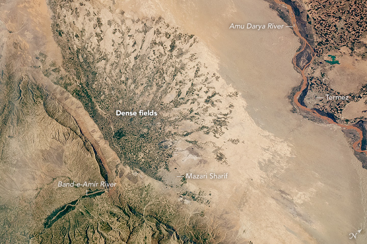
Termez ( uz, Termiz/Термиз; fa, ترمذ ''Termez, Tirmiz''; ar, ترمذ ''Tirmidh''; russian: Термез; Ancient Greek: ''Tàrmita'', ''Thàrmis'', ) is the capital of Surxondaryo Region in southern Uzbekistan. Administratively, it is a district-level city. Its population is 182,800 (2021). It is notable as the site of Alexander the Great's city Alexandria on the Oxus, as a center of Early Buddhism, as a site of Muslim pilgrimage, and as a base of Soviet Union military operations in Afghanistan, accessible via the nearby Hairatan border crossing. Etymology Some link the name of the city to the Greek word Θέρμος (''thermos''), meaning "hot", and date the toponym to the rule of Alexander the Great. Others suggest that it came from Sanskrit तर्मतो (''taramato''), meaning "on the river bank". History Ancient times One of Central Asia's oldest towns, Old Termez, located a few kilometers west of the modern city along the Amu Darya river, was establish ... [...More Info...] [...Related Items...] OR: [Wikipedia] [Google] [Baidu] |
Mazari Sharif
, official_name = , settlement_type = City , image_skyline = , pushpin_map = Afghanistan#Bactria#West Asia , pushpin_label = Mazar-i-Sharif , pushpin_label_position = bottom , pushpin_mapsize = , pushpin_relief = yes , pushpin_map_caption = Location in Afghanistan , coordinates = , subdivision_type = Country , subdivision_name = Afghanistan , subdivision_type1 = Province , subdivision_type2 = District , subdivision_name1 = Balkh Province , subdivision_name2 = Mazar-i-Sharif District , established_title = , established_date = , leader_title = Mayor , leader_name = Abdullhaq Khurami , area_total_km2 = , area_land_km2 ... [...More Info...] [...Related Items...] OR: [Wikipedia] [Google] [Baidu] |
Khulm
Kholm or Khulm (Dari/Pashto: خلم), formerly known as Tashqurghan (Dari/Uzbek: تاشقرغان), is a town in Balkh Province of northern Afghanistan, 60 km east of Mazar-i-Sharif one-third of the way to Kunduz. Kholm is an ancient town located on the fertile, inland delta fan of the Khulm River (Darya-i- Tashqurghan). As such, it is an agriculturally rich locale and densely populated. It is famous for its covered market, and is a centre for trading in sheep and wood. The town was once part of Samangan Province, now in the Khulm District of Balkh. Etymology The original name Tashqurghan (also romanized ''Tashkorghan'') is Uzbeki word for "stone mausoleum/kurgan". The town's name was changed to Kholm (also romanized ''Khulm'') during the Pashtunisation of northern Afghanistan by the central government headed by Minister of the Interior, Wazir Mohammad Gul Khan. History and background For many centuries Afghanistan was located on the old serais (along the Silk Road) ... [...More Info...] [...Related Items...] OR: [Wikipedia] [Google] [Baidu] |
Kunduz
, native_name_lang = prs , other_name = , settlement_type = City , image_skyline = Kunduz River valley.jpg , imagesize = 300 , image_alt = , image_caption = , image_flag = , flag_size = , flag_alt = , flag_border = , flag_link = , image_seal = , seal_size = , seal_alt = , seal_link = , seal_type = , image_shield = , shield_size = , shield_alt = , shield_link = , image_blank_emblem = , blank_emblem_type = , blank_emblem_size = , blank_emblem_alt = , blank_emblem_link = , etymology = , nickname = , nicknames = , motto = , mottoes = , anthem = , image_map = , m ... [...More Info...] [...Related Items...] OR: [Wikipedia] [Google] [Baidu] |
Kabul
Kabul (; ps, , ; , ) is the capital and largest city of Afghanistan. Located in the eastern half of the country, it is also a municipality, forming part of the Kabul Province; it is administratively divided into 22 municipal districts. According to late 2022 estimates, the population of Kabul was 13.5 million people. In contemporary times, the city has served as Afghanistan's political, cultural, and economical centre, and rapid urbanisation has made Kabul the 75th-largest city in the world and the country's primate city. The modern-day city of Kabul is located high up in a narrow valley between the Hindu Kush, and is bounded by the Kabul River. At an elevation of , it is one of the highest capital cities in the world. Kabul is said to be over 3,500 years old, mentioned since at least the time of the Achaemenid Persian Empire. Located at a crossroads in Asia—roughly halfway between Istanbul, Turkey, in the west and Hanoi, Vietnam, in the east—it is situated in a stra ... [...More Info...] [...Related Items...] OR: [Wikipedia] [Google] [Baidu] |
Charikar
Imam Abu Hanifa ( fa, امام ابو حنیفه), historically known as Charikar (Persian: چاریکار) but renamed by Talibans recently to Imam Abu Hanifa, is the main town of the Koh Daman Valley and the capital of Parwan Province in northern Afghanistan. It has a population of around 171,200, which is majority Tajik populated. The city lies on the Afghan Ring Road, 69 km from Kabul along the route to the northern provinces. Travelers would pass Imam Abu Hanifa City when traveling to Mazar-i-Sharif, Kunduz or Puli Khumri. Despite the proximity to Kabul, slightly more than half of the land is not built-up. Of the built-up land almost equal parts is residential (37%) as vacant plots (32%) with a grid network of road coverage amounting to 19% of built-up land area. Imam Abu Hanifa City is at the gateway to the Panjshir Valley, where the Shamali plains meet the foothills of the Hindu Kush. Imam Abu Hanifa City is known for its pottery and high-quality grapes. The city of ... [...More Info...] [...Related Items...] OR: [Wikipedia] [Google] [Baidu] |
Soviets
Soviet people ( rus, сове́тский наро́д, r=sovyétsky naród), or citizens of the USSR ( rus, гра́ждане СССР, grázhdanye SSSR), was an umbrella demonym for the population of the Soviet Union. Nationality policy in the Soviet Union During the history of the Soviet Union, different doctrines and practices on ethnic distinctions within the Soviet population were applied at different times. Minority national cultures were never completely abolished. Instead the Soviet definition of national cultures required them to be "socialist by content and national by form", an approach that was used to promote the official aims and values of the state. The goal was always to cement the nationalities together in a common state structure. In the 1920s and the early 1930s, the policy of national delimitation was used to demarcate separate areas of national culture and the policy of korenizatsiya (indigenisation) was used to promote federalism and strengthen non-Russian ... [...More Info...] [...Related Items...] OR: [Wikipedia] [Google] [Baidu] |
Mughal Dynasty
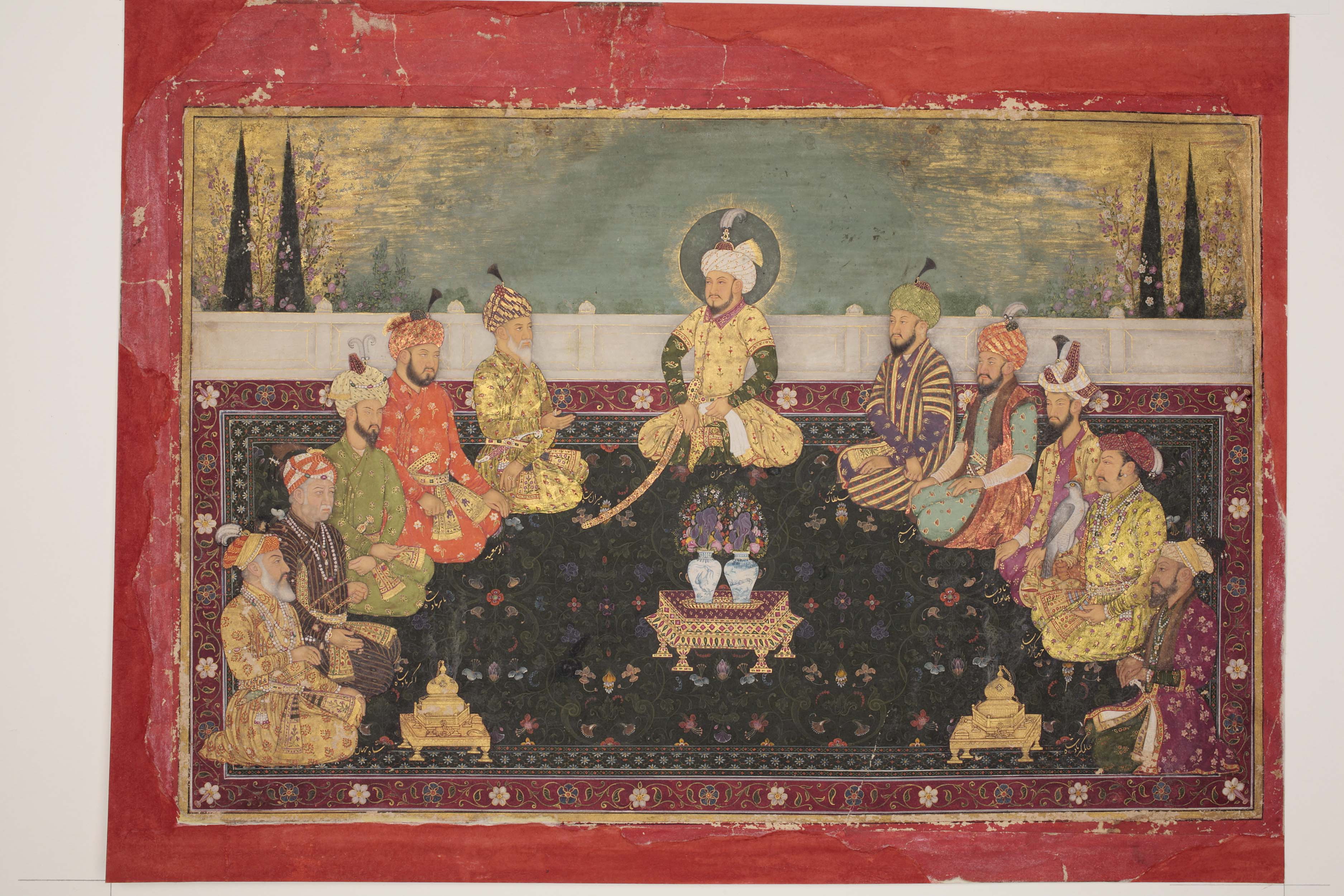
The Mughal dynasty ( fa, ; ''Dudmân-e Mughal'') comprised the members of the imperial House of Babur ( fa, ; ''Khāndān-e-Āl-e-Bābur''), also known as the Gurkanis ( fa, ; ''Gūrkāniyān''), who ruled the Mughal Empire from to 1857. The Mughals originated as a Central Asian branch of the Timurid dynasty, supplemented with extra Borjigin (the clan which ruled the Mongol Empire and its successor states) bloodlines. The dynasty's founder, Babur (born 1483), was a direct descendant of the Asian conqueror Timur (1336–1405) on his father's side and of Mongol emperor Genghis Khan (died 1227) on his mother's side, and Babur's ancestors had other affiliations with Genghisids through marriage and common ancestry. The term "Mughal" is itself a derivative form of "Mongol" in the Arabic and Persian languages: it emphasised the Mongol origins of the Mughal dynasty. During much of the Empire's history, the emperor functioned as the absolute head of state, head of government and h ... [...More Info...] [...Related Items...] OR: [Wikipedia] [Google] [Baidu] |


.jpg)


