|
Kattaha Brahmin
The Kattaha Brahmins (also known as Maha Brahmins or Mahapatra ), are a Hindu caste found in the state of Uttar Pradesh, Panjab, Hariyana, Rajasthan, Uttarakhand, Madhya Pradesh and Bihar in India. They are basically a priestly community who primarily perform death rites and are the traditional funeral priests of North India. Social organization The Kattaha are the traditional funeral priests of North India. They are also known as Acharya. They are said to derive their name from the Hindi word ''pind-kattana'', which means to cut the flour balls, an important ritual in Hindu funerals. Little is known about the origin of this community, and their status as Brahmin is barely recognized by other Brahmin grouping. The Kuthaliya Bora are a strictly endogamous community, and practice clan exogamy. Their three main clans or gotras are the Kashyap, Bharadwaj and Sandilya. They live in multi-caste villages, but occupy their own quarters and hamlets. Present circumstances The Kattah ... [...More Info...] [...Related Items...] OR: [Wikipedia] [Google] [Baidu] |
Hindu
Hindus (; ) are people who religiously adhere to Hinduism.Jeffery D. Long (2007), A Vision for Hinduism, IB Tauris, , pages 35–37 Historically, the term has also been used as a geographical, cultural, and later religious identifier for people living in the Indian subcontinent. The term ''"Hindu"'' traces back to Old Persian which derived these names from the Sanskrit name ''Sindhu'' (सिन्धु ), referring to the river Indus. The Greek cognates of the same terms are "''Indus''" (for the river) and "''India''" (for the land of the river). The term "''Hindu''" also implied a geographic, ethnic or cultural identifier for people living in the Indian subcontinent around or beyond the Sindhu (Indus) River. By the 16th century CE, the term began to refer to residents of the subcontinent who were not Turkic or Muslims. Hindoo is an archaic spelling variant, whose use today is considered derogatory. The historical development of Hindu self-identity within the local In ... [...More Info...] [...Related Items...] OR: [Wikipedia] [Google] [Baidu] |
Unnao District
Unnao district is a district of Uttar Pradesh state in northern India. The city of Unnao is the district headquarters. The district is part of Lucknow Division. As of the 2011 census, Unnao district has a population of 3,108,367, making it the 31st-most populous district in Uttar Pradesh. It is a predominantly rural district, with over 80% of the population living in rural areas. Unnao District is known as "The Land Of Pen and Sword" (कलम और तलवार की धरती). History Unnao district was created by the British upon their annexation of Oudh State in February 1856. Before then, under the Nawabs of Awadh, the area was divided between several different districts or : Purwa covered the eastern part, and to the north were Rasulabad and Safipur. The pargana of Auras, meanwhile, was part of the chakla of Sandila, and the parganas of Baiswara were included in the chakla of the same name, whose headquarters were at Rae Bareli. After the British takeover, ... [...More Info...] [...Related Items...] OR: [Wikipedia] [Google] [Baidu] |
Awadhi Language
Awadhi (; ), also known as Audhi (), is an Indo-Aryan language spoken in North India, northern India and Nepal. It is primarily spoken in the Awadh region of present-day Uttar Pradesh, Uttar Pradesh, India. The name ''Awadh'' is connected to Ayodhya, the ancient city, which is regarded as the homeland of the Hindu god Rama. See also, the Oudh state which was settled in North India during the Mughal Empire, Mughal rule. It was, along with Braj Bhasha, used widely as a literary vehicle before being displaced by Hindustani language, Hindustani in the 19th century. Linguistically, Awadhi is a language at par with Hindustani language, Hindustani. However, it is regarded by the state to be a dialect of the Hindi languages, Central Indo-Aryan (Hindi) languages, and the area where Awadhi is spoken to be a part of the Hindi-language area owing to their cultural proximity. As a result, Hindi, Modern Standard Hindi, rather than Awadhi, is used for school instructions as well as administ ... [...More Info...] [...Related Items...] OR: [Wikipedia] [Google] [Baidu] |
Odisha
Odisha (English: , ), formerly Orissa ( the official name until 2011), is an Indian state located in Eastern India. It is the 8th largest state by area, and the 11th largest by population. The state has the third largest population of Scheduled Tribes in India. It neighbours the states of Jharkhand and West Bengal to the north, Chhattisgarh to the west, and Andhra Pradesh to the south. Odisha has a coastline of along the Bay of Bengal in Indian Ocean. The region is also known as Utkala and is also mentioned in India's national anthem, " Jana Gana Mana". The language of Odisha is Odia, which is one of the Classical Languages of India. The ancient kingdom of Kalinga, which was invaded by the Mauryan Emperor Ashoka (which was again won back from them by King Kharavela) in 261 BCE resulting in the Kalinga War, coincides with the borders of modern-day Odisha. The modern boundaries of Odisha were demarcated by the British Indian government when Orissa Province wa ... [...More Info...] [...Related Items...] OR: [Wikipedia] [Google] [Baidu] |
Rohilkhand
Rohilkhand (previously Rampur State) is a region in the northwestern part of Uttar Pradesh, India, that is centered on the Rampur, Bareilly and Moradabad divisions. It is part of the upper Ganges Plain, and is named after the Rohilla tribe. The region was called Madhyadesh and Panchala in the Sanskrit epics ''Mahabharata'' and ''Ramayana''. Etymology ''Rohilkhand'' means "the land of the Rohilla". The term ''Rohilla'' first became common in the 17th century, with ''Rohilla'' used to refer to the people coming from the land of Roh, which was originally a geographical term that corresponded with the territory from Swat and Bajaur in the north to Sibi in the south, and from Hasan Abdal (Attock) in the east to Kabul and Kandahar in the west. A majority of the Rohillas migrated from Pashtunistan to North India between the 17th and 18th centuries. Geography Rohilkhand lies on the upper Ganges alluvial plain and has an area of about (in and around the Bareilly and Moradabad divi ... [...More Info...] [...Related Items...] OR: [Wikipedia] [Google] [Baidu] |
Bareilly District
The Bareilly district belongs to the state Uttar Pradesh in northern India. Its capital is Bareilly city and it is divided in six administrative division or tehsils: Aonla, Baheri, Bareilly city, Faridpur, Mirganj, and Nawabganj. The Bareilly district is a part of the Bareilly Division and occupies an area of 4120 km2 with a population of 4,448,359 people (previously it was 3,618,589) according to the census of 2011.http://www.censusindia.gov.in/2011census/dchb/0919_PART_B_DCHB_BAREILLY.pdf The modern City of Bareilly was founded by Mukrand Rai in 1657. Later it became the capital of the Rohilkhand region before getting handed over to Nawab Vazir of Awadh and then to the East India Company, becoming an integral part of India. History Ancient period Historically, the region was the capital of the ancient kingdom of Panchala. The Panchalas occupied the country to the east of the Kurus, between the upper Himalayas and the river Ganges. The country was divided into U ... [...More Info...] [...Related Items...] OR: [Wikipedia] [Google] [Baidu] |
Shahjahanpur District
Shahjahanpur district is a districts of Uttar Pradesh India. It is a part of Bareilly division. It was established in 1813 by the British Government. Previously it was a part of district Bareilly. Geographically the main town is Shahjahanpur which is its headquarters. Its 4 Tehsils are: Powayan, Tilhar, Jalalabad and Sadar. History Very little is known about the early history of this region. There are prominent ruins at Mati, Nigohi, and Gola Raipur. The area covered by Shahjahanpur district was likely part of the ancient kingdom of Ahichhatra, which is supported by numerous Ahichhatra coins found at Mati, which appears to have been an important city in ancient times. For a long time, tradition holds that this area was ruled by indigenous groups like the Gujars, the Ahirs, the Pasis, the Arakhs, the Bhihars, and the Bhils. Their rule appears to have been supplanted by the Rajputs and Muslims later than other places in the region. During the middle ages, Shahjahanpur di ... [...More Info...] [...Related Items...] OR: [Wikipedia] [Google] [Baidu] |
Awadh
Awadh (), known in British historical texts as Avadh or Oudh, is a region in the modern Indian state of Uttar Pradesh, which was before independence known as the United Provinces of Agra and Oudh. It is synonymous with the Kośāla region of Hindu, Bauddh, and Jain scriptures. Awadh is bounded by the Ganges Doab to the southwest, Rohilkhand to the northwest, Nepal to the north, and Bhojpur-Purvanchal to the east. Its inhabitants are referred to as Awadhis. It was established as one of the twelve original subahs (top-level imperial provinces) under 16th-century Mughal emperor Akbar and became a hereditary tributary polity around 1722, with Faizabad as its initial capital and Saadat Ali Khan as its first Subadar Nawab and progenitor of a dynasty of Nawabs of Awadh (often styled Nawab Wazir al-Mamalik). The traditional capital of Awadh is Lucknow, also the station of the British Resident, which now is the capital of Uttar Pradesh. Etymology The word Awadh is supposed to ... [...More Info...] [...Related Items...] OR: [Wikipedia] [Google] [Baidu] |
Hardoi District
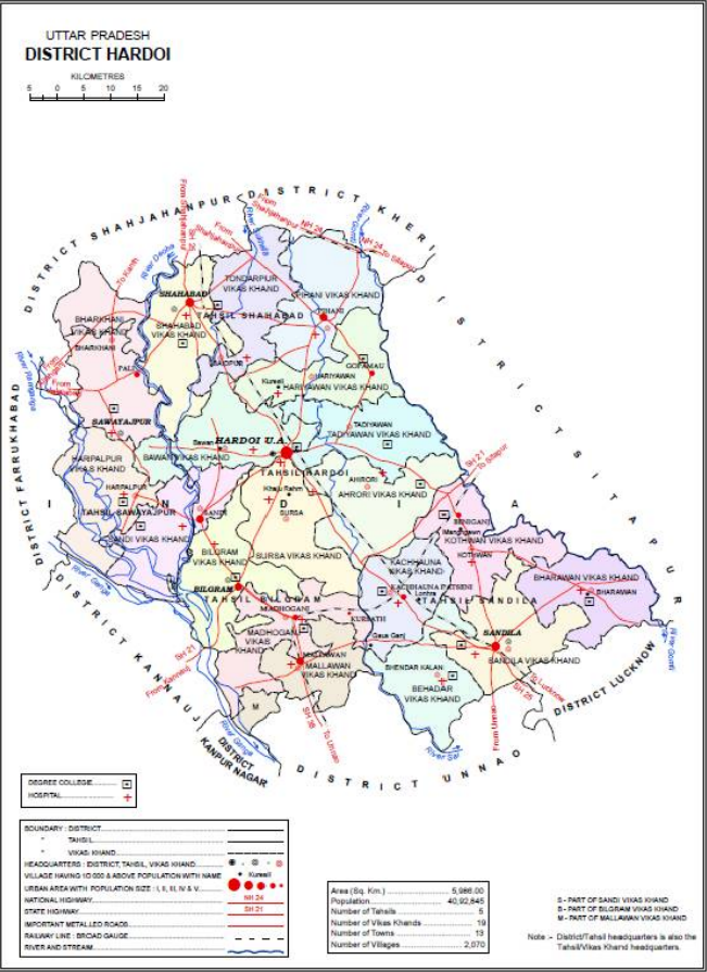
Hardoi district is a district situated in the center of Uttar Pradesh, India. The district headquarters is in the city of Hardoi. Hardoi is the third largest district of Uttar Pradesh. It falls under Lucknow division in the history region of Awadh As of the 2011 census, the total population of Hardoi district is 4,092,845 people, in 730,442 households. It is the 13th-most populous district in Uttar Pradesh. History The present-day Hardoi district was created by the British after their takeover of Awadh in 1856. At the time of Akbar in the 1500s, the area of the modern district was divided between the sarkars of Lucknow and Khairabad. Five ''mahal''s were in Lucknow sarkar: Sandila, Mallanwan, Kachhandao, "Garanda" (probably a miscopying of Gundwa), and Bilgram. The Ain-i-Akbari does list a mahal of Hardoi in Lucknow district, but this was referring to the Hardoi in modern Rae Bareli district instead of the one in Hardoi district. As for the sarkar of Khairabad, the mahals ... [...More Info...] [...Related Items...] OR: [Wikipedia] [Google] [Baidu] |
Caste
Caste is a form of social stratification characterised by endogamy, hereditary transmission of a style of life which often includes an occupation, ritual status in a hierarchy, and customary social interaction and exclusion based on cultural notions of purity and pollution. * Quote: "caste ort., casta=basket ranked groups based on heredity within rigid systems of social stratification, especially those that constitute Hindu India. Some scholars, in fact, deny that true caste systems are found outside India. The caste is a closed group whose members are severely restricted in their choice of occupation and degree of social participation. Marriage outside the caste is prohibited. Social status is determined by the caste of one's birth and may only rarely be transcended." * Quote: "caste, any of the ranked, hereditary, endogamous social groups, often linked with occupation, that together constitute traditional societies in South Asia, particularly among Hindus in India. Althoug ... [...More Info...] [...Related Items...] OR: [Wikipedia] [Google] [Baidu] |
.jpg)


