|
Junagadh Rock Inscription Of Rudradaman
The Junagadh rock inscription of Rudradaman, also known as the Girnar Rock inscription of Rudradaman, is a Sanskrit prose inscribed on a rock by the Western Satraps ruler Rudradaman I. It is located near Girnar hill near Junagadh, Gujarat, India. The inscription is dated to shortly after 150 CE. The Junagadh rock contains inscriptions of Ashoka (one of fourteen of the Major Rock Edicts of Ashoka), Rudradaman I and Skandagupta.Artefacts of History: Archaeology, Historiography and Indian Pasts, Sudeshna Guha, SAGE Publications India, 201p.50/ref> Description The inscription is found on a major rock to the east of the town of Junagadh in Kathiavad region of Gujarat, India. It is near the base of the Girnar mountain. The Rudradaman inscription is one of the three significant inscriptions found on the rock, dated to be the second in chronology. The oldest inscription is a version of Ashoka edicts, while the last and third inscription is of Skandagupta. The Rudradaman inscription is ne ... [...More Info...] [...Related Items...] OR: [Wikipedia] [Google] [Baidu] |
Sanskrit
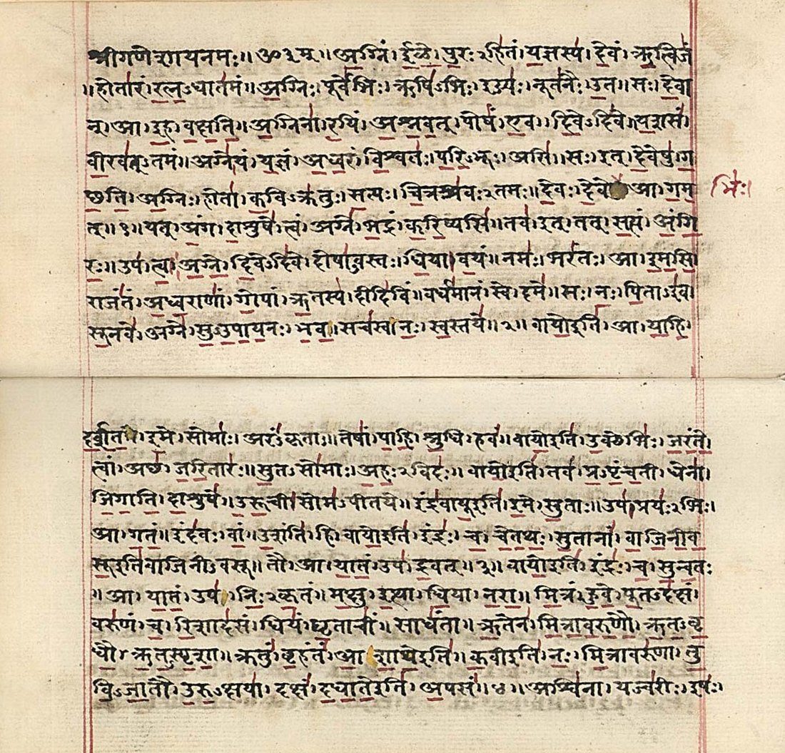
Sanskrit (; attributively , ; nominally , , ) is a classical language belonging to the Indo-Aryan branch of the Indo-European languages. It arose in South Asia after its predecessor languages had diffused there from the northwest in the late Bronze Age. Sanskrit is the sacred language of Hinduism, the language of classical Hindu philosophy, and of historical texts of Buddhism and Jainism. It was a link language in ancient and medieval South Asia, and upon transmission of Hindu and Buddhist culture to Southeast Asia, East Asia and Central Asia in the early medieval era, it became a language of religion and high culture, and of the political elites in some of these regions. As a result, Sanskrit had a lasting impact on the languages of South Asia, Southeast Asia and East Asia, especially in their formal and learned vocabularies. Sanskrit generally connotes several Old Indo-Aryan language varieties. The most archaic of these is the Vedic Sanskrit found in the Rig Veda, a colle ... [...More Info...] [...Related Items...] OR: [Wikipedia] [Google] [Baidu] |
Malwa
Malwa is a historical region of west-central India occupying a plateau of volcanic origin. Geologically, the Malwa Plateau generally refers to the volcanic upland north of the Vindhya Range. Politically and administratively, it is also synonymous with the former state of Madhya Bharat which was later merged with Madhya Pradesh. At present the historical Malwa region includes districts of western Madhya Pradesh and parts of south-eastern Rajasthan. Sometimes the definition of Malwa is extended to include the Nimar region south of the Vindhyas. The Malwa region had been a separate political unit from the time of the ancient Malava Kingdom. It has been ruled by several kingdoms and dynasties, including the Avanti Kingdom, The Mauryans, the Malavas, the Guptas, the Paramaras, the Delhi Sultanate, the Malwa sultans, the Mughals and the Marathas. Malwa continued to be an administrative division until 1947, when the Malwa Agency of British India was merged into Madhya Bharat (a ... [...More Info...] [...Related Items...] OR: [Wikipedia] [Google] [Baidu] |
Konkan
The Konkan ( kok, कोंकण) or Kokan () is a stretch of land by the western coast of India, running from Damaon in the north to Karwar in the south; with the Arabian Sea to the west and the Deccan plateau in the east. The hinterland east of the coast has numerous river valleys and riverine islands among the hilly slopes leading up into the tablelands of the Deccan. The region has been recognised by name, since at least the time of Strabo in the third century C.E., and was a thriving mercantile port with Arab tradesmen from the 10th century. The best-known islands of Konkan are Ilhas de Goa, the site of the Goa state's capital at Panjim, and the seven islands of Bombay, on which lies the capital of the State of Maharashtra. Definition Historically, the limits of Konkan have been flexible, and it has been known by additional names like "Aparanta" and "Gomanchal", the latter being defined as the coastal area between the Daman Ganga River in the north and the Gangava ... [...More Info...] [...Related Items...] OR: [Wikipedia] [Google] [Baidu] |
Aparanta
Aparanta, or Aparantaka (meaning "Western border") was a geographical region of ancient India. It corresponded to the northern part of the Konkan region on the western coast of India. English civil servant-turned-historian J. F. Fleet believed that the Aparanta region included Kathiawad, Kutch, and Sindh, beside Konkan. However, historical records make it clear that the extent of Aparanta was much smaller. The Junagadh inscription of Rudradaman mentions that during Ashoka's reign, a ''Yonaraja'' (literally; Ionian, or Greek, King), Tushaspha was the governor of Aparanta. A Buddhist text, the Mahavamsa states (xii.5) that at the conclusion of the Third Buddhist Council (c.250 BCE), a ''Yona'' (Greek) ''Thera'' (monk) Dhammarakkhita was sent here by the emperor Ashoka to preach Dhamma and 37,000 people embraced Buddhism due to his effort (''Mahavamsa'', xii.34-6). According to Buddhist scholar A.K. Warder, the Dharmaguptaka sect originated here.Indian Buddhism by A.K. Warder ... [...More Info...] [...Related Items...] OR: [Wikipedia] [Google] [Baidu] |
Rajputana
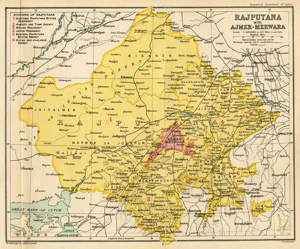
Rājputana, meaning "Land of the Rajputs", was a region in the Indian subcontinent that included mainly the present-day Indian state of Rajasthan, as well as parts of Madhya Pradesh and Gujarat, and some adjoining areas of Sindh in modern-day southern Pakistan. The main settlements to the west of the Aravalli Hills came to be known as ''Rajputana'', early in the Medieval Period. The name was later adopted by British government as the Rajputana Agency for its dependencies in the region of the present-day Indian state of Rājasthān. The Rajputana Agency included 18 princely states, two chiefships and the British district of Ajmer-Merwara. This British official term remained until its replacement by "Rajasthan" in the constitution of 1949. Name George Thomas (''Military Memories'') was the first in 1800, to term this region the ''Rajputana Agency''. The historian John Keay in his book, ''India: A History'', stated that the ''Rajputana'' name was coined by the British, but that ... [...More Info...] [...Related Items...] OR: [Wikipedia] [Google] [Baidu] |
Multan
Multan (; ) is a city in Punjab, Pakistan, on the bank of the Chenab River. Multan is Pakistan's seventh largest city as per the 2017 census, and the major cultural, religious and economic centre of southern Punjab. Multan is one of the List of oldest continuously inhabited cities#Asia, oldest continuously inhabited cities in Asia, with a history stretching deep into antiquity. The ancient city was the site of the renowned Multan Sun Temple, and was besieged by Alexander the Great during the Mallian Campaign. A historic cultural centre of the wider Punjab, it was conquered by the Ummayad military commander Muhammad bin qasim, Muhammad bin Qasim. The city later became independent as the capital of the Emirate of Multan in 855 A.D., before subsequently coming under the rule of empires such as the Ghaznavids, the Ghurids and the Mamluk Sultanate, Mamluks. In 1445, it became capital of the Langah Sultanate. In 1526, it was conquered by the Mughal Empire. Multan Subah would become o ... [...More Info...] [...Related Items...] OR: [Wikipedia] [Google] [Baidu] |
Sindh
Sindh (; ; ur, , ; historically romanized as Sind) is one of the four provinces of Pakistan. Located in the southeastern region of the country, Sindh is the third-largest province of Pakistan by land area and the second-largest province by population after Punjab. It shares land borders with the Pakistani provinces of Balochistan to the west and north-west and Punjab to the north. It shares International border with the Indian states of Gujarat and Rajasthan to the east; it is also bounded by the Arabian Sea to the south. Sindh's landscape consists mostly of alluvial plains flanking the Indus River, the Thar Desert in the eastern portion of the province along the international border with India, and the Kirthar Mountains in the western portion of the province. The economy of Sindh is the second-largest in Pakistan after the province of Punjab; its provincial capital of Karachi is the most populous city in the country as well as its main financial hub. Sindh is home ... [...More Info...] [...Related Items...] OR: [Wikipedia] [Google] [Baidu] |
Sauvira
Sauvīra was an ancient kingdom of the lower Indus Valley mentioned in the Late Vedic and early Buddhist literature and the Hindu epic ''Mahabharata''. It is often mentioned alongside the Sindhu Kingdom. Its capital city was Roruka, identified with present-day Aror/Rohri in Sindh, mentioned in the Buddhist literature as a major trading center. According to the Mahabharata, Jayadratha was the king of the Sindhus, Sauviras and Sivis, having conquered Sauvira and Sivi, two kingdoms close to the Sindhu kingdom. Jayadratha was an ally of Duryodhana and the husband of Duryodhana's sister Dussala. The kingdom of Sauvira is also stated to be close to the Dwaraka and Anarta kingdoms. According to Bhagwat Puran Sauviras were once connected with Abhira. References to Sauvira in the ''Mahabharata'' Cultural affinity Culturally, the Sauviras were mentioned by the character Karna as being similar to the Madras: "The Prasthalas, the Madras, the Gandharas, the Arattas, those called Kh ... [...More Info...] [...Related Items...] OR: [Wikipedia] [Google] [Baidu] |
Sindhu
The Indus ( ) is a transboundary river of Asia and a trans-Himalayan river of South and Central Asia. The river rises in mountain springs northeast of Mount Kailash in Western Tibet, flows northwest through the disputed region of Kashmir, Quote: "Kashmir, region of the northwestern Indian subcontinent. It is bounded by the Uygur Autonomous Region of Xinjiang to the northeast and the Tibet Autonomous Region to the east (both parts of China), by the Indian states of Himachal Pradesh and Punjab to the south, by Pakistan to the west, and by Afghanistan to the northwest. The northern and western portions are administered by Pakistan and comprise three areas: Azad Kashmir, Gilgit, and Baltistan, ... The southern and southeastern portions constitute the Indian state of Jammu and Kashmir. The Indian- and Pakistani-administered portions are divided by a "line of control" agreed to in 1972, although neither country recognizes it as an international boundary. In addition, China became ... [...More Info...] [...Related Items...] OR: [Wikipedia] [Google] [Baidu] |
Cutch State
Cutch, also spelled Kutch or Kachchh and also historically known as the Kingdom of Kutch, was a kingdom in the Kutch region from 1147 to 1819 and a princely state under British rule from 1819 to 1947. Its territories covered the present day Kutch region of Gujarat north of the Gulf of Kutch. Bordered by Sindh in the north, Cutch State was one of the few princely states with a coastline. The state had an area of and a population estimated at in 1901. During the British Raj, the state was part of the Cutch Agency and later the Western India States Agency within the Bombay Presidency. The rulers maintained an army of 354 cavalry, 1,412 infantry and 164 guns. Cutch's flag was a red rectangle with images of a white elephant and Bhujia Fort in the centre and the word BHOOJ inscribed above the fort in white. The motto: ''Courage and Confidence'' was written below in a white ribbon. History A predecessor state known as the Kingdom of Kutch was founded around 1147 by Lakho Ja ... [...More Info...] [...Related Items...] OR: [Wikipedia] [Google] [Baidu] |
Marwar
Marwar (also called Jodhpur region) is a region of western Rajasthan state in North Western India. It lies partly in the Thar Desert. The word 'maru' is Sanskrit for desert. In Rajasthani languages, "wad" means a particular area. English translation of the word 'marwar' is 'the region of desert.' Historically, the term 'Marwar' referred to a geographical entity spanning a cultural area across nearly all of Rajasthan. More specifically, it designates the western region of the present-day state of Rajasthan, spanning the districts of Jaisalmer, Barmer, Jalore, Jodhpur, Nagaur, Pali, Bikaner, Sikar, Churu, and Jhunjhunu. In its most contracted definition, Marwar comprises the areas governed by the erstwhile princely state of Jodhpur State, which includes the present-day districts of Barmer, Jalore, Jodhpur, Nagaur, Pali and parts of Sikar. Jodhpur State was bounded on the north by Jangladesh region, on the northeast by Dhundhar, on the east by Ajmer, on the southeast by Me ... [...More Info...] [...Related Items...] OR: [Wikipedia] [Google] [Baidu] |
Surashtra
Saurashtra, also known as Sorath or Kathiawar, is a peninsular region of Gujarat, India, located on the Arabian Sea coast. It covers about a third of Gujarat state, notably 11 districts of Gujarat, including Rajkot District. It was formerly a state of India before it merged with Bombay state. In 1961 it separated from Bombay and joined Gujarat. Location Saurashtra peninsula is bound on the south and south-west by the Arabian sea, on the north-west by the Gulf of Kutch and on the east by the Gulf of Khambhat. From the apex of these two gulfs, the Little Rann of Kutch and Khambhat, waste tracts half salt morass half sandy desert, stretch inland towards each other and complete the isolation of Kathiawar, except one narrow neck which connects it on the north-east with the mainland of Gujarat. The peninsula is sometimes referred to as Kathiawar after the Kathi Darbar, which once ruled most of the region. However, Saurashtra is not entirely synonymous with Kathiawar, since a small ... [...More Info...] [...Related Items...] OR: [Wikipedia] [Google] [Baidu] |


_Suresh_Godara.jpg)
