|
ICFRE
The Indian Council of Forestry Research and Education (ICFRE) is an autonomous organisation or governmental agency under the Ministry of Environment and Forests, Government of India. Headquartered in Dehradun, its functions are to conduct forestry research; transfer the technologies developed to the states of India and other user agencies; and to impart forestry education. The council has 9 research institutes and 4 advanced centres to cater to the research needs of different bio-geographical regions. These are located at Dehradun, Shimla, Ranchi, Jorhat, Jabalpur, Jodhpur, Bengaluru, Coimbatore, Prayagraj, Chhindwara, Aizawl, Hyderabad and Agartala. History ICFRE is the largest organisation responsible for forestry research in India. ICFRE was created in 1986, under the Central Ministry of Environment and Forests (India), to direct and manage research and education in forestry sector in India. ICFRE is headed by a Director General with headquarters at Dehradun. ICFRE became a ... [...More Info...] [...Related Items...] OR: [Wikipedia] [Google] [Baidu] |
Arid Forest Research Institute
Arid Forest Research Institute (AFRI) is a research institute situated in Jodhpur, Rajasthan, India. The institute conducts scientific research in forestry in order to provide technologies to increase the vegetative cover and to conserve biodiversity in the hot arid and semi-arid regions of Rajasthan and Gujarat. It operates under the Indian Council of Forestry Research and Education (ICFRE) of the Ministry of Environment and Forests, Government of India. About The Arid Forest Research Institute was established in 1988 to cater the forestry research needs of the arid and semi-arid region of Rajasthan, Gujarat, Dadra and Nagar Haveli, and Daman-Diu. The institute is situated on Jodhpur Pali Road ( NH 65) in a campus spreading over 66 hectares, housing office buildings, laboratories, a library-cum-information center, community center, guest house, scientist hostel and residential quarters. The institute has an additional campus at Plot No. 729 adjoining CAZRI. The institute a ... [...More Info...] [...Related Items...] OR: [Wikipedia] [Google] [Baidu] |
Hfri Shimla
Himalayan Forest Research Institute (HFRI) is a Research institute situated in Shimla in Himachal Pradesh. It works under the Indian Council of Forestry Research and Education (ICFRE) of the Ministry of Environment and Forests, Govt. of India. Divisions * Forest Ecology & Climate Change Division * Forest Protection Division * Silviculture & Forest Management Division * Genetics & Tree Improvement Division * Extension Division See also * Indian Council of Forestry Research and Education * Van Vigyan Kendra (VVK) Forest Science Centres * Social forestry in India Social forestry is the management and protection of forests and afforestation of barren and deforested lands with the purpose of helping environmental, social and rural development. The term social forestry was first used in 1976 by The Nation ... References {{authority control Indian forest research institutes Indian Council of Forestry Research and Education Ministry of Environment, Forest and Climate Change ... [...More Info...] [...Related Items...] OR: [Wikipedia] [Google] [Baidu] |
Himalayan Forest Research Institute (HFRI)
Himalayan Forest Research Institute (HFRI) is a Research institute situated in Shimla in Himachal Pradesh. It works under the Indian Council of Forestry Research and Education (ICFRE) of the Ministry of Environment and Forests, Govt. of India. Divisions * Forest Ecology & Climate Change Division * Forest Protection Division * Silviculture & Forest Management Division * Genetics & Tree Improvement Division * Extension Division See also * Indian Council of Forestry Research and Education * Van Vigyan Kendra (VVK) Forest Science Centres * Social forestry in India Social forestry is the management and protection of forests and afforestation of barren and deforested lands with the purpose of helping environmental, social and rural development. The term social forestry was first used in 1976 by The Nation ... References {{authority control Indian forest research institutes Indian Council of Forestry Research and Education Ministry of Environment, Forest and Climate Change ... [...More Info...] [...Related Items...] OR: [Wikipedia] [Google] [Baidu] |
Dehradun
Dehradun () is the capital and the most populous city of the Indian state of Uttarakhand. It is the administrative headquarters of the eponymous district and is governed by the Dehradun Municipal Corporation, with the Uttarakhand Legislative Assembly holding its winter sessions in the city as its winter capital. Part of the Garhwal region, and housing the headquarters of its Divisional Commissioner. Dehradun is one of the " Counter Magnets" of the National Capital Region (NCR) being developed as an alternative center of growth to help ease the migration and population explosion in the Delhi metropolitan area and to establish a smart city in the Himalayas. It is the third largest city in the Himalayas after Kathmandu and Srinagar. Dehradun is located in the Doon Valley on the foothills of the Himalayas nestled between Song river, a tributary of Ganga on the east and the Asan river, a tributary of Yamuna on the west. The city is noted for its picturesque landscape and slightly m ... [...More Info...] [...Related Items...] OR: [Wikipedia] [Google] [Baidu] |
Ministry Of Environment And Forests (India)
The Ministry of Environment, Forest and Climate Change (MoEFCC) is an Indian government ministry. This ministry is headed by Secretary Rank senior most IAS officer. The ministry portfolio is currently held by Bhupender Yadav, Union Minister of Environment, Forest and Climate Change. The ministry is responsible for planning, promoting, coordinating, and overseeing the implementation of environmental and forestry programmes in the country. The main activities undertaken by the ministry include conservation and survey of the flora of India and fauna of India, forests and other wilderness areas; prevention and control of pollution; Indian Himalayan Environment and its sustainable development; afforestation, and land degradation mitigation. It is responsible for the administration of the 1947 national parks of India. The Ministry of Environment, Forest and Climate Change is the cadre controlling authority of the Indian Forest Service (IFS), one of the three All India Services. His ... [...More Info...] [...Related Items...] OR: [Wikipedia] [Google] [Baidu] |
Ministry Of Environment, Forest And Climate Change
The Ministry of Environment, Forest and Climate Change (MoEFCC) is an Indian government ministry. This ministry is headed by Secretary Rank senior most IAS officer. The ministry portfolio is currently held by Bhupender Yadav, Union Minister of Environment, Forest and Climate Change. The ministry is responsible for planning, promoting, coordinating, and overseeing the implementation of environmental and forestry programmes in the country. The main activities undertaken by the ministry include conservation and survey of the flora of India and fauna of India, forests and other wilderness areas; prevention and control of pollution; Indian Himalayan Environment and its sustainable development;afforestation, and land degradation mitigation. It is responsible for the administration of the 1947 national parks of India. The Ministry of Environment, Forest and Climate Change is the cadre controlling authority of the Indian Forest Service (IFS), one of the three All India Services. Hist ... [...More Info...] [...Related Items...] OR: [Wikipedia] [Google] [Baidu] |
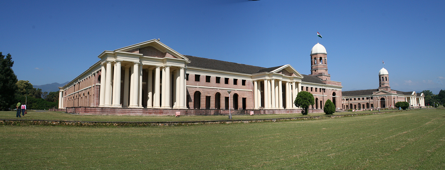
Forest Research Institute Campus, Dehradun, India
A forest is an area of land dominated by trees. Hundreds of definitions of forest are used throughout the world, incorporating factors such as tree density, tree height, land use, legal standing, and ecological function. The United Nations' Food and Agriculture Organization (FAO) defines a forest as, "Land spanning more than 0.5 hectares with trees higher than 5 meters and a canopy cover of more than 10 percent, or trees able to reach these thresholds ''in situ''. It does not include land that is predominantly under agricultural or urban use." Using this definition, '' Global Forest Resources Assessment 2020'' (FRA 2020) found that forests covered , or approximately 31 percent of the world's land area in 2020. Forests are the predominant terrestrial ecosystem of Earth, and are found around the globe. More than half of the world's forests are found in only five countries (Brazil, Canada, China, Russia, and the United States). The largest share of forests (45 percent) are in th ... [...More Info...] [...Related Items...] OR: [Wikipedia] [Google] [Baidu] |
Rajasthan
Rajasthan (; lit. 'Land of Kings') is a state in northern India. It covers or 10.4 per cent of India's total geographical area. It is the largest Indian state by area and the seventh largest by population. It is on India's northwestern side, where it comprises most of the wide and inhospitable Thar Desert (also known as the Great Indian Desert) and shares a border with the Pakistani provinces of Punjab to the northwest and Sindh to the west, along the Sutlej- Indus River valley. It is bordered by five other Indian states: Punjab to the north; Haryana and Uttar Pradesh to the northeast; Madhya Pradesh to the southeast; and Gujarat to the southwest. Its geographical location is 23.3 to 30.12 North latitude and 69.30 to 78.17 East longitude, with the Tropic of Cancer passing through its southernmost tip. Its major features include the ruins of the Indus Valley civilisation at Kalibangan and Balathal, the Dilwara Temples, a Jain pilgrimage site at Rajasthan's only hill stat ... [...More Info...] [...Related Items...] OR: [Wikipedia] [Google] [Baidu] |
Gujarat
Gujarat (, ) is a state along the western coast of India. Its coastline of about is the longest in the country, most of which lies on the Kathiawar peninsula. Gujarat is the fifth-largest Indian state by area, covering some ; and the ninth-most populous state, with a population of 60.4 million. It is bordered by Rajasthan to the northeast, Dadra and Nagar Haveli and Daman and Diu to the south, Maharashtra to the southeast, Madhya Pradesh to the east, and the Arabian Sea and the Pakistani province of Sindh to the west. Gujarat's capital city is Gandhinagar, while its largest city is Ahmedabad. The Gujaratis are indigenous to the state and their language, Gujarati, is the state's official language. The state encompasses 23 sites of the ancient Indus Valley civilisation (more than any other state). The most important sites are Lothal (the world's first dry dock), Dholavira (the fifth largest site), and Gola Dhoro (where 5 uncommon seals were found). Lothal i ... [...More Info...] [...Related Items...] OR: [Wikipedia] [Google] [Baidu] |
Dadra And Nagar Haveli
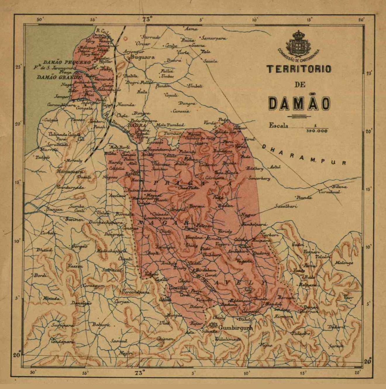
Dadra and Nagar Haveli is a district of the union territory of Dadra and Nagar Haveli and Daman and Diu in western India. It is composed of two separate geographical entities: Nagar Haveli, wedged in between Maharashtra and Gujarat states to the north-west, the smaller enclave of Dadra, which is surrounded by Gujarat. Silvassa is the administrative headquarters of Dadra and Nagar Haveli. Unlike the surrounding areas, Dadra and Nagar Haveli was ruled by the Portuguese from 1783 until the mid-20th century. The area was captured by pro-India forces in 1954 and administered as the de facto state of Free Dadra and Nagar Haveli before being annexed to India as a union territory, the union territory of Dadra and Nagar Haveli in 1961. The union territory was merged with the neighbouring union territory of Daman and Diu to form the new union territory of "Dadra and Nagar Haveli and Daman and Diu" on 26 January 2020. The territory of Dadra and Nagar Haveli then became one of the thre ... [...More Info...] [...Related Items...] OR: [Wikipedia] [Google] [Baidu] |
Delhi
Delhi, officially the National Capital Territory (NCT) of Delhi, is a city and a union territory of India containing New Delhi, the capital of India. Straddling the Yamuna river, primarily its western or right bank, Delhi shares borders with the state of Uttar Pradesh in the east and with the state of Haryana in the remaining directions. The NCT covers an area of . According to the 2011 census, Delhi's city proper population was over 11 million, while the NCT's population was about 16.8 million. Delhi's urban agglomeration, which includes the satellite cities of Ghaziabad, Faridabad, Gurgaon and Noida in an area known as the National Capital Region (NCR), has an estimated population of over 28 million, making it the largest metropolitan area in India and the second-largest in the world (after Tokyo). The topography of the medieval fort Purana Qila on the banks of the river Yamuna matches the literary description of the citadel Indraprastha in the Sanskrit ... [...More Info...] [...Related Items...] OR: [Wikipedia] [Google] [Baidu] |
Haryana
Haryana (; ) is an Indian state located in the northern part of the country. It was carved out of the former state of East Punjab on 1 Nov 1966 on a linguistic basis. It is ranked 21st in terms of area, with less than 1.4% () of India's land area. The state capital is Chandigarh, which it shares with the neighboring state of Punjab, and the most populous city is Faridabad, which is a part of the National Capital Region (India), National Capital Region. The city of Gurugram is among India's largest financial and technology hubs. Haryana has 6 Divisions of Haryana, administrative divisions, 22 List of districts of Haryana, districts, 72 sub-divisions, 93 tehsil, revenue tehsils, 50 sub-tehsils, 140 Community development block in India, community development blocks, 154 List of cities in Haryana by population, cities and towns, 7,356 villages, and 6,222 Gram panchayat, villages panchayats. Haryana contains 32 special economic zones (SEZs), mainly located within the industrial corri ... [...More Info...] [...Related Items...] OR: [Wikipedia] [Google] [Baidu] |


.jpg)


