|
Hartland Bridge
The Hartland Covered Bridge in Hartland, New Brunswick, is the world's longest covered bridge, at long. It crosses the Saint John River from Hartland to Somerville, New Brunswick, Canada. The framework consists of seven small Howe Truss bridges joined on six piers. History Before the bridge, the only way to cross the Saint John River was by ferry. Plans and specifications of the bridge began in 1898 and the bridge was constructed in 1901 by the Hartland Bridge Company. On May 13, 1901, Dr. Estey was the first person to cross the bridge before its scheduled opening, because he had to respond to an emergency call. Workers placed planks on the bridge so he could drive across the bridge. It was finally inaugurated by Justice McKeowan on July 4, 1901, before a crowd of 2,000 people. It was funded by tolls until it was purchased by the provincial government on May 1, 1906. The bridge was not originally built covered. A fire in 1907 burnt some of the structure and nearly destr ... [...More Info...] [...Related Items...] OR: [Wikipedia] [Google] [Baidu] |
Somerville, New Brunswick
Somerville (2016 pop.: 286) is a Canadian rural community in Carleton County, New Brunswick. Somerville is located on Route 103 between Wakefield and Hartland. The Hartland Bridge, the longest covered bridge A covered bridge is a timber-truss bridge with a roof, decking, and siding, which in most covered bridges create an almost complete enclosure. The purpose of the covering is to protect the wooden structural members from the weather. Uncovered woo ... in the world, crosses the Saint John River between Hartland and Somerville. History Notable people See also * List of communities in New Brunswick References Communities in Carleton County, New Brunswick Designated places in New Brunswick {{NewBrunswick-geo-stub ... [...More Info...] [...Related Items...] OR: [Wikipedia] [Google] [Baidu] |
Wagon
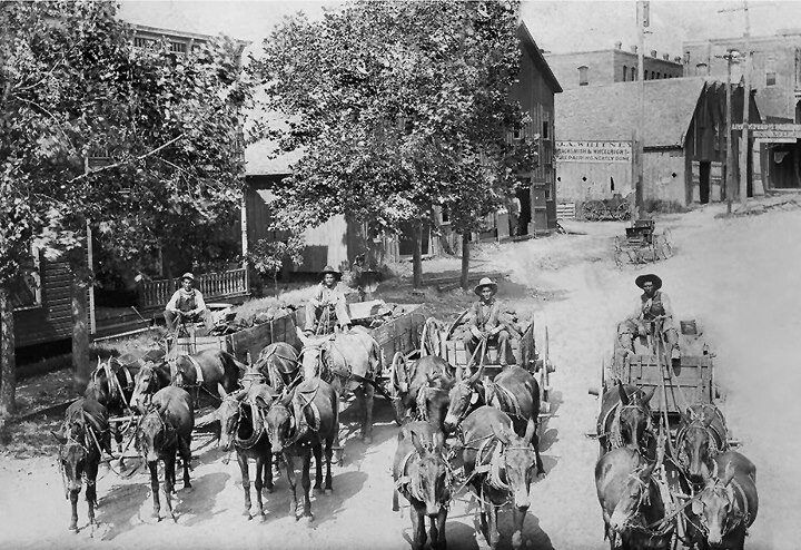
A wagon or waggon is a heavy four-wheeled vehicle pulled by draught animals or on occasion by humans, used for transporting goods, commodities, agricultural materials, supplies and sometimes people. Wagons are immediately distinguished from carts (which have two wheels) and from lighter four-wheeled vehicles primarily for carrying people, such as carriages. Animals such as horses, mules, or oxen usually pull wagons. One animal or several, often in pairs or teams may pull wagons. However, there are examples of human-propelled wagons, such as mining corfs. A wagon was formerly called a wain and one who builds or repairs wagons is a wainwright. More specifically, a wain is a type of horse- or oxen-drawn, load-carrying vehicle, used for agricultural purposes rather than transporting people. A wagon or cart, usually four-wheeled; for example, a haywain, normally has four wheels, but the term has now acquired slightly poetical connotations, so is not always used with technical ... [...More Info...] [...Related Items...] OR: [Wikipedia] [Google] [Baidu] |
Columbia–Wrightsville Bridge
The Columbia–Wrightsville Bridge, officially the Veterans Memorial Bridge, spans the Susquehanna River between Columbia and Wrightsville, Pennsylvania, and carries Pennsylvania Route 462 and BicyclePA Route S. Built originally as the Lancaster-York Intercounty Bridge, construction began in 1929, and the bridge opened September 30, 1930. On November 11, 1980, it was officially dedicated as Veterans Memorial Bridge, though it is still referenced locally as the Columbia–Wrightsville Bridge. In nominating the present Columbia–Wrightsville Bridge as an engineering landmark, the Pennsylvania section of the American Society of Civil Engineers noted that it is "a splendid example of the graceful multiple-span, reinforced-concrete arched form popular in early 20th Century highway bridges in the United States." The bridge is designated State Route 462 and is listed on the National Register of Historic Places, and is also a National Historic Civil Engineering Landmark. Instead of ... [...More Info...] [...Related Items...] OR: [Wikipedia] [Google] [Baidu] |
Quebec
Quebec ( ; )According to the Canadian government, ''Québec'' (with the acute accent) is the official name in Canadian French and ''Quebec'' (without the accent) is the province's official name in Canadian English is one of the thirteen provinces and territories of Canada. It is the largest province by area and the second-largest by population. Much of the population lives in urban areas along the St. Lawrence River, between the most populous city, Montreal, and the provincial capital, Quebec City. Quebec is the home of the Québécois nation. Located in Central Canada, the province shares land borders with Ontario to the west, Newfoundland and Labrador to the northeast, New Brunswick to the southeast, and a coastal border with Nunavut; in the south it borders Maine, New Hampshire, Vermont, and New York in the United States. Between 1534 and 1763, Quebec was called ''Canada'' and was the most developed colony in New France. Following the Seven Years' War, Quebec b ... [...More Info...] [...Related Items...] OR: [Wikipedia] [Google] [Baidu] |
Batiscan River
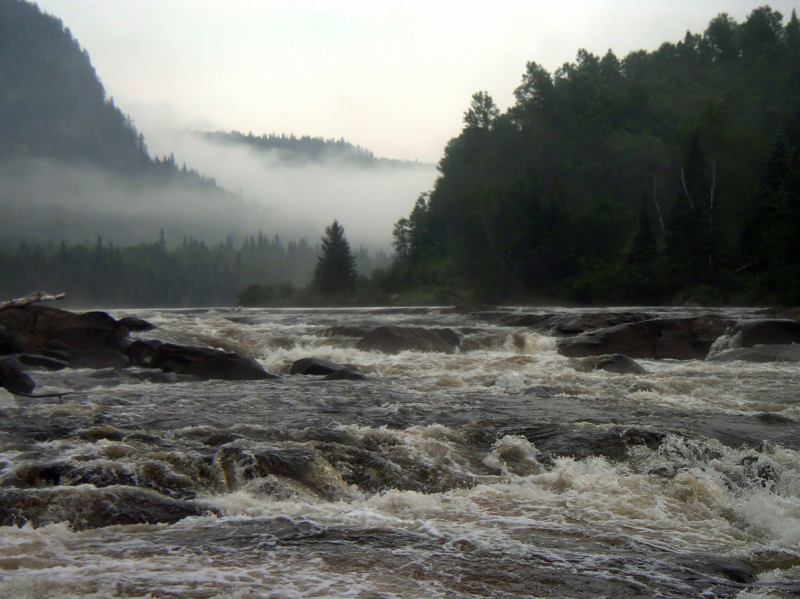
The Batiscan River is located in La Mauricie administrative region, in the Quebec province, Canada. This river flows from Lake Édouard in Mauricie south and west to empty into the St. Lawrence River at Batiscan, Quebec, northeast of Trois-Rivières, Quebec. It passes through the regional county municipalities (RCM) (MRC in French) of La Tuque, Portneuf, Mékinac and Les Chenaux. The river traverses a territory covered mainly by forest from its source to the Saint-Adelphe, Quebec railway bridge; the rest of its course is predominantly agricultural. The Batiscan river valley is designated "Batiscanie, Quebec". Today, this valley is a paradise for camping, vacationing, observations of nature and water activities such as canoeing, kayaking, rafting, pontoon and swimming in designated areas. The Batiscan River is a popular Canadian whitewater kayaking destination, providing numerous class III, IV, and V rapids. Toponymy The river was named in 1602 by Samuel de Champlain. He re ... [...More Info...] [...Related Items...] OR: [Wikipedia] [Google] [Baidu] |
New Brunswick Route 130
Route 130 is a mostly north/south provincial highway in the Canadian province of New Brunswick. The road has a length of approximately 108 kilometres, and services small, otherwise isolated rural communities. In these areas, the highway is often unofficially referred to as "Main Street." The highway is known as ''Broadway'' and ''Portage Road'' in Grand Falls, and ''West Riverside Drive'' in Perth-Andover. History Route 130 was created in 1965 as a short spur from the Trans-Canada Highway into Grand Falls. When a new 4-lane TCH was opened in 2007, the route was extended by over 95 km south from Grand Falls along the former TCH to Aroostook, along a formerly unnumbered route (part of the original Route 2 until the 1960s) from Aroostook to Perth-Andover, the former TCH again from Perth-Andover to Somerville (near Hartland), and a new access road that meets up with the new highway at Waterville. Major intersections Communities along the Route * G ... [...More Info...] [...Related Items...] OR: [Wikipedia] [Google] [Baidu] |
Hugh John Flemming Bridge
The Hugh John Flemming Bridge is part of Route 130 located near the town of Hartland in Carleton County, New Brunswick, Canada. See also * List of bridges in Canada This is a list of bridges and viaducts in Canada, including those for pedestrians and vehicular traffic. Historical and architectural interest bridges There are only a few covered bridges left in Canada compared to all those that were built in t ... References External linksImages Road bridges in New Brunswick Bridges completed in 1960 Buildings and structures in Carleton County, New Brunswick Transport in Carleton County, New Brunswick Tourist attractions in Carleton County, New Brunswick 1962 establishments in New Brunswick Former segments of the Trans-Canada Highway {{Canada-bridge-struct-stub ... [...More Info...] [...Related Items...] OR: [Wikipedia] [Google] [Baidu] |
East-northeast
The points of the compass are a set of horizontal, radially arrayed compass directions (or azimuths) used in navigation and cartography. A compass rose is primarily composed of four cardinal directions—north, east, south, and west—each separated by 90 degrees, and secondarily divided by four ordinal (intercardinal) directions—northeast, southeast, southwest, and northwest—each located halfway between two cardinal directions. Some disciplines such as meteorology and navigation further divide the compass with additional azimuths. Within European tradition, a fully defined compass has 32 'points' (and any finer subdivisions are described in fractions of points). Compass points are valuable in that they allow a user to refer to a specific azimuth in a colloquial fashion, without having to compute or remember degrees. Designations The names of the compass point directions follow these rules: 8-wind compass rose * The four cardinal directions are north (N), east (E), s ... [...More Info...] [...Related Items...] OR: [Wikipedia] [Google] [Baidu] |
West-southwest
The points of the compass are a set of horizontal, radially arrayed compass directions (or azimuths) used in navigation and cartography. A compass rose is primarily composed of four cardinal directions—north, east, south, and west—each separated by 90 degrees, and secondarily divided by four ordinal (intercardinal) directions—northeast, southeast, southwest, and northwest—each located halfway between two cardinal directions. Some disciplines such as meteorology and navigation further divide the compass with additional azimuths. Within European tradition, a fully defined compass has 32 'points' (and any finer subdivisions are described in fractions of points). Compass points are valuable in that they allow a user to refer to a specific azimuth in a colloquial fashion, without having to compute or remember degrees. Designations The names of the compass point directions follow these rules: 8-wind compass rose * The four cardinal directions are north (N), east (E), s ... [...More Info...] [...Related Items...] OR: [Wikipedia] [Google] [Baidu] |
Carleton County, New Brunswick
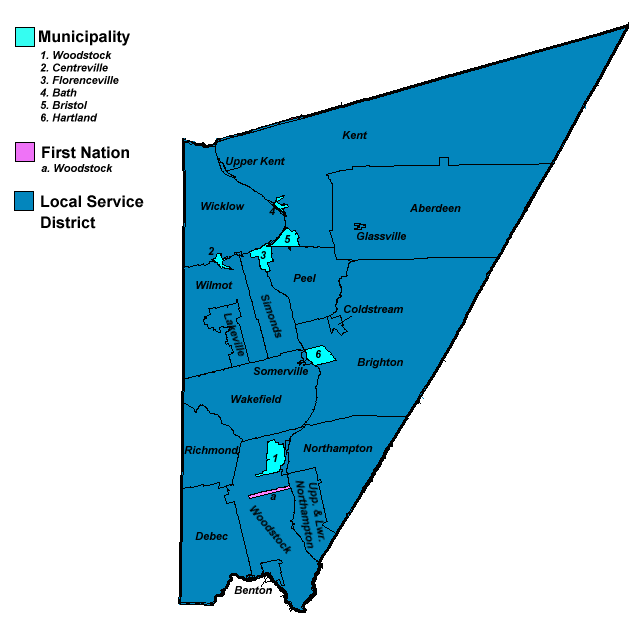
Carleton County (2016 population 26,220) is located in west-central New Brunswick, Canada. The western border is Aroostook County, Maine, Aroostook County, Maine, the northern border is Victoria County, New Brunswick, Victoria County, and the southeastern border is York County, New Brunswick, York County from which it was formed in 1831. The Saint John River (New Brunswick), Saint John River bisects the western section of the county. The Southwest Miramichi River flows through the eastern section of the county. Potato farming is a major industry. The scenic town of Hartland, New Brunswick, Hartland is home to the longest covered bridge in the world. Transportation Major Highways * * * * * * * * * * * * * * * * * * * * Census subdivisions List of communities in New Brunswick, Communities There are five incorporated municipalities within Carleton County (listed by 2016 population): First Nations There is one First Nations reserve in Carleton County, the Woodstock_First_Na ... [...More Info...] [...Related Items...] OR: [Wikipedia] [Google] [Baidu] |
Local Service District (New Brunswick)
A local service district (LSD) is a provincial administrative unit for the provision of local services in the Canadian province of New Brunswick. LSDs relate to areas of the province's former county municipalities that were not incorporated as municipalities around centres of population. They are defined in law by the ''Local Service Districts Regulation'' of the ''Municipalities Act''. In 2017, the ''Municipalities Act'' was replaced by the ''Local Governance Act'', which continued the ''Local Service Districts Regulation''. LSDs are operated by provincial staff. Residents have the opportunity to serve in an advisory capacity to provincial staff. As management units collectively referred to as unincorporated areas, application of the LSD concept has evolved to fit changes in communities over time, and they define their communities to varying degrees. For example, sub-units of the LSD make it possible to have separate taxing units within a LSD where one area may have grown to ha ... [...More Info...] [...Related Items...] OR: [Wikipedia] [Google] [Baidu] |
Canada
Canada is a country in North America. Its ten provinces and three territories extend from the Atlantic Ocean to the Pacific Ocean and northward into the Arctic Ocean, covering over , making it the world's second-largest country by total area. Its southern and western border with the United States, stretching , is the world's longest binational land border. Canada's capital is Ottawa, and its three largest metropolitan areas are Toronto, Montreal, and Vancouver. Indigenous peoples have continuously inhabited what is now Canada for thousands of years. Beginning in the 16th century, British and French expeditions explored and later settled along the Atlantic coast. As a consequence of various armed conflicts, France ceded nearly all of its colonies in North America in 1763. In 1867, with the union of three British North American colonies through Confederation, Canada was formed as a federal dominion of four provinces. This began an accretion of provinces an ... [...More Info...] [...Related Items...] OR: [Wikipedia] [Google] [Baidu] |


