|
Eismitte
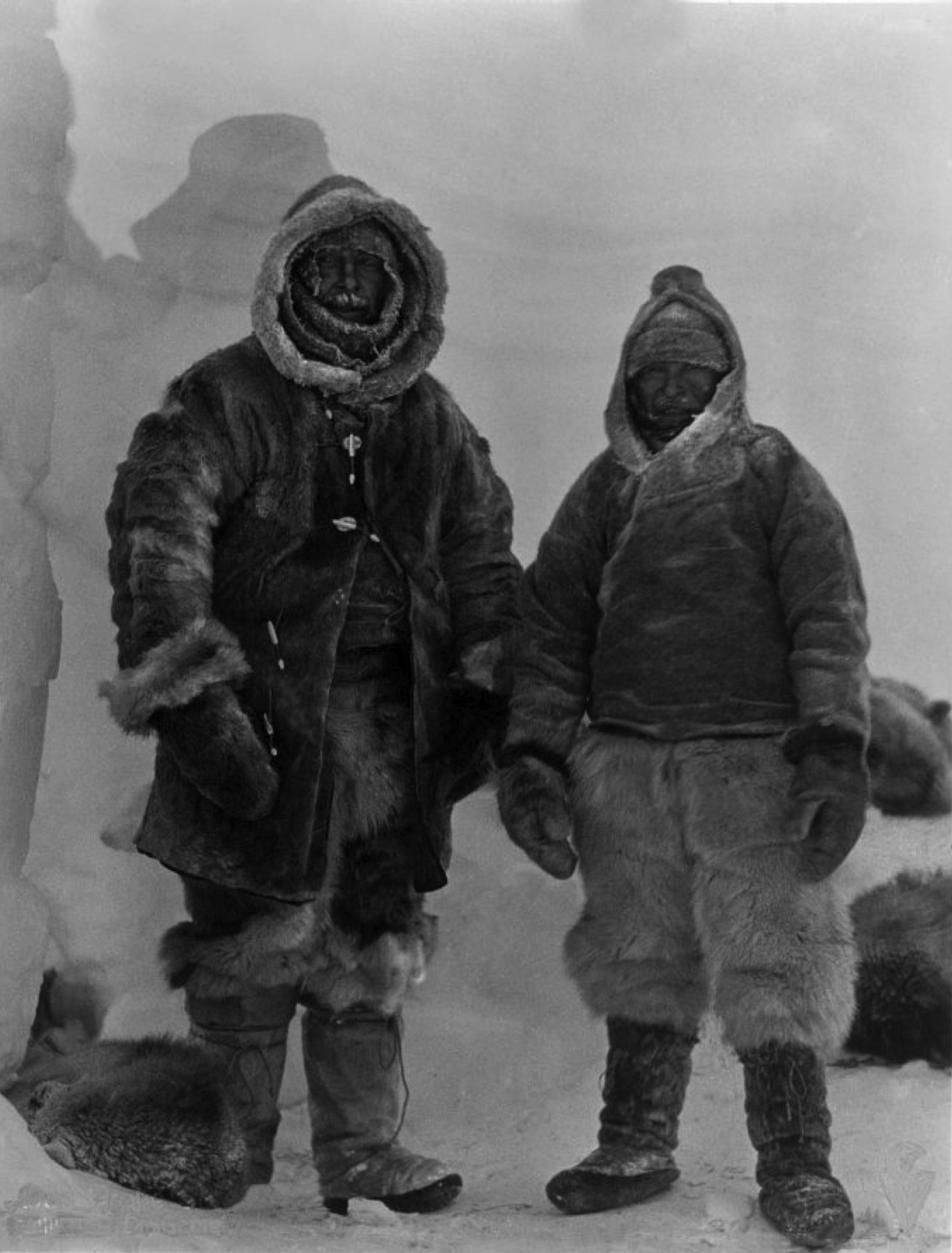
Eismitte, in English also called Mid-Ice, was the site of an Arctic expedition in the interior of Greenland that took place from July 1930 through August 1931, and claimed the life of noted German scientist Alfred Wegener. The name "Eismitte" means ''Ice-Middle'' in German, and the campsite was located from the coast at an estimated altitude of 3,010 meters (9,875 feet). The coldest temperature recorded during the expedition was −64.8 °C (−84.6 °F) on March 20, 1931, while the warmest temperature noted was −1.8 °C (28.8 °F) on July 9, 1931. For the 12-month period beginning August 1, 1930 and ending August 5, 1931, the warmest month, July, had a mean monthly temperature of −12.2 °C (10 °F), while the coldest month, February, averaged −47.2 °C (−53 °F). Over the same period a total of 110 millimeters (4.33 inches) of water-equivalent precipitation was recorded, with most of it, rather surprisingly, being received in w ... [...More Info...] [...Related Items...] OR: [Wikipedia] [Google] [Baidu] |
Alfred Wegener
Alfred Lothar Wegener (; ; 1 November 1880 – November 1930) was a German climatologist, geologist, geophysicist, meteorologist, and polar researcher. During his lifetime he was primarily known for his achievements in meteorology and as a pioneer of polar research, but today he is most remembered as the originator of continental drift hypothesis by suggesting in 1912 that the continents are slowly drifting around the Earth (German: '). His hypothesis was controversial and widely rejected by mainstream geology until the 1950s, when numerous discoveries such as palaeomagnetism provided strong support for continental drift, and thereby a substantial basis for today's model of plate tectonics. Wegener was involved in several expeditions to Greenland to study polar air circulation before the existence of the jet stream was accepted. Expedition participants made many meteorological observations and were the first to overwinter on the inland Greenland ice sheet and the firs ... [...More Info...] [...Related Items...] OR: [Wikipedia] [Google] [Baidu] |
Summit Camp
Summit Camp, also Summit Station, is a year-round staffed research station near the apex of the Greenland ice sheet. The station is located at above sea level. The population of the station is typically five in wintertime and reaches a maximum of 38 in the summer. The station is operated by the United States National Science FoundationArctic Logistics Information And Support (ALIAS) through the logistical-support contractor Battelle Arctic Research Operations (Battelle ARO). A permit from the Danish Polar Center ( da, Dansk Polarcenter) under the auspices of the Home R ... [...More Info...] [...Related Items...] OR: [Wikipedia] [Google] [Baidu] |
Greenland
Greenland ( kl, Kalaallit Nunaat, ; da, Grønland, ) is an island country in North America that is part of the Kingdom of Denmark. It is located between the Arctic and Atlantic oceans, east of the Canadian Arctic Archipelago. Greenland is the world's largest island. It is one of three constituent countries that form the Kingdom of Denmark, along with Denmark and the Faroe Islands; the citizens of these countries are all citizens of Denmark and the European Union. Greenland's capital is Nuuk. Though a part of the continent of North America, Greenland has been politically and culturally associated with Europe (specifically Norway and Denmark, the colonial powers) for more than a millennium, beginning in 986.The Fate of Greenland's Vikings , by Dale Mackenzie Brown, ''Archaeological Institute of Americ ... [...More Info...] [...Related Items...] OR: [Wikipedia] [Google] [Baidu] |
North Ice
North Ice was a research station of the British North Greenland Expedition (1952 to 1954) on the inland ice of Greenland. The coordinates of the station were , at an altitude of above sea level. The British North Greenland Expedition was led by Commander James Simpson RN. The station recorded a temperature of on 9 January 1954, which made it the lowest temperature ever recorded in North America up until that time. It was superseded by an observation of at the Greenland Ice Sheet on 22 December 1991. The name of the station contrasts to the former British South Ice station in Antarctica. See also * List of research stations in the Arctic * Eismitte *Summit Camp Summit Camp, also Summit Station, is a year-round staffed research station near the apex of the Greenland ice sheet. The station is located at above sea level. The population of the station is typically five in wintertime and reaches a maximu ... * NEEM Camp References Research stations in Greenland A ... [...More Info...] [...Related Items...] OR: [Wikipedia] [Google] [Baidu] |
1930 In Science
Year 193 ( CXCIII) was a common year starting on Monday (link will display the full calendar) of the Julian calendar. At the time, it was known as the Year of the Consulship of Sosius and Ericius (or, less frequently, year 946 ''Ab urbe condita''). The denomination 193 for this year has been used since the early medieval period, when the Anno Domini calendar era became the prevalent method in Europe for naming years. Events By place Roman Empire * January 1 – Year of the Five Emperors: The Roman Senate chooses Publius Helvius Pertinax, against his will, to succeed the late Commodus as Emperor. Pertinax is forced to reorganize the handling of finances, which were wrecked under Commodus, to reestablish discipline in the Roman army, and to suspend the food programs established by Trajan, provoking the ire of the Praetorian Guard. * March 28 – Pertinax is assassinated by members of the Praetorian Guard, who storm the imperial palace. The Empire is auctioned of ... [...More Info...] [...Related Items...] OR: [Wikipedia] [Google] [Baidu] |
History Of Greenland
The history of Greenland is a history of life under extreme Arctic conditions: currently, an ice sheet covers about eighty percent of the island, restricting human activity largely to the coasts. The first humans are thought to have arrived in Greenland around 2500 BC. Their descendants apparently died out and were succeeded by several other groups migrating from continental North America. There has been no evidence discovered that Greenland was known to Europeans until the 10th century, when Icelandic Vikings settled on its southwestern coast, which seems to have been uninhabited when they arrived. The ancestors of the Inuit Greenlanders who live there today appear to have migrated there later, around AD 1200, from northwestern Greenland. While the Inuit survived in the icy world of the Little Ice Age, the early Norse settlements along the southwestern coast disappeared, leaving the Inuit as the only inhabitants of the island for several centuries. During this time, Denmark-No ... [...More Info...] [...Related Items...] OR: [Wikipedia] [Google] [Baidu] |
Pole Of Inaccessibility
A pole of inaccessibility with respect to a geographical criterion of inaccessibility marks a location that is the most challenging to reach according to that criterion. Often it refers to the most distant point from the coastline, implying a maximum degree of continentality or oceanity. In these cases, a pole of inaccessibility can be defined as the center of the largest circle that can be drawn within an area of interest without encountering a coast. Where a coast is imprecisely defined, the pole will be similarly imprecise. Northern pole of inaccessibility The Northern pole of inaccessibility, sometimes known as the Arctic pole, is located on the Arctic Ocean pack ice at a distance farthest from any land mass. The original position was wrongly believed to lie at 84°03′N 174°51′W. It is not clear who first defined this point but it may have been Sir Hubert Wilkins, who wished to traverse the Arctic Ocean by aircraft, in 1927. He was finally successful in 1928. In 1968 ... [...More Info...] [...Related Items...] OR: [Wikipedia] [Google] [Baidu] |
Renland
Renland is a peninsula in eastern Greenland. It is a part of the Sermersooq municipality. Despite its proximity to the coast Renland has an ice cap climate with bitterly cold winters and very low maximum temperatures in the summer. Renland was named after the reindeer which were found formerly in the area, but disappeared around the early 20th century.Archaeology, p. 18 Geography Renland is surrounded to the north by the Nordvestfjord of the Scoresby Sound, to the south by the 6 to 10 km wide Ofjord and to the southwest by the Rype Fjord. To the west the peninsula is attached to the mainland and to the northwest lies Th. Sørensen Land and beyond it the Hinksland peninsula. Nathorst Land lies to the north, across the Nordvestfjord The Bjorne Islands lie off its eastern shore and to the south across the Ofjord lie the islands of Milneland and Storo. Renland has its own ice cap on a high plateau in the middle of the peninsula and in the southern part there are glacial lak ... [...More Info...] [...Related Items...] OR: [Wikipedia] [Google] [Baidu] |
Camp Century
Camp Century was an Arctic United States military scientific research base in Greenland. situated 240 km (150 miles) east of Thule Air Base. When built, Camp Century was publicized as a demonstration for affordable ice-cap military outposts and a base for scientific research. Camp Century was a preliminary camp for Project Iceworm whose end goal was to install a vast network of nuclear missile launch sites that could survive a first strike. This was according to documents declassified in 1996. The missiles were never fielded and necessary consent from the Danish Government to do so was never broached. The camp operated from 1959 until 1967. It consisted of 21 tunnels with a total length of , and was powered by a nuclear reactor. Project Iceworm was aborted after it was realized that the ice sheet was not as stable as originally assessed, and that the missile basing concept would not be feasible. The reactor was removed and Camp Century later abandoned. However, hazard ... [...More Info...] [...Related Items...] OR: [Wikipedia] [Google] [Baidu] |
NEEM Camp
NEEM Camp was a small research facility on the northern Greenland Ice Sheet, used as a base for ice core drilling. It was located about 313 km east of the closest coast, Peabody Bay in northern Greenland, 275 km northwest of the historical ice sheet camp North Ice, and 484 km east-northeast of Siorapaluk, the closest settlement. There was one heavy-duty tent for accommodation of the researchers during summer. Access was by skiway (snow runway). The acronym NEEM stands for North Greenland Eemian Ice Drilling. The ice at the NEEM coring location (77°27'N 51°3.6'W) was predicted to be 2545 m thick. Drilling started at NEEM in June 2009 and drillers expected to hit bedrock in 2010. The drilling progressed well and reached through the brittle zone (~800 m) in mid-July 2009. The plan was to process the ice below the brittle zone, per decision at the steering committee meeting in November 2008 in Copenhagen. By September 1, 2009, the coring had reached 1757.84 m for ... [...More Info...] [...Related Items...] OR: [Wikipedia] [Google] [Baidu] |
Polar Night
The polar night is a phenomenon where the nighttime lasts for more than 24 hours that occurs in the northernmost and southernmost regions of Earth. This occurs only inside the polar circles. The opposite phenomenon, the polar day, or midnight sun, occurs when the Sun remains above the horizon for more than 24 hours. "Night" is understood as the center of the Sun being below a free horizon. Since the atmosphere refracts sunlight, the polar day is longer than the polar night, and the area that is affected by polar night is somewhat smaller than the area of midnight sun. The polar circle is located at a latitude between these two areas, at approximately 66.5°. While it is day in the Arctic Circle, it is night in the Antarctic Circle, and vice versa. Any planet or moon with a sufficient axial tilt that rotates with respect to its star significantly more frequently than it orbits the star (no tidal locking between the two) will experience the same phenomenon (a nightt ... [...More Info...] [...Related Items...] OR: [Wikipedia] [Google] [Baidu] |
Ice Cap Climate
An ice cap climate is a polar climate where no mean monthly temperature exceeds . The climate covers areas in or near the high latitudes (65° latitude) to polar regions (70–90° north and south latitude), such as Antarctica, some of the northernmost islands of Canada and Russia, Greenland, along with some regions and islands of Norway's Svalbard Archipelago that have vast deserts of snow and ice. Areas with ice cap climates are normally covered by a permanent layer of ice and have no vegetation. There is limited animal life in most ice cap climates, usually found near the oceanic margins. Although ice cap climates are inhospitable to human life, there are some small research stations scattered in Antarctica and interior Greenland. Description Under the Köppen climate classification, the ice cap climate is denoted as ''EF''. Ice caps are defined as a climate with no months above . Such areas are found around the north and south pole, and on the top of many high mountains. Si ... [...More Info...] [...Related Items...] OR: [Wikipedia] [Google] [Baidu] |


.png)


.jpg)
