|
Dalanzadgad
Dalanzadgad ( mn, Даланзадгад; ) is the capital of Ömnögovi Aimag in Mongolia. It is located south of the national capital Ulaanbaatar. The altitude of the city center is 1,470 meters (4,823 feet). As of 2011, its population is 19,396. Transportation The Dalanzadgad Airport (ZMDZ/DLZ) is served by regular domestic flights from and to Ulaanbaatar. There are summer and winter timetables. In 2007 the Mongolian Civil Aviation Authority built a new airport with a paved runway. The runway is second longest in the country after Buyant-Ukhaa International Airport. Before that, the airport had only one gravel runway. The Dalanzadgad town has a paved road connecting it with capital Ulaanbaatar city. Gallery File:Dalanzadgad 04.JPG, Provincial Government Building. File:Dalanzadgad 01.JPG, Dalanzadgad Airport. File:DalanzadgadTemple.jpg, Temple. File:Dalanzadgad 06.JPG, Gandirs Shopping center. File:Dalanzadgad 09.JPG, The old Khan Bank. File:Dalanzadgad 17.JPG, Hotel Dalanz ... [...More Info...] [...Related Items...] OR: [Wikipedia] [Google] [Baidu] |
Dalanzadgad Airport
Dalanzadgad Airport is a public airport located in Dalanzadgad, the capital of Ömnögovi Province in Mongolia. Although Dalanzadgad Airport is classified as an international airport there are no scheduled flights outside Mongolia. Airlines and destinations See also * List of airports in Mongolia * List of airlines of Mongolia This is a list of airlines which have a current air operator's certificate issued by the Civil Aviation Authority of Mongolia ( mn, Иргэний Нисэхийн Ерөнхий Газар). Scheduled airlines Charter airlines Cargo airlines ... References External links world aero dataDalanzadgad Airports in Mongolia {{Mongolia-airport-stub ... [...More Info...] [...Related Items...] OR: [Wikipedia] [Google] [Baidu] |
Ömnögovi Province
Ömnögovi ( mn, Өмнөговь ''Ömnögovǐ'', ''South Gobi'') is an aimag (province) of Mongolia, located in the south of the country, in the Gobi Desert. Ömnögovi is Mongolia's largest aimag. The capital is Dalanzadgad. The province is rich in mineral deposits, including gold and copper. Agriculture is of minor importance. Vegetables are grown in some oases, e.g. in Dal near Dalanzadgad. As the aimag has various sights to offer, tourism is gaining importance. Ömnögovi includes several well known tourist areas, including the Flaming Cliffs, Gobi Gurvansaikhan National Park and Khongoryn Els - The Singing Sand Dunes. Transportation The Dalanzadgad Airport (ZMDZ/DLZ) has one concrete runway. It is served by regular domestic flights from and to Ulaanbaatar. Administrative subdivisions Image:OmnogoviLandscape.jpg, Landscape in Ömnögovi Aimag Image:Khulan.JPG, A Khulan (Mongolian Wild Ass) on a hill in the Gobi The Gobi Desert ( Chinese: 戈壁 (沙漠), ... [...More Info...] [...Related Items...] OR: [Wikipedia] [Google] [Baidu] |
Buyant-Ukhaa International Airport
Buyant-Ukhaa International Airport,, formerly called Chinggis Khaan International Airport, from 2005 to 2020 , is a semi-operational international airport serving Ulaanbaatar, Mongolia, situated southwest of the capital. Largely replaced by a new airport, it currently functions as a backup airport, with a view to be used for flight training as well as for special, charter, and government flights. History Development The airport was first established as Buyant-Ukhaa Central Airport, on 19 February 1957. In 1958, international flights began with flights to Irkutsk and Beijing using Ilyushin Il-14 aircraft. Regular flights from the airport started in 1961. The terminal was upgraded to make it suitable for international traffic in 1986. Following the Mongolian Revolution of 1990 and between 1994 and 1997 a further major upgrade of construction and air navigation was achieved with the assistance of the Asian Development Bank, making the airport compliant with ICAO standa ... [...More Info...] [...Related Items...] OR: [Wikipedia] [Google] [Baidu] |
Tsetserleg (city)
Tsetserleg , also romanized as Cecerleg ( mn, Цэцэрлэг, ; "park" or "garden") is the capital of Arkhangai Aimag (province) in Mongolia. It lies on the northeastern slopes of the Khangai Mountains, southwest of Ulaanbaatar. It has a population of 16,553 (2000 census, with Erdenebulgan sum rural territories population was 18,519), 16,618 (2003 est.), 16,300 (2006 est.). Tsetserleg is geographically located in the Bulgan sum in the south of the aimag. It is not to be confused with Tsetserleg sum in the north. In 1992 Tsetserleg was designated as Erdenebulgan sum, which has an area of . History Tsetserleg is an ancient cultural and commercial centre. It was once the seat of a monastery ( Zayiin Gegeen Monastery), built by the First Khalkh Zaya Pandita, Luvsanperenlei (1642–1715) (who should not be confused with Zaya Pandita Namkhaijantsan (1599–1662)). It consisted of the main Guden Süm, the Right, or Summer Semchin Temple, and the Left, or Winter Semchin Temple, a ... [...More Info...] [...Related Items...] OR: [Wikipedia] [Google] [Baidu] |
Mongolia
Mongolia; Mongolian script: , , ; lit. "Mongol Nation" or "State of Mongolia" () is a landlocked country in East Asia, bordered by Russia to the north and China to the south. It covers an area of , with a population of just 3.3 million, making it the world's most sparsely populated sovereign nation. Mongolia is the world's largest landlocked country that does not border a closed sea, and much of its area is covered by grassy steppe, with mountains to the north and west and the Gobi Desert to the south. Ulaanbaatar, the capital and largest city, is home to roughly half of the country's population. The territory of modern-day Mongolia has been ruled by various nomadic empires, including the Xiongnu, the Xianbei, the Rouran, the First Turkic Khaganate, and others. In 1206, Genghis Khan founded the Mongol Empire, which became the largest contiguous land empire in history. His grandson Kublai Khan conquered China proper and established the Yuan dynasty. After the co ... [...More Info...] [...Related Items...] OR: [Wikipedia] [Google] [Baidu] |
City
A city is a human settlement of notable size.Goodall, B. (1987) ''The Penguin Dictionary of Human Geography''. London: Penguin.Kuper, A. and Kuper, J., eds (1996) ''The Social Science Encyclopedia''. 2nd edition. London: Routledge. It can be defined as a permanent and densely settled place with administratively defined boundaries whose members work primarily on non-agricultural tasks. Cities generally have extensive systems for housing, transportation, sanitation, utilities, land use, production of goods, and communication. Their density facilitates interaction between people, government organisations and businesses, sometimes benefiting different parties in the process, such as improving efficiency of goods and service distribution. Historically, city-dwellers have been a small proportion of humanity overall, but following two centuries of unprecedented and rapid urbanization, more than half of the world population now lives in cities, which has had profound consequences for g ... [...More Info...] [...Related Items...] OR: [Wikipedia] [Google] [Baidu] |
Khulan
Khulan may refer to: * Khulan, a Mongolian word for a subspecies of the onager called the Mongolian wild ass, ''Equus hemionus hemionus'', * Khulan, a common female name in Mongolia: ** Khulan khatun Khulan ( mn, ᠬᠤᠯᠠᠨ, Ppp=qulan; ; – ) was an empress consort of Genghis Khan and head of the second Court of Genghis Khan. Her status in the Mongol Empire was second only to Grand Empress Börte. Biography Khulan was a daughter of ... ( – ), wife of Genghis Khan ** Khulan (wife of Anatole) ** Chuluuny Khulan, Mongolian actress ** Khashbatyn Khulan, Mongolian politician See also * Kulan (other) {{disambig, surname ... [...More Info...] [...Related Items...] OR: [Wikipedia] [Google] [Baidu] |
National Oceanic And Atmospheric Administration
The National Oceanic and Atmospheric Administration (abbreviated as NOAA ) is an United States scientific and regulatory agency within the United States Department of Commerce that forecasts weather, monitors oceanic and atmospheric conditions, charts the seas, conducts deep sea exploration, and manages fishing and protection of marine mammals and endangered species in the U.S. exclusive economic zone. Purpose and function NOAA's specific roles include: * ''Supplying Environmental Information Products''. NOAA supplies to its customers and partners information pertaining to the state of the oceans and the atmosphere, such as weather warnings and forecasts via the National Weather Service. NOAA's information services extend as well to climate, ecosystems, and commerce. * ''Providing Environmental Stewardship Services''. NOAA is a steward of U.S. coastal and marine environments. In coordination with federal, state, local, tribal and international authorities, NOAA manages the ... [...More Info...] [...Related Items...] OR: [Wikipedia] [Google] [Baidu] |
Hohhot
Hohhot,; abbreviated zh, c=呼市, p=Hūshì, labels=no formerly known as Kweisui, is the capital of Inner Mongolia in the north of the People's Republic of China, serving as the region's administrative, economic and cultural center.''The New Encyclopædia Britannica'', 15th Edition (1977), Vol. I, p. 275. Its population was 3,446,100 inhabitants as of the 2020 census, of whom 2,944,889 lived in the metropolitan area consisting of 4 urban districts (including Hohhot Economic and Development Zone) plus the Tümed Left Banner. The name of the city in Mongolian means "Blue City", although it is also wrongly referred to as the "Green City."Perkins (1999), p. 212. The color blue in Mongol culture is associated with the sky, eternity and purity. In Chinese, the name can be translated as ''Qīng Chéng'' () The name has also been variously romanized as Kokotan, Kokutan, Kuku-hoton, Huhohaot'e, Huhehot, Huhot, or Köke qota. The city is a seat of the Inner Mongolia University, th ... [...More Info...] [...Related Items...] OR: [Wikipedia] [Google] [Baidu] |
Arvaikheer
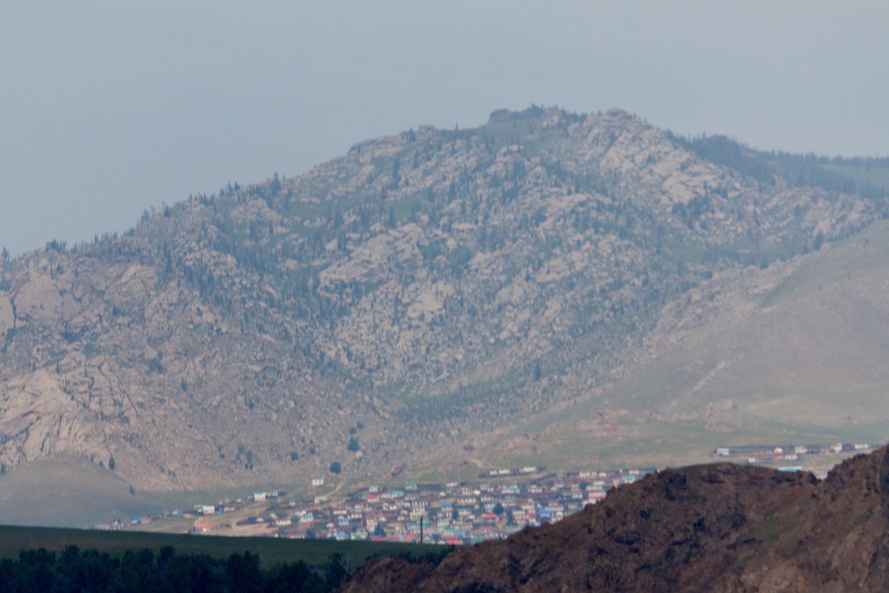
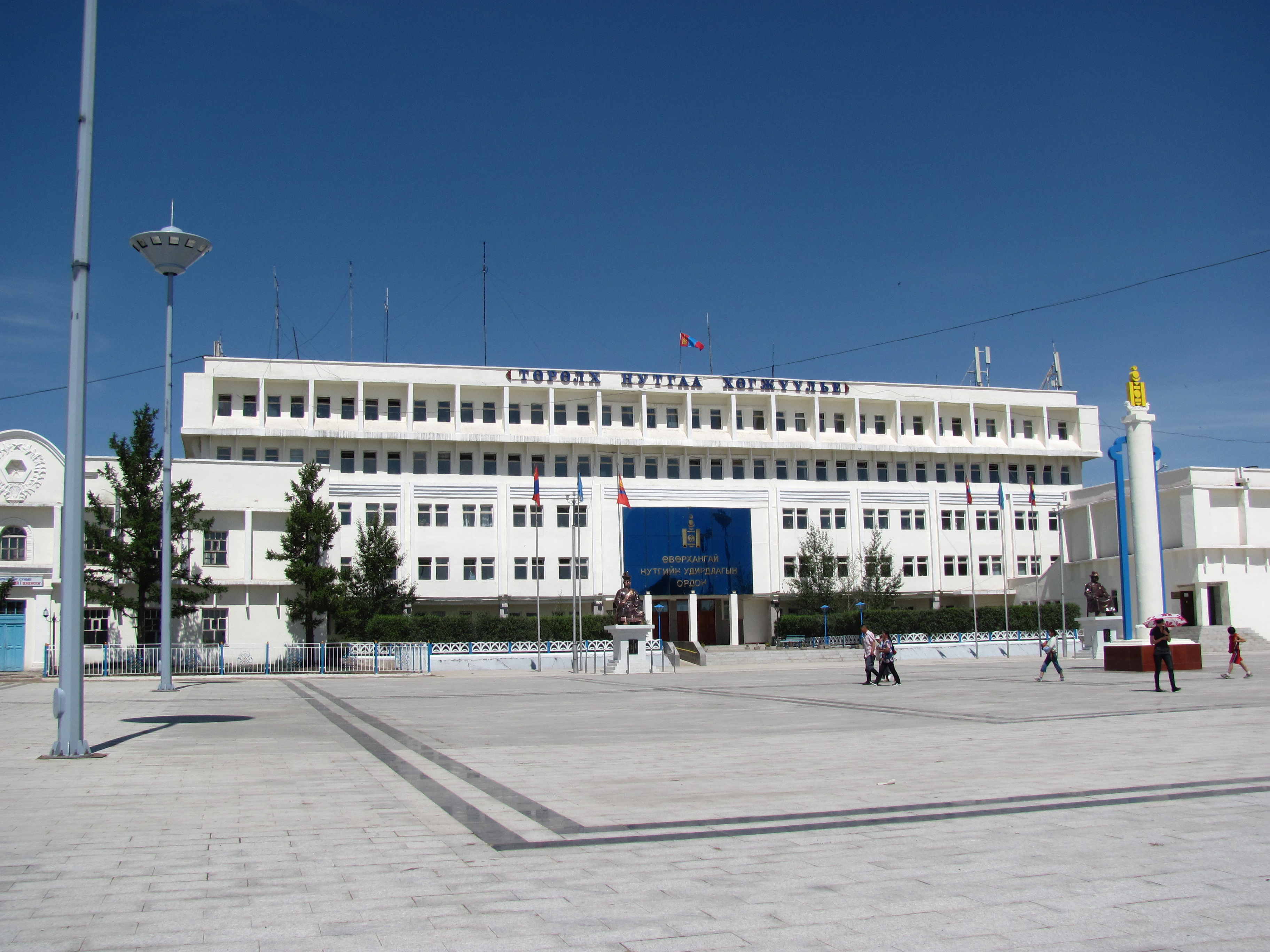
Arvaikheer, also spelt Arwaiheer ( mn, Арвайхээр, ; "Barley Steppe") is the capital of Övörkhangai Aimag (province) and one of the most central points of Mongolia. It is a centre for traditional crafts, goat herding and equestrian sports, and hosts a large regional horse festival every year. Arvaikheer has a population of 19,058 (2000 census), 23,298 (2004 est.), 24,954 (2006 est.), 25,622 (2008 est.Övörkhangai Aimag Sums Statistics, 2009 ). Arvaikheer is by far the largest town in the . Climate Arvaikheer has a |
Yolyn Am
Remnants of the Yolyn Am ice field, September 2006 Yolyn Am ( mn, Ёлын Ам, ''Lammergeier Valley'') is a deep and narrow gorge in the Gurvan Saikhan Mountains of southern Mongolia. The valley is named after the Lammergeier, which is called ''Yol'' in Mongolian. The Lammergeier is an Old World vulture, hence the name is often translated to ''Valley of the Vultures'' or ''Valley of the Eagles''. The valley is located within Gobi Gurvansaikhan National Park. Yolyn Am is found in the Zuun Saikhanii Nuruu (the ''Eastern Beauty'') subrange of the Gurvan Saikhan Mountains. The area, as part of the Gobi Desert, sees little precipitation. However, Yolyn Am is notable for a deep ice field An ice field (also spelled icefield) is a mass of interconnected valley glaciers (also called mountain glaciers or alpine glaciers) on a mountain mass with protruding rock ridges or summits. They are often found in the colder climates and highe .... The ice field reaches several meters thic ... [...More Info...] [...Related Items...] OR: [Wikipedia] [Google] [Baidu] |
Köppen Climate Classification
The Köppen climate classification is one of the most widely used climate classification systems. It was first published by German-Russian climatologist Wladimir Köppen (1846–1940) in 1884, with several later modifications by Köppen, notably in 1918 and 1936. Later, the climatologist Rudolf Geiger (1894–1981) introduced some changes to the classification system, which is thus sometimes called the Köppen–Geiger climate classification system. The Köppen climate classification divides climates into five main climate groups, with each group being divided based on seasonal precipitation and temperature patterns. The five main groups are ''A'' (tropical), ''B'' (arid), ''C'' (temperate), ''D'' (continental), and ''E'' (polar). Each group and subgroup is represented by a letter. All climates are assigned a main group (the first letter). All climates except for those in the ''E'' group are assigned a seasonal precipitation subgroup (the second letter). For example, ''Af'' indi ... [...More Info...] [...Related Items...] OR: [Wikipedia] [Google] [Baidu] |


