|
Tsetserleg (city)
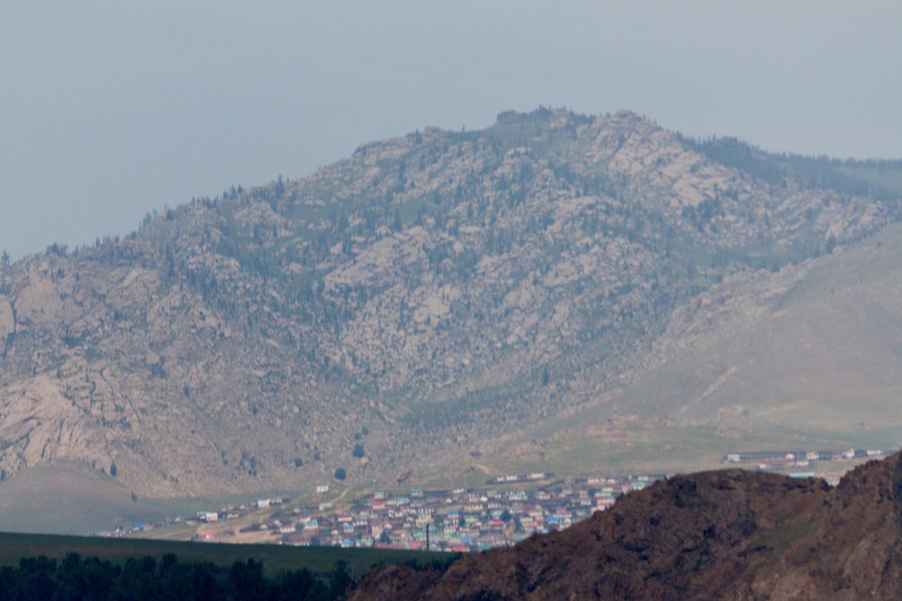
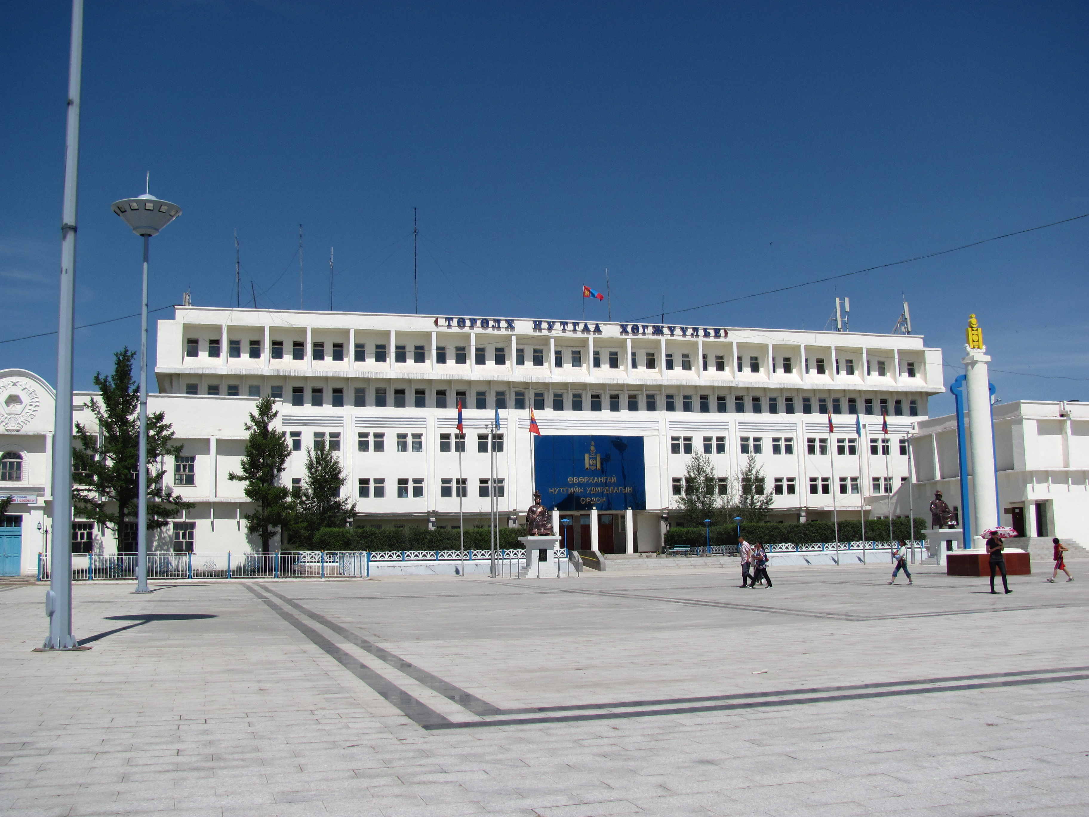
Tsetserleg , also romanized as Cecerleg ( mn, Цэцэрлэг, ; "park" or "garden") is the capital of Arkhangai Aimag (province) in Mongolia. It lies on the northeastern slopes of the Khangai Mountains, southwest of Ulaanbaatar. It has a population of 16,553 (2000 census, with Erdenebulgan sum rural territories population was 18,519), 16,618 (2003 est.), 16,300 (2006 est.). Tsetserleg is geographically located in the Bulgan sum in the south of the aimag. It is not to be confused with Tsetserleg sum in the north. In 1992 Tsetserleg was designated as Erdenebulgan sum, which has an area of . History Tsetserleg is an ancient cultural and commercial centre. It was once the seat of a monastery ( Zayiin Gegeen Monastery), built by the First Khalkh Zaya Pandita, Luvsanperenlei (1642–1715) (who should not be confused with Zaya Pandita Namkhaijantsan (1599–1662)). It consisted of the main Guden Süm, the Right, or Summer Semchin Temple, and the Left, or Winter Semchin Temple, a ... [...More Info...] [...Related Items...] OR: [Wikipedia] [Google] [Baidu] |
Tsetserleg, Arkhangai
Tsetserleg ( mn, Цэцэрлэг сум; "Garden District") is a sum (district) of Arkhangai Province in central Mongolia Mongolia; Mongolian script: , , ; lit. "Mongol Nation" or "State of Mongolia" () is a landlocked country in East Asia, bordered by Russia to the north and China to the south. It covers an area of , with a population of just 3.3 millio .... In 2009, its population was 3,813.Dec. 31 2009 estimation. Arkhangai Aimag Statistical Service The sum is located in the north of the aimag, both geographically and administratively separate from the aimag capital Tsetserleg. References [...More Info...] [...Related Items...] OR: [Wikipedia] [Google] [Baidu] |
Baabar
Baabar (; born Bat-Erdeniin Batbayar [] in Tsetserleg (city), Tsetserleg, Arkhangai, in 1954) is a Mongolian retired politician, political analyst and writer. Education *1972 Graduated from a high school in Ulan-Bator *1972–1973 Attended a preparatory course at the Mongolian State University *1973–1980 Studied at the Jagiellonian University, Kraków, Poland until he was transferred to Mongolian State University which he graduated in 1981 majoring in biochemistry. *1987–1989 Studied at the Moscow State University, Soviet Union. *1990 Scholarship at The Imperial College of Science, Technology and Medicine, London, United Kingdom. Career Baabar worked at the Microbiological Research and Production Center as a Researcher in 1981–1991 until he became the Leader of the Mongolian Social Democratic Party. He resigned as the Leader of the Mongolian Social Democratic Party in 1994. Baabar was elected to the State Great Hural of Mongolia in 1996. From 1998 to 1999, he was Min ... [...More Info...] [...Related Items...] OR: [Wikipedia] [Google] [Baidu] |
Bellingham, Washington
Bellingham ( ) is the most populous city in, and county seat of Whatcom County in the U.S. state of Washington. It lies south of the U.S.–Canada border in between two major cities of the Pacific Northwest: Vancouver, British Columbia (located to the northwest) and Seattle ( to the south). The city had a population of 92,314 as of 2019. The city of Bellingham, incorporated in 1903, consolidated four settlements: Bellingham, Whatcom, Fairhaven, and Sehome. It takes its name from Bellingham Bay, named by George Vancouver in 1792, for Sir William Bellingham, the Controller of Storekeeper Accounts of the Royal Navy during the Vancouver Expedition. Today, Bellingham is the northernmost city with a population of more than 90,000 people in the contiguous United States. It is a popular tourist destination known for its easy access to outdoor recreation in the San Juan Islands and North Cascades. More than of former industrial land on the Bellingham waterfront is undergoin ... [...More Info...] [...Related Items...] OR: [Wikipedia] [Google] [Baidu] |
National Oceanic And Atmospheric Administration
The National Oceanic and Atmospheric Administration (abbreviated as NOAA ) is an United States scientific and regulatory agency within the United States Department of Commerce that forecasts weather, monitors oceanic and atmospheric conditions, charts the seas, conducts deep sea exploration, and manages fishing and protection of marine mammals and endangered species in the U.S. exclusive economic zone. Purpose and function NOAA's specific roles include: * ''Supplying Environmental Information Products''. NOAA supplies to its customers and partners information pertaining to the state of the oceans and the atmosphere, such as weather warnings and forecasts via the National Weather Service. NOAA's information services extend as well to climate, ecosystems, and commerce. * ''Providing Environmental Stewardship Services''. NOAA is a steward of U.S. coastal and marine environments. In coordination with federal, state, local, tribal and international authorities, NOAA manages the ... [...More Info...] [...Related Items...] OR: [Wikipedia] [Google] [Baidu] |
Hardiness Zone
A hardiness zone is a geographic area defined as having a certain average annual minimum temperature, a factor relevant to the survival of many plants. In some systems other statistics are included in the calculations. The original and most widely used system, developed by the United States Department of Agriculture (USDA) as a rough guide for landscaping and gardening, defines 13 zones by long-term average annual extreme minimum temperatures. It has been adapted by and to other countries (such as Canada) in various forms. Unless otherwise specified, in American contexts "hardiness zone" or simply "zone" usually refers to the USDA scale. For example, a plant may be described as "hardy to zone 10": this means that the plant can withstand a minimum temperature of 30 °F (−1.1 °C) to 40 °F (4.4 °C). Other hardiness rating schemes have been developed as well, such as the UK Royal Horticultural Society and US Sunset Western Garden Book systems. A heat zone (s ... [...More Info...] [...Related Items...] OR: [Wikipedia] [Google] [Baidu] |
Arvaikheer
Arvaikheer, also spelt Arwaiheer ( mn, Арвайхээр, ; "Barley Steppe") is the capital of Övörkhangai Aimag (province) and one of the most central points of Mongolia. It is a centre for traditional crafts, goat herding and equestrian sports, and hosts a large regional horse festival every year. Arvaikheer has a population of 19,058 (2000 census), 23,298 (2004 est.), 24,954 (2006 est.), 25,622 (2008 est.Övörkhangai Aimag Sums Statistics, 2009 ). Arvaikheer is by far the largest town in the . Climate Arvaikheer has a |
Dalanzadgad
Dalanzadgad ( mn, Даланзадгад; ) is the capital of Ömnögovi Aimag in Mongolia. It is located south of the national capital Ulaanbaatar. The altitude of the city center is 1,470 meters (4,823 feet). As of 2011, its population is 19,396. Transportation The Dalanzadgad Airport (ZMDZ/DLZ) is served by regular domestic flights from and to Ulaanbaatar. There are summer and winter timetables. In 2007 the Mongolian Civil Aviation Authority built a new airport with a paved runway. The runway is second longest in the country after Buyant-Ukhaa International Airport. Before that, the airport had only one gravel runway. The Dalanzadgad town has a paved road connecting it with capital Ulaanbaatar city. Gallery File:Dalanzadgad 04.JPG, Provincial Government Building. File:Dalanzadgad 01.JPG, Dalanzadgad Airport. File:DalanzadgadTemple.jpg, Temple. File:Dalanzadgad 06.JPG, Gandirs Shopping center. File:Dalanzadgad 09.JPG, The old Khan Bank. File:Dalanzadgad 17.JPG, Hotel Dalan ... [...More Info...] [...Related Items...] OR: [Wikipedia] [Google] [Baidu] |
Hohhot
Hohhot,; abbreviated zh, c=呼市, p=Hūshì, labels=no formerly known as Kweisui, is the capital of Inner Mongolia in the north of the People's Republic of China, serving as the region's administrative, economic and cultural center.''The New Encyclopædia Britannica'', 15th Edition (1977), Vol. I, p. 275. Its population was 3,446,100 inhabitants as of the 2020 census, of whom 2,944,889 lived in the metropolitan area consisting of 4 urban districts (including Hohhot Economic and Development Zone) plus the Tümed Left Banner. The name of the city in Mongolian means "Blue City", although it is also wrongly referred to as the "Green City."Perkins (1999), p. 212. The color blue in Mongol culture is associated with the sky, eternity and purity. In Chinese, the name can be translated as ''Qīng Chéng'' () The name has also been variously romanized as Kokotan, Kokutan, Kuku-hoton, Huhohaot'e, Huhehot, Huhot, or Köke qota. The city is a seat of the Inner Mongolia University, ... [...More Info...] [...Related Items...] OR: [Wikipedia] [Google] [Baidu] |
Microclimate
A microclimate (or micro-climate) is a local set of atmospheric conditions that differ from those in the surrounding areas, often with a slight difference but sometimes with a substantial one. The term may refer to areas as small as a few square meters or square feet (for example a garden bed or a cave) or as large as many square kilometers or square miles. Because climate is statistical, which implies spatial and temporal variation of the mean values of the describing parameters, within a region there can occur and persist over time sets of statistically distinct conditions, that is, microclimates. Microclimates can be found in most places but are most pronounced in topographically dynamic zones such as mountainous areas, islands, coastal areas. Microclimates exist, for example, near bodies of water which may cool the local atmosphere, or in heavy urban areas where brick, concrete, and asphalt absorb the sun's energy, heat up, and re-radiate that heat to the ambient air: the ... [...More Info...] [...Related Items...] OR: [Wikipedia] [Google] [Baidu] |
Köppen Climate Classification
The Köppen climate classification is one of the most widely used climate classification systems. It was first published by German-Russian climatologist Wladimir Köppen (1846–1940) in 1884, with several later modifications by Köppen, notably in 1918 and 1936. Later, the climatologist Rudolf Geiger (1894–1981) introduced some changes to the classification system, which is thus sometimes called the Köppen–Geiger climate classification system. The Köppen climate classification divides climates into five main climate groups, with each group being divided based on seasonal precipitation and temperature patterns. The five main groups are ''A'' (tropical), ''B'' (arid), ''C'' (temperate), ''D'' (continental), and ''E'' (polar). Each group and subgroup is represented by a letter. All climates are assigned a main group (the first letter). All climates except for those in the ''E'' group are assigned a seasonal precipitation subgroup (the second letter). For example, ''Af'' i ... [...More Info...] [...Related Items...] OR: [Wikipedia] [Google] [Baidu] |
Subarctic Climate
The subarctic climate (also called subpolar climate, or boreal climate) is a climate with long, cold (often very cold) winters, and short, warm to cool summers. It is found on large landmasses, often away from the moderating effects of an ocean, generally at latitudes from 50° to 70°N, poleward of the humid continental climates. Subarctic or boreal climates are the source regions for the cold air that affects temperate latitudes to the south in winter. These climates represent Köppen climate classification ''Dfc'', ''Dwc'', ''Dsc'', ''Dfd'', ''Dwd'' and ''Dsd''. Description This type of climate offers some of the most extreme seasonal temperature variations found on the planet: in winter, temperatures can drop to below and in summer, the temperature may exceed . However, the summers are short; no more than three months of the year (but at least one month) must have a 24-hour average temperature of at least to fall into this category of climate, and the coldest month should a ... [...More Info...] [...Related Items...] OR: [Wikipedia] [Google] [Baidu] |
Maidarjavyn Ganzorig
Maidarjavyn Ganzorig ( mn, Майдаржавын Ганзориг; 5 February 1949 – 4 July 2021) was a Mongolian cosmonaut and academic. In 1978, he participated in the Soviet Intercosmos program and trained for the Soyuz 39 mission. Biography Ganzorig was born in Tsetserleg, Arkhangai in 1949, finishing his secondary education in 1968. He studied at Kyiv Polytechnic Institute, earning a degree in heating and precision automated devices maintenance, graduating in 1975. In 1978, he was selected as the backup to Jügderdemidiin Gürragchaa for the Soyuz 39 mission, who would become the first Mongolian in space. In 1984, he received a Candidate of Technical Sciences degree. From 1984 to 1991 Ganzorig was Head of the RS Laboratory at the Institute of Physics and Technology, Mongolian Academy of Sciences, and since 1991 served as the Director of Informatics at the Remote Sensing Center, Mongolian Academy of Sciences, Ulaanbaatar Ulaanbaatar (; mn, Улаанбаата ... [...More Info...] [...Related Items...] OR: [Wikipedia] [Google] [Baidu] |

.jpeg)


