|
Chongju Chongnyon Station
Chŏngju Ch'ŏngnyŏn Station is a railway station in Yŏkchŏn-dong, Chŏngju city, North P'yŏngan Province, North Korea. It is the junction of the P'yŏngŭi and P'yŏngbuk lines of the Korean State Railway.Kokubu, Hayato, 将軍様の鉄道 (Shōgun-sama no Tetsudō), History The station was opened, along with the rest of this section of the Kyŏngŭi Line, on 5 November 1905. After the bridge across the Yalu River was opened on 1 November 1911, connecting Sinŭiju to Dandong, China, Chŏngju station became a stop for international trains to and from Manchuria. It is still a stopping point for international trains between P'yŏngyang and Beijing. Destroyed during the Korean War , date = {{Ubl, 25 June 1950 – 27 July 1953 (''de facto'')({{Age in years, months, weeks and days, month1=6, day1=25, year1=1950, month2=7, day2=27, year2=1953), 25 June 1950 – present (''de jure'')({{Age in years, months, weeks a ..., the station was rebuilt after the end ... [...More Info...] [...Related Items...] OR: [Wikipedia] [Google] [Baidu] |
Chongju
Chŏngju (; also Jŏngju) is a ''si'', or city, in southern North P'yŏngan province, North Korea. Prior to 1994, it was designated as a ''kun'' or county. The terrain is mostly level, but mountainous in the north. To the south lies the Chŏngju Plain, where the hills do not rise above . Chŏngju also includes approximately 10 islands in the Yellow Sea. Geography Some 40 percent of Chŏngju is covered by coniferous forestland. Administrative divisions Chŏngju is divided into 14 ''tong'' (neighbourhoods) and 18 '' ri'' (villages): Economy Local agriculture is dominated by orcharding and rice farming; the chestnuts of this region are especially famous. Transportation The city is served by both road and rail; it is the junction point of the P'yŏngŭi and P'yŏngbuk lines of the Korean State Railway. Politics In February 2011, the city and others in North P'yŏngan had rare protests, of a few score of people, calling for adequate provision of rice and power. At the time ... [...More Info...] [...Related Items...] OR: [Wikipedia] [Google] [Baidu] |
Sinuiju
Sinŭiju (''Sinŭiju-si'', ; known before 1925 in English as Yeng Byen City) is a city in North Korea which faces Dandong, Liaoning, China across the international border of the Yalu River. It is the capital of North P'yŏngan province. Part of the city is included in the Sinŭiju Special Administrative Region, which was established in 2002 to experiment with introducing a market economy. In recent years, the city, despite lagging behind the development in the capital Pyongyang, has seen a small construction boom and increasing tourism from China. Geography Sinŭiju is bordered by the Amnok River, and by P'ihyŏn and Ryongch'ŏn counties. The city's altitude is 1 metre (4 feet) above sea level. There are several islands at the mouth of the Amnok River - Wihwa-do, Rim-do, Ryuch'o-do and Tongryuch'o-do. Administrative divisions Sinuiju city is the heart of the Sinuiju Special Administrative Region. The city is currently divided into 49 ''tong'' (neighbourhoods) and 9 '' ... [...More Info...] [...Related Items...] OR: [Wikipedia] [Google] [Baidu] |
Railway Stations In North Korea ...
List of railway stations in North Korea. Closed stations are not included. Alphabetical list References {{Asia topic, List of railway stations in * North Korea Railway stations Railway stations A train station, railway station, railroad station or depot is a railway facility where trains stop to load or unload passengers, freight or both. It generally consists of at least one platform, one track and a station building providing such ... [...More Info...] [...Related Items...] OR: [Wikipedia] [Google] [Baidu] |
Korean War
, date = {{Ubl, 25 June 1950 – 27 July 1953 (''de facto'')({{Age in years, months, weeks and days, month1=6, day1=25, year1=1950, month2=7, day2=27, year2=1953), 25 June 1950 – present (''de jure'')({{Age in years, months, weeks and days, month1=6, day1=25, year1=1950) , place = Korean Peninsula, Yellow Sea, Sea of Japan, Korea Strait, China–North Korea border , territory = Korean Demilitarized Zone established * North Korea gains the city of Kaesong, but loses a net total of {{Convert, 1506, sqmi, km2, abbr=on, order=flip, including the city of Sokcho, to South Korea. , result = Inconclusive , combatant1 = {{Flag, First Republic of Korea, name=South Korea, 1949, size=23px , combatant1a = {{Plainlist , * {{Flagicon, United Nations, size=23px United Nations Command, United Nations{{Refn , name = nbUNforces , group = lower-alpha , On 9 July 1951 troop constituents were: US: 70.4%, ROK: 23.3% other UNC: 6.3%{{Cite ... [...More Info...] [...Related Items...] OR: [Wikipedia] [Google] [Baidu] |
Beijing
} Beijing ( ; ; ), alternatively romanized as Peking ( ), is the capital of the People's Republic of China. It is the center of power and development of the country. Beijing is the world's most populous national capital city, with over 21 million residents. It has an administrative area of , the third in the country after Guangzhou and Shanghai. It is located in Northern China, and is governed as a municipality under the direct administration of the State Council with 16 urban, suburban, and rural districts.Figures based on 2006 statistics published in 2007 National Statistical Yearbook of China and available online at archive. Retrieved 21 April 2009. Beijing is mostly surrounded by Hebei Province with the exception of neighboring Tianjin to the southeast; together, the three divisions form the Jingjinji megalopolis and the national capital region of China. Beijing is a global city and one of the world's leading centres for culture, diplomacy, politics, finance, busi ... [...More Info...] [...Related Items...] OR: [Wikipedia] [Google] [Baidu] |
Pyongyang
Pyongyang (, , ) is the capital and largest city of North Korea, where it is known as the "Capital of the Revolution". Pyongyang is located on the Taedong River about upstream from its mouth on the Yellow Sea. According to the 2008 population census, it has a population of 3,255,288. Pyongyang is a directly administered city () with equal status to North Korean provinces. Pyongyang is one of the oldest cities in Korea. It was the capital of two ancient Korean kingdoms, Gojoseon and Goguryeo, and served as the secondary capital of Goryeo. Much of the city was destroyed during the First Sino-Japanese War, but it was revived Korea under Japanese rule, under Japanese rule and became an industrial center. Following the establishment of North Korea in 1948, Pyongyang became its ''de facto'' capital. The city was again devastated during the Korean War, but was quickly rebuilt after the war with Soviet Union, Soviet assistance. Pyongyang is the political, industrial and transport ... [...More Info...] [...Related Items...] OR: [Wikipedia] [Google] [Baidu] |
Manchuria
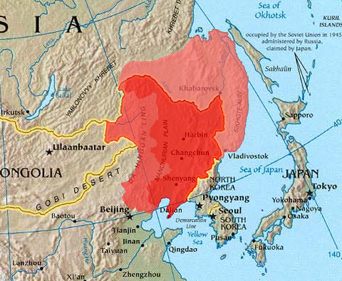
Manchuria is an exonym (derived from the endo demonym " Manchu") for a historical and geographic region in Northeast Asia encompassing the entirety of present-day Northeast China (Inner Manchuria) and parts of the Russian Far East (Outer Manchuria). Its meaning may vary depending on the context: * Historical polities and geographical regions usually referred to as Manchuria: ** The Later Jin (1616–1636), the Manchu-led dynasty which renamed itself from "Jin" to "Qing", and the ethnicity from "Jurchen" to "Manchu" in 1636 ** the subsequent duration of the Qing dynasty prior to its conquest of China proper (1644) ** the northeastern region of Qing dynasty China, the homeland of Manchus, known as "Guandong" or "Guanwai" during the Qing dynasty ** The region of Northeast Asia that served as the historical homeland of the Jurchens and later their descendants Manchus ***Qing control of Dauria (the region north of the Amur River, but in its watershed) was contested in 1643 when ... [...More Info...] [...Related Items...] OR: [Wikipedia] [Google] [Baidu] |
China
China, officially the People's Republic of China (PRC), is a country in East Asia. It is the world's most populous country, with a population exceeding 1.4 billion, slightly ahead of India. China spans the equivalent of five time zones and borders fourteen countries by land, the most of any country in the world, tied with Russia. Covering an area of approximately , it is the world's third largest country by total land area. The country consists of 22 provinces, five autonomous regions, four municipalities, and two Special Administrative Regions (Hong Kong and Macau). The national capital is Beijing, and the most populous city and financial center is Shanghai. Modern Chinese trace their origins to a cradle of civilization in the fertile basin of the Yellow River in the North China Plain. The semi-legendary Xia dynasty in the 21st century BCE and the well-attested Shang and Zhou dynasties developed a bureaucratic political system to serve hereditary monarchies, or dyna ... [...More Info...] [...Related Items...] OR: [Wikipedia] [Google] [Baidu] |
Dandong
Dandong (), formerly known as Andong, is a coastal prefecture-level city in southeastern Liaoning province, in the northeastern region of People's Republic of China. It is the largest Chinese border city, facing Sinuiju, North Korea across the Yalu River, which demarcates the Sino-North Korean border. To the southwest of the city, the river flows into Korea Bay. Dandong has therefore had a dynamic history because of its strategic location for the northeast's rich natural resources and because of its convenient access to the ocean. It is designated as a major export production centre for the province, and is a port city connected by rail with Shenyang and Sinuiju. A significant amount of trade with North Korea flows through the city. Kanto, Dick K. and Mark E. Manyin. ''China-North Korea Relations''. DIANE Publishing. December 28, 2010.10 Retrieved from Google Books on October 23, 2012. , 9781437985115. The size of the administrative city (prefecture) is . As of the 2020 ... [...More Info...] [...Related Items...] OR: [Wikipedia] [Google] [Baidu] |
Yalu River
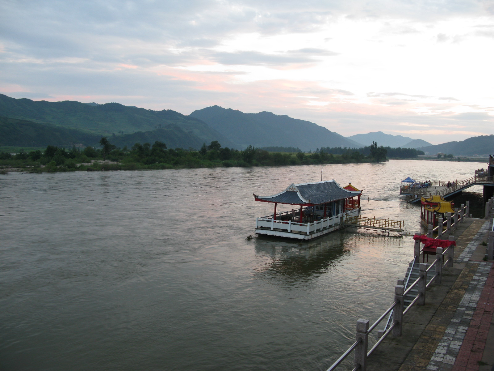
The Yalu River, known by Koreans as the Amrok River or Amnok River, is a river on the border between North Korea and China. Together with the Tumen River to its east, and a small portion of Paektu Mountain, the Yalu forms the border between North Korea and China. Its valley became the scene of several military conflicts in the past centuries. Name Two theories are given regarding the origin of the river's name. One theory is that the name derived from ''Yalu ula'' () in the Manchu language. The Manchu word ''yalu'' () means "the boundary between two countries". In Mandarin Chinese, phonetically approximates the original Manchu word, but literally means "duck green", which was said to have been once the color of the river. The other theory is that the river was named after the combination of its two upper branches, which were called "" ( or'' Ap'') and "" ( or ''R''(or ''n'')''ok'')", respectively. Revised Romanization of Korean spelled it (; "Amnok River") and Revised Roma ... [...More Info...] [...Related Items...] OR: [Wikipedia] [Google] [Baidu] |
North Pyongan Province
North Pyongan Province (Phyŏnganbukto; , also spelled North P'yŏngan), is a western province of North Korea. The province was formed in 1896 from the northern half of the former P'yŏng'an Province, remained a province of Korea until 1945, then became a province of North Korea. Its capital is Sinŭiju. In 2002, Sinŭiju Special Administrative Region—near the city of Sinuiju—was established as a separately governed Special Administrative Region. Geography The Yalu River forms the northern border with China's Liaoning province. The province is also bordered on the east by Chagang Province and on the south by South Pyong'an Province. The Sinŭiju Special Administrative Region is located in the western corner of the province, and was created as an administrative entity separate from North Pyongan in 2002. North Pyongan is bounded by water on the west with Korea Bay and the Yellow Sea. Administrative divisions North Pyongan is divided into 3 cities ( ''si'') and 22 counties ... [...More Info...] [...Related Items...] OR: [Wikipedia] [Google] [Baidu] |
Gyeongui Line
The Gyeongui Line is a railway line between Seoul Station and Dorasan Station in Paju. Korail operates the Seoul Metropolitan Subway service between Seoul Station and Dorasan Station. History ''For the original line's history and other information prior to 1945, see Gyeongui Line (1904–1945).'' Originally the line continued to P'yŏngyang and Sinŭiju, where it connected to the South Manchuria Railway, linking the Korean railway system to the rest of Asia and Europe. The Korean Empire intended to build the Gyeongui Line itself at the end of the 19th century, but a shortage of funding resulted in the project's suspension. The Empire of Japan, which gained a concession to build the Gyeongbu Line from Busan to Seoul, also sought to gain control of the Gyeongui Line project as its continuation further north, recognizing the trunk route as a means to keep Korea under its influence. The line was also advanced for military considerations in expectation of a confrontation with ... [...More Info...] [...Related Items...] OR: [Wikipedia] [Google] [Baidu] |
.jpg)


