|
Capsian
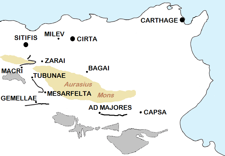
The Capsian culture was a Mesolithic and Neolithic culture centered in the Maghreb that lasted from about 8,000 to 2,700 BC. It was named after the town of Gafsa in Tunisia, which was known as Capsa in Roman times. Capsian industry was concentrated mainly in modern Tunisia and Algeria, with some lithic sites attested from southern Spain to Sicily. It is traditionally divided into two horizons, the ''Capsien typique'' (Typical Capsian) and the ''Capsien supérieur'' (Upper Capsian), which are sometimes found in chronostratigraphic sequence. Sometimes, a third period, ''Capsian Neolithic'' (6,200–5,300 BP) is also specified. They represent variants of one tradition, the differences between them being both typological and technological.2005 D. Lubell. Continuité et changement dans l'Epipaléolithique du Maghreb. In, M. Sahnouni (ed.) ''Le Paléolithique en Afrique: l’histoire la plus longue'', pp. 205–226. Paris: Guides de la Préhistoire Mondiale, Éditions Artcom’/Errance ... [...More Info...] [...Related Items...] OR: [Wikipedia] [Google] [Baidu] |
Iberomaurusian
The Iberomaurusian is a backed bladelet lithic industry found near the coasts of Morocco, Algeria, and Tunisia. It is also known from a single major site in Libya, the Haua Fteah, where the industry is locally known as the Eastern Oranian.The "Western Oranian" would refer to the Iberomaurusian in Morocco, Algeria, and Tunisia, but this expression is seldom used. The Iberomaurusian seems to have appeared around the time of the Last Glacial Maximum (LGM), somewhere between c. 25,000 and 23,000 cal BP. It would have lasted until the early Holocene c. 11,000 cal BP. The name of the Iberomaurusian means "of Iberia and Mauretania", the latter being a Latin name for Northwest Africa. Pallary (1909) coined this termPallary, P., 1909. Instructions pour la recherche préhistorique dans le Nord-Ouest de l'Afrique, Algiers. to describe assemblages from the site of La Mouillah in the belief that the industry extended over the strait of Gibraltar into the Iberian peninsula. This theory is now ... [...More Info...] [...Related Items...] OR: [Wikipedia] [Google] [Baidu] |
African Humid Period
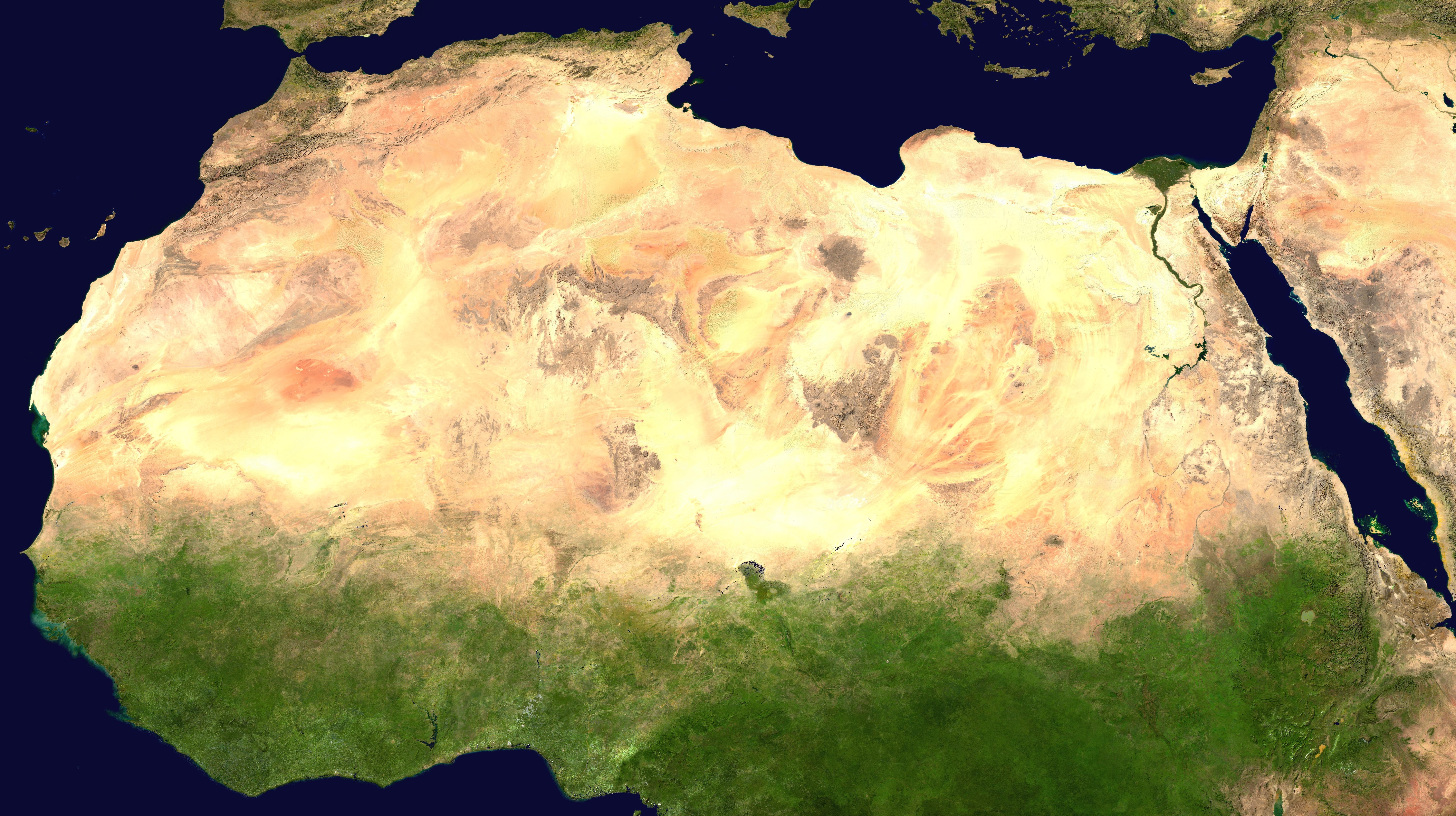
The African humid period (AHP) (also known by other names) is a climate period in Africa during the late Pleistocene and Holocene geologic epochs, when northern Africa was wetter than today. The covering of much of the Sahara desert by grasses, trees and lakes was caused by changes in Earth's orbit around the Sun; changes in vegetation and dust in the Sahara which strengthened the African monsoon; and increased greenhouse gases. During the preceding Last Glacial Maximum, the Sahara contained extensive dune fields and was mostly uninhabited. It was much larger than today, but its lakes and rivers such as Lake Victoria and the White Nile were either dry or at low levels. The humid period began about 14,600–14,500 years ago at the end of Heinrich event 1, simultaneously to the Bølling–Allerød warming. Rivers and lakes such as Lake Chad formed or expanded, glaciers grew on Mount Kilimanjaro and the Sahara retreated. Two major dry fluctuations occurred; during the Younge ... [...More Info...] [...Related Items...] OR: [Wikipedia] [Google] [Baidu] |
Gafsa
Gafsa ( aeb, ڨفصة '; ar, قفصة qafṣah), originally called Capsa in Latin, is the capital of Gafsa Governorate of Tunisia. It lends its Latin name to the Mesolithic Capsian culture. With a population of 111,170, Gafsa is the ninth-largest Tunisian city and it is 335 kilometers from the capital Tunis. Overview Gafsa is the capital of the southwest of Tunisia and is both a historical oasis and home to the mining industry of Tunisia. The city had 111,170 inhabitants at the 2014 census, under the rule of the mayor, Helmi Belhani. The city lies by road southwest of Tunis. Its geographical coordinates are . Ancient history Excavations at prehistoric sites in the Gafsa area have yielded artefacts and skeletal remains associated with the Capsian culture. This Mesolithic civilisation has been radiocarbon dated to between 10,000 and 6,000 BCE. The associated ancient population, known as the ''Snail eaters'', are known for their extensive middens of snail shells. Th ... [...More Info...] [...Related Items...] OR: [Wikipedia] [Google] [Baidu] |
Capsa (Roman Colonia)
Gafsa ( aeb, ڨفصة '; ar, قفصة qafṣah), originally called Capsa in Latin, is the capital of Gafsa Governorate of Tunisia. It lends its Latin name to the Mesolithic Capsian culture. With a population of 111,170, Gafsa is the ninth-largest Tunisian city and it is 335 kilometers from the capital Tunis. Overview Gafsa is the capital of the southwest of Tunisia and is both a historical oasis and home to the mining industry of Tunisia. The city had 111,170 inhabitants at the 2014 census, under the rule of the mayor, Helmi Belhani. The city lies by road southwest of Tunis. Its geographical coordinates are . Ancient history Excavations at prehistoric sites in the Gafsa area have yielded artefacts and skeletal remains associated with the Capsian culture. This Mesolithic civilisation has been radiocarbon dated to between 10,000 and 6,000 BCE. The associated ancient population, known as the ''Snail eaters'', are known for their extensive middens of snail shells. They ar ... [...More Info...] [...Related Items...] OR: [Wikipedia] [Google] [Baidu] |
Tunisia
) , image_map = Tunisia location (orthographic projection).svg , map_caption = Location of Tunisia in northern Africa , image_map2 = , capital = Tunis , largest_city = capital , coordinates = , official_languages = Arabic Translation by the University of Bern: "Tunisia is a free State, independent and sovereign; its religion is the Islam, its language is Arabic, and its form is the Republic." , religion = , languages_type = Spoken languages , languages = Minority Dialects : Jerba Berber (Chelha) Matmata Berber Judeo-Tunisian Arabic (UNESCO CR) , languages2_type = Foreign languages , languages2 = , ethnic_groups = * 98% Arab * 2% Other , demonym = Tunisian , government_type = Unitary presidential republic , leader_title1 = President , leader_name1 = Kais Saied , leader_t ... [...More Info...] [...Related Items...] OR: [Wikipedia] [Google] [Baidu] |
Mesolithic
The Mesolithic (Greek: μέσος, ''mesos'' 'middle' + λίθος, ''lithos'' 'stone') or Middle Stone Age is the Old World archaeological period between the Upper Paleolithic and the Neolithic. The term Epipaleolithic is often used synonymously, especially for outside northern Europe, and for the corresponding period in the Levant and Caucasus. The Mesolithic has different time spans in different parts of Eurasia. It refers to the final period of hunter-gatherer cultures in Europe and Western Asia, between the end of the Last Glacial Maximum and the Neolithic Revolution. In Europe it spans roughly 15,000 to 5,000 BP; in Southwest Asia (the Epipalaeolithic Near East) roughly 20,000 to 10,000 BP. The term is less used of areas farther east, and not at all beyond Eurasia and North Africa. The type of culture associated with the Mesolithic varies between areas, but it is associated with a decline in the group hunting of large animals in favour of a broader hunt ... [...More Info...] [...Related Items...] OR: [Wikipedia] [Google] [Baidu] |
Sicily
(man) it, Siciliana (woman) , population_note = , population_blank1_title = , population_blank1 = , demographics_type1 = Ethnicity , demographics1_footnotes = , demographics1_title1 = Sicilian , demographics1_info1 = 98% , demographics1_title2 = , demographics1_info2 = , demographics1_title3 = , demographics1_info3 = , timezone1 = CET , utc_offset1 = +1 , timezone1_DST = CEST , utc_offset1_DST = +2 , postal_code_type = , postal_code = , area_code_type = ISO 3166 code , area_code = IT-82 , blank_name_sec1 = GDP (nominal) , blank_info_sec1 = €89.2 billion (2018) , blank1_name_sec1 = GDP per capita , blank1_info_sec1 ... [...More Info...] [...Related Items...] OR: [Wikipedia] [Google] [Baidu] |
Lithic Technology
In archaeology, lithic technology includes a broad array of techniques used to produce usable tools from various types of stone. The earliest stone tools were recovered from modern Ethiopia and were dated to between two-million and three-million years old. The archaeological record of lithic technology is divided into three major time periods: the Paleolithic (Old Stone Age), Mesolithic (Middle Stone Age), and Neolithic (New Stone Age). Not all cultures in all parts of the world exhibit the same pattern of lithic technological development, and stone tool technology continues to be used to this day, but these three time periods represent the span of the archaeological record when lithic technology was paramount. By analysing modern stone tool usage within an ethnoarchaeological context, insight into the breadth of factors influencing lithic technologies in general may be studied. See: Stone tool. For example, for the Gamo of Southern Ethiopia, political, environmental, and social f ... [...More Info...] [...Related Items...] OR: [Wikipedia] [Google] [Baidu] |
Spain
, image_flag = Bandera de España.svg , image_coat = Escudo de España (mazonado).svg , national_motto = '' Plus ultra'' ( Latin)(English: "Further Beyond") , national_anthem = (English: "Royal March") , image_map = , map_caption = , image_map2 = , capital = Madrid , coordinates = , largest_city = Madrid , languages_type = Official language , languages = Spanish , ethnic_groups = , ethnic_groups_year = , ethnic_groups_ref = , religion = , religion_ref = , religion_year = 2020 , demonym = , government_type = Unitary parliamentary constitutional monarchy , leader_title1 = Monarch , leader_name1 = Felipe VI , leader_title2 = Prime Minister , leader_name2 = Pedro Sánchez , legislature = ... [...More Info...] [...Related Items...] OR: [Wikipedia] [Google] [Baidu] |
Mediterranean Forest
Mediterranean forests, woodlands, and scrub is a biome defined by the World Wide Fund for Nature. The biome is generally characterized by dry summers and rainy winters, although in some areas rainfall may be uniform. Summers are typically hot in low-lying inland locations but can be cool near colder seas. Winters are typically mild to cool in low-lying locations but can be cold in inland and higher locations. All these ecoregions are highly distinctive, collectively harboring 10% of the Earth's plant species. Distribution The Mediterranean forests, woodlands, and scrub biome mostly occurs in, but not limited to, the Mediterranean climate zones, in the mid-latitudes: *the Mediterranean Basin *the Chilean Matorral *the California chaparral and woodlands ecoregion of California and the Baja California Peninsula *the Western Cape of South Africa *the southwest and southern Australia. The biome is not limited to the Mediterranean climate zone. It can also be present in other ... [...More Info...] [...Related Items...] OR: [Wikipedia] [Google] [Baidu] |
Savanna
A savanna or savannah is a mixed woodland-grassland (i.e. grassy woodland) ecosystem characterised by the trees being sufficiently widely spaced so that the canopy does not close. The open canopy allows sufficient light to reach the ground to support an unbroken herbaceous layer consisting primarily of grasses. According to '' Britannica'', there exists four savanna forms; ''savanna woodland'' where trees and shrubs form a light canopy, ''tree savanna'' with scattered trees and shrubs, ''shrub savanna'' with distributed shrubs, and ''grass savanna'' where trees and shrubs are mostly nonexistent.Smith, Jeremy M.B.. "savanna". Encyclopedia Britannica, 5 Sep. 2016, https://www.britannica.com/science/savanna/Environment. Accessed 17 September 2022. Savannas maintain an open canopy despite a high tree density. It is often believed that savannas feature widely spaced, scattered trees. However, in many savannas, tree densities are higher and trees are more regularly spaced than in for ... [...More Info...] [...Related Items...] OR: [Wikipedia] [Google] [Baidu] |
Altitude
Altitude or height (also sometimes known as depth) is a distance measurement, usually in the vertical or "up" direction, between a reference datum and a point or object. The exact definition and reference datum varies according to the context (e.g., aviation, geometry, geographical survey, sport, or atmospheric pressure). Although the term ''altitude'' is commonly used to mean the height above sea level of a location, in geography the term elevation is often preferred for this usage. Vertical distance measurements in the "down" direction are commonly referred to as depth. In aviation In aviation, the term altitude can have several meanings, and is always qualified by explicitly adding a modifier (e.g. "true altitude"), or implicitly through the context of the communication. Parties exchanging altitude information must be clear which definition is being used. Aviation altitude is measured using either mean sea level (MSL) or local ground level (above ground leve ... [...More Info...] [...Related Items...] OR: [Wikipedia] [Google] [Baidu] |


