|
Bié Plateau
The Bié Plateau or Central Plateau of Angola is a plateau that occupies most of central Angola. The elevation of the plateau is from 1,520 m to 1,824.8956 m. Several major rivers originate from the plateau such as the Cunene River, the Kuanza River, and the Kwango River. Its climate is cool and has enough rainfall to allow for the cultivation of coffee, corn, rice, sisal, sugarcane, and peanuts. Along the more elevated parts, more rain falls, but it gradually declines further within. About half of the rural population of Angola reside on the Bié plateau. The Benguela Railway connects it to the ocean and its principal towns are Huambo Huambo, formerly Nova Lisboa (English: ''New Lisbon''), is the third-most populous city in Angola, after the capital city Luanda and Lubango, with a population of 595,304 in the city and a population of 713,134 in the municipality of Huambo (Cens ... and Kuito. Plateaus of Angola {{Angola-geo-stub ... [...More Info...] [...Related Items...] OR: [Wikipedia] [Google] [Baidu] |
Location Bié
In geography, location or place are used to denote a region (point, line, or area) on Earth's surface or elsewhere. The term ''location'' generally implies a higher degree of certainty than ''place'', the latter often indicating an entity with an ambiguous boundary, relying more on human or social attributes of place identity and sense of place than on geometry. Types Locality A locality, settlement, or populated place is likely to have a well-defined name but a boundary that is not well defined varies by context. London, for instance, has a legal boundary, but this is unlikely to completely match with general usage. An area within a town, such as Covent Garden in London, also almost always has some ambiguity as to its extent. In geography, location is considered to be more precise than "place". Relative location A relative location, or situation, is described as a displacement from another site. An example is "3 miles northwest of Seattle". Absolute location An absolute locati ... [...More Info...] [...Related Items...] OR: [Wikipedia] [Google] [Baidu] |
Plateau
In geology and physical geography, a plateau (; ; ), also called a high plain or a tableland, is an area of a highland consisting of flat terrain that is raised sharply above the surrounding area on at least one side. Often one or more sides have deep hills or escarpments. Plateaus can be formed by a number of processes, including upwelling of volcanic magma, extrusion of lava, and erosion by water and glaciers. Plateaus are classified according to their surrounding environment as intermontane, piedmont, or continental. A few plateaus may have a small flat top while others have wide ones. Formation Plateaus can be formed by a number of processes, including upwelling of volcanic magma, extrusion of lava, Plate tectonics movements and erosion by water and glaciers. Volcanic Volcanic plateaus are produced by volcanic activity. The Columbia Plateau in the north-western United States is an example. They may be formed by upwelling of volcanic magma or extrusion of lava. The un ... [...More Info...] [...Related Items...] OR: [Wikipedia] [Google] [Baidu] |
Angola
, national_anthem = " Angola Avante"() , image_map = , map_caption = , capital = Luanda , religion = , religion_year = 2020 , religion_ref = , coordinates = , largest_city = capital , official_languages = Portuguese , languages2_type = National languages , languages2 = , ethnic_groups = , ethnic_groups_ref = , ethnic_groups_year = 2000 , demonym = , government_type = Unitary dominant-party presidential republic , leader_title1 = President , leader_name1 = João Lourenço , leader_title2 = Vice President , leader_name2 = Esperança da CostaInvestidura do Pr ... [...More Info...] [...Related Items...] OR: [Wikipedia] [Google] [Baidu] |
Cunene River
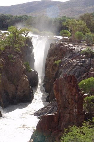
The Cunene (Portuguese spelling) or Kunene (common Namibian spelling) is a river in Southern Africa. It flows from the Angola highlands south to the border with Namibia. It then flows west along the border until it reaches the Atlantic Ocean. It is one of the few perennial rivers in the region. It is about long, with a drainage basin in area. Its mean annual discharge is 174 m3/s (6,145 cfs) at its mouth. The Epupa Falls lie on the river. Olushandja Dam dams a tributary of the river, the Etaka, and helps provide the Ruacana Power Station with water. Dam controversies The Namibian government proposed in the late 1990s to build the Epupa Dam, a controversial hydroelectric dam on the Cunene. In 2012 the Governments of Namibia and Angola announced plans to jointly build the Orokawe dam in the Baynes Mountains. According to the indigenous Himba who would have been most affected by the construction of the dam, the dam threatens the local ecosystem and therefore the economic bas ... [...More Info...] [...Related Items...] OR: [Wikipedia] [Google] [Baidu] |
Kwango River
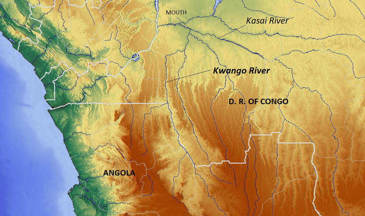
The Cuango or Kwango ( pt, Rio Cuango) is a transboundary river of Angola and Democratic Republic of Congo. It is the largest left bank tributary of the Kasai River in the Congo River basin. It flows through Malanje in Angola. The Kwango River basin has large resources of diamonds in the Chitamba-Lulo Kimberlite Cluster in Lunda Norte Province, discovered in the main river channel and on flats and terraces in its flood plains. History The Rund Kingdom, which expanded to become the Lunda Empire, encompassed territory stretching from Kwango River to the Luapula River. Its rulers partook in the slave trade. Lunda's expansion in the valley promoted a common political and cultural heritage while also promoting slave trading, accounting for the low population densities between the Kwango and Kwilu rivers.Ogot, p.607 The Portuguese colonized the Kwango River valley and usurped the Kingdom of Kasanje. The Kwango River was subject to a Portuguese treaty signing in Lisbon on May 25, 1 ... [...More Info...] [...Related Items...] OR: [Wikipedia] [Google] [Baidu] |
Climate
Climate is the long-term weather pattern in an area, typically averaged over 30 years. More rigorously, it is the mean and variability of meteorological variables over a time spanning from months to millions of years. Some of the meteorological variables that are commonly measured are temperature, humidity, atmospheric pressure, wind, and precipitation. In a broader sense, climate is the state of the components of the climate system, including the atmosphere, hydrosphere, cryosphere, lithosphere and biosphere and the interactions between them. The climate of a location is affected by its latitude/longitude, terrain, altitude, land use and nearby water bodies and their currents. Climates can be classified according to the average and typical variables, most commonly temperature and precipitation. The most widely used classification scheme was the Köppen climate classification. The Thornthwaite system, in use since 1948, incorporates evapotranspiration along with temperature ... [...More Info...] [...Related Items...] OR: [Wikipedia] [Google] [Baidu] |
Rainfall
Rain is water droplets that have condensed from atmospheric water vapor and then fall under gravity. Rain is a major component of the water cycle and is responsible for depositing most of the fresh water on the Earth. It provides water for hydroelectric power plants, crop irrigation, and suitable conditions for many types of ecosystems. The major cause of rain production is moisture moving along three-dimensional zones of temperature and moisture contrasts known as weather fronts. If enough moisture and upward motion is present, precipitation falls from convective clouds (those with strong upward vertical motion) such as cumulonimbus (thunder clouds) which can organize into narrow rainbands. In mountainous areas, heavy precipitation is possible where upslope flow is maximized within windward sides of the terrain at elevation which forces moist air to condense and fall out as rainfall along the sides of mountains. On the leeward side of mountains, desert climates can exi ... [...More Info...] [...Related Items...] OR: [Wikipedia] [Google] [Baidu] |
Coffee
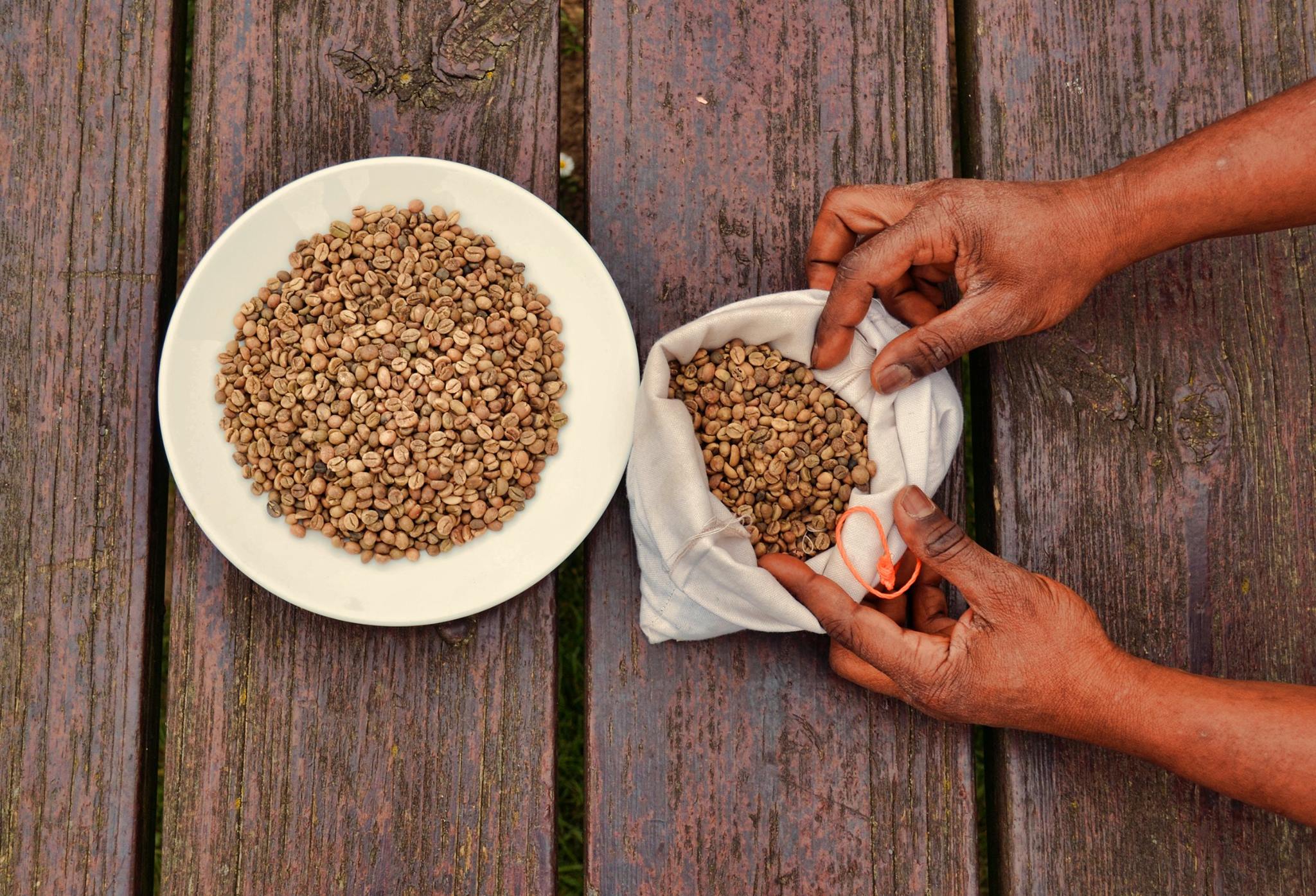
Coffee is a drink prepared from roasted coffee beans. Darkly colored, bitter, and slightly acidic, coffee has a stimulant, stimulating effect on humans, primarily due to its caffeine content. It is the most popular hot drink in the world. Seeds of the ''Coffea'' plant's fruits are separated to produce unroasted green coffee beans. The beans are Coffee roasting, roasted and then ground into fine particles that are typically steeped in hot water before being filtered out, producing a cup of coffee. It is usually served hot, although chilled or iced coffee is common. Coffee can be prepared and presented in a variety of ways (e.g., espresso, French press, caffè latte, or already-brewed canned coffee). Sugar, sugar substitutes, milk, and cream are often used to mask the bitter taste or enhance the flavor. Though coffee is now a global commodity, it has a History of coffee, long history tied closely to food traditions around the Red Sea. The earliest credible evidence of coffee d ... [...More Info...] [...Related Items...] OR: [Wikipedia] [Google] [Baidu] |
Maize
Maize ( ; ''Zea mays'' subsp. ''mays'', from es, maíz after tnq, mahiz), also known as corn (North American and Australian English), is a cereal grain first domesticated by indigenous peoples in southern Mexico about 10,000 years ago. The leafy stalk of the plant produces pollen inflorescences (or "tassels") and separate ovuliferous inflorescences called ears that when fertilized yield kernels or seeds, which are fruits. The term ''maize'' is preferred in formal, scientific, and international usage as a common name because it refers specifically to this one grain, unlike ''corn'', which has a complex variety of meanings that vary by context and geographic region. Maize has become a staple food in many parts of the world, with the total production of maize surpassing that of wheat or rice. In addition to being consumed directly by humans (often in the form of masa), maize is also used for corn ethanol, animal feed and other maize products, such as corn starch and ... [...More Info...] [...Related Items...] OR: [Wikipedia] [Google] [Baidu] |
Rice
Rice is the seed of the grass species ''Oryza sativa'' (Asian rice) or less commonly ''Oryza glaberrima ''Oryza glaberrima'', commonly known as African rice, is one of the two domesticated rice species. It was first domesticated and grown in West Africa around 3,000 years ago. In agriculture, it has largely been replaced by higher-yielding Asian r ...'' (African rice). The name wild rice is usually used for species of the genera ''Zizania (genus), Zizania'' and ''Porteresia'', both wild and domesticated, although the term may also be used for primitive or uncultivated varieties of ''Oryza''. As a cereal, cereal grain, domesticated rice is the most widely consumed staple food for over half of the world's World population, human population,Abstract, "Rice feeds more than half the world's population." especially in Asia and Africa. It is the agricultural commodity with the third-highest worldwide production, after sugarcane and maize. Since sizable portions of sugarcane and ma ... [...More Info...] [...Related Items...] OR: [Wikipedia] [Google] [Baidu] |
Sisal
Sisal (, ) (''Agave sisalana'') is a species of flowering plant native to southern Mexico, but widely cultivated and naturalized in many other countries. It yields a stiff fibre used in making rope and various other products. The term sisal may refer either to the plant's common name or the fibre, depending on the context. The sisal fibre is traditionally used for rope and twine, and has many other uses, including paper, cloth, footwear, hats, bags, carpets, geotextiles, and dartboards. It is also used as fibre reinforcements for composite fibreglass, rubber, and concrete products. Taxonomy The native origin of ''Agave sisalana'' is uncertain. Traditionally, it was deemed to be a native of the Yucatán Peninsula, but no records exist of botanical collections from there. They were originally shipped from the Spanish colonial port of Sisal in Yucatán (thus the name). The Yucatán plantations now cultivate henequen (''Agave fourcroydes''). H.S. Gentry hypothesized a Chiapas ... [...More Info...] [...Related Items...] OR: [Wikipedia] [Google] [Baidu] |
Sugarcane
Sugarcane or sugar cane is a species of (often hybrid) tall, Perennial plant, perennial grass (in the genus ''Saccharum'', tribe Andropogoneae) that is used for sugar Sugar industry, production. The plants are 2–6 m (6–20 ft) tall with stout, jointed, fibrous stalks that are rich in sucrose, which accumulates in the Plant stem, stalk internodes. Sugarcanes belong to the grass family, Poaceae, an economically important flowering plant family that includes maize, wheat, rice, and sorghum, and many forage crops. It is native to the warm temperate and tropical regions of India, Southeast Asia, and New Guinea. The plant is also grown for biofuel production, especially in Brazil, as the canes can be used directly to produce ethyl alcohol (ethanol). Grown in tropical and subtropical regions, sugarcane is the world's largest crop by production quantity, totaling 1.9 billion tonnes in 2020, with Brazil accounting for 40% of the world total. Sugarcane accounts for 79% of sug ... [...More Info...] [...Related Items...] OR: [Wikipedia] [Google] [Baidu] |


