Quebec Route 201 on:
[Wikipedia]
[Google]
[Amazon]
Route 201 is a north/south provincial highway within the
 *
*
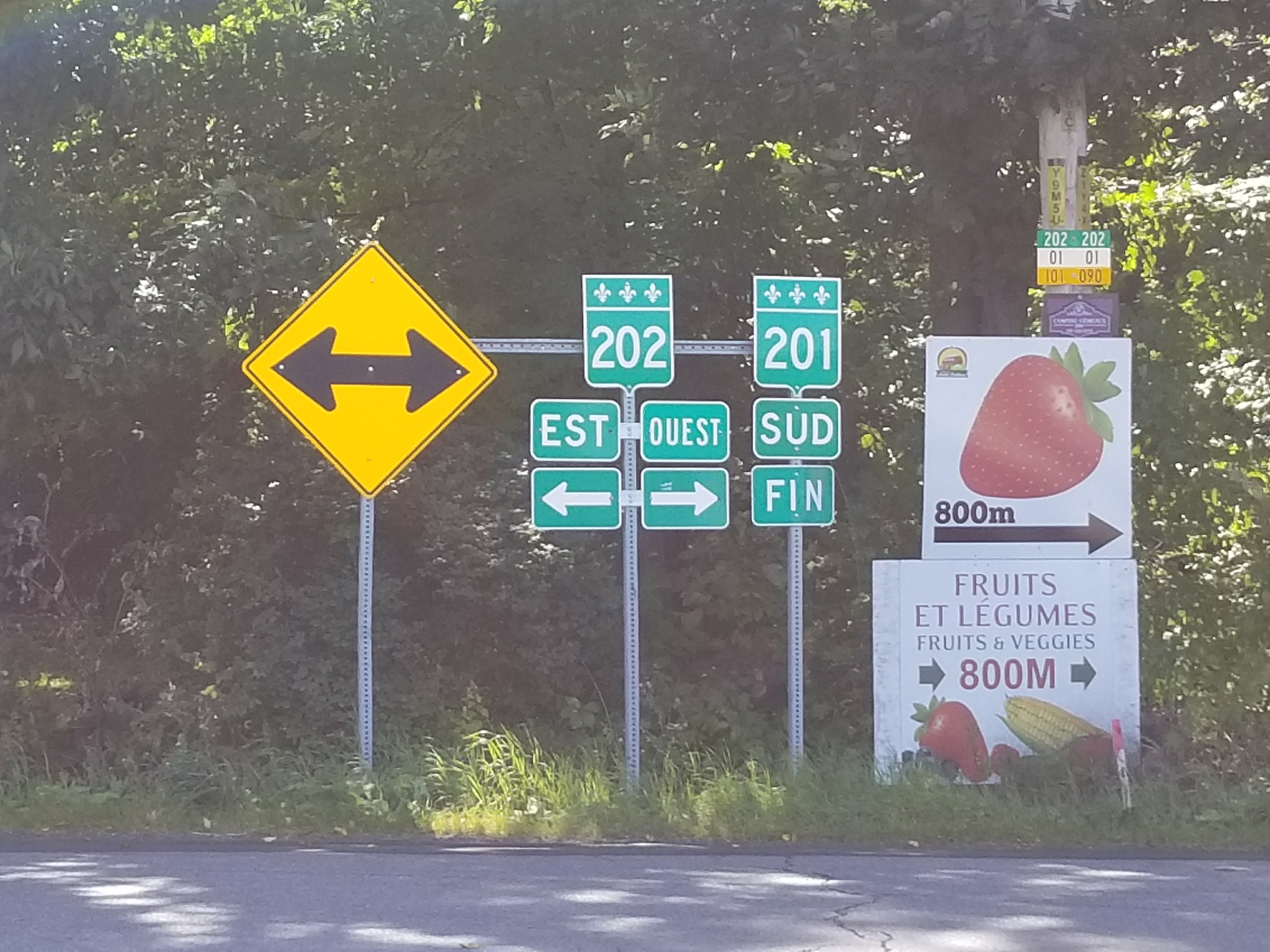
File:Route 201 Sud Fin.jpg, Southern end at route 202.
File:Quebec Provincial Route 132 (35533986550).jpg, Intersection with Route 132 in Saint-Stanislas.
File:Quebec Provincial Route 132 (35533977490).jpg, Route 201 is concurrent with Route 132 and Autoroute 530.
File:20, 132, and 201 DSCN8616 (35752487602).jpg, Route 201 in Valleyfield.
File:Monseigneur Langlois Bridge.jpg, Monseigneur-Langlois Bridge between Valleyfield and Coteau-du-Lac.
File:Construction at 20 DSCN8617 (35533963100).jpg, Interchange with Autoroute 20.
File:St-Clet QC 1.JPG, Junction of
Route 201
on
Official Transport Quebec Road Map
(Courtesy of the Quebec Ministry of Transportation) {{coord , 45.3828, N, 74.2445, W, display=title
Canadian province
Within the geographical areas of Canada, the ten provinces and three territories are sub-national administrative divisions under the jurisdiction of the Canadian Constitution. In the 1867 Canadian Confederation, three provinces of British North ...
of Quebec
Quebec ( ; )According to the Canadian government, ''Québec'' (with the acute accent) is the official name in Canadian French and ''Quebec'' (without the accent) is the province's official name in Canadian English is one of the thirtee ...
, running between Route 202 in Franklin
Franklin may refer to:
People
* Franklin (given name)
* Franklin (surname)
* Franklin (class), a member of a historical English social class
Places Australia
* Franklin, Tasmania, a township
* Division of Franklin, federal electoral d ...
(near the Canada–US border) and Route 342 in Rigaud. Its total length is approximately 70 kilometres.
Route 201 links Salaberry-de-Valleyfield
Salaberry-de-Valleyfield is a city in southwestern Quebec, Canada, in the Regional County Municipality of Beauharnois-Salaberry.
The population as of 2019 was 42,410. Situated on Grande-Île, an island in the Saint Lawrence River, it is bordere ...
with Autoroute 20 using the Monseigneur Langlois Bridge to cross the Saint Lawrence River
The St. Lawrence River (french: Fleuve Saint-Laurent, ) is a large river in the middle latitudes of North America. Its headwaters begin flowing from Lake Ontario in a (roughly) northeasterly direction, into the Gulf of St. Lawrence, connectin ...
. It is among the four primary or secondary highways to cross the Saint Lawrence River and is the only 200 series highway to be partly north of that river.
Municipalities along Route 201
 *
* Franklin
Franklin may refer to:
People
* Franklin (given name)
* Franklin (surname)
* Franklin (class), a member of a historical English social class
Places Australia
* Franklin, Tasmania, a township
* Division of Franklin, federal electoral d ...
* Ormstown
Ormstown is a municipality in Quebec, Canada, which is situated on the Chateauguay River in the heart of the Chateauguay Valley. It is approximately one hour southwest of Montreal and 20 minutes north of New York State in the United States. The po ...
* Saint-Stanislas-de-Kostka
* Salaberry-de-Valleyfield
Salaberry-de-Valleyfield is a city in southwestern Quebec, Canada, in the Regional County Municipality of Beauharnois-Salaberry.
The population as of 2019 was 42,410. Situated on Grande-Île, an island in the Saint Lawrence River, it is bordere ...
* Coteau-du-Lac
Coteau-du-Lac is a small city in southwestern Quebec, Canada. It is on the north shore of the St. Lawrence River in the Vaudreuil-Soulanges Regional County Municipality.
The name of the town comes from the French word ''Coteau'' which meant "sl ...
* Saint-Clet
* Saint-Lazare
* Sainte-Marthe
* Rigaud
340
Year 340 (Roman numerals, CCCXL) was a leap year starting on Tuesday (link will display the full calendar) of the Julian calendar. At the time, it was known as the Year of the Consulship of Acindynus and Valerius (or, less frequently, year 1093 ...
and 201 in Saint-Clet.
Major intersections
See also
*List of Quebec provincial highways
This is a list of highways maintained by the government of Quebec.
Autoroutes
The Autoroute system in Quebec is a network of expressways which operate under the same principle of controlled access as the Interstate Highway System in the United ...
References
External links
Route 201
on
Google Maps
Google Maps is a web mapping platform and consumer application offered by Google. It offers satellite imagery, aerial photography, street maps, 360° interactive panoramic views of streets ( Street View), real-time traffic conditions, and rou ...
Official Transport Quebec Road Map
(Courtesy of the Quebec Ministry of Transportation) {{coord , 45.3828, N, 74.2445, W, display=title
201
Year 201 ( CCI) was a common year starting on Thursday (link will display the full calendar) of the Julian calendar. At the time, it was known as the Year of the Consulship of Fabianus and Arrius (or, less frequently, year 954 '' Ab urbe condi ...
Roads in Montérégie