|
Quebec Autoroute 530
Autoroute 530 (A-530) is an autoroute located Salaberry-de-Valleyfield, Montérégie, Quebec Quebec ( ; )According to the Canadian government, ''Québec'' (with the acute accent) is the official name in Canadian French and ''Quebec'' (without the accent) is the province's official name in Canadian English is one of the thirtee .... The spur route links Autoroute 30 with Salaberry-de-Valleyfield and features two interchanges, one at Boulevard Pie XII and the other at Route 201. Autoroute 530 was originally part of Autoroute 30, but was re-designated in 2012 when A-30 was realigned to cross the St. Lawrence River. Exit list From west to east. Photo gallery File:Quebec Autoroute 530 - EB (1).jpg File:Quebec Autoroute 530 - EB (2).jpg File:Quebec Autoroute 530 - EB (3).jpg File:Quebec Autoroute 530 - EB (4).jpg File:Quebec Autoroute 530 - EB (5).jpg File:Quebec Autoroute 530 - EB (6).jpg File:Quebec Autoroute 530 - EB (7).jpg References External link ... [...More Info...] [...Related Items...] OR: [Wikipedia] [Google] [Baidu] |
Salaberry-de-Valleyfield
Salaberry-de-Valleyfield is a city in southwestern Quebec, Canada, in the Regional County Municipality of Beauharnois-Salaberry. The population as of 2019 was 42,410. Situated on Grande-Île, an island in the Saint Lawrence River, it is bordered at its western end by Lake Saint Francis, with the Saint Lawrence to the north and the Beauharnois Canal to its south. The Port of Valleyfield is on the canal. The historic downtown is a major touristic centre for the area. Due to the presence of Lake St. Francis (St. Lawrence River), St. Francis Bay in downtown, and of numerous rivers and canals all over the town, the city is nicknamed "The Venice of Quebec". History The actual city was founded in 1874, the first mayor was Moise Plante. The first settlers arrived in 1798. At that moment, the settlement was named Pointe-du-Lac (Lake Point). The colony was then renamed Saranac, then Sainte-Cécile. Salaberry-de-Valleyfield was officially named in 1874 after Colonel Charles de Salaberry ... [...More Info...] [...Related Items...] OR: [Wikipedia] [Google] [Baidu] |
Quebec Autoroute 30
Autoroute 30 (A-30), or the Autoroute de l'Acier (In English, ''Steel Freeway'') is an Autoroute in Quebec, Canada. Construction of the A-30 dates back to the early days of autoroute construction in the 1960s. Originally called Highway 3, the A-30 was designed to replace Route 132 as the main artery linking the communities along the South Shore of the St. Lawrence River. The A-30 was originally intended to begin at Autoroute 40 in Vaudreuil-Dorion and end at Saint-Pierre-les-Becquets (in Centre-du-Québec). :fr:Autoroute 30 In the late 1970s an eight-year moratorium on new autoroute construction in favour of public transport by the Parti Québécois prevented implementation of that plan. The original section of Autoroute 30 in 1968 linked Sorel-Tracy to Route 116, which was then called Highway 9. The A-30 was extended to an interchange with Autoroute 10 in Brossard by 1985 and to Autoroute 15 in Candiac by 1996. Growing road congestion in and around Montreal led to the a ... [...More Info...] [...Related Items...] OR: [Wikipedia] [Google] [Baidu] |
Autoroutes Of Quebec
The autoroute system is a network of freeways within the province of Quebec, Canada, operating under the same principle of controlled access as the Interstate Highway System in the United States and the 400-series highways in neighbouring Ontario. The Autoroutes are the backbone of Quebec's highway system, spanning almost . The speed limit on the Autoroutes is generally in rural areas and in urban areas; most roads are made of asphalt concrete. The word ''autoroute'' is a blend of ''auto'' and '' route'', equivalent to "freeway" or "motorway" in English, and it became the equivalent of "expressway" in French. In the 1950s, when the first Autoroutes were being planned, the design documents called them ''autostrades'' from the Italian word ''autostrada''. Signage Autoroutes are identified by blue-and-red shields, similar to the American Interstate system. The red header of the shield contains a white image representing a highway overpass, and the blue lower portion of the shie ... [...More Info...] [...Related Items...] OR: [Wikipedia] [Google] [Baidu] |
Montérégie
Montérégie () is an administrative region in the southwest part of Quebec. It includes the cities of Boucherville, Brossard, Châteauguay, Longueuil, Saint-Hyacinthe, Saint-Jean-sur-Richelieu, Salaberry-de-Valleyfield and Vaudreuil-Dorion. The region had a population of 1,507,070 as of the 2016 census and a land area of , giving it a population density of 135.4 inhabitants/km2 (350 per sq. mi.). With approximately 18.5% of the province's population, it is the second most populous region of Quebec after Montreal. The majority of the population lives near the Saint Lawrence River, on the south shore of Montreal. Montérégie is known for its vineyards, orchards, panoramas, products, and the Monteregian mountains. The region is both urban (second in terms of population in Quebec) and rural. The regional economy is based on agriculture and the production of goods and services. Tourism also makes up a significant portion of the economy. History Jacques Cartier named Mont Royal in O ... [...More Info...] [...Related Items...] OR: [Wikipedia] [Google] [Baidu] |
Quebec
Quebec ( ; )According to the Canadian government, ''Québec'' (with the acute accent) is the official name in Canadian French and ''Quebec'' (without the accent) is the province's official name in Canadian English is one of the thirteen provinces and territories of Canada. It is the largest province by area and the second-largest by population. Much of the population lives in urban areas along the St. Lawrence River, between the most populous city, Montreal, and the provincial capital, Quebec City. Quebec is the home of the Québécois nation. Located in Central Canada, the province shares land borders with Ontario to the west, Newfoundland and Labrador to the northeast, New Brunswick to the southeast, and a coastal border with Nunavut; in the south it borders Maine, New Hampshire, Vermont, and New York in the United States. Between 1534 and 1763, Quebec was called ''Canada'' and was the most developed colony in New France. Following the Seven Years' War, Quebec b ... [...More Info...] [...Related Items...] OR: [Wikipedia] [Google] [Baidu] |
Pope Pius XII
Pope Pius XII ( it, Pio XII), born Eugenio Maria Giuseppe Giovanni Pacelli (; 2 March 18769 October 1958), was head of the Catholic Church and sovereign of the Vatican City State from 2 March 1939 until his death in October 1958. Before his election to the papacy, he served as secretary of the Department of Extraordinary Ecclesiastical Affairs, papal nuncio to Germany, and Cardinal Secretary of State, in which capacity he worked to conclude treaties with European and Latin American nations, such as the ''Reichskonkordat'' with the German Reich. While the Vatican was officially neutral during World War II, the ''Reichskonkordat'' and his leadership of the Catholic Church during the war remain the subject of controversy—including allegations of public silence and inaction about the fate of the Jews. Pius employed diplomacy to aid the victims of the Nazis during the war and, through directing the church to provide discreet aid to Jews and others, saved hundreds of thousands ... [...More Info...] [...Related Items...] OR: [Wikipedia] [Google] [Baidu] |
Quebec Route 201
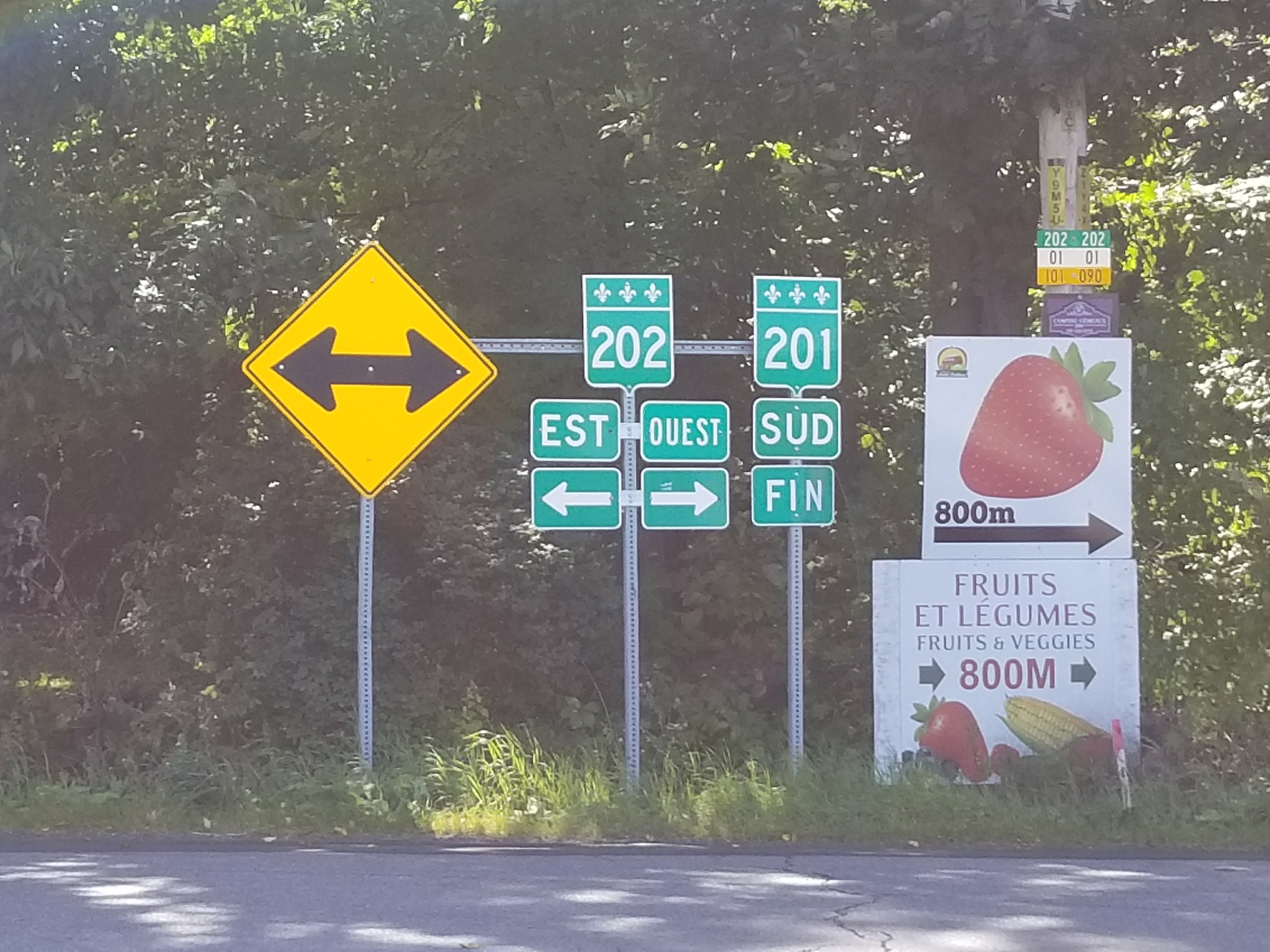
Route 201 is a north/south provincial highway within the Canadian province of Quebec, running between Route 202 in Franklin (near the Canada–US border) and Route 342 in Rigaud. Its total length is approximately 70 kilometres. Route 201 links Salaberry-de-Valleyfield with Autoroute 20 using the Monseigneur Langlois Bridge to cross the Saint Lawrence River. It is among the four primary or secondary highways to cross the Saint Lawrence River and is the only 200 series highway to be partly north of that river. Municipalities along Route 201 * Franklin * Ormstown * Saint-Stanislas-de-Kostka * Salaberry-de-Valleyfield * Coteau-du-Lac * Saint-Clet * Saint-Lazare * Sainte-Marthe * Rigaud File:Route 201 Sud Fin.jpg, Southern end at route 202. File:Quebec Provincial Route 132 (35533986550).jpg, Intersection with Route 132 in Saint-Stanislas. File:Quebec Provincial Route 132 (35533977490).jpg, Route 201 is concurrent with Route 132 and Autoroute 530. File:20, 132, and 201 ... [...More Info...] [...Related Items...] OR: [Wikipedia] [Google] [Baidu] |
Saint-Louis-de-Gonzague, Montérégie, Quebec
Saint-Louis-de-Gonzague is a parish municipality in the Beauharnois-Salaberry Regional County Municipality in the Montérégie region of Quebec, Canada. The population as of the Canada 2021 Census was 1,950. Demographics In the 2021 Census of Population conducted by Statistics Canada, Saint-Louis-de-Gonzague had a population of living in of its total private dwellings, a change of from its 2016 population of . With a land area of , it had a population density of in 2021. See also * Beauharnois-Salaberry Regional County Municipality * Beauharnois Canal * Saint-Louis River (Beauharnois) * List of parish municipalities in Quebec This is a list of municipalities that have the Quebec municipal type of parish municipality (''paroisse'', code=P), an administrative division defined by the Ministry of Municipal Affairs, Regions and Land Occupancy. The ''Commission de toponymi ... References External links * {{DEFAULTSORT:Saint-Louis-de-Gonzague, Monteregie, Queb ... [...More Info...] [...Related Items...] OR: [Wikipedia] [Google] [Baidu] |


