|
Zande People
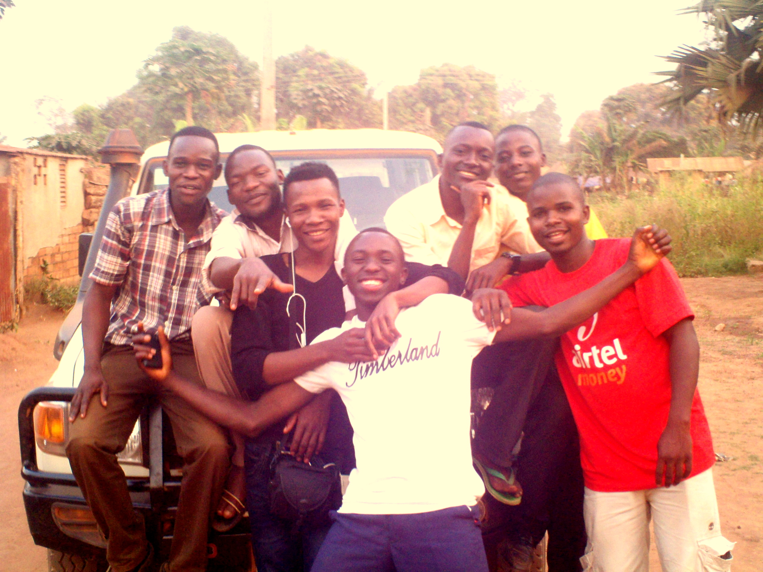
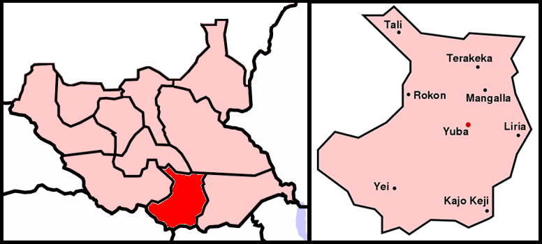
The Azande are an Ubangian ethnic group in Central Africa. They live in the south-central and southwestern part of South Sudan, southeastern Central African Republic, and northeastern parts of the Democratic Republic of the Congo. The Congolese Azande live in Orientale Province along the Uele River; Isiro, Dungu, Kisangani and Duruma. The Central African Azande live in the districts of Rafaï, Bangasu and Obo. The Azande of South Sudan live in Central, Western Equatoria and Western Bahr al-Ghazal States, Yei, Maridi, Yambio, Tombura, Deim Zubeir, Wau Town and Momoi. Zande people are similar to Bantu and their languages are similar to Bantu languages. History The Azande were believed to be formed by a military conquest during the first half of the 18th century. They were led by two dynasties that differed in origin and political strategy. The Vungara clan created most of the political, linguistic, and cultural parts. A non-Zande dynasty, the Bandia, expanded into northern Zair ... [...More Info...] [...Related Items...] OR: [Wikipedia] [Google] [Baidu] |
Zande Language
Zande is the largest of the Zande languages. It is spoken by the Azande, primarily in the northeast of the Democratic Republic of the Congo and western South Sudan, but also in the eastern part of the Central African Republic. It is called Pazande in the Zande language and Kizande in Lingala. Estimates about the number of speakers vary; in 2001 Koen Impens cited studies that put the number between 700,000 and one million. Phonology Consonants * Alveolar sounds /d, z, ⁿz, s, t, ⁿd/ have allophones as palato-alveolar sounds ͡ʒ, ʒ, ⁿʒ, ʃ, t͡ʃ, ⁿd͡ʒwhen preceding /i/. * The retroflex tap /ɽ/ can be heard as an alveolar trill in free variation. Vowels Writing system Sample text in Zande ''Avunguagudee, oni nangarasa rukutu awironi na gu sosono yo i mangi agu asunge dunduko na ngbarago i afuhe fuyo i mangihe, singia si tii Bambu Kindo yo, watadu ba bakere adunguratise yo?'' Translation Parents, do you encourage your children and teenagers to work che ... [...More Info...] [...Related Items...] OR: [Wikipedia] [Google] [Baidu] |
Democratic Republic Of The Congo
The Democratic Republic of the Congo (french: République démocratique du Congo (RDC), colloquially "La RDC" ), informally Congo-Kinshasa, DR Congo, the DRC, the DROC, or the Congo, and formerly and also colloquially Zaire, is a country in Central Africa. It is bordered to the northwest by the Republic of the Congo, to the north by the Central African Republic, to the northeast by South Sudan, to the east by Uganda, Rwanda, and Burundi, and by Tanzania (across Lake Tanganyika), to the south and southeast by Zambia, to the southwest by Angola, and to the west by the South Atlantic Ocean and the Cabinda exclave of Angola. By area, it is the second-largest country in Africa and the 11th-largest in the world. With a population of around 108 million, the Democratic Republic of the Congo is the most populous officially Francophone country in the world. The national capital and largest city is Kinshasa, which is also the nation's economic center. Centered on the Cong ... [...More Info...] [...Related Items...] OR: [Wikipedia] [Google] [Baidu] |
Dynasty
A dynasty is a sequence of rulers from the same family,''Oxford English Dictionary'', "dynasty, ''n''." Oxford University Press (Oxford), 1897. usually in the context of a monarchical system, but sometimes also appearing in republics. A dynasty may also be referred to as a "house", "family" or "clan", among others. Historians periodize the histories of many states and civilizations, such as Ancient Iran (3200 - 539 BC), Ancient Egypt (3100 – 30 BC) and Ancient and Imperial China (2070 BC – AD 1912), using a framework of successive dynasties. As such, the term "dynasty" may be used to delimit the era during which a family reigned. Before the 18th century, most dynasties throughout the world have traditionally been reckoned patrilineally, such as those that follow the Frankish Salic law. In polities where it was permitted, succession through a daughter usually established a new dynasty in her husband's family name. This has changed in all of Europe's remaining mo ... [...More Info...] [...Related Items...] OR: [Wikipedia] [Google] [Baidu] |
Bantu Peoples Of South Africa
South African Bantu-speaking peoples are the majority of black South Africans. Occasionally grouped as Bantu, the term itself is derived from the word for "people" common to many of the Bantu languages. The Oxford Dictionary of South African English describes its contemporary usage in a racial context as "obsolescent and offensive" because of its strong association with white minority rule with their apartheid system. However, Bantu is used without pejorative connotations in other parts of Africa and is still used in South Africa as the group term for the language family. History The history of the Bantu-speaking peoples from South Africa has in the past been misunderstood due to the deliberate spreading of false narratives such as ''The Empty Land Myth''. First published by W.A. Holden in the 1860s, this doctrine claims that South Africa had mostly been an unsettled region and that Bantu-speaking peoples had begun to migrate southwards from present day Zimbabwe at the same t ... [...More Info...] [...Related Items...] OR: [Wikipedia] [Google] [Baidu] |
Deim Zubeir
Deim Zubeir, from the Arabic ديم الزبير Daim az-Zubayr" commonly translated as the "Camp of Zubeir", is the historically established but highly controversial name of Uyujuku town in the Western Bahr el Ghazal of the Republic of South Sudan, located in the Western Bahr El Ghazal part of the country, some 70 km from the border with the Central African Republic (CAR), near the Biri tributary of the River Chel. Due to different transliterations from the Arabic, the name components are also spelled in various combinations Dem, Dehm, Deym, Dam, Daym or Daim, and Zubair, Zubayr, Zoubair, Zoubeir, Zoubayr, Zobeir, Ziber, Zebehr, or Zubier, respectively. The historical remains of the slave camp have been designated a potential UNESCO World Heritage Centre site. In the collective memory of South Sudanese people, the very name Deim Zubeir rings as a synonym for millennia of slavery, at least since Pharaonic times. Stefano Santandrea (1966) had written a lexicon and gramma ... [...More Info...] [...Related Items...] OR: [Wikipedia] [Google] [Baidu] |
Western Bahr Al-Ghazal
Western Bahr el Ghazal is a state in South Sudan. It has an area of and is the least populous state in South Sudan, according to the controversial Sudanese census conducted in 2008. It is part of the Bahr el Ghazal region. Its capital is Wau. The state shared international borders with Sudan to the north and the Central African Republic to the west. The portion now occupied by Raga County (pronounced 'Raja') is the southern part of the historical region known as "Dar Fertit". History This state, and Raga County in particular, was the part of South Sudan that was most affected by the slave trade conducted by nearby Muslim sultanates from the 18th century on and by Mameluk Egypt in the second half of the 19th century, and Raga County is the only part of South Sudan with a significant number of Muslims and Arabs. In addition to the Baggara Arabs, another local Muslim ethnic group is the Feroghe (Feroge, etc.). Traditionally, the northern part of Raga County falls within the "Bagga ... [...More Info...] [...Related Items...] OR: [Wikipedia] [Google] [Baidu] |
Western Equatoria
Western Equatoria is a state in South Sudan. It has an area of . Its capital is Yambio. The state was divided into counties, each headed by a County Commissioner. Western Equatoria seceded from Sudan as part of the Republic of South Sudan on 9 July 1956. On October 2, 2011, the state was divided into Amadi, Maridi, and Gbudwe states, and Tambura State was split from Gbudwe state on January 14, 2015. Western Equatoria was re-established by a peace agreement signed on 22 February 2020. History Since the 16th century, Western Equatoria has been a home to the Avukaya, Azande, Baka, Moru, Mundu and Balanda. The Mahdist Revolt of the 1880s destabilized the nascent province, and Equatoria ceased to exist as an Egyptian outpost in 1889. Important settlements in Equatoria included Lado, Gondokoro, Dufile and Wadelai. European colonial maneuverings in the region came to a head in 1898, when the Fashoda Incident occurred at present-day Kodok; Britain and France almost went to w ... [...More Info...] [...Related Items...] OR: [Wikipedia] [Google] [Baidu] |
Central Equatoria
Central Equatoria is a state in South Sudan. With an area of , it is the smallest of the original South Sudanese states. Its previous name was Bahr al-Jabal (also Bahr-el-Jebel), named after a tributary of the White Nile that flows through the state. It was renamed Central Equatoria in the first Interim Legislative Assembly on 1 April 2005 under the government of Southern Sudan. Central Equatoria seceded from Sudan as part of the Republic of South Sudan on 9 July 2011. The state's capital, Juba, is also the national capital of South Sudan. On October 2, 2015, the state was split into three states: Jubek, Terekeka, and Yei River. The state of Central Equatoria was re-established by a peace agreement signed on 22 February 2020. Administrative divisions Central Equatoria, like other states in South Sudan, is subdivided into counties, which are further divided into Payams, then Bomas. Each county is led by a County Commissioner, appointed by the State Governor in consultation wi ... [...More Info...] [...Related Items...] OR: [Wikipedia] [Google] [Baidu] |
Zemio
Zemio is a town and sub-prefecture in the Haut-Mbomou prefecture of the south-eastern Central African Republic. History On 28 June 2017 Ugandan forces withdrew from Zemio. Armed Muslims entered town killing at least 28 civilians. As of January 2021 Zemio remains under control of Union for Peace in the Central African Republic rebel groups. 23 January 2021 Transport The town is served byZemio Airport
Zemio Airport is an airport serving the village of Zemio, in the Haut-Mbomou prefecture of the Central Afri ...
[...More Info...] [...Related Items...] OR: [Wikipedia] [Google] [Baidu] |
Rafaï
Rafaï is a town and sub-prefecture on the Chinko River, in the Central African Republic prefecture of Mbomou. Its estimated population is about 14,000 people. History The Sultanate of Rafaï was the last of Ubangi-Shari to still have its sultan. The last sultan assumed the throne in 1909. On 12 March 2013 Rafaï was captured by Seleka rebels. On 3 March 2018 it was captured by UPC rebels, but three days later it was recaptured by Anti-balaka The Anti-balaka is an alliance of militia groups based in the Central African Republic in the early 21st century said to be composed primarily of Christians. However, some church leaders have contested the claimed exclusively Christian character .... On 26 March 2021 it was reported that 14 rebels with automatic weapons were stationed near centre of Rafaï. On 30 October armed forces returned to Rafai after eight years of absence. [...More Info...] [...Related Items...] OR: [Wikipedia] [Google] [Baidu] |
Kisangani
Kisangani (formerly Stanleyville or Stanleystad) is the capital of Tshopo province in the Democratic Republic of the Congo. It is the fifth most populous urban area in the country, with an estimated population of 1,312,000 in 2021, and the largest of the cities that lie in the tropical woodlands of the Congo. Some from the mouth of the Congo River, Kisangani is the farthest navigable point upstream. Kisangani is the nation's most important inland port after Kinshasa, an important commercial hub point for river and land transportation and a major marketing and distribution centre for the north-eastern part of the country. It has been the commercial capital of the northern Congo since the late 19th century. History Before Henry Morton Stanley, working on behalf of King Leopold II of the Belgians, founded what would become Stanley Falls Station in 1883, on the Island of Wana Rusari in the Congo River, the area was inhabited by a native Congolese tribe known as the Clans of ... [...More Info...] [...Related Items...] OR: [Wikipedia] [Google] [Baidu] |
Dungu, Democratic Republic Of The Congo
Dungu ( ) is a town in Haut-Uele Province located at the confluence of the Dungu and Kibali Rivers where they join to form the Uele River, south of the Garamba National Park. Dungu's terrain is wooded savannah, and its climate is tropical. It is the principal town in Dungu Territory. It has a hospital, nursing school, high school, Internet cafe, and a cathedral—as it is the seat of the Roman Catholic Diocese of Ndoromo–Dungu. The town is divided into five main neighbourhoods: Uye (south), Mussa (south center), Ngirimo (center), Bamokandi and R.D.C border Town of Nabiapai to the (north) towards Yambio. Dungu is served by Dungu-Uye Airport, which is just southeast of the town. In 2004 its population was estimated at over 23,000. The major tribe is the Azande, and the national language used locally is Pa-Zande Zande language) and Lingala. Some people speak a dialect of Lingala called Bangala language">Bangala, which contains many words from Zande language, Swahili la ... [...More Info...] [...Related Items...] OR: [Wikipedia] [Google] [Baidu] |


.jpg)