|
USS Mack (DE-358)
USS ''Mack'' (DE-358) was a in service with the United States Navy from 1944 to 1946. She was scrapped in 1973. Namesake Harold John Mack was born on 29 December 1917 in LeMars, Iowa. He enlisted in the United States Navy on 18 May 1938. He reported to on 14 September 1938 after completing training at Great Lakes, Illinois. During the Battle of Savo Island on 9 August 1942, Gunner's Mate 2/c Mack was incapacitated by severe wounds in both legs. In spite of his injuries he continued to fulfill his duties as gun captain until ordered to abandon ship. After the loss of the ship, Mack was reported missing in action and was declared dead on 10 August 1943. He was posthumously awarded the Navy Cross. History The warship was launched on 11 April 1944 by Consolidated Steel Corp., Shipbuilding Division at Orange, Texas, sponsored by Mrs. Gertrude Mack, mother of the ship's namesake. The destroyer escort was commissioned on 16 August 1944. Pacific Theatre operations After initial ... [...More Info...] [...Related Items...] OR: [Wikipedia] [Google] [Baidu] |
Consolidated Steel Corporation
Consolidated Steel Corporation (formed 18 December 1928) was an American steel and shipbuilding business. Consolidated built ships during World War II in two locations: Wilmington, California and Orange, Texas. It was created in 1929 by the merger of Llewellyn Iron Works, Baker Iron Works and Union Iron Works, all of Los Angeles. Orange shipyard The Orange, Texas shipyard lay on the banks of the Sabine River (Texas-Louisiana), Sabine River, a few miles upstream of the Sabine Pass that grants access to the Gulf of Mexico. () It was expanded in 1940 when Consolidated Steel was awarded destroyer contracts from the U.S. Navy. They were the Orange Car & Steel Company and Southern Dry Dock & Shipbuilding Company before the war. After the war the yard became a U.S. Steel fabrication plant. Steel sold to Signal International and then sold to Westport Orange Shipyard, LLC. At its peak durning the war, it employed 20,000 people. The first ship launched was the destroyer on March 2, ... [...More Info...] [...Related Items...] OR: [Wikipedia] [Google] [Baidu] |
Kossol Roads
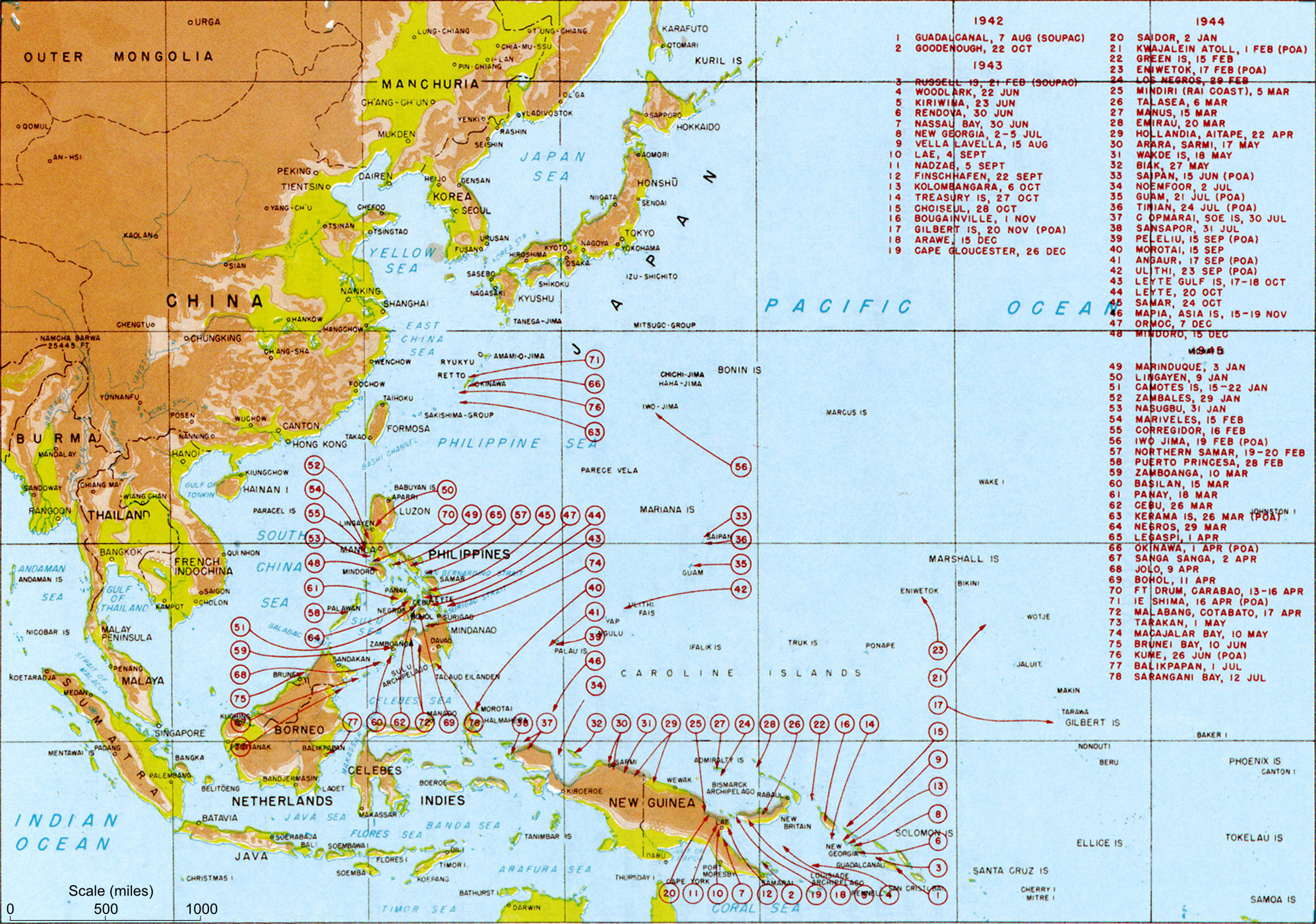
Kossol Roads is a large body of reef-enclosed water north of Babeldaob in northern Palau at .Kossol Roads at Pacific War Online Encyclopaedia Accessed 28 December 2021] Kossol Roads is also known as: Kossol Passage, Kawassak, Garaseg, Kanal von Kossol, Kossol Durchfahrt, Kossoi Passage, Kosusoru-suido, Toachel Ngkesol, Kawassak, and Ngkesol. At the outbreak of , Kossol Roads was under Japanese control. American forces seized it in September 1944, after which the used it as the location of a floating resupply and repair base and waypo ... [...More Info...] [...Related Items...] OR: [Wikipedia] [Google] [Baidu] |
Surrender Of Japan
The surrender of the Empire of Japan in World War II was announced by Emperor Hirohito on 15 August and formally signed on 2 September 1945, bringing the war's hostilities to a close. By the end of July 1945, the Imperial Japanese Navy (IJN) had become incapable of conducting major operations and an Allied invasion of Japan was imminent. Together with the United Kingdom and China, the United States called for the unconditional surrender of the Japanese armed forces in the Potsdam Declaration on 26 July 1945—the alternative being "prompt and utter destruction". While publicly stating their intent to fight on to the bitter end, Japan's leaders (the Supreme Council for the Direction of the War, also known as the "Big Six") were privately making entreaties to the publicly neutral Soviet Union to mediate peace on terms more favorable to the Japanese. While maintaining a sufficient level of diplomatic engagement with the Japanese to give them the impression they might be wi ... [...More Info...] [...Related Items...] OR: [Wikipedia] [Google] [Baidu] |
Okinawa
is a prefecture of Japan. Okinawa Prefecture is the southernmost and westernmost prefecture of Japan, has a population of 1,457,162 (as of 2 February 2020) and a geographic area of 2,281 km2 (880 sq mi). Naha is the capital and largest city of Okinawa Prefecture, with other major cities including Okinawa, Uruma, and Urasoe. Okinawa Prefecture encompasses two thirds of the Ryukyu Islands, including the Okinawa, Daitō and Sakishima groups, extending southwest from the Satsunan Islands of Kagoshima Prefecture to Taiwan ( Hualien and Yilan Counties). Okinawa Prefecture's largest island, Okinawa Island, is the home to a majority of Okinawa's population. Okinawa Prefecture's indigenous ethnic group are the Ryukyuan people, who also live in the Amami Islands of Kagoshima Prefecture. Okinawa Prefecture was ruled by the Ryukyu Kingdom from 1429 and unofficially annexed by Japan after the Invasion of Ryukyu in 1609. Okinawa Prefecture was officially founded in 1879 by the Empi ... [...More Info...] [...Related Items...] OR: [Wikipedia] [Google] [Baidu] |
Subic Bay
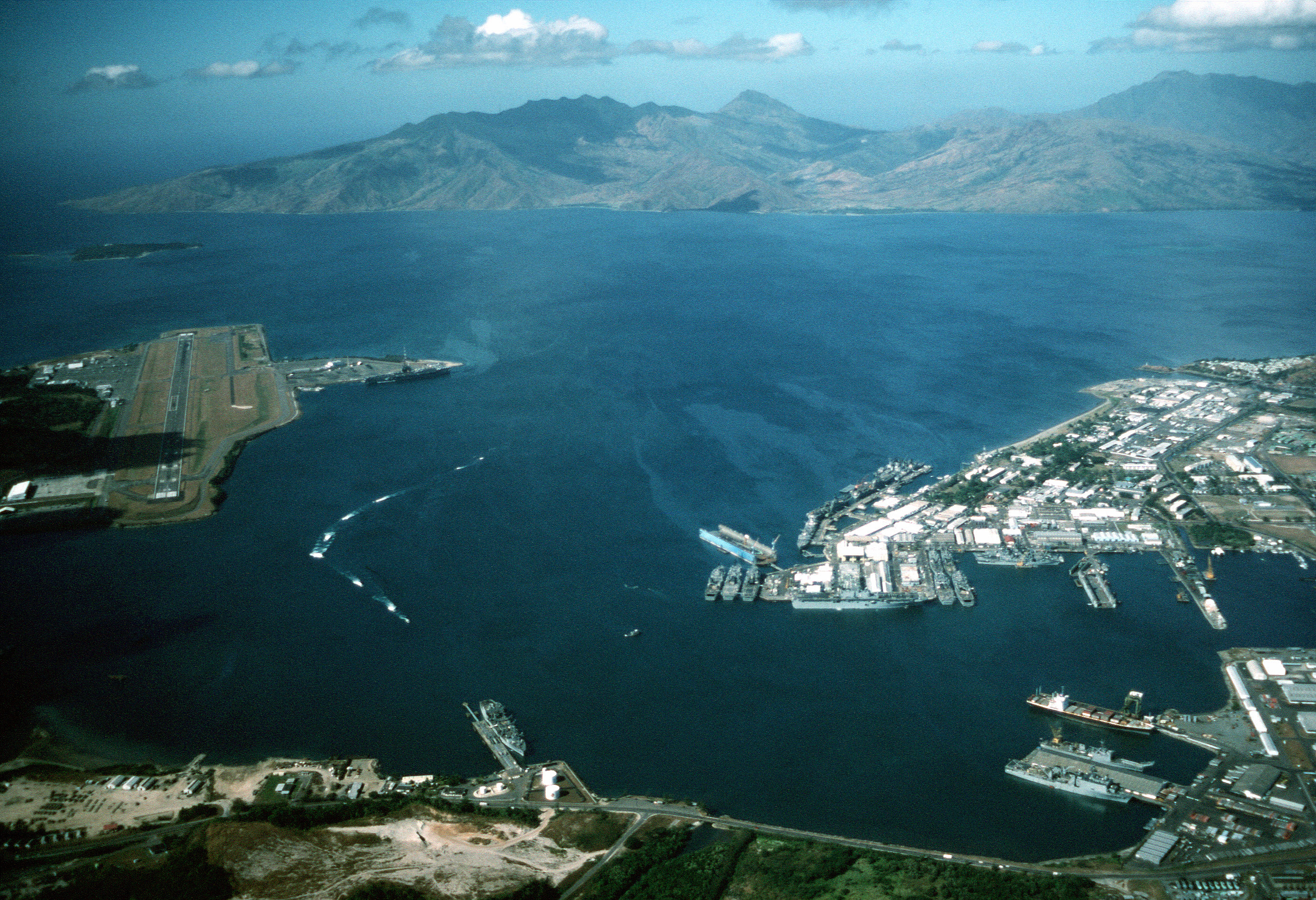
Subic Bay is a bay on the west coast of the island of Luzon in the Philippines, about northwest of Manila Bay. An extension of the South China Sea, its shores were formerly the site of a major United States Navy facility, U.S. Naval Base Subic Bay, now an industrial and commercial area known as the Subic Bay Freeport Zone under the Subic Bay Metropolitan Authority. Today, water as well as the towns and establishments surrounding the bay are collectively known as Subic Bay. This includes the former naval base, Hanjin shipyard, Olongapo city, the municipal town of Subic, and the erstwhile US defense housing areas of Binictican and Kalayan housing, up to Morong, Bataan. The bay was long recognized for its deep and protected waters, but development was slow due to lack of level terrain around the bay. History In 1542, Spanish conquistador Juan de Salcedo sailed into Subic Bay but no port developed there because the main Spanish naval base would be established in the nearby Ma ... [...More Info...] [...Related Items...] OR: [Wikipedia] [Google] [Baidu] |
Landing Craft
Landing craft are small and medium seagoing watercraft, such as boats and barges, used to convey a landing force (infantry and vehicles) from the sea to the shore during an amphibious assault. The term excludes landing ships, which are larger. Production of landing craft peaked during World War II, with a significant number of different designs produced in large quantities by the United Kingdom and United States. Because of the need to run up onto a suitable beach, World War II landing craft were flat-bottomed, and many designs had a flat front, often with a lowerable ramp, rather than a normal bow. This made them difficult to control and very uncomfortable in rough seas. The control point (too rudimentary to call a bridge on LCA and similar craft) was normally at the extreme rear of the vessel, as were the engines. In all cases, they were known by an abbreviation derived from the official name rather than by the full title. History In the days of sail, the ship's boats were us ... [...More Info...] [...Related Items...] OR: [Wikipedia] [Google] [Baidu] |
Luzon
Luzon (; ) is the largest and most populous island in the Philippines. Located in the northern portion of the Philippines archipelago, it is the economic and political center of the nation, being home to the country's capital city, Manila, as well as Quezon City, the country's most populous city. With a population of 64 million , it contains 52.5% of the country's total population and is the fourth most populous island in the world. It is the 15th largest island in the world by land area. ''Luzon'' may also refer to one of the three primary island groups in the country. In this usage, it includes the Luzon mainland, the Batanes and Babuyan groups of islands to the north, Polillo Islands to the east, and the outlying islands of Catanduanes, Marinduque and Mindoro, among others, to the south. The islands of Masbate, Palawan and Romblon are also included, although these three are sometimes grouped with another of the island groups, the Visayas. Etymology The name ''Luz ... [...More Info...] [...Related Items...] OR: [Wikipedia] [Google] [Baidu] |
Manila
Manila ( , ; fil, Maynila, ), officially the City of Manila ( fil, Lungsod ng Maynila, ), is the capital of the Philippines, and its second-most populous city. It is highly urbanized and, as of 2019, was the world's most densely populated city proper. Manila is considered to be a global city and rated as an Alpha – City by Globalization and World Cities Research Network (GaWC). It was the first chartered city in the country, designated as such by the Philippine Commission Act 183 of July 31, 1901. It became autonomous with the passage of Republic Act No. 409, "The Revised Charter of the City of Manila", on June 18, 1949. Manila is considered to be part of the world's original set of global cities because its commercial networks were the first to extend across the Pacific Ocean and connect Asia with the Spanish Americas through the galleon trade; when this was accomplished, it marked the first time in world history that an uninterrupted chain of trade routes circling ... [...More Info...] [...Related Items...] OR: [Wikipedia] [Google] [Baidu] |
Mangarin Bay
Mangarin Bay is a bay of the South China Sea, on the west coast of Mindoro island, in Occidental Mindoro Province of the Philippines. The bay is shoal, and sheltered from the wind by Mangarin Point to the east and by Ilin Island. Magarin Point terminates in a long sandy pit off which the depth is 4 to 5 fathoms. Farther in the water shoals rapidly. The settlement of Mangarin San Jose, officially the Municipality of San Jose ( tgl, Bayan ng San Jose), is a 1st class municipality in the province of Occidental Mindoro, Philippines. According to the 2020 census, it has a population of 153,267, representing a third of ... is only accessible by light boat. The surroundings are marshy, and few supplies are available. References Bays of the Philippines Mindoro Landforms of Occidental Mindoro Bodies of water of the South China Sea {{Mimaropa-geo-stub ... [...More Info...] [...Related Items...] OR: [Wikipedia] [Google] [Baidu] |
Sonar
Sonar (sound navigation and ranging or sonic navigation and ranging) is a technique that uses sound propagation (usually underwater, as in submarine navigation) to navigation, navigate, measure distances (ranging), communicate with or detect objects on or under the surface of the water, such as other vessels. "Sonar" can refer to one of two types of technology: ''passive'' sonar means listening for the sound made by vessels; ''active'' sonar means emitting pulses of sounds and listening for echoes. Sonar may be used as a means of acoustic location and of measurement of the echo characteristics of "targets" in the water. Acoustic location in air was used before the introduction of radar. Sonar may also be used for robot navigation, and SODAR (an upward-looking in-air sonar) is used for atmospheric investigations. The term ''sonar'' is also used for the equipment used to generate and receive the sound. The acoustic frequencies used in sonar systems vary from very low (infrasonic ... [...More Info...] [...Related Items...] OR: [Wikipedia] [Google] [Baidu] |
Philippines
The Philippines (; fil, Pilipinas, links=no), officially the Republic of the Philippines ( fil, Republika ng Pilipinas, links=no), * bik, Republika kan Filipinas * ceb, Republika sa Pilipinas * cbk, República de Filipinas * hil, Republika sang Filipinas * ibg, Republika nat Filipinas * ilo, Republika ti Filipinas * ivv, Republika nu Filipinas * pam, Republika ning Filipinas * krj, Republika kang Pilipinas * mdh, Republika nu Pilipinas * mrw, Republika a Pilipinas * pag, Republika na Filipinas * xsb, Republika nin Pilipinas * sgd, Republika nan Pilipinas * tgl, Republika ng Pilipinas * tsg, Republika sin Pilipinas * war, Republika han Pilipinas * yka, Republika si Pilipinas In the recognized optional languages of the Philippines: * es, República de las Filipinas * ar, جمهورية الفلبين, Jumhūriyyat al-Filibbīn is an archipelagic country in Southeast Asia. It is situated in the western Pacific Ocean and consists of around 7,641 islands t ... [...More Info...] [...Related Items...] OR: [Wikipedia] [Google] [Baidu] |
South China Sea
The South China Sea is a marginal sea of the Western Pacific Ocean. It is bounded in the north by the shores of South China (hence the name), in the west by the Indochinese Peninsula, in the east by the islands of Taiwan and northwestern Philippines (mainly Luzon, Mindoro and Palawan), and in the south by Borneo, eastern Sumatra and the Bangka Belitung Islands, encompassing an area of around . It communicates with the East China Sea via the Taiwan Strait, the Philippine Sea via the Luzon Strait, the Sulu Sea via the straits around Palawan (e.g. the Mindoro and Balabac Straits), the Strait of Malacca via the Singapore Strait, and the Java Sea via the Karimata and Bangka Straits. The Gulf of Thailand and the Gulf of Tonkin are also part of the South China Sea. The shallow waters south of the Riau Islands are also known as the Natuna Sea. The South China Sea is a region of tremendous economic and geostrategic importance. One-third of the world's maritime shipping passe ... [...More Info...] [...Related Items...] OR: [Wikipedia] [Google] [Baidu] |


