|
Union Canal (Pennsylvania)
The Union Canal was a towpath canal that existed in southeastern Pennsylvania in the United States during the 19th century. First proposed in 1690 to connect Philadelphia with the Susquehanna River, it ran approximately 82 mi from Middletown on the Susquehanna below Harrisburg to Reading on the Schuylkill River. History 18th century Construction began in 1792 during George Washington's administration, but financial difficulties delayed its completion until 1828. Called the "Golden Link," it provided a critical early transportation route for shipping anthracite coal and lumber eastward to Philadelphia. Closed in the 1880s, remnants of the canal remain, most notably the Union Canal Tunnel, a hand-built engineering marvel that is the oldest existing transportation tunnel in the United States. The tunnel is a National Historic Landmark. The idea of uniting the Schuylkill and Susquehanna rivers by a canal was first proposed and discussed by William Penn in 1690. ... [...More Info...] [...Related Items...] OR: [Wikipedia] [Google] [Baidu] |
Pennsylvania
Pennsylvania (; ( Pennsylvania Dutch: )), officially the Commonwealth of Pennsylvania, is a state spanning the Mid-Atlantic, Northeastern, Appalachian, and Great Lakes regions of the United States. It borders Delaware to its southeast, Maryland to its south, West Virginia to its southwest, Ohio to its west, Lake Erie and the Canadian province of Ontario to its northwest, New York to its north, and the Delaware River and New Jersey to its east. Pennsylvania is the fifth-most populous state in the nation with over 13 million residents as of 2020. It is the 33rd-largest state by area and ranks ninth among all states in population density. The southeastern Delaware Valley metropolitan area comprises and surrounds Philadelphia, the state's largest and nation's sixth most populous city. Another 2.37 million reside in Greater Pittsburgh in the southwest, centered around Pittsburgh, the state's second-largest and Western Pennsylvania's largest city. The state's su ... [...More Info...] [...Related Items...] OR: [Wikipedia] [Google] [Baidu] |
Philadelphia
Philadelphia, often called Philly, is the largest city in the Commonwealth of Pennsylvania, the sixth-largest city in the U.S., the second-largest city in both the Northeast megalopolis and Mid-Atlantic regions after New York City. Since 1854, the city has been coextensive with Philadelphia County, the most populous county in Pennsylvania and the urban core of the Delaware Valley, the nation's seventh-largest and one of world's largest metropolitan regions, with 6.245 million residents . The city's population at the 2020 census was 1,603,797, and over 56 million people live within of Philadelphia. Philadelphia was founded in 1682 by William Penn, an English Quaker. The city served as capital of the Pennsylvania Colony during the British colonial era and went on to play a historic and vital role as the central meeting place for the nation's founding fathers whose plans and actions in Philadelphia ultimately inspired the American Revolution and the nation's inde ... [...More Info...] [...Related Items...] OR: [Wikipedia] [Google] [Baidu] |
Lebanon, Pennsylvania
Lebanon () is a city in and the county seat of Lebanon County, Pennsylvania, United States. The population was 26,814 at the 2020 United States Census, 2020 census. Lebanon is located in the central part of the Lebanon Valley, east of Harrisburg, Pennsylvania, Harrisburg and west of Reading, Pennsylvania, Reading. Lebanon was founded by George Steitz in 1740 and was originally named Steitztown. Lebanon is located southwest of Allentown, Pennsylvania, Allentown, east of Harrisburg, Pennsylvania, Harrisburg, and northwest of Philadelphia. History Native tribes in the area of what is now Lebanon included the Shawnee, Susquehannock, Gawanese, Lenape (or Delaware), and Nanticoke peoples.A Brief History of Lancaster County Web.archive.org (1999-02-03). Retrieved on 2013-07-2 ... [...More Info...] [...Related Items...] OR: [Wikipedia] [Google] [Baidu] |
Summit-level Canal
A summit-level canal is an artificial waterway connecting two separate river valleys. The term refers to a canal that rises to cross a summit then falls down the other side. The summit pound is a level stretch of water at the highest part of the canal, contained by two locks that prevent the water from flowing downstream in both directions. Since water flows out when locks open to admit boats, the summit pound must have a water supply. By contrast, a ''lateral canal'' has a continuous fall only. Summit-level canals were an essential step in developing transport systems connecting different parts of a country before the railways or modern road transport. History The first canal to connect rivers across a watershed was the Lingqu Canal ("Magic Canal") in China which connected the Xiang and Li rivers in 219 BCE for military transport; however this is not usually considered a summit level canal as the summit level was a flat cut and there were originally no locks, though lateral ... [...More Info...] [...Related Items...] OR: [Wikipedia] [Google] [Baidu] |
Lake Ontario
Lake Ontario is one of the five Great Lakes of North America. It is bounded on the north, west, and southwest by the Canadian province of Ontario, and on the south and east by the U.S. state of New York. The Canada–United States border spans the centre of the lake. The Canadian cities of Toronto, Kingston, Mississauga, and Hamilton are located on the lake's northern and western shorelines, while the American city of Rochester is located on the south shore. In the Huron language, the name means "great lake". Its primary inlet is the Niagara River from Lake Erie. The last in the Great Lakes chain, Lake Ontario serves as the outlet to the Atlantic Ocean via the Saint Lawrence River, comprising the eastern end of the Saint Lawrence Seaway. The Moses-Saunders Power Dam regulates the water level of the lake. Geography Lake Ontario is the easternmost of the Great Lakes and the smallest in surface area (7,340 sq mi, 18,960 km2), although it exceeds Lake Eri ... [...More Info...] [...Related Items...] OR: [Wikipedia] [Google] [Baidu] |
Mohawk River
The Mohawk River is a U.S. Geological Survey. National Hydrography Dataset high-resolution flowline dataThe National Map accessed October 3, 2011 river in the U.S. state of New York. It is the largest tributary of the Hudson River. The Mohawk flows into the Hudson in Cohoes, New York, a few miles north of the city of Albany.Mohawk River , The Columbia Gazetteer of North America The river is named for the of the Iroquois Confederacy. It is a major waterway in north-central New York. The largest tributary, the Schoharie Creek, accounts fo ... [...More Info...] [...Related Items...] OR: [Wikipedia] [Google] [Baidu] |
Lake Erie
Lake Erie ( "eerie") is the fourth largest lake by surface area of the five Great Lakes in North America and the eleventh-largest globally. It is the southernmost, shallowest, and smallest by volume of the Great Lakes and therefore also has the shortest average water residence time. At its deepest point Lake Erie is deep. Situated on the International Boundary between Canada and the United States, Lake Erie's northern shore is the Canadian province of Ontario, specifically the Ontario Peninsula, with the U.S. states of Michigan, Ohio, Pennsylvania, and New York on its western, southern, and eastern shores. These jurisdictions divide the surface area of the lake with water boundaries. The largest city on the lake is Cleveland, anchoring the third largest U.S. metro area in the Great Lakes region, after Greater Chicago and Metro Detroit. Other major cities along the lake shore include Buffalo, New York; Erie, Pennsylvania; and Toledo, Ohio. Situated below Lake Huron, Erie's p ... [...More Info...] [...Related Items...] OR: [Wikipedia] [Google] [Baidu] |
David Rittenhouse
David Rittenhouse (April 8, 1732 – June 26, 1796) was an American astronomer, inventor, clockmaker, mathematician, surveyor, scientific instrument craftsman, and public official. Rittenhouse was a member of the American Philosophical Society and the first director of the United States Mint. Biography David Rittenhouse was born on April 8, 1732, in Roxborough Township, Philadelphia County, near a small village within Philadelphia called Rittenhousetown. This village is located near Germantown, along the stream Paper Mill Run, which is a tiny tributary of the Wissahickon Creek. When his uncle, William Rittenhouse, died, David inherited his uncle's carpentry tools and instructional books. At a young age, David showed a high level of intelligence by creating a working scale model of his great-grandfather William Rittenhouse's paper mill. He built other scale models in his youth, like a working waterwheel. David never attended elementary school—he was self-taught from his f ... [...More Info...] [...Related Items...] OR: [Wikipedia] [Google] [Baidu] |
Robert Morris (financier)
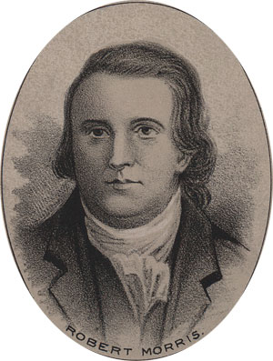
Robert Morris Jr. (January 20, 1734May 8, 1806) was an English-born merchant and a Founding Father of the United States. He served as a member of the Pennsylvania legislature, the Second Continental Congress, and the United States Senate, and he was a signer of the Declaration of Independence, the Articles of Confederation, and the United States Constitution. From 1781 to 1784, he served as the Superintendent of Finance of the United States, becoming known as the "Financier of the Revolution." Along with Alexander Hamilton and Albert Gallatin, he is widely regarded as one of the founders of the financial system of the United States. Born in Liverpool, Morris migrated to North America in his teens, quickly becoming a partner in a successful shipping firm based in Philadelphia. In the aftermath of the French and Indian War, Morris joined with other merchants in opposing British tax policies such as the 1765 Stamp Act. By 1775 he was the richest man in America. After the outbreak ... [...More Info...] [...Related Items...] OR: [Wikipedia] [Google] [Baidu] |
Conestoga River
The Conestoga River, also referred to as Conestoga Creek, is a U.S. Geological Survey. National Hydrography Dataset high-resolution flowline dataThe National Map, accessed August 8, 2011 tributary of the Susquehanna River flowing through the center of Lancaster County, Pennsylvania, United States. Geography Its headwaters rise mostly in southern Berks County and northeastern Lancaster County, in an area known as "Bortz's Swamp" or "Penngall Field" (a small area rises in Chester County). The East Branch and West Branch of the Conestoga join to form the main river just north of Morgantown, and the stream flows from northeast to southwest for more than , passing close to the center of Lancaster and ending at Safe Harbor along the Susquehanna River, approximately north of the Pennsylvania-Maryland state line. The principal tributaries of the Conestoga River are Cocalico Creek, Mill Creek, and Little Conestoga Creek; they drain into the Conestoga River watershed in the order ... [...More Info...] [...Related Items...] OR: [Wikipedia] [Google] [Baidu] |
Lancaster, Pennsylvania
Lancaster, ( ; pdc, Lengeschder) is a city in and the county seat of Lancaster County, Pennsylvania. It is one of the oldest inland cities in the United States. With a population at the 2020 census of 58,039, it ranks 11th in population among Pennsylvania's municipalities. The Lancaster metropolitan area population is 507,766, making it the 104th-largest metropolitan area in the U.S. and second-largest in the South Central Pennsylvania area. The city's primary industries include healthcare, tourism, public administration, manufacturing, and both professional and semi-professional services. Lancaster is a hub of Pennsylvania's Dutch Country. Lancaster is located southwest of Allentown and west of Philadelphia. History Originally called Hickory Town, the city was renamed after the English city of Lancaster by native John Wright. Its symbol, the red rose, is from the House of Lancaster. Lancaster was part of the 1681 Penn's Woods Charter of William Penn, and was laid ... [...More Info...] [...Related Items...] OR: [Wikipedia] [Google] [Baidu] |
Phoenixville, Pennsylvania
Phoenixville is a Borough (Pennsylvania), borough in Chester County, Pennsylvania, United States. It is located northwest of Philadelphia, Pennsylvania, Philadelphia at the junction of French Creek (Schuylkill River tributary), French Creek and the Schuylkill River. It is in the Delaware Valley, Philadelphia metropolitan area. The population is 18,616 as of the 2020 Census. As noted by ''Forbes'', Phoenixville is a former beaten-down mill town with a recent downtown revitalization plan that led to 10 craft breweries, a distillery, and winery tasting rooms. History Originally called Manavon, Phoenixville was settled in 1732 and incorporated as a borough in 1849. In its industrial heyday early in the twentieth century, it was an important manufacturing center and the site of great iron and steel mills such as the Phoenix Iron Works (Phoenixville, Pennsylvania), Phoenix Iron Works, boiler works, silk mill, underwear and hosiery factory, factories, a match factory, and the famous ... [...More Info...] [...Related Items...] OR: [Wikipedia] [Google] [Baidu] |

.jpg)


