|
Undulated Tinamou
The undulated tinamou (''Crypturellus undulatus'') is a species of ground bird found in a wide range of wooded habitats in eastern and northern South America. Etymology Its generic name ''Crypturellus'' is formed from three Latin or Greek words - ''kruptos'' meaning "covered" or "hidden", ''oura'' meaning "tail", and ''ellus'' meaning "diminutive". Therefore, ''Crypturellus'' means small, hidden tail. The specific name ''undulatus'' originates from the Latin word ''unda'', meaning "wave", and means "furnished with wave-like markings". Taxonomy All tinamous are from the family Tinamidae, so are also ratites. Unlike other ratites, tinamous can fly, although in general, they are not strong fliers. All ratites evolved from prehistoric flying birds, and tinamous are the closest living relative of these birds. Subspecies * ''C. u. manapiare'' is only known with certainty from the vicinity of the Ventuari River in northern Amazonas State in Venezuela, but probably also occurs i ... [...More Info...] [...Related Items...] OR: [Wikipedia] [Google] [Baidu] |
Coenraad Jacob Temminck
Coenraad Jacob Temminck (; 31 March 1778 – 30 January 1858) was a Dutch people, Dutch Aristocracy (class), aristocrat, Zoology, zoologist and museum director. Biography Coenraad Jacob Temminck was born on 31 March 1778 in Amsterdam in the Dutch Republic. From his father, Jacob Temminck, who was treasurer of the Dutch East India Company with links to numerous travellers and collectors, he inherited a large collection of bird specimens. His father was a good friend of Francois Levaillant who also guided Coenraad. Temminck's ''Manuel d'ornithologie, ou Tableau systématique des oiseaux qui se trouvent en Europe'' (1815) was the standard work on European birds for many years. He was also the author of ''Histoire naturelle générale des Pigeons et des Gallinacées'' (1813–1817), ''Nouveau Recueil de Planches coloriées d'Oiseaux'' (1820–1839), and contributed to the mammalian sections of Philipp Franz von Siebold's ''Fauna japonica'' (1844–1850). Temminck was the first dire ... [...More Info...] [...Related Items...] OR: [Wikipedia] [Google] [Baidu] |
Tapajós River
The Tapajós ( pt, Rio Tapajós ) is a river in Brazil. It runs through the Amazon Rainforest and is a major tributary of the Amazon River. When combined with the Juruena River, the Tapajós is approximately long. It is one of the largest clearwater rivers, accounting for about 6% of the water in the Amazon basin. Course For most of its length the Tapajós runs through Pará State, but the upper (southern) part forms the border between Pará and Amazonas State. The source is at the Juruena–Teles Pires river junction. The Tapajós River basin accounts for 6% of the water in the Amazon Basin, making it the fifth largest in the system.Hales, J., and P. Petry (2013). Tapajos – Juruena'. Freshwater Ecoregions of the World. Retrieved 16 February 2013. From the lower Arinos River (a tributary of Juruena) to the Maranhão Grande falls are a more or less continuous series of formidable cataracts and rapids; but from the Maranhão Grande to the mouth of Tapajós, about , the r ... [...More Info...] [...Related Items...] OR: [Wikipedia] [Google] [Baidu] |
Beak
The beak, bill, or rostrum is an external anatomical structure found mostly in birds, but also in turtles, non-avian dinosaurs and a few mammals. A beak is used for eating, preening, manipulating objects, killing prey, fighting, probing for food, courtship, and feeding young. The terms ''beak'' and ''rostrum'' are also used to refer to a similar mouth part in some ornithischians, pterosaurs, cetaceans, dicynodonts, anuran tadpoles, monotremes (i.e. echidnas and platypuses, which have a beak-like structure), sirens, pufferfish, billfishes and cephalopods. Although beaks vary significantly in size, shape, color and texture, they share a similar underlying structure. Two bony projections – the upper and lower mandibles – are covered with a thin keratinized layer of epidermis known as the rhamphotheca. In most species, two holes called ''nares'' lead to the respiratory system. Etymology Although the word "beak" was, in the past, generally restricted to the sharpened bills o ... [...More Info...] [...Related Items...] OR: [Wikipedia] [Google] [Baidu] |
Araguaia River
The Araguaia River ( pt, Rio Araguaia , Karajá: ♂ ''Berohokỹ'' eɾohoˈkə̃ ♀ ''Bèrakuhukỹ'' ɛɾakuhuˈkə̃ is one of the major rivers of Brazil though it is almost equal in volume at its confluence with the Tocantins. It has a total length of approximately 2,627 km. Geography The Araguaia River comes from Goiás-Mato Grosso south borders. From there it flows northeast to a junction with the Tocantins near the town of São João. Along its course, the river forms the border between the states of Goiás, Mato Grosso, Tocantins and Pará. Roughly in the middle of its course the Araguaia splits into two forks (with the western one retaining the name Araguaia and the eastern one being called the Javaés River). These later reunite, forming the Ilha do Bananal, the world's largest river island. The vein of the Javaés forms a broad inland where it pours back into the main Araguaia, a 100,000 hectare expanse of igapós or flooded forest, blackwater river channels, an ... [...More Info...] [...Related Items...] OR: [Wikipedia] [Google] [Baidu] |
Argentina
Argentina (), officially the Argentine Republic ( es, link=no, República Argentina), is a country in the southern half of South America. Argentina covers an area of , making it the second-largest country in South America after Brazil, the fourth-largest country in the Americas, and the eighth-largest country in the world. It shares the bulk of the Southern Cone with Chile to the west, and is also bordered by Bolivia and Paraguay to the north, Brazil to the northeast, Uruguay and the South Atlantic Ocean to the east, and the Drake Passage to the south. Argentina is a federal state subdivided into twenty-three provinces, and one autonomous city, which is the federal capital and largest city of the nation, Buenos Aires. The provinces and the capital have their own constitutions, but exist under a federal system. Argentina claims sovereignty over the Falkland Islands, South Georgia and the South Sandwich Islands, and a part of Antarctica. The earliest recorded human prese ... [...More Info...] [...Related Items...] OR: [Wikipedia] [Google] [Baidu] |
Paraguay
Paraguay (; ), officially the Republic of Paraguay ( es, República del Paraguay, links=no; gn, Tavakuairetã Paraguái, links=si), is a landlocked country in South America. It is bordered by Argentina to the south and southwest, Brazil to the east and northeast, and Bolivia to the northwest. It has a population of seven million, nearly three million of whom live in the capital and largest city of Asunción, and its surrounding metro. Although one of only two landlocked countries in South America (Bolivia is the other), Paraguay has ports on the Paraguay and Paraná rivers that give exit to the Atlantic Ocean, through the Paraná-Paraguay Waterway. Spanish conquistadores arrived in 1524, and in 1537, they established the city of Asunción, the first capital of the Governorate of the Río de la Plata. During the 17th century, Paraguay was the center of Jesuit missions, where the native Guaraní people were converted to Christianity and introduced to European culture. ... [...More Info...] [...Related Items...] OR: [Wikipedia] [Google] [Baidu] |
Pantanal
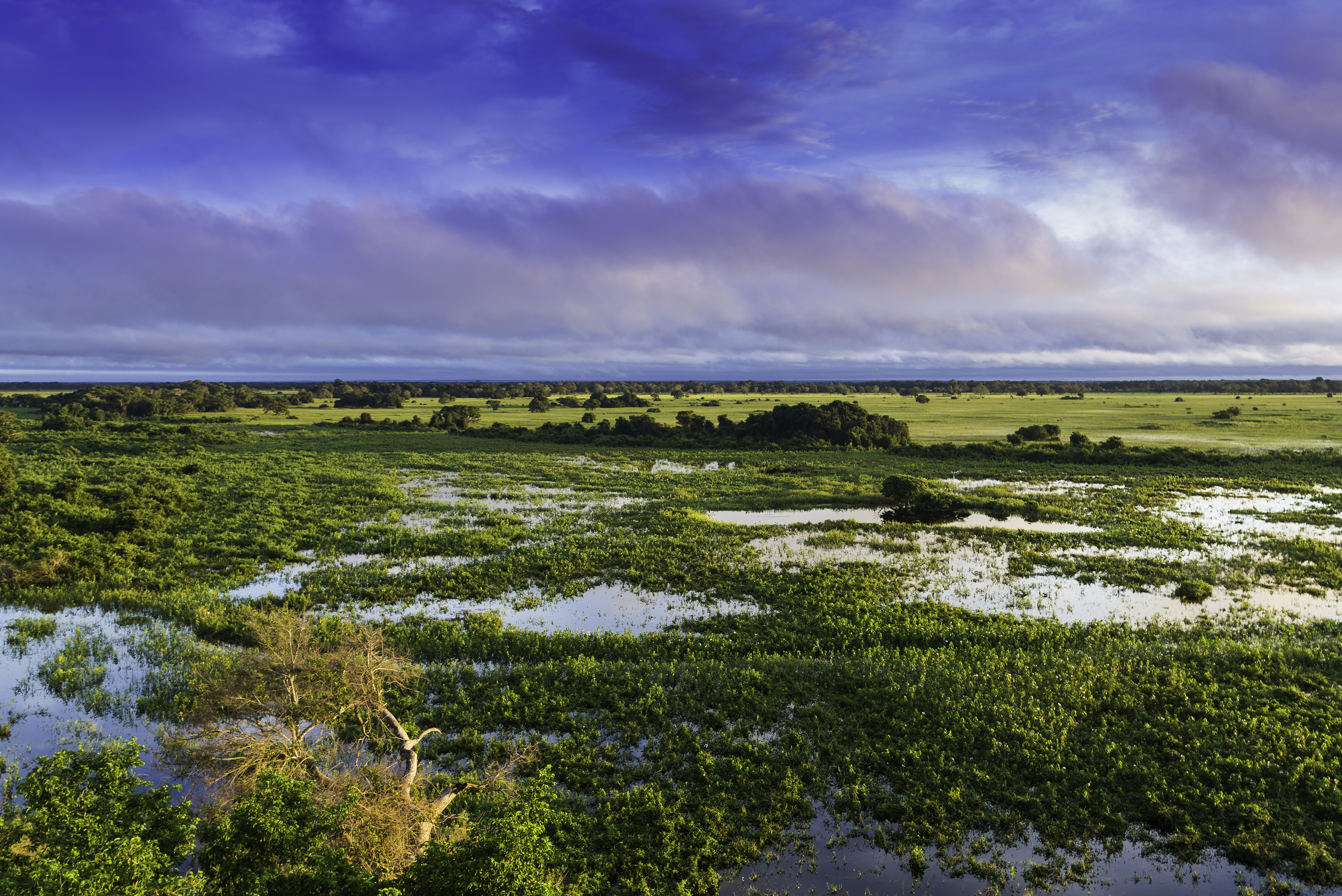
The Pantanal () is a natural region encompassing the world's largest tropical wetland area, and the world's largest flooded grasslands. It is located mostly within the Brazilian state of Mato Grosso do Sul, but it extends into Mato Grosso and portions of Bolivia and Paraguay. It sprawls over an area estimated at between . Various subregional ecosystems exist, each with distinct hydrological, geological and ecological characteristics; up to 12 of them have been defined.Susan Mcgrath, photos by Joel Sartore, ''Brazil's Wild Wet'', National Geographic Magazine, August 2005 Roughly 80% of the Pantanal floodplains are submerged during the rainy seasons, nurturing a biologically diverse collection of aquatic plants and helping to support a dense array of animal species. Etymology The name "Pantanal" comes from the Portuguese word ''pântano'' that means "big wetland", "big bog", "big swamp", "big quagmire" or "big marsh" plus the suffix ''-al'', that means "abundance, agglomeratio ... [...More Info...] [...Related Items...] OR: [Wikipedia] [Google] [Baidu] |
Bolivia
, image_flag = Bandera de Bolivia (Estado).svg , flag_alt = Horizontal tricolor (red, yellow, and green from top to bottom) with the coat of arms of Bolivia in the center , flag_alt2 = 7 × 7 square patchwork with the (top left to bottom right) diagonals forming colored stripes (green, blue, purple, red, orange, yellow, white, green, blue, purple, red, orange, yellow, from top right to bottom left) , other_symbol = , other_symbol_type = Dual flag: , image_coat = Escudo de Bolivia.svg , national_anthem = " National Anthem of Bolivia" , image_map = BOL orthographic.svg , map_width = 220px , alt_map = , image_map2 = , alt_map2 = , map_caption = , capital = La Paz Sucre , largest_city = , official_languages = Spanish , languages_type = Co-official languages , languages ... [...More Info...] [...Related Items...] OR: [Wikipedia] [Google] [Baidu] |
Mato Grosso
Mato Grosso ( – lit. "Thick Bush") is one of the states of Brazil, the third largest by area, located in the Central-West region. The state has 1.66% of the Brazilian population and is responsible for 1.9% of the Brazilian GDP. Neighboring states (from west clockwise) are: Rondônia, Amazonas, Pará, Tocantins, Goiás and Mato Grosso do Sul. The state is roughly 82.2% of the size of its southwest neighbor, the nation of Bolivia. A state with a flat landscape that alternates between vast ''chapadas'' and plain areas, Mato Grosso contains three main ecosystems: the Cerrado, the Pantanal and the Amazon rainforest. The Chapada dos Guimarães National Park, with caves, grottoes, tracks, and waterfalls, is one of its tourist attractions. The extreme northwest of the state has a small part of the Amazonian forest. The Xingu Indigenous Park and the Araguaia River are in Mato Grosso. Farther south, the Pantanal, the world's largest wetland, is the habitat for nearly one thousand ... [...More Info...] [...Related Items...] OR: [Wikipedia] [Google] [Baidu] |
Maranhão
Maranhão () is a state in Brazil. Located in the country's Northeast Region, it has a population of about 7 million and an area of . Clockwise from north, it borders on the Atlantic Ocean for 2,243 km and the states of Piauí, Tocantins and Pará. The people of Maranhão have a distinctive accent inside the common Northeastern Brazilian dialect. Maranhão is described in books such as '' The Land of the Palm Trees'' by Gonçalves Dias and ''Casa de Pensão'' by Aluísio Azevedo. The dunes of Lençóis are an important area of environmental preservation. Also of interest is the state capital of São Luís, designated a Unesco World Heritage Site. Another important conservation area is the Parnaíba River delta, between the states of Maranhão and Piauí, with its lagoons, desert dunes and deserted beaches or islands, such as the Caju island, which shelters rare birds. Geography The northern portion of the state is a heavily forested plain traversed by numerous rivers, ... [...More Info...] [...Related Items...] OR: [Wikipedia] [Google] [Baidu] |
Purús River
The Purus River (Portuguese: ''Rio Purus''; Spanish: ''Río Purús'') is a tributary of the Amazon River in South America. Its drainage basin is , and the mean annual discharge is . The river shares its name with the Alto Purús National Park and the Purús Province (and its conformed Purús District), one of the four provinces of Peru in the Ucayali Region. Geography The Purus River rises in Peru. It defines the boundary between Peru and Brazil in the centre of the state of Acre, then runs for a short distance along the boundary of the Santa Rosa do Purus National Forest, a sustainable use conservation unit created in 2001 after it is joined by the Santa Rosa River. It then flows north east through Manoel Urbano It runs through a continuous forest at the bottom of the great depression, lying between the Madeira River, which skirts the edge of the Brazilian sandstone plateau, and the Ucayali River, which hugs the base of the Andes. In the state of Amazonas the river runs ... [...More Info...] [...Related Items...] OR: [Wikipedia] [Google] [Baidu] |
Peru
, image_flag = Flag of Peru.svg , image_coat = Escudo nacional del Perú.svg , other_symbol = Great Seal of the State , other_symbol_type = Seal (emblem), National seal , national_motto = "Firm and Happy for the Union" , national_anthem = "National Anthem of Peru" , march = "March of Flags" , image_map = PER orthographic.svg , map_caption = , image_map2 = , capital = Lima , coordinates = , largest_city = capital , official_languages = Peruvian Spanish, Spanish , languages_type = Co-official languages , languages = , ethnic_groups = , ethnic_groups_year = 2017 , demonym = Peruvians, Peruvian , government_type = Unitary state, Unitary Semi-presidential system, semi-presidential republic , leader_title1 = President of Peru, President ... [...More Info...] [...Related Items...] OR: [Wikipedia] [Google] [Baidu] |


.jpg)
