|
Tropical Storm Halong (2008)
Severe Tropical Storm Halong, known in the Philippines as Severe Tropical Storm Cosme, was the fourth severe tropical storm named by the Japan Meteorological Agency (JMA) who are the Regional Specialized Meteorological Centre for the Northwestern Pacific Ocean. The Joint Typhoon Warning Center also recognised Halong as the fifth tropical depression, the fourth tropical storm as well as the third typhoon of the 2008 Pacific typhoon season. Meteorological history Late on May 13 a tropical disturbance formed in the South China Sea. Early the next day, the Japan Meteorological Agency (JMA) and the Philippine Atmospheric, Geophysical and Astronomical Services Administration (PAGASA) designated the disturbance as a tropical depression, with PAGASA assigning the local name of Cosme. However the Joint Typhoon Warning Center (JTWC) did not issue a Tropical Cyclone Formation Alert until later that day. The JTWC then designated the depression as 05W on May 15. On May 16 both the ... [...More Info...] [...Related Items...] OR: [Wikipedia] [Google] [Baidu] |
Philippines
The Philippines (; fil, Pilipinas, links=no), officially the Republic of the Philippines ( fil, Republika ng Pilipinas, links=no), * bik, Republika kan Filipinas * ceb, Republika sa Pilipinas * cbk, República de Filipinas * hil, Republika sang Filipinas * ibg, Republika nat Filipinas * ilo, Republika ti Filipinas * ivv, Republika nu Filipinas * pam, Republika ning Filipinas * krj, Republika kang Pilipinas * mdh, Republika nu Pilipinas * mrw, Republika a Pilipinas * pag, Republika na Filipinas * xsb, Republika nin Pilipinas * sgd, Republika nan Pilipinas * tgl, Republika ng Pilipinas * tsg, Republika sin Pilipinas * war, Republika han Pilipinas * yka, Republika si Pilipinas In the recognized optional languages of the Philippines: * es, República de las Filipinas * ar, جمهورية الفلبين, Jumhūriyyat al-Filibbīn is an archipelagic country in Southeast Asia. It is situated in the western Pacific Ocean and consists of around 7,641 islands t ... [...More Info...] [...Related Items...] OR: [Wikipedia] [Google] [Baidu] |
La Union
La Union (), officially the Province of La Union ( ilo, Probinsia ti La Union; Kankanaey'': Probinsyan di La Union;'' Ibaloi'': Probinsya ne La Union;'' pag, Luyag/Probinsia na La Union; Tagalog'': Lalawigan ng La Union),'' is a province in the Philippines located in the Ilocos Region in the Island of Luzon. Its capital is the City of San Fernando, which also serves as the regional center of the Ilocos Region. The province is bordered by Ilocos Sur to the north, Benguet to the east, Pangasinan to the south, and to the west by the shores of the South China Sea. History Pre-colonial era During the pre-colonial era, the coastal plains of northwestern La Union and Ilocos Sur stretching from the town of "Tagudan" (Tagudin) in the north to ''Namacpacan'' (Luna), Bangar, "''Basnutan''" ( Bacnotan), and "''Purao''" or "''Puraw''" (Balaoan) in the south, and along the riverbanks of the Amburayan River – were the early settlement of the “''Samtoy”'' or the " Ilocanos" in ... [...More Info...] [...Related Items...] OR: [Wikipedia] [Google] [Baidu] |
Apayao
Apayao, officially the Province of Apayao ( ilo, Probinsia ti Apayao; fil, Lalawigan ng Apayao), is a landlocked Provinces of the Philippines, province in the Philippines in the Cordillera Administrative Region in Luzon. Kabugao, Apayao, Kabugao serves as its capital. The provincial capitol and its associated offices are located at the New Government Center in Luna, Apayao, Luna. The province borders Cagayan to the north and east, Abra (province), Abra and Ilocos Norte to the west, and Kalinga (province), Kalinga to the south. Prior to 1995, Kalinga and Apayao comprised a single province named ''Kalinga-Apayao'', which was partition (politics), partitioned to better service the needs of individual ethnic groups. With a population of 124,366 (as of the 2020 census) covering an area of , Apayao is the least Population density, densely-populated province in the Philippines. History By 20th century, Apayao is predominated by the Isneg people. They are located primarily in the hi ... [...More Info...] [...Related Items...] OR: [Wikipedia] [Google] [Baidu] |
Abra (province)
Abra, officially the Province of Abra ( ilo, Probinsia ti Abra; tl, Lalawigan ng Abra), is a 3rd class province in the Cordillera Administrative Region of the Philippines. Its capital is the municipality of Bangued. It is bordered by Ilocos Norte on the northwest, Apayao on the northeast, Kalinga on the mid-east, Mountain Province on the southeast, and Ilocos Sur on the southwest. Etymology Abra is from the Spanish word ''abre'' meaning gorge, pass, breach or opening. It was first used by the Spaniards to denote the region above the Banaoang Gap where the Abra River exits into the West Philippine Sea, thus the Rio Grande de Abra. History Pre-colonial period The first inhabitants of Abra were the ancestors of the Bontocs and the Ifugaos. These inhabitants eventually left to settle in the old Mountain Province. Other early inhabitants were the Tingguians or Itnegs. Spanish era In 1585 the Tingguians were mentioned for the first time in a letter from Father Domingo de Sala ... [...More Info...] [...Related Items...] OR: [Wikipedia] [Google] [Baidu] |
Kalinga (province)
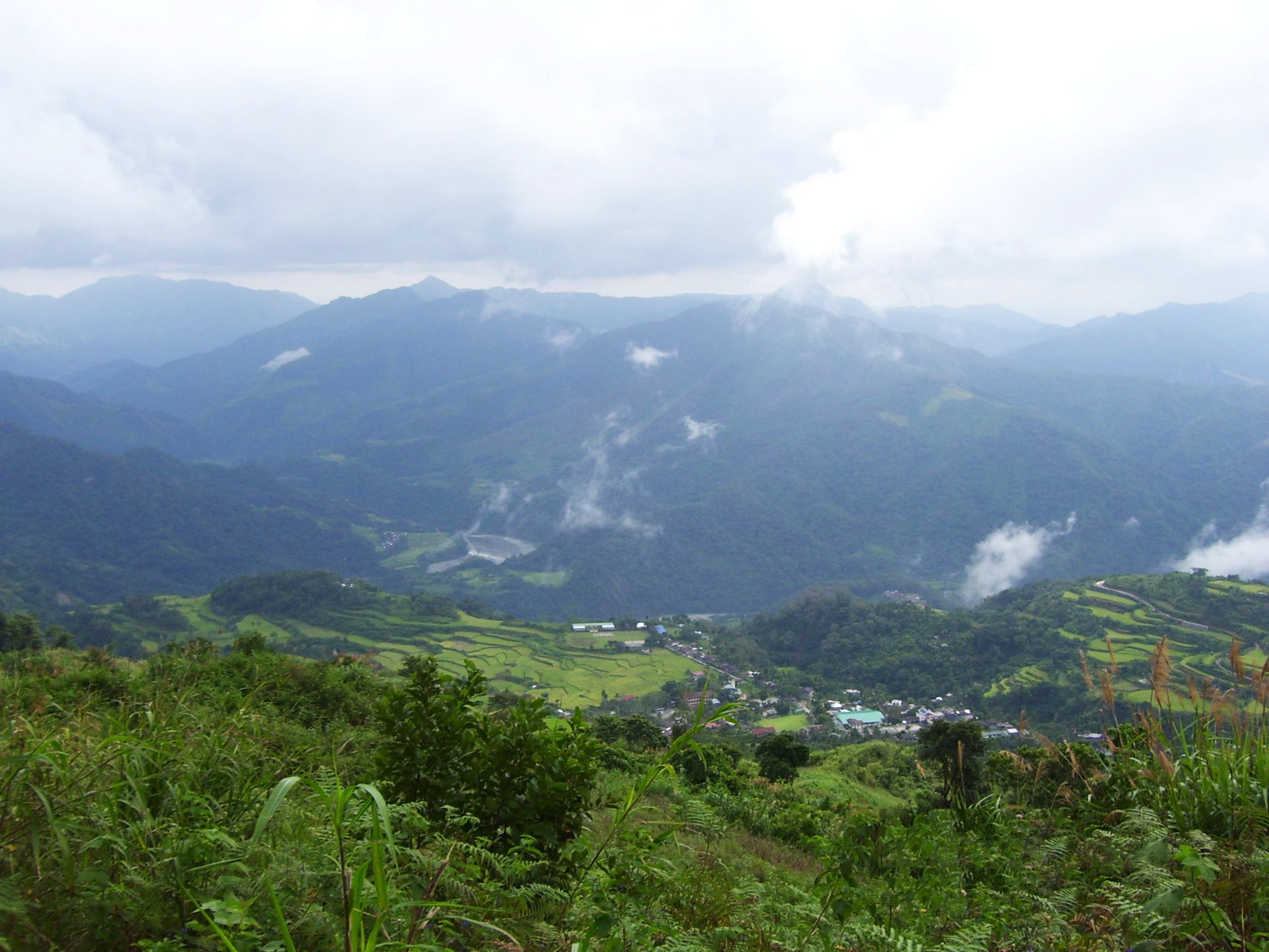
; tl, Lalawigan ng Kalinga) , native_name = , other_name = , settlement_type = , image_skyline = , image_caption = (from top: left to right) Bum-bag Rice Terraces, Pasil Valley, Lubuagan Mountains, Mount Manting-oy, Mount Binuluan and Tabuk City Hall. , image_flag = PH-KAL Flag.png , flag_size = 100x80px , image_seal = , seal_size = 100x80px , image_map = , map_caption = Location in the Philippines , coordinates = , subdivision_type = Country , subdivision_name = , subdivision_type1 = Region , subdivision_name1 = , established_title = Founded , established_date = May 8, 1995 , seat_type = Capital , seat = Tabuk , leader_party = , leader_title = Governor , leader_name = James S ... [...More Info...] [...Related Items...] OR: [Wikipedia] [Google] [Baidu] |
Ifugao
Ifugao, officially the Province of Ifugao ( ilo, Probinsia ti Ifugao; tl, Lalawigan ng Ifugao), is a landlocked province of the Philippines in the Cordillera Administrative Region in Luzon. Its capital is Lagawe and it borders Benguet to the west, Mountain Province to the north, Isabela to the east, and Nueva Vizcaya to the south. The Rice Terraces of the Philippine Cordilleras and Banaue Rice Terraces are the main tourist attractions in the province. These terraces are believed to have been hand-carved into the mountains 2,000 years ago to plant rice. However, recent research by carbon dating suggests that they were built much later. In 1995, the Rice Terraces of the Philippine Cordilleras were declared as a UNESCO World Heritage Site. In 2008 and 2015, the ''Hudhud chants of the Ifugao'' and the ''Punnuk (Tugging rituals and games)'' were inscribed in the UNESCO Intangible Cultural Heritage Lists. Etymology Ifugao is named after the term ''i-pugo'' (''"i"'' rom/peopleand ' ... [...More Info...] [...Related Items...] OR: [Wikipedia] [Google] [Baidu] |
Quirino
Quirino, officially the Province of Quirino ( ilo, Probinsia ti Quirino; tl, Lalawigan ng Quirino), is a landlocked province in the Philippines located in the Cagayan Valley region in Luzon. Its capital is Cabarroguis. It is named after Elpidio Quirino, the sixth President of the Philippines. The province borders Aurora to the southeast, Nueva Vizcaya to the west, and Isabela to the north. Quirino used to be part of the province of Nueva Vizcaya, until it was separated in 1966. History Long before its formal creation as an independent province, Quirino was the forest region of the province of Nueva Vizcaya, inhabited by tribal groups known as the Negritos. They roamed the hinterlands and built their huts at the heart of the jungle. On June 18, 1966, Republic Act No. 4734 was enacted, constituting the municipalities of Diffun, Saguday, Aglipay, and Maddela, all from Nueva Vizcaya province, into a new sub-province to be known as "Quirino", named after the late Philippin ... [...More Info...] [...Related Items...] OR: [Wikipedia] [Google] [Baidu] |
Nueva Ecija
Nueva Ecija, officially the Province of Nueva Ecija ( tgl, Lalawigan ng Nueva Ecija , also ; ilo, Probinsia ti Nueva Ecija; pag, Luyag/Probinsia na Nueva Ecija; Kapampangan: ''Lalawigan/Probinsia ning Nueva Ecija''), is a landlocked province in the Philippines located in the Central Luzon region. Its capital is the city of Palayan, while Cabanatuan, its former capital, is the largest local government unit (LGU). Nueva Ecija borders, from the south clockwise, Bulacan, Pampanga, Tarlac, Pangasinan, Nueva Vizcaya and Aurora. The province is nationally known as the ''Rice Granary of the Philippines'', producing the largest rice yield in the country. History Precolonial era These first settlers included tribes of Ilongots ( Egungot) or Italons, Abaca and Buquids. Settlements were built along the banks following the river's undulations. The Ilongots, meaning people of the forest, were the fierce headhunters and animist tribes who occupied Carranglan and the mountainous terrain of ... [...More Info...] [...Related Items...] OR: [Wikipedia] [Google] [Baidu] |
Nueva Vizcaya
Nueva Vizcaya, officially the Province of Nueva Vizcaya ( ilo, Probinsia ti Nueva Vizcaya; gad, Probinsia na Nueva Vizcaya; Pangasinan: ''Luyag/Probinsia na Nueva Vizcaya''; tl, Lalawigan ng Nueva Vizcaya ), is a landlocked province in the Philippines located in the Cagayan Valley region in Luzon. Its capital is Bayombong. It is bordered by Benguet to the west, Ifugao to the north, Isabela to the northeast, Quirino to the east, Aurora to the southeast, Nueva Ecija to the south, and Pangasinan to the southwest. Quirino province was created from Nueva Vizcaya in 1966. Etymology The name ''Nueva Vizcaya'' is derived from the name of the province of Biscay (called ''Vizcaya'' in Spanish, Bizkaia in Basque) during the Spanish colonial period. This can be seen in the right part of the seal, a representation of the heraldic of Vizcaya in Spain. History Spanish period The areas of present-day Nueva Vizcaya used to be part of the vast Provincia de Cagayan. Organized religi ... [...More Info...] [...Related Items...] OR: [Wikipedia] [Google] [Baidu] |
Pampanga
Pampanga, officially the Province of Pampanga ( pam, Lalawigan ning Pampanga; tl, Lalawigan ng Pampanga ), is a province in the Central Luzon region of the Philippines. Lying on the northern shore of Manila Bay, Pampanga is bordered by Tarlac to the north, Nueva Ecija to the northeast, Bulacan to the east, the Manila Bay to the central-south, Bataan to the southwest and Zambales to the west. Its capital is the City of San Fernando. Angeles City is the largest LGU but while geographically within Pampanga, it is classified as a first-class, highly urbanized city and has been governed independently of the province since it received its charter in 1964. The name ''La Pampanga'' was given by the Spaniards, who encountered natives living along the banks (''pampáng'') of the Pampanga River. Its creation in 1571 makes it the first Spanish province on Luzon Island (Cebu in Visayas is older as it was founded by the Spaniards in 1565). The town of Villa de Bacolor in the province bri ... [...More Info...] [...Related Items...] OR: [Wikipedia] [Google] [Baidu] |
Bulacan
Bulacan, officially the Province of Bulacan ( tl, Lalawigan ng Bulacan), is a province in the Philippines located in the Central Luzon region. Its capital is the city of Malolos. Bulacan was established on August 15, 1578, and part of the Metro Luzon Urban Beltway Super Region. It has 569 barangays in 20 municipalities and four component cities (Baliuag, Malolos the provincial capital, Meycauayan, and San Jose del Monte). Bulacan is located immediately north of Metro Manila. Bordering Bulacan are the provinces of Pampanga to the west, Nueva Ecija to the north, Aurora and Quezon to the east, and Metro Manila and Rizal to the south. Bulacan also lies on the north-eastern shore of Manila Bay. In the 2020 census, Bulacan had a population of 3,708,890 people, the most populous in Central Luzon and the third most populous in the Philippines, after Cebu and Cavite. Bulacan's most populated city is San Jose del Monte, the most populated municipality is Santa Maria while the least po ... [...More Info...] [...Related Items...] OR: [Wikipedia] [Google] [Baidu] |
Bataan
Bataan (), officially the Province of Bataan ( fil, Lalawigan ng Bataan ), is a province in the Central Luzon region of the Philippines. Its capital is the city of Balanga while Mariveles is the largest town in the province. Occupying the entire Bataan Peninsula on Luzon, Bataan is bordered by the provinces of Zambales and Pampanga to the north. The peninsula faces the South China Sea to the west and Subic Bay to the north-west, and encloses Manila Bay to the east. The Battle of Bataan is known in history as one of the last stands of American and Filipino soldiers before they were overwhelmed by the Japanese forces in World War II. The Bataan Death March was named after the province, where the infamous march started. History Classical Period The first inhabitants of the Bataan peninsula are the Ayta Magbeken people, who are one of the first Negrito ancestors of present-day Filipinos. Later on, Tagalog communities from southern Luzon migrated to parts of Bataan and the Ayta Ma ... [...More Info...] [...Related Items...] OR: [Wikipedia] [Google] [Baidu] |


