|
Trans-Himalayan Multi-dimensional Connectivity Network
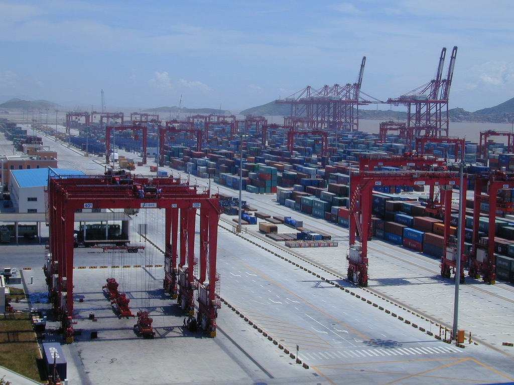
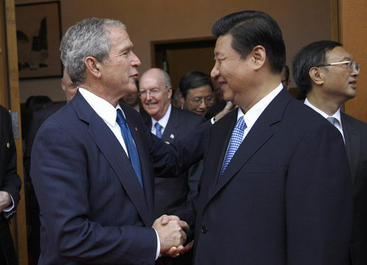
The Trans-Himalayan Multi-dimensional Connectivity Network (abbreviated as THMCN and sometimes referred to as the Trans-Himalayan network) is an economic corridor between Nepal and China and part of China's Belt and Road Initiative, a global development initiative that develops connectivity especially across Eurasia. During a state visit to Nepal in 2019, the corridor was hailed by Chinese President and General Secretary of the Communist Party Xi Jinping as changing Nepal "from a landlocked to a land-linked country." Infrastructure The corridor consists of several transportation infrastructure projects. The flagship infrastructure project is the China–Nepal railway, which currently at the stage of feasibility study. A number of highway projects are to be implemented including the construction of a tunnel road and upgrading of the Araniko Highway, which was shutdown after the Gorkha earthquake. The Araniko Highway ends at the border of the village of Kodari and the Chinese border c ... [...More Info...] [...Related Items...] OR: [Wikipedia] [Google] [Baidu] |
Economic Corridor
Economic corridors are integrated networks of infrastructure within a geographical area designed to stimulate economic development. They connect different economic agents in particular geographic area. Corridors may be developed within a country or between countries. Corridors exist in Asia, Africa, and other areas. Economic corridors often feature integrated infrastructure, such as highways, railroads and ports, and may link cities or countries. Corridors may be created to link manufacturing hubs, areas with high supply and demand, and manufacturers of value-added goods. When implemented, economic corridors are often one of a package of different measures including infrastructure development, visa and transport agreements, and standardisation. Consideration of social needs, such as housing, is often considered. The Asian Development Bank coined the term in 1998. In practice the term "Economic Corridors" has most often been used to connote road highways (e.g. East-West Economic ... [...More Info...] [...Related Items...] OR: [Wikipedia] [Google] [Baidu] |
Nepal
Nepal (; ne, नेपाल ), formerly the Federal Democratic Republic of Nepal ( ne, सङ्घीय लोकतान्त्रिक गणतन्त्र नेपाल ), is a landlocked country in South Asia. It is mainly situated in the Himalayas, but also includes parts of the Indo-Gangetic Plain, bordering the Tibet Autonomous Region of China to the north, and India in the south, east, and west, while it is narrowly separated from Bangladesh by the Siliguri Corridor, and from Bhutan by the Indian state of Sikkim. Nepal has a diverse geography, including fertile plains, subalpine forested hills, and eight of the world's ten tallest mountains, including Mount Everest, the highest point on Earth. Nepal is a multi-ethnic, multi-lingual, multi-religious and multi-cultural state, with Nepali as the official language. Kathmandu is the nation's capital and the largest city. The name "Nepal" is first recorded in texts from the Vedic period of the ... [...More Info...] [...Related Items...] OR: [Wikipedia] [Google] [Baidu] |
China
China, officially the People's Republic of China (PRC), is a country in East Asia. It is the world's List of countries and dependencies by population, most populous country, with a Population of China, population exceeding 1.4 billion, slightly ahead of India. China spans the equivalent of five time zones and Borders of China, borders fourteen countries by land, the List of countries and territories by land borders, most of any country in the world, tied with Russia. Covering an area of approximately , it is the world's third List of countries and dependencies by area, largest country by total land area. The country consists of 22 provinces of China, provinces, five autonomous regions of China, autonomous regions, four direct-administered municipalities of China, municipalities, and two special administrative regions of China, Special Administrative Regions (Hong Kong and Macau). The national capital is Beijing, and the List of cities in China by population, most populous cit ... [...More Info...] [...Related Items...] OR: [Wikipedia] [Google] [Baidu] |
Belt And Road Initiative
The Belt and Road Initiative (BRI, or B&R), formerly known as One Belt One Road ( zh, link=no, 一带一路) or OBOR for short, is a global infrastructure development strategy adopted by the Chinese government in 2013 to invest in nearly 150 countries and international organizations. It is considered a centerpiece of the Chinese leader Xi Jinping's foreign policy. The BRI forms a central component of Xi's "Major Country Diplomacy" ( zh, 大国外交) strategy, which calls for China to assume a greater leadership role for global affairs in accordance with its rising power and status. It has been compared to the American Marshall Plan. , 149 countries were listed as having signed up to the BRI. Xi originally announced the strategy as the "Silk Road Economic Belt" during an official visit to Kazakhstan in September 2013. "Belt" is short for the " Silk Road Economic Belt," referring to the proposed overland routes for road and rail transportation through landlocked Centra ... [...More Info...] [...Related Items...] OR: [Wikipedia] [Google] [Baidu] |
Eurasia
Eurasia (, ) is the largest continental area on Earth, comprising all of Europe and Asia. Primarily in the Northern and Eastern Hemispheres, it spans from the British Isles and the Iberian Peninsula in the west to the Japanese archipelago and the Russian Far East to the east. The continental landmass is bordered by the Atlantic Ocean and Africa to the west, the Pacific Ocean to the east, the Arctic Ocean to the north, and by Africa, the Mediterranean Sea, and the Indian Ocean to the south. The division between Europe and Asia as two continents is a historical social construct, as many of their borders are over land; thus, in some parts of the world, Eurasia is recognized as the largest of the six, five, or four continents on Earth. In geology, Eurasia is often considered as a single rigid megablock. However, the rigidity of Eurasia is debated based on paleomagnetic data. Eurasia covers around , or around 36.2% of the Earth's total land area. It is also home to the ... [...More Info...] [...Related Items...] OR: [Wikipedia] [Google] [Baidu] |
Xi Jinping
Xi Jinping ( ; ; ; born 15 June 1953) is a Chinese politician who has served as the general secretary of the Chinese Communist Party (CCP) and chairman of the Central Military Commission (CMC), and thus as the paramount leader of China, since 2012. Xi has also served as the president of the People's Republic of China (PRC) since 2013. The son of Chinese Communist veteran Xi Zhongxun, Xi was exiled to rural Yanchuan County as a teenager following his father's purge during the Cultural Revolution. He lived in a yaodong in the village of Liangjiahe, Shaanxi province, where he joined the CCP after several failed attempts and worked as the local party secretary. After studying chemical engineering at Tsinghua University as a worker-peasant-soldier student, Xi rose through the ranks politically in China's coastal provinces. Xi was governor of Fujian from 1999 to 2002, before becoming governor and party secretary of neighboring Zhejiang from 2002 to 2007. Following dis ... [...More Info...] [...Related Items...] OR: [Wikipedia] [Google] [Baidu] |
China–Nepal Railway
The China–Nepal Railway ( zh, 中尼铁路; ne, चीन-नेपाल रेलवे) is a planned railway between China and Nepal. The railway will link Kathmandu with Shigatse, Tibet, crossing the China–Nepal border at Gyirong–Rasuwa. History As early as 1973, Mao Zedong proposed a connection between the two countries to King Birendra of Nepal in Beijing. In 2006, the Qinghai–Tibet Railway, the first railway in Tibet, was completed. The same year, the then chairman of Tibet Autonomous Region Qiangba Puncog told the current Prime Minister of Nepal Khadga Prasad Oli, then Deputy Prime Minister, that the railway would be extended to Shigatse and eventually to China–Nepal border. In 2016, during Oli's visit to China, the two countries signed a treaty on trade and transit, including a plan to build a high speed railway from Kathmandu to the Chinese border. In June 2018, Nepal and China agreed on construction of the railway as a component of a series of cooperatio ... [...More Info...] [...Related Items...] OR: [Wikipedia] [Google] [Baidu] |
April 2015 Nepal Earthquake
The April 2015 Nepal earthquake (also known as the Gorkha earthquake) killed 8,964 people and injured 21,952 more. It occurred at on Saturday, 25 April 2015, with a magnitude of 7.8 Mw or 8.1 Ms and a maximum Mercalli Intensity of X (''Extreme''). Its epicenter was east of Gorkha District at Barpak, Gorkha, roughly northwest of central Kathmandu, and its hypocenter was at a depth of approximately . It was the worst natural disaster to strike Nepal since the 1934 Nepal–Bihar earthquake. The ground motion recorded in Kathmandu, capital of Nepal, was of low frequency, which, along with its occurrence at an hour where many people in rural areas were working outdoors, decreased the loss of property and human lives. The earthquake triggered an avalanche on Mount Everest, killing 22, the deadliest incident on the mountain on record. The earthquake triggered another huge avalanche in the Langtang valley, where 250 people were reported missing. Hundreds of thousands of Nepal ... [...More Info...] [...Related Items...] OR: [Wikipedia] [Google] [Baidu] |
Kodari
Kodari is a small village located at the border with Tibet- China. The village is located at the end–point of the Arniko Highway, which connects Kodari with the capital city of Kathmandu. Kathmandu is away from Kodari. Kodari is a major border crossing from Nepal into the Tibet Autonomous Region. Kodari is a part of Bhotekoshi rural municipality in Sindhupalchok District of Bagmati Province (previously Tatopani VDC of Bagmati Zone of Central Development Region; from 1990–2017). The other side is the town of Zhangmu (also known as Dram or Khasa in Nepali) located in Nyalam County, Shigatse Prefecture of the Tibet. History In ancient times, it was the starting point of a trans-Himalayan caravan route. Newar traders headed north from Kodari and after crossing Kuti pass turned east to continue their journey across the Tibetan Plateau to Lhasa. The construction of the Kathmandu-Kodari Road during the 1963-67 period. It was named Araniko Highway in Nepal and China Nationa ... [...More Info...] [...Related Items...] OR: [Wikipedia] [Google] [Baidu] |
Zhangmu
Zhangmu (also from Tibetan as Dram or Zham, from Nepali as Khasa) is a customs town and port of entry located in Nyalam County on the Nepal- China border, just uphill and across the Bhote Koshi River from the Nepalese town of Kodari. At above sea level, Zhangmu has mild and humid subtropical climate, which is a rarity for Tibet. History In ancient times, Kodari, the Nepalese village on the other side, was the starting point of a trans-Himalayan caravan route. Newar traders headed north from Kodari and after crossing Kuti pass turned east to continue their journey across the Tibetan Plateau to Lhasa. The construction of the Kathmandu-Kodari Road occurred during the 1963–67 period. It was named China National Highway 318 in China and Araniko Highway in Nepal. China has long planned and discussed building a railway connecting Lhasa with Zhangmu on the Nepal-China border, from 2008 onwards. It would be an extension of the Qinghai-Tibet Railway. However, as of late ... [...More Info...] [...Related Items...] OR: [Wikipedia] [Google] [Baidu] |


