|
Tempoku Line
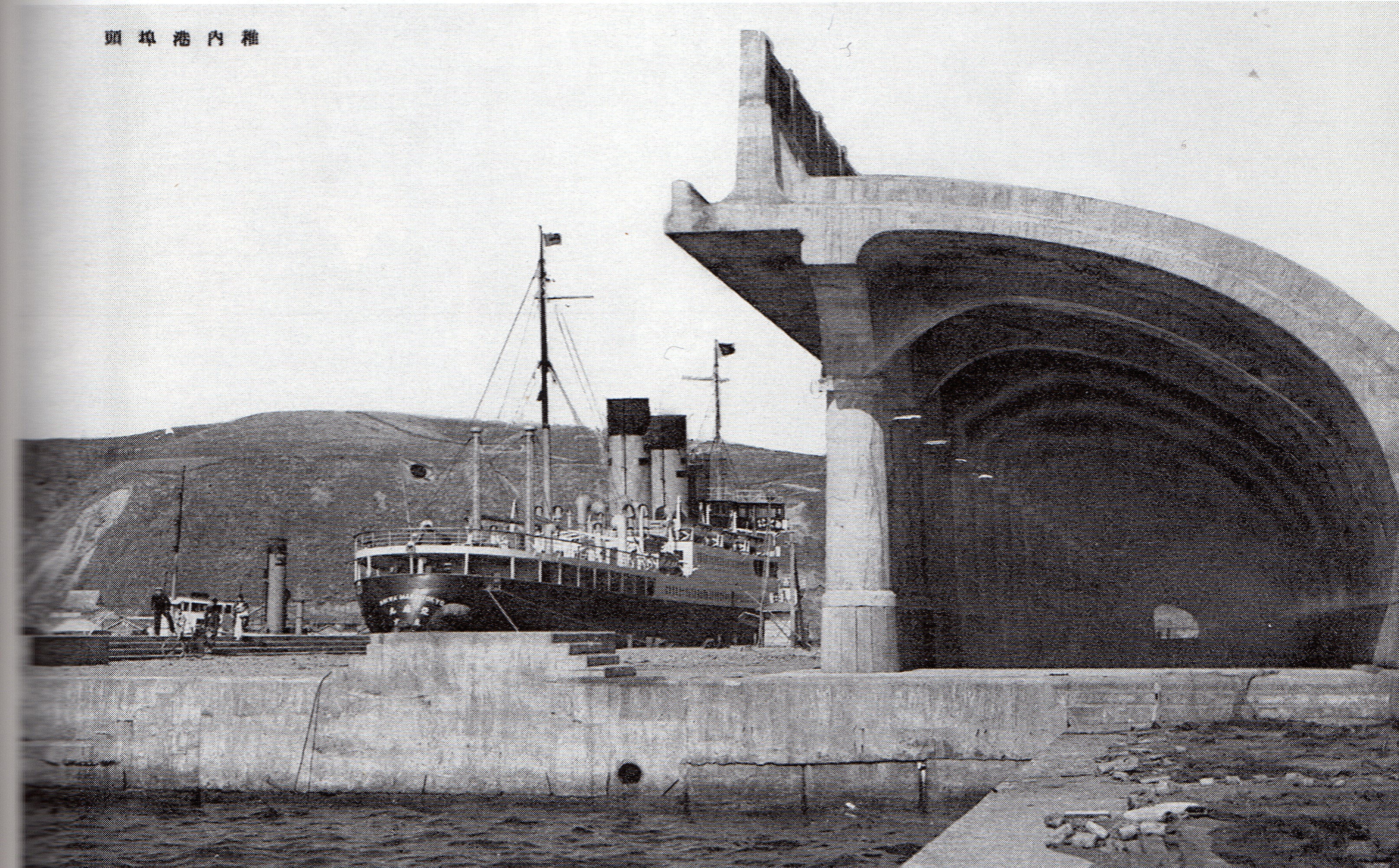
The Tempoku Line (天北線 Tempoku-sen) was a railway line most recently operated by Hokkaido Railway Company (JR Hokkaido) in Hokkaidō, Japan. The 148.9 kilometres line connected from Otoineppu to Minami-Wakkanai via Nakatonbetsu, Hamatonbetsu and Sarufutsu until its closure in 1989. This railway line was named after Teshio Province and Kitami Province. History The first section from Otoineppu to Shō-Tombetsu was opened in 1914. All section was opened in 1922, as the first railway line for Wakkanai. In 1926, Teshio line via Horonobe was opened. From Otoineppu to Wakkanai, the distance of this line was longer than Teshio line. In 1930, Teshio line was integrated into Sōya Main Line, and this line was separated from it and renamed Kitami line.田中和夫(監修) 『写真で見る北海道の鉄道』上巻 国鉄・JR線 北海道新聞社(編集)2002年7月15日 。 In 1961, Kitami line was renamed to Tempoku line. In 1987, JNR was privatized, and this lin ... [...More Info...] [...Related Items...] OR: [Wikipedia] [Google] [Baidu] |
Hokkaido
is Japan, Japan's Japanese archipelago, second largest island and comprises the largest and northernmost Prefectures of Japan, prefecture, making up its own List of regions of Japan, region. The Tsugaru Strait separates Hokkaidō from Honshu; the two islands are connected by the undersea railway Seikan Tunnel. The largest city on Hokkaidō is its capital, Sapporo, which is also its only Cities designated by government ordinance of Japan, ordinance-designated city. Sakhalin lies about 43 kilometers (26 mi) to the north of Hokkaidō, and to the east and northeast are the Kuril Islands, which are administered by Russia, though the four most southerly are Kuril Islands dispute, claimed by Japan. Hokkaidō was formerly known as ''Ezo'', ''Yezo'', ''Yeso'', or ''Yesso''.Louis Frédéric, Nussbaum, Louis-Frédéric. (2005). "Hokkaidō" in Although there were Japanese settlers who ruled the southern tip of the island since the 16th century, Hokkaido was considered foreign territo ... [...More Info...] [...Related Items...] OR: [Wikipedia] [Google] [Baidu] |
Wakkanai, Hokkaido
' meaning "cold water river" is a Cities of Japan, city located in Sōya Subprefecture, Hokkaido, Japan. It is the capital of Sōya Subprefecture. It contains Japan's northernmost point, Cape Sōya, from which the Russian island of Sakhalin can be seen. As of 1 June 1975, the city has an estimated population of 55,465 and a population density of 72.8 persons per km2 (189 persons per mi2). The total area is . Wakkanai is also home to Japan's first nursing home built inside the central train station of its city, a novel approach to caring for Japan's growing elderly population that has since been imitated in several other cities. History Wakkanai was originally home to an Ainu people, Ainu population. The first Japanese settlement was established in 1685. *1879: The village of Wakkanai was founded. *1897: Sōya Subprefecture established. *1901: Wakkanai village became Wakkanai town. *1949: Wakkanai town became Wakkanai city. *1955: Soya village was merged into Wakkanai city. *19 ... [...More Info...] [...Related Items...] OR: [Wikipedia] [Google] [Baidu] |
Tokyu Group
The is a railway keiretsu whose parent company is the Tokyu Corporation railway company, which links Tokyo and its suburbs. Many companies in the group are designed to enhance the value of the Tokyu rail network. In addition to the railroad system, the group includes other companies in transportation, real-estate, retail, leisure, and cultural endeavors. Here is a partial list of companies in the Tokyu Group. Transportation * Tokyu Railways, a major private railway operator in the Greater Tokyo Area * Izukyū Corporation, a railway in Shizuoka Prefecture * Ueda Kotsū (Holding company of Ueda Electric Railway etc.), in Nagano Prefecture * Tokyu Bus * Tokyu Transsés in Shibuya * Tokyu Shachi Bus, a charter bus service in the greater Nagoya metro area * Jōtetsu (in Sapporo, Hokkaido) * Sōya Bus (in Wakkanai, Hokkaido) * Hokkaido Kitami Bus (in Kitami, Hokkaido) * Abashiri Kōtsū (in Abashiri District, Hokkaido) * Shari Bus (in Shari, Shari District) Real estate * Tokyu L ... [...More Info...] [...Related Items...] OR: [Wikipedia] [Google] [Baidu] |
Soya Bus
The is a Japanese bus company. It was established on 1 July 1952 to inherit part of the business of the Dohoku Bus. History The SOYA bus operates around the northernmost part of Japan. The bus company belonged to Tokyu Group from 1959 until 2009. Chronicle *July 1952: Commenced operations *August 1954: Established Omu Office *1956: Head office moved from Esashi, Hokkaido (Sōya) to Wakkanai, Hokkaido *December 1959: Affiliated to Tokyu Corporation *1971: Discontinued Omu Office *July 1985: Kohinhoku Line was discontinued *May 1989: Tempoku Line was discontinued *October 2010: Tokyu Corporation and Jōtetsu relinquished their shares, and transferred to Jay Will Partners. Company broke away from Tokyu Corporation Local bus services Offices * Wakkanai Office * Rishiri Office (Rishiri Island) * Rebun Office (Rebun Island) * Esashi Office * Sapporo Office Wickets * Wakkanai Bus Terminal * Wakkanai Ferry Terminal * Onishibetsu Bus Terminal * Hamatonbetsu Bus Terminal * Otoine ... [...More Info...] [...Related Items...] OR: [Wikipedia] [Google] [Baidu] |
Wakkanai, Hokkaidō
' meaning "cold water river" is a city located in Sōya Subprefecture, Hokkaido, Japan. It is the capital of Sōya Subprefecture. It contains Japan's northernmost point, Cape Sōya, from which the Russian island of Sakhalin can be seen. As of 1 June 1975, the city has an estimated population of 55,465 and a population density of 72.8 persons per km2 (189 persons per mi2). The total area is . Wakkanai is also home to Japan's first nursing home built inside the central train station of its city, a novel approach to caring for Japan's growing elderly population that has since been imitated in several other cities. History Wakkanai was originally home to an Ainu population. The first Japanese settlement was established in 1685. *1879: The village of Wakkanai was founded. *1897: Sōya Subprefecture established. *1901: Wakkanai village became Wakkanai town. *1949: Wakkanai town became Wakkanai city. *1955: Soya village was merged into Wakkanai city. *1959: Wakkanai Airport open ... [...More Info...] [...Related Items...] OR: [Wikipedia] [Google] [Baidu] |
Otoineppu, Hokkaido
is a village located in Kamikawa Subprefecture, Hokkaido, Japan. As of 2022, the village had an estimated population of 667 among 453 households. The total area of Otoineppu is . Otoineppu designates itself as the "smallest village in Hokkaido". Etymology In Ainu language, Otoineppu means "muddy river mouth". The name is probably a reference to muddy appearance of the water at the confluence of the Teshio River and one of its many tributaries, the Otoineppu River. Geography Otoineppu is a landlocked village at the north of Hokkaido. The village sits at the northern tip of the Nayoro Basin, and is flanked by the Kitami Mountains to the east and the Teshio Mountains to the west. The town covers , measures from east to west and from north to south. The village sits at an elevation of . 80% of the village is covered by forest. The Teshio River (), the fourth longest river in Japan, flows north through Otoineppu before turning sharply west near the village center. The JR ... [...More Info...] [...Related Items...] OR: [Wikipedia] [Google] [Baidu] |
Sōya Main Line
The is a Japanese railway line operated by Hokkaido Railway Company (JR Hokkaido) in Hokkaido. The line connects Asahikawa Station in Asahikawa and Wakkanai Station in Wakkanai, and is the northernmost railway line in Japan. The name comes from Sōya Subprefecture. On 19 November 2016, JR Hokkaido's President announced plans to rationalise the network by up to 1,237 km, or ~50% of the current network, including proposed conversion of the Nayoro - Wakkanai section of the Soya Line to Third Sector operation, but if local governments are not agreeable, the section will face closure. Services One '' Sōya'' limited express service operates each way between and daily, and two '' Sarobetsu'' limited express services also operate each way between Asahikawa and Wakkanai daily. All-stations "Local" train services operate between and , at approximately 1 to 2 hour intervals. All-stations "Local" train services operate between Nayoro and Wakkanai, at approximately 3 to 4 hour ... [...More Info...] [...Related Items...] OR: [Wikipedia] [Google] [Baidu] |
Kitami Province
was a short-lived province located in Hokkaidō. It corresponded to modern-day Sōya Subprefecture and Abashiri Subprefecture minus part of Abashiri District. History After 1869, the northern Japanese island was known as Hokkaido; and regional administrative subdivisions were identified, including Kitami Province. Satow, Ernest. (1882). "The Geography of Japan" in *August 15, 1869 Kitami Province established with 8 districts *1872 Census finds a population of 1,511 * July 1881 Abashiri District (網尻郡) incorporated for Abashiri District (網走郡) from Kushiro Province *1882 Provinces dissolved in Hokkaidō Districts * Sōya (宗谷郡) * Rishiri (利尻郡) * Rebun (礼文郡) * Esashi (枝幸郡) * Monbetsu (紋別郡) *Tokoro (常呂郡) *Abashiri (網走郡) * Shari (斜里郡) Notes References * Nussbaum, Louis-Frédéric and Käthe Roth. (2005) ''Japan encyclopedia.''Cambridge: Harvard University Press Harvard University Press (HUP) is a publishing house ... [...More Info...] [...Related Items...] OR: [Wikipedia] [Google] [Baidu] |
Hokkaido Railway Company
The is one of the constituent companies of the Japan Railways Group (JR Group), and is often referred to using its official abbreviation of . It operates intercity and local rail services in Hokkaido, Japan. The company introduced Kitaca, a smart card ticketing system, in autumn 2008. At the time of its privatization in 1987, JR Hokkaido operated 21 railway lines totalling of narrow-gauge () track, as well as a ferry service to Aomori. Since then, that figure has dwindled to just below , as unprofitable lines have been shut down or spun off (in the case of the Hokkaidō Chihoku Kōgen Railway). The ferry service has also been replaced by the Seikan Tunnel. On 19 November 2016, JR Hokkaido's president announced plans to further rationalize its network by the withdrawal of services from up to 1,237 km, or about 50% of the current network, including closure of the remaining section of the Rumoi Main Line (the Rumoi - Mashike section closed on 4 December 2016), the Shin-Yu ... [...More Info...] [...Related Items...] OR: [Wikipedia] [Google] [Baidu] |
Teshio Province
was a short-lived province located in Hokkaidō, corresponding to all of modern-day Rumoi Subprefecture and the northern half of Kamikawa Subprefecture. History After 1869, the northern Japanese island was known as Hokkaido; and regional administrative subdivisions were identified, including Teshio Province. Satow, Ernest. (1882). "The Geography of Japan" in *August 15, 1869 Teshio Province established with 6 districts *1872 Census finds a population of 1,576 *1882 Provinces dissolved in Hokkaidō Districts * Mashike (増毛郡) * Rumoi (留萌郡) *Tomamae (苫前郡) * Teshio (天塩郡) * Nakagawa (中川郡) * Kamikawa (上川郡) Notes References * Nussbaum, Louis-Frédéric and Käthe Roth. (2005) ''Japan encyclopedia.''Cambridge: Harvard University Press Harvard University Press (HUP) is a publishing house established on January 13, 1913, as a division of Harvard University, and focused on academic publishing. It is a member of the Association of American Univ ... [...More Info...] [...Related Items...] OR: [Wikipedia] [Google] [Baidu] |
Sarufutsu, Hokkaido
is a village located in Sōya Subprefecture, Hokkaido, Japan. As of September 2014, the village has an estimated population of 2,884 and a density of 4.91 persons per km². The total area is 590.00 km². Geography Sarufutsu is the northernmost village in Japan and is the largest village in Hokkaido in area. Located on the Tonbetsu Plain, it faces the Sea of Okhotsk to the east where, during the winter, there is drift ice. 80% of the village's total area is covered by forests. * Mountains: Mount Horoshiri * Rivers: Sarufutsu River * Lakes: Poro Swamp, Kamuito Swamp, Mokeuni Swamp Settlements/Localities in Sarufutsu *Ashino (芦野) *Asajino (浅茅野) *Chiraibetsu (知来別) *Hamaonishibetsu (浜鬼志別) *Hamasarufutsu (浜猿払) *Onishibetsu (鬼志別)(Town Hall is located here) *Koishi (小石) Neighbouring municipalities * Hokkaido ** Wakkanai ** Toyotomi ** Hamatonbestu ** Horonobe Climate Economy Sarufutsu is famous for its large and particularly excellent ... [...More Info...] [...Related Items...] OR: [Wikipedia] [Google] [Baidu] |


