|
Superior Hiking Trail
The Superior Hiking Trail, also known as the SHT, is a long hiking trail in northeastern Minnesota that follows the rocky ridges overlooking Lake Superior for most of its length. The trail travels through forests of birch, aspen, pine, fir, and cedar. Hikers enjoy views of boreal forests, the Sawtooth Mountains, babbling brooks, rushing waterfalls, and abundant wildlife. The lowest point in the path is above sea level and the highest point is above sea level. The footpath is intended for hiking only. Motorized vehicles, mountain bikes, and horses are not allowed on the trail. Many people use the trail for long-distance hiking, and facilitating this purpose are 94 backcountry, fee-free campsites. History Construction of the Superior Hiking Trail began in the mid-1980s, and the trail now extends from the Minnesota-Wisconsin border southwest of Duluth to the Canada–US border. In addition there are of spur trails that connect trailheads to the main trail. Inspiration for buil ... [...More Info...] [...Related Items...] OR: [Wikipedia] [Google] [Baidu] |
Finland, Minnesota
Finland is an unincorporated community and census-designated place (CDP) in Crystal Bay and Beaver Bay townships, Lake County, Minnesota, United States. As of the 2020 census, its population was 195. Geography The community of Finland is located inland from Lake Superior's North Shore and northeast of the city of Two Harbors. State Highway 1, County Road 6, and County Road 7 are three of the main routes in the community. State Highway 1 continues northwest from Finland to Ely. According to the United States Census Bureau, the Finland CDP has a total area of , of which , or 0.41%, are water. The Baptism River flows through the community. George H. Crosby Manitou State Park is located northeast of Finland. The community is located within the Finland State Forest in Lake County. Demographics History A post office called Finland has been in operation since 1915, and a cooperative general store was established in 1913, which is Minnesota's longest continuously operated ... [...More Info...] [...Related Items...] OR: [Wikipedia] [Google] [Baidu] |
Appalachian Trail
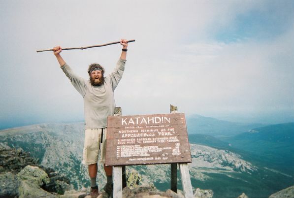
The Appalachian Trail (also called the A.T.), is a hiking trail in the Eastern United States, extending almost between Springer Mountain in Georgia and Mount Katahdin in Maine, and passing through 14 states.Gailey, Chris (2006)"Appalachian Trail FAQs" Outdoors.org (accessed September 14, 2006) The Appalachian Trail Conservancy claims the Appalachian Trail to be the longest hiking-only trail in the world. More than three million people hike segments of the trail each year. The trail was first proposed in 1921 and completed in 1937 after more than a decade of work. Improvements and changes have continued since then. It became the Appalachian National Scenic Trail under the National Trails System Act of 1968. The trail is maintained by 31 trail clubs and multiple partnerships, and managed by the National Park Service, United States Forest Service, and the nonprofit Appalachian Trail Conservancy. Most of the trail is in forest or wild lands, although some portions traverse towns, ... [...More Info...] [...Related Items...] OR: [Wikipedia] [Google] [Baidu] |
Gooseberry Falls State Park
Gooseberry Falls State Park is a state park of Minnesota, United States, on the North Shore (Lake Superior), North Shore of Lake Superior. The park is located in Silver Creek Township, Lake County, Minnesota, Silver Creek Township, about 13 miles (21 km) northeast of Two Harbors, Minnesota in Lake County, Minnesota, Lake County on scenic Minnesota State Highway 61, Minnesota Highway 61. The park surrounds the mouth of the Gooseberry River and includes Upper, Middle and Lower Gooseberry Falls. History and facilities The Minnesota Legislature authorized preservation of the area around Gooseberry Falls in 1933, and the area was officially designated Gooseberry Falls State Park in 1937. The National Park Service rustic, rustic style resources in Gooseberry Falls State Park were constructed by the Civilian Conservation Corps between 1934 and 1941. The structures are notable for their stone construction, using red, blue, brown, and black basalt. The designs were supervised ... [...More Info...] [...Related Items...] OR: [Wikipedia] [Google] [Baidu] |
Canal Park (Duluth)
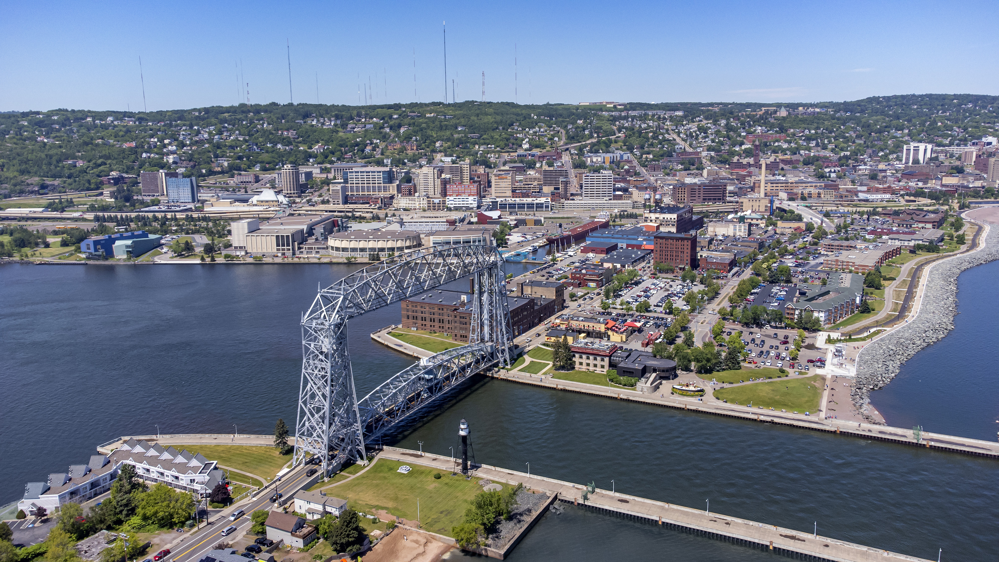
Canal Park is a tourist and recreation-oriented district of Duluth, Minnesota, United States. Situated across the Interstate 35 freeway from Downtown Duluth, it is connected by the Aerial Lift Bridge across the Duluth Ship Canal to the Park Point sandbar and neighborhood. Canal Park Drive and Lake Avenue South serve as the main routes in Canal Park. History Canal Park is largely a conversion of an old warehouse district into restaurants, shops (especially those dealing in antiques and other novelties), cafés, and hotels. This conversion began in the 1980s as an attempt to use Duluth's rich industrial past, the decline of which had left the city in economic turmoil at the time, as an asset in a prospective tourist industry. Attractions Many annual events are held in the Canal Park area, such as the Bayfront Blues Festival and Grandma's Marathon, which starts in Two Harbors, Minnesota, and finishes in Canal Park. Some of Canal Park's attractions include a 4.2 mile long lake wal ... [...More Info...] [...Related Items...] OR: [Wikipedia] [Google] [Baidu] |
Enger Tower
Enger Tower is an , five-story stone observation tower atop Enger Hill in Duluth, Minnesota.''Enger Tower, Duluth'' entry at Emporis. Retrieved on February 7, 2008. Description  Enger Tower stands above , providing panoramic views of the . The landmark is near
 [...More Info...] [...Related Items...] OR: [Wikipedia] [Google] [Baidu] |
Vermont
Vermont () is a state in the northeast New England region of the United States. Vermont is bordered by the states of Massachusetts to the south, New Hampshire to the east, and New York to the west, and the Canadian province of Quebec to the north. Admitted to the union in 1791 as the 14th state, it is the only state in New England not bordered by the Atlantic Ocean. According to the 2020 U.S. census, the state has a population of 643,503, ranking it the second least-populated in the U.S. after Wyoming. It is also the nation's sixth-smallest state in area. The state's capital Montpelier is the least-populous state capital in the U.S., while its most-populous city, Burlington, is the least-populous to be a state's largest. For some 12,000 years, indigenous peoples have inhabited this area. The competitive tribes of the Algonquian-speaking Abenaki and Iroquoian-speaking Mohawk were active in the area at the time of European encounter. During the 17th century, Fr ... [...More Info...] [...Related Items...] OR: [Wikipedia] [Google] [Baidu] |
North Dakota
North Dakota () is a U.S. state in the Upper Midwest, named after the Native Americans in the United States, indigenous Dakota people, Dakota Sioux. North Dakota is bordered by the Canadian provinces of Saskatchewan and Manitoba to the north and by the U.S. states of Minnesota to the east, South Dakota to the south, and Montana to the west. It is believed to host the geographic center of North America, Rugby, North Dakota, Rugby, and is home to the tallest man-made structure in the Western Hemisphere, the KVLY-TV mast. North Dakota is the List of U.S. states and territories by area, 19th largest state, but with a population of less than 780,000 2020 United States census, as of 2020, it is the List of U.S. states and territories by population, 4th least populous and List of U.S. states by population density, 4th most sparsely populated. The capital is Bismarck, North Dakota, Bismarck while the largest city is Fargo, North Dakota, Fargo, which accounts for nearly a fifth of the s ... [...More Info...] [...Related Items...] OR: [Wikipedia] [Google] [Baidu] |
National Trails System
The National Trails System is a series of trails in the United States designated "to promote the preservation of, public access to, travel within, and enjoyment and appreciation of the open-air, outdoor areas and historic resources of the Nation". There are four types of trails: the national scenic trails, national historic trails, national recreation trails, and connecting or side trails. The national trails provide opportunities for hiking and historic education, as well as horseback riding, biking, camping, scenic driving, water sports, and other activities. The National Trails System consists of 11 national scenic trails, 19 national historic trails, over 1,300 national recreation trails, and seven connecting and side trails, as well as one national geologic trail, with a total length of more than . The scenic and historic trails are in every state, and Virginia and Wyoming have the most running through them, with six. In response to a call by President Lyndon B. Johnson ... [...More Info...] [...Related Items...] OR: [Wikipedia] [Google] [Baidu] |
North Country Trail
The North Country National Scenic Trail, generally known as the North Country Trail or simply the NCT, is a footpath stretching over from Middlebury in central Vermont to Lake Sakakawea State Park in central North Dakota in the United States; connecting both the Long Trail and the Appalachian Trail with the Lewis and Clark Trail. Passing through the eight states of Vermont, New York, Pennsylvania, Ohio, Michigan, Wisconsin, Minnesota and North Dakota, it is the longest of the eleven National Scenic Trails authorized by Congress. As of early 2019, 3,129 miles (5,036 km) of the trail is in place. The NCT is administered by the National Park Service, managed by federal, state, and local agencies, and built and maintained primarily by the volunteers of the North Country Trail Association (NCTA) and its partners. The 28 chapters of the NCTA, its 3,200+ members and each affiliate organization have assumed responsibility for trail construction and maintenance of a specific secti ... [...More Info...] [...Related Items...] OR: [Wikipedia] [Google] [Baidu] |
Thru-hike
Thru-hiking, or through-hiking, is the act of hiking an established end-to-end trail or long-distance trail with continuous footsteps. In the United States, the term is most commonly associated with the Appalachian Trail (AT), the Pacific Crest Trail (PCT), and the Continental Divide Trail (CDT), but may also refer to other end-to-end hikes. Other examples of thru-hikes include Te Araroa in New Zealand, the Camino de Santiago in Spain and France, the HexaTrek in France, the Via Francigena in France and Italy, the Va Sentiero in Italy, the Lycian Way in Turkey, the Israel National Trail, and the Great Divide Trail (GDT) in Canada. The Appalachian Trail Conservancy (ATC) defines a thru-hike as a hike of the entire AT in 12 months or less. A “2,000-miler” is a hiker who has walked the entire length of the AT and reported his or her hike completion to the ATC, which has kept records of thru-hike completions since 1937. (The ATC uses the term “2,000-miler” since the exact len ... [...More Info...] [...Related Items...] OR: [Wikipedia] [Google] [Baidu] |
Ultramarathon
An ultramarathon, also called ultra distance or ultra running, is any footrace longer than the traditional marathon length of . Various distances are raced competitively, from the shortest common ultramarathon of to over . 50k and 100k are both World Athletics record distances, but some races are among the oldest and most prestigious events, especially in North America. Around 100 miles is typically the longest course distance raced in under 24 hours but there are also longer multi-day races of or more, sometimes raced in stages with breaks for sleep. While some ultras are road races, many take place on trails, leading to a large overlap with the sports of trail running and mountain running. Overview There are two main types of ultramarathon events: those that cover a specified distance or route, and those that last for a predetermined period of time (with the winner covering the most distance in that time). The most common distances are , , , and , although many races have ... [...More Info...] [...Related Items...] OR: [Wikipedia] [Google] [Baidu] |


