|
Spirit River (Wisconsin)
The Spirit River is a tributary of the Wisconsin River with headwaters in Price County and a confluence with the Wisconsin in Lincoln County just downstream from Lake Mohawksin. The source is Spirit Lake near Timms Hill. The Ojibwe name for the river was ''Manatokikewe Sebe'' (Stooping Spirit River). The river flows nearly west to east. About one mile from its mouth, the Wisconsin Valley Improvement Company maintains a dam which forms the Spirit River Flowage. See also *List of rivers in Wisconsin This is a list of rivers in the U.S. state of Wisconsin. By drainage basin This list is arranged by drainage basin, with respective tributaries indented under each larger stream's name. Great Lakes Drainage Lake Michigan *Menominee River ... Notes External links * File:SpiritFalls-1992-07.JPG , Spirit Falls (viewed upstream). File:SpiritFlowage-1987-11.JPG , The Spirit River Flowage. File:SpiritRiver-Canoeing-1994-B.JPG , Spring time on the Spirit River. ... [...More Info...] [...Related Items...] OR: [Wikipedia] [Google] [Baidu] |
New Year's Day
New Year's Day is a festival observed in most of the world on 1 January, the first day of the year in the modern Gregorian calendar. 1 January is also New Year's Day on the Julian calendar, but this is not the same day as the Gregorian one. Whilst most solar calendars (like the Gregorian and Julian) begin the year regularly at or near the northern winter solstice, cultures that observe a lunisolar or lunar calendar celebrate their New Year (such as the Chinese New Year and the Islamic New Year) at less fixed points relative to the solar year. In pre-Christian Rome under the Julian calendar, the day was dedicated to Janus, god of gateways and beginnings, for whom January is also named. From Roman times until the middle of the 18th century, the new year was celebrated at various stages and in various parts of Christian Europe on 25 December, on 1 March, on 25 March and on the movable feast of Easter. In the present day, with most countries now using the Gregorian calendar ... [...More Info...] [...Related Items...] OR: [Wikipedia] [Google] [Baidu] |
United States
The United States of America (U.S.A. or USA), commonly known as the United States (U.S. or US) or America, is a country primarily located in North America. It consists of 50 states, a federal district, five major unincorporated territories, nine Minor Outlying Islands, and 326 Indian reservations. The United States is also in free association with three Pacific Island sovereign states: the Federated States of Micronesia, the Marshall Islands, and the Republic of Palau. It is the world's third-largest country by both land and total area. It shares land borders with Canada to its north and with Mexico to its south and has maritime borders with the Bahamas, Cuba, Russia, and other nations. With a population of over 333 million, it is the most populous country in the Americas and the third most populous in the world. The national capital of the United States is Washington, D.C. and its most populous city and principal financial center is New York City. Paleo-Americ ... [...More Info...] [...Related Items...] OR: [Wikipedia] [Google] [Baidu] |
Wisconsin
Wisconsin () is a state in the upper Midwestern United States. Wisconsin is the 25th-largest state by total area and the 20th-most populous. It is bordered by Minnesota to the west, Iowa to the southwest, Illinois to the south, Lake Michigan to the east, Michigan to the northeast, and Lake Superior to the north. The bulk of Wisconsin's population live in areas situated along the shores of Lake Michigan. The largest city, Milwaukee, anchors its largest metropolitan area, followed by Green Bay and Kenosha, the third- and fourth-most-populated Wisconsin cities respectively. The state capital, Madison, is currently the second-most-populated and fastest-growing city in the state. Wisconsin is divided into 72 counties and as of the 2020 census had a population of nearly 5.9 million. Wisconsin's geography is diverse, having been greatly impacted by glaciers during the Ice Age with the exception of the Driftless Area. The Northern Highland and Western Upland along wi ... [...More Info...] [...Related Items...] OR: [Wikipedia] [Google] [Baidu] |
Price County, Wisconsin
Price County is a county in the U.S. state of Wisconsin. As of the 2020 census, the population was 14,054. Its county seat is Phillips. History Price County was created on March 3, 1879, when Wisconsin Governor William E. Smith signed legislation creating the county. The county was later organized in 1882. William T. Price (1824–1886), for whom Price County was named, was President of the Wisconsin Senate and an early logger in Price County; he later was elected to the U.S. Congress. The county was formed from portions of Chippewa and Lincoln counties. The first white settler in what is now Price County was Major Isaac Stone, who located on the Spirit River in 1860 to engage in lumbering. Price County continues today to be a large producer of raw timber. Geography According to the U.S. Census Bureau, the county has a total area of , of which is land and (1.9%) is water. The highest natural point in Wisconsin, Timms Hill at 1,951 feet (595 m), is located in Price Coun ... [...More Info...] [...Related Items...] OR: [Wikipedia] [Google] [Baidu] |
Lincoln County, Wisconsin
Lincoln County is a county located in the U.S. state of Wisconsin. As of the 2020 census, the population was 28,415. Its county seat is Merrill. The county was created in 1875 and named after President Abraham Lincoln. Lincoln County comprises the Merrill, WI Micropolitan Statistical Area, which is also included in the Wausau-Stevens Point-Wisconsin Rapids, WI Combined Statistical Area. Geography According to the U.S. Census Bureau, the county has a total area of , of which is land and (3.1%) is water. Adjacent counties * Oneida County - north * Langlade County - east * Marathon County - south * Taylor County - west * Price County - northwest Major highways * U.S. Highway 8 * U.S. Highway 51 * Highway 17 (Wisconsin) * Highway 64 (Wisconsin) * Highway 86 (Wisconsin) * Highway 107 (Wisconsin) Railroads *Tomahawk Railway *Watco Buses *List of intercity bus stops in Wisconsin Airports * KRRL - Merrill Municipal Airport * KTKV - Tomahawk Regional Airport Dem ... [...More Info...] [...Related Items...] OR: [Wikipedia] [Google] [Baidu] |
Spirit Lake (Price County, Wisconsin)
Spirit Lake is a lake in Price County, Wisconsin and Taylor County, Wisconsin that is the source of the Spirit River. It is contiguous and at the same elevation as North Spirit Lake, connected by a narrow channel. The lake features a number of species of recreational fish including muskellunge, panfish, largemouth bass, northern pike and walleye. In 1982 the non-profit Spirit Lakes Improvement Association was established for the purpose of improving the general quality of Spirit Lake and North Spirit Lake. References External links * * Lakes of Wisconsin Bodies of water of Price County, Wisconsin Bodies of water of Taylor County, Wisconsin {{TaylorCountyWI-geo-stub ... [...More Info...] [...Related Items...] OR: [Wikipedia] [Google] [Baidu] |
Wisconsin River
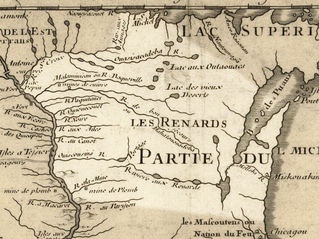
The Wisconsin River is a tributary of the Mississippi River in the U.S. state of Wisconsin. At approximately 430 miles (692 km) long, it is the state's longest river. The river's name, first recorded in 1673 by Jacques Marquette as "Meskousing", is rooted in the Algonquian languages used by the area's American Indian tribes, but its original meaning is obscure. French explorers who followed in the wake of Marquette later modified the name to "Ouisconsin", and so it appears on Guillaume de L'Isle's map (Paris, 1718). This was simplified to "Wisconsin" in the early 19th century before being applied to Wisconsin Territory and finally the state of Wisconsin. The Wisconsin River originates in the forests of the North Woods Lake District of northern Wisconsin, in Lac Vieux Desert near the border of the Upper Peninsula of Michigan. It flows south across the glacial plain of central Wisconsin, passing through Wausau, Stevens Point, and Wisconsin Rapids. In southern Wisconsin it en ... [...More Info...] [...Related Items...] OR: [Wikipedia] [Google] [Baidu] |
Bradley, Wisconsin
Bradley is a town in Lincoln County, Wisconsin, United States. The population was 2,408 at the 2010 census, down from 2,573 at the 2000 census. The unincorporated communities of Bradley, Gilbert, Heafford Junction, and West Kraft are located in the town. Geography Bradley occupies northern Lincoln County and is bordered to the north by Oneida County. It surrounds the city of Tomahawk, a separate municipality. The U.S. Route 51 freeway runs along the eastern side of the town, leading south to Merrill, the Lincoln county seat, and north to Hurley. According to the United States Census Bureau, the town has a total area of , of which are land and , or 13.30%, are water. The Wisconsin River flows through the town and the center of Tomahawk, where it is joined by the Tomahawk, Somo, and Spirit rivers. The river system is impounded by the Tomahawk Dam in Bradley just south of the Tomahawk city limits, forming Lake Mohawksin, and by a separate dam forming the Spirit River Flowage. ... [...More Info...] [...Related Items...] OR: [Wikipedia] [Google] [Baidu] |
Lake Mohawksin
Lake Mohawksin is the name of the reservoir on the Wisconsin River formed by the Tomahawk Dam. The dam is located about one mile south of the city limits of Tomahawk, Wisconsin Tomahawk is a city in Lincoln County, Wisconsin, United States. The population was 3,346 at the 2010 census. The city is located to the northeast of the Town of Tomahawk and is not contiguous with it. History Before 1837, the land where Tomah .... Lake Mohawksin was originally called Lake Tomahawk, but the name was changed to avoid confusion with the town of Lake Tomahawk as well as the lake near that town (which is actually called Tomahawk Lake). The name Mohawksin is derived from a concatenation of the last syllables of the three rivers which flow into it – the Somo, the Tomahawk and the Wisconsin. The name came via a contest won by Herbert Atcherson in 1926. The lake has an area of 1515 acres, and a maximum depth of 25 feet. There are 6 public boat landings, and the lake features northe ... [...More Info...] [...Related Items...] OR: [Wikipedia] [Google] [Baidu] |
Timms Hill
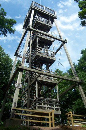
Timms Hill or Timm's Hill is the highest natural point in the U.S. state of Wisconsin and is located in north-central Wisconsin in Timms Hill County Park in the Town of Hill in Price County. After being surveyed by Quentin Stevens of Ogema Telephone Co in 1962, Timms Hill was discovered to have an elevation of . It is less than south of Highway 86, about midway between Ogema and Spirit and about west of Tomahawk. Description Timms Hill is located in Timms Hill County Park. A public lookout tower is atop the hill. Visible to the southeast is Rib Mountain (elev. 1,924 ft, 586 m), 44 miles away by line of sight. The Timms Hill Trail connects to the Ice Age Trail, a National Scenic Trail The National Trails System is a series of trails in the United States designated "to promote the preservation of, public access to, travel within, and enjoyment and appreciation of the open-air, outdoor areas and historic resources of the Nati ... stretching across glacial terrain in W ... [...More Info...] [...Related Items...] OR: [Wikipedia] [Google] [Baidu] |
Ojibwe
The Ojibwe, Ojibwa, Chippewa, or Saulteaux are an Anishinaabe people in what is currently southern Canada, the northern Midwestern United States, and Northern Plains. According to the U.S. census, in the United States Ojibwe people are one of the largest tribal populations among Native American peoples. In Canada, they are the second-largest First Nations population, surpassed only by the Cree. They are one of the most numerous Indigenous Peoples north of the Rio Grande. The Ojibwe population is approximately 320,000 people, with 170,742 living in the United States , and approximately 160,000 living in Canada. In the United States, there are 77,940 mainline Ojibwe; 76,760 Saulteaux; and 8,770 Mississauga, organized in 125 bands. In Canada, they live from western Quebec to eastern British Columbia. The Ojibwe language is Anishinaabemowin, a branch of the Algonquian language family. They are part of the Council of Three Fires (which also include the Odawa and Potawatomi) and ... [...More Info...] [...Related Items...] OR: [Wikipedia] [Google] [Baidu] |
Wisconsin Valley Improvement Company
The Wisconsin Valley Improvement Company is a private company chartered by Section 182.70 of the Wisconsin Statutes. The company is responsible for organizing the flow from most of the upper Wisconsin River tributaries, and this flow affects the economy and ecosystem of the entire river. Its member companies are the owners and operators of dams along the Wisconsin River, such as paper manufacturers and utility companies with hydroelectric facilities on that river. The company is located in Wausau, Wisconsin. They include: *NewPage * Domtar *Packaging Corporation of America *Wisconsin River Power Company * Alliant Energy *Wausau Paper *Expera Specialty Solutions * Wisconsin Public Service Corporation According to its charter, the company is to maintain nearly a uniform flow of water as practicable in the Wisconsin and Tomahawk rivers by storing in reservoirs surplus water for discharge when the water supply is low to improve the usefulness of the rivers for all public purposes and ... [...More Info...] [...Related Items...] OR: [Wikipedia] [Google] [Baidu] |


