|
Lake Mohawksin
Lake Mohawksin is the name of the reservoir on the Wisconsin River formed by the Tomahawk Dam. The dam is located about one mile south of the city limits of Tomahawk, Wisconsin. Lake Mohawksin was originally called Lake Tomahawk, but the name was changed to avoid confusion with the town of Lake Tomahawk as well as the lake near that town (which is actually called Tomahawk Lake). The name Mohawksin is derived from a concatenation of the last syllables of the three rivers which flow into it – the Somo, the Tomahawk and the Wisconsin. The name came via a contest won by Herbert Atcherson in 1926. The lake has an area of 1515 acres, and a maximum depth of 25 feet. There are 6 public boat landings, and the lake features northern pike, walleyed pike and muskellunge fishing. The dam is owned by the Wisconsin Public Service Corporation. File:TomahawkDam-MainDam.jpg, The main part of the Tomahawk Dam, which creates Lake Mohawksin, viewed from down stream. File:TomahawkDam-WingD ... [...More Info...] [...Related Items...] OR: [Wikipedia] [Google] [Baidu] |
Lincoln County, Wisconsin
Lincoln County is a county located in the U.S. state of Wisconsin. As of the 2020 census, the population was 28,415. Its county seat is Merrill. The county was created in 1875 and named after President Abraham Lincoln. Lincoln County comprises the Merrill, WI Micropolitan Statistical Area, which is also included in the Wausau-Stevens Point-Wisconsin Rapids, WI Combined Statistical Area. Geography According to the U.S. Census Bureau, the county has a total area of , of which is land and (3.1%) is water. Adjacent counties * Oneida County - north * Langlade County - east * Marathon County - south * Taylor County - west * Price County - northwest Major highways * U.S. Highway 8 * U.S. Highway 51 * Highway 17 (Wisconsin) * Highway 64 (Wisconsin) * Highway 86 (Wisconsin) * Highway 107 (Wisconsin) Railroads *Tomahawk Railway *Watco Buses *List of intercity bus stops in Wisconsin Airports * KRRL - Merrill Municipal Airport * KTKV - Tomahawk Regional Airport Dem ... [...More Info...] [...Related Items...] OR: [Wikipedia] [Google] [Baidu] |
Wisconsin
Wisconsin () is a state in the upper Midwestern United States. Wisconsin is the 25th-largest state by total area and the 20th-most populous. It is bordered by Minnesota to the west, Iowa to the southwest, Illinois to the south, Lake Michigan to the east, Michigan to the northeast, and Lake Superior to the north. The bulk of Wisconsin's population live in areas situated along the shores of Lake Michigan. The largest city, Milwaukee, anchors its largest metropolitan area, followed by Green Bay and Kenosha, the third- and fourth-most-populated Wisconsin cities respectively. The state capital, Madison, is currently the second-most-populated and fastest-growing city in the state. Wisconsin is divided into 72 counties and as of the 2020 census had a population of nearly 5.9 million. Wisconsin's geography is diverse, having been greatly impacted by glaciers during the Ice Age with the exception of the Driftless Area. The Northern Highland and Western Upland along wi ... [...More Info...] [...Related Items...] OR: [Wikipedia] [Google] [Baidu] |
United States
The United States of America (U.S.A. or USA), commonly known as the United States (U.S. or US) or America, is a country primarily located in North America. It consists of 50 states, a federal district, five major unincorporated territories, nine Minor Outlying Islands, and 326 Indian reservations. The United States is also in free association with three Pacific Island sovereign states: the Federated States of Micronesia, the Marshall Islands, and the Republic of Palau. It is the world's third-largest country by both land and total area. It shares land borders with Canada to its north and with Mexico to its south and has maritime borders with the Bahamas, Cuba, Russia, and other nations. With a population of over 333 million, it is the most populous country in the Americas and the third most populous in the world. The national capital of the United States is Washington, D.C. and its most populous city and principal financial center is New York City. Paleo-Americ ... [...More Info...] [...Related Items...] OR: [Wikipedia] [Google] [Baidu] |
Wisconsin River
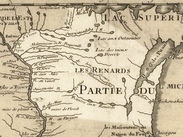
The Wisconsin River is a tributary of the Mississippi River in the U.S. state of Wisconsin. At approximately 430 miles (692 km) long, it is the state's longest river. The river's name, first recorded in 1673 by Jacques Marquette as "Meskousing", is rooted in the Algonquian languages used by the area's American Indian tribes, but its original meaning is obscure. French explorers who followed in the wake of Marquette later modified the name to "Ouisconsin", and so it appears on Guillaume de L'Isle's map (Paris, 1718). This was simplified to "Wisconsin" in the early 19th century before being applied to Wisconsin Territory and finally the state of Wisconsin. The Wisconsin River originates in the forests of the North Woods Lake District of northern Wisconsin, in Lac Vieux Desert near the border of the Upper Peninsula of Michigan. It flows south across the glacial plain of central Wisconsin, passing through Wausau, Stevens Point, and Wisconsin Rapids. In southern Wisconsin it en ... [...More Info...] [...Related Items...] OR: [Wikipedia] [Google] [Baidu] |
Tomahawk, Wisconsin
Tomahawk is a city in Lincoln County, Wisconsin, United States. The population was 3,346 at the 2010 census. The city is located to the northeast of the Town of Tomahawk and is not contiguous with it. History Before 1837, the land where Tomahawk is now situated belonged to the Ojibwe, who traded actively with fur traders such as the American Fur Company and the Northwest Company. After the 1837 cession, the practical situation changed only slightly: the federal survey teams had not arrived yet, logging activity was still light, and Ojibwe continued to actively occupy the general area. There was a village just north of the modern Tomahawk, in the vicinity of modern Bradley, and a village on Skanawan Creek. The 1854 Treaty of La Pointe created the reservations at Lac du Flambeau, Lac Courte Oreilles and Bad River. Even after this treaty, the region was largely public domain land and the treaties allowed the Ojibwe usufructory rights to hunt, fish, gather wild rice and mak ... [...More Info...] [...Related Items...] OR: [Wikipedia] [Google] [Baidu] |
Lake Tomahawk, Wisconsin
Lake Tomahawk is a town in Oneida County, Wisconsin, United States named for the adjacent freshwater lake of the same name. The population was 1,160 at the 2000 census. The census-designated place of Lake Tomahawk and the unincorporated community of Sunflower are located in the town. Geography According to the United States Census Bureau, the town has a total area of 39.2 square miles (101.6 km2), of which, 34.3 square miles (88.9 km2) of it is land and 4.9 square miles (12.7 km2) of it (12.50%) is water. Climate The climate is Humid Continental in the Köppen Climate System, abbreviated as ''Dfb.'' Demographics As of the census of 2000, there were 1,160 people, 475 households, and 317 families residing in the town. The population density was 33.8 people per square mile (13.1/km2). There were 1,052 housing units at an average density of 30.7 per square mile (11.8/km2). The racial makeup of the town was 93.97% White, 4.40% African American, 0.78% ... [...More Info...] [...Related Items...] OR: [Wikipedia] [Google] [Baidu] |
Tomahawk Lake (Wisconsin)
Tomahawk Lake is a lake in Oneida County, Wisconsin, United States. The lake covers an area of and has a maximum depth of . The community of Lake Tomahawk is located on the eastern edge of the lake. Tomahawk Lake was so named from the fact its outline resembles a tomahawk. Tomahawk Lake is the source of the Tomahawk River The Tomahawk River is a river in the U.S. state of Wisconsin. It is the largest tributary of the Wisconsin River in terms of flow. It begins at Tomahawk Lake in southern Vilas County, flows through Oneida County, and terminates at Lake Mohawks .... Historically Tomahawk Lake was part of travel route for traders and Indians who portaged to and from the Wisconsin River at the east end of the lake. References Lakes of Oneida County, Wisconsin {{OneidaCountyWI-geo-stub ... [...More Info...] [...Related Items...] OR: [Wikipedia] [Google] [Baidu] |
Somo River
The Somo River (sometimes called the Big Somo) is a tributary of the Tomahawk River, with headwaters in Price County, but mostly lying in Lincoln County. The source is the confluence of Somo Creek and Little Somo Creek in the unincorporated community of Clifford. The river flows approximately east-southeast, and terminates in Lake Mohawksin. Prior to the existence of Lake Mohawksin, which floods the confluence, the Somo flowed into the Tomahawk, just a few hundred yards up stream of its confluence with the Wisconsin.See original plat map for Township 35 North Range 6 East, Lincoln County, Wisconsin. A primary tributary of the Somo is the Little Somo River, which joins the main river about five miles upstream from Lake Mohawksin. Somo Lake is on the Little Somo, not the Somo. The Little Somo, Somo Lake and the Somo River are traditionally combined in general reference as the "Somo region." See also *List of rivers in Wisconsin This is a list of rivers in the U.S. state of Wisco ... [...More Info...] [...Related Items...] OR: [Wikipedia] [Google] [Baidu] |
Tomahawk River
The Tomahawk River is a river in the U.S. state of Wisconsin. It is the largest tributary of the Wisconsin River in terms of flow. It begins at Tomahawk Lake in southern Vilas County, flows through Oneida County, and terminates at Lake Mohawksin in Tomahawk. It flows through the Willow Reservoir and Lake Nokomis Lake Nokomis is one of several lakes in Minneapolis, Minnesota, and part of the city's Chain of Lakes. The lake was previously named Lake Amelia in honor of Captain George Gooding's daughter, Amelia, in 1819. Its current name was adopted in 1910 ... (artificial reservoirs), and Kawaguesaga Lake and Minocqua Lake (natural lakes). At one time the Tomahawk River was known as the Little Wisconsin River. Historically it was part of the most important north-south travel route in Wisconsin for both Indians and non-Indians (fur traders). References External links * Rivers of Wisconsin Bodies of water of Vilas County, Wisconsin Rivers of Oneida County, Wisco ... [...More Info...] [...Related Items...] OR: [Wikipedia] [Google] [Baidu] |
Northern Pike
The northern pike (''Esox lucius'') is a species of carnivorous fish of the genus '' Esox'' (the pikes). They are typical of brackish and fresh waters of the Northern Hemisphere (''i.e.'' holarctic in distribution). They are known simply as a pike in Britain, Ireland, and most of Eastern Europe, Canada and the United States. Pike can grow to a relatively large size: the average length is about , with maximum recorded lengths of up to and published weights of . The IGFA currently recognizes a pike caught by Lothar Louis on Greffern Lake, Germany, on 16 October 1986, as the all-tackle world-record northern pike. Northern pike grow to larger sizes in Eurasia than in North America, and typically grow to larger sizes in coastal than inland regions of Eurasia. Etymology The northern pike gets its common name from its resemblance to the pole-weapon known as the pike (from the Middle English for 'pointed'). Various other unofficial trivial names are common pike, Lakes pike, great n ... [...More Info...] [...Related Items...] OR: [Wikipedia] [Google] [Baidu] |
Walleye
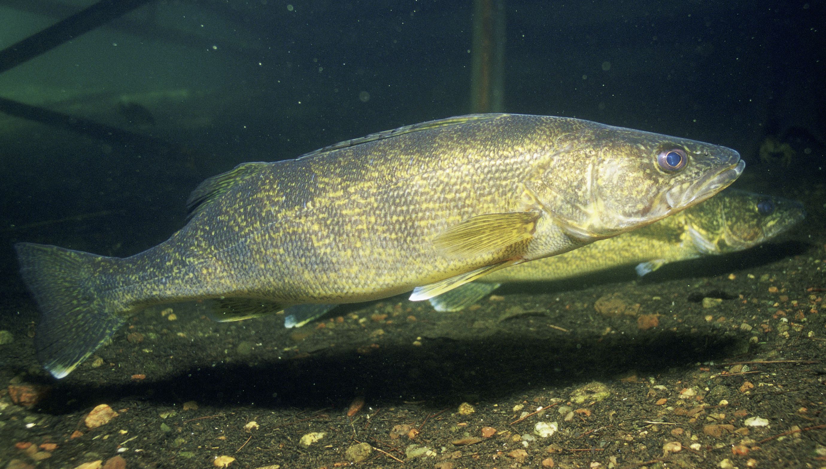
The walleye (''Sander vitreus'', synonym ''Stizostedion vitreum''), also called the yellow pike or yellow pickerel, is a freshwater perciform fish native to most of Canada and to the Northern United States. It is a North American close relative of the European zander, also known as the pikeperch. The walleye is sometimes called the yellow walleye to distinguish it from the blue walleye, which is a color morph that was once found in the southern Ontario and Quebec regions, but is now presumed extinct. However, recent genetic analysis of a preserved (frozen) 'blue walleye' sample suggests that the blue and yellow walleye were simply phenotypes within the same species and do not merit separate taxonomic classification. In parts of its range in English-speaking Canada, the walleye is known as a pickerel, though the fish is not related to the true pickerels, which are members of the family ''Esocidae''. Walleyes show a fair amount of variation across watersheds. In general, fis ... [...More Info...] [...Related Items...] OR: [Wikipedia] [Google] [Baidu] |
Muskellunge
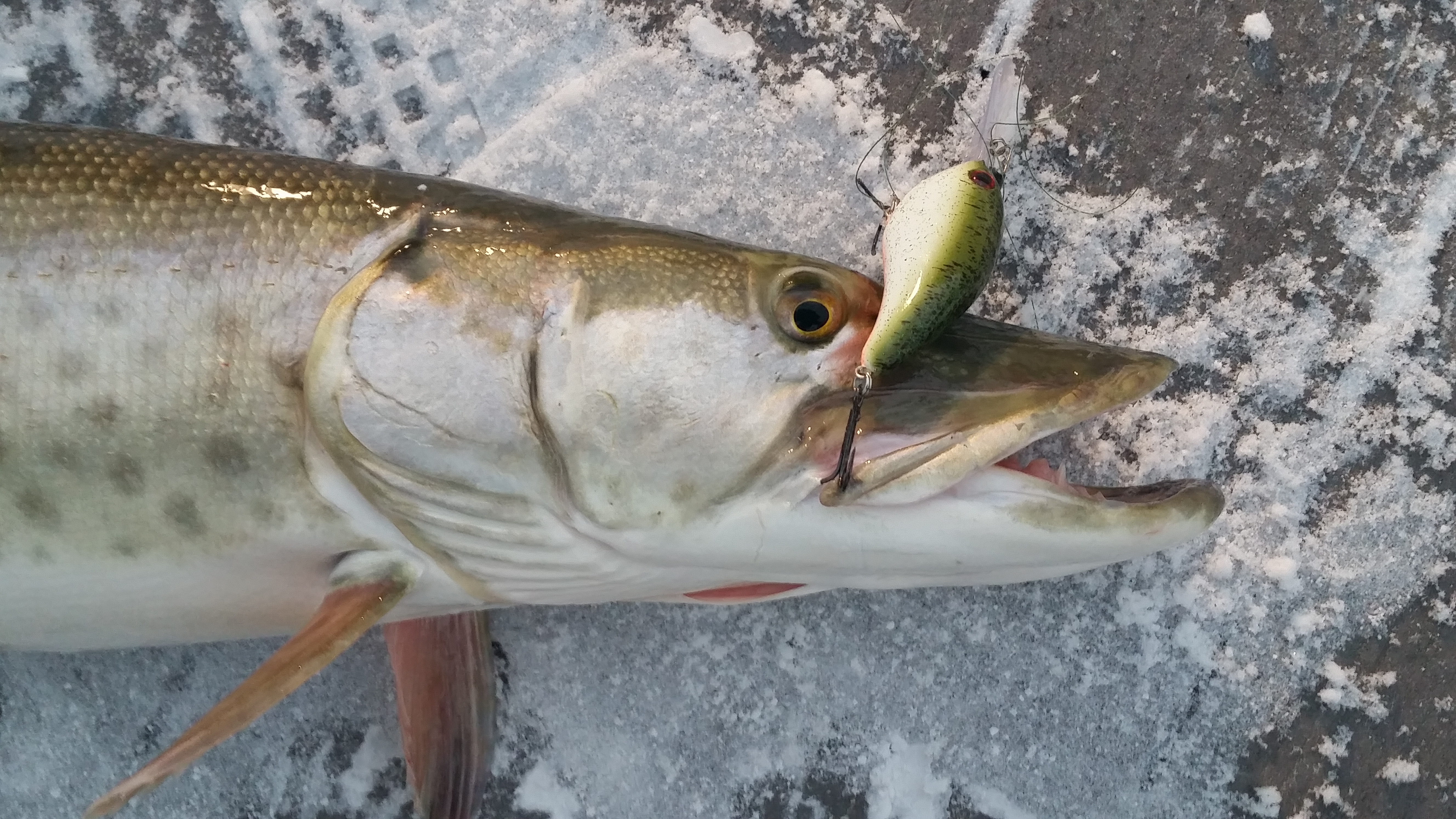
The muskellunge ''(Esox masquinongy)'', often shortened to muskie, musky or lunge is a species of large freshwater predatory fish native to North America. It is the largest member of the pike family, Esocidae. Origin of name The name "muskellunge" originates from the Ojibwe words ''maashkinoozhe'' (meaning "great fish"), ''maskinoše'' or ''mashkinonge'' (meaning "big pike" or "ugly pike") and the Algonquin word ''maskinunga'', which are borrowed into the Canadian French words ''masquinongé'' or ''maskinongé''. In English, before settling on the common name "muskellunge", there have been at least 94 common names applied to this species, including but not limited to: ''muskelunge'', ''muscallonge'', ''muskallonge'', ''milliganong'', ''maskinonge'', ''maskalonge'', ''mascalonge'', ''maskalung'', ''muskinunge'' and ''masquenongez''. The word muskellunge is German and means "muscle lung". Description Muskellunge closely resemble other esocids such as the northern pike and Ameri ... [...More Info...] [...Related Items...] OR: [Wikipedia] [Google] [Baidu] |


