|
Scano Di Montiferro
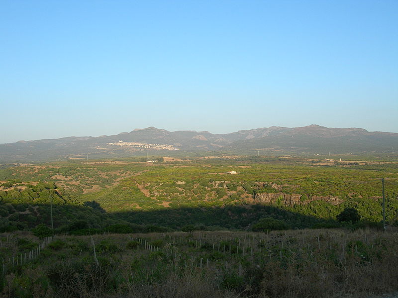
Scano di Montiferro ( sc, Iscanu) is a ''comune'' (municipality) in the Province of Oristano in the Italian region Sardinia, located about northwest of Cagliari and about north of Oristano. Scano di Montiferro borders the following municipalities: Borore, Cuglieri, Flussio, Macomer, Sagama, Santu Lussurgiu, Sennariolo, Sindia. History The municipality of Scano was populated since prehistoric times as shown by the recoveries in its territory of Domus de Janas and Giant's graves the presence of numerous nuragic installations. In the Middle Ages the villa of Scano belonged to the curatoria of the Montiferro, in the giudicato of Torres; in 1259, with the death of the giudicessa Adelasia, the curatoria was attached to the giudicato of Arborea. In 1410 the villa passed to the Aragonese and in 1421 was included in the territories subjected to the Catalan Zatrillas family. Geography The town rises to the slopes of the Montiferru, in one of the healthiest zones of the island up to ... [...More Info...] [...Related Items...] OR: [Wikipedia] [Google] [Baidu] |
Sardinia
Sardinia ( ; it, Sardegna, label=Italian, Corsican and Tabarchino ; sc, Sardigna , sdc, Sardhigna; french: Sardaigne; sdn, Saldigna; ca, Sardenya, label=Algherese and Catalan) is the second-largest island in the Mediterranean Sea, after Sicily, and one of the 20 regions of Italy. It is located west of the Italian Peninsula, north of Tunisia and immediately south of the French island of Corsica. It is one of the five Italian regions with some degree of domestic autonomy being granted by a special statute. Its official name, Autonomous Region of Sardinia, is bilingual in Italian and Sardinian: / . It is divided into four provinces and a metropolitan city. The capital of the region of Sardinia — and its largest city — is Cagliari. Sardinia's indigenous language and Algherese Catalan are referred to by both the regional and national law as two of Italy's twelve officially recognized linguistic minorities, albeit gravely endangered, while the regional law provides ... [...More Info...] [...Related Items...] OR: [Wikipedia] [Google] [Baidu] |
Sagama
Sagama ( sc, Sàgama) is a ''comune'' (municipality) in the Province of Oristano in the Italian region Sardinia, located about northwest of Cagliari and about north of Oristano. As of 31 December 2004, it had a population of 201 and an area of .All demographics and other statistics: National Institute of Statistics (Italy) (Istat). Sagama borders the following municipalities: Flussio, Scano di Montiferro, Sindia, Suni, Tinnura Tinnura is a ''comune'' (municipality) in the Province of Oristano in the Italian region Sardinia, located about northwest of Cagliari and about north of Oristano. As of 31 December 2004, it had a population of 268 and an area of .All demographic .... Demographic evolution Colors= id:lightgrey value:gray(0.9) id:darkgrey value:gray(0.8) id:sfondo value:rgb(1,1,1) id:barra value:rgb(0.6,0.7,0.8) ImageSize = width:455 height:303 PlotArea = left:50 bottom:50 top:30 right:30 DateFormat = x.y Period = from:0 till:1000 TimeAxis = orient ... [...More Info...] [...Related Items...] OR: [Wikipedia] [Google] [Baidu] |
Montiferru
Montiferru is a historical region of central-western Sardinia, Italy. It takes its name from the eponymous extinct volcano massif, whose main peak is the Monte Urtigu (1,050 m). Extending for some 700 km², the massif had originally a maximum elevation of c. 1,600/1,700 m, later reduced due to erosion. The volcanic origin of the area is testified by the basaltic rocks of the seaside. Water sources are frequent, rivers from the area including the Rio Mannu. The economy is essentially rural, based on agriculture and animal husbandry. Flora goes from the Mediterranean shrubland of the coast to olive and fruit trees in the mainland, up to pine and oaks in the more elevated parts. Wildlife include wild boar, fox, Sardinian hare, European hedgehog, least weasel, marten, the rare Sardinian wildcat, vulture, carrion crow, peregrine falcon, hoopoe, little owl, Eurasian scops owl and others. Geology The rocks of Montiferru are the remains of an extinct volcanic complex, co ... [...More Info...] [...Related Items...] OR: [Wikipedia] [Google] [Baidu] |
Giudicato Of Arborea
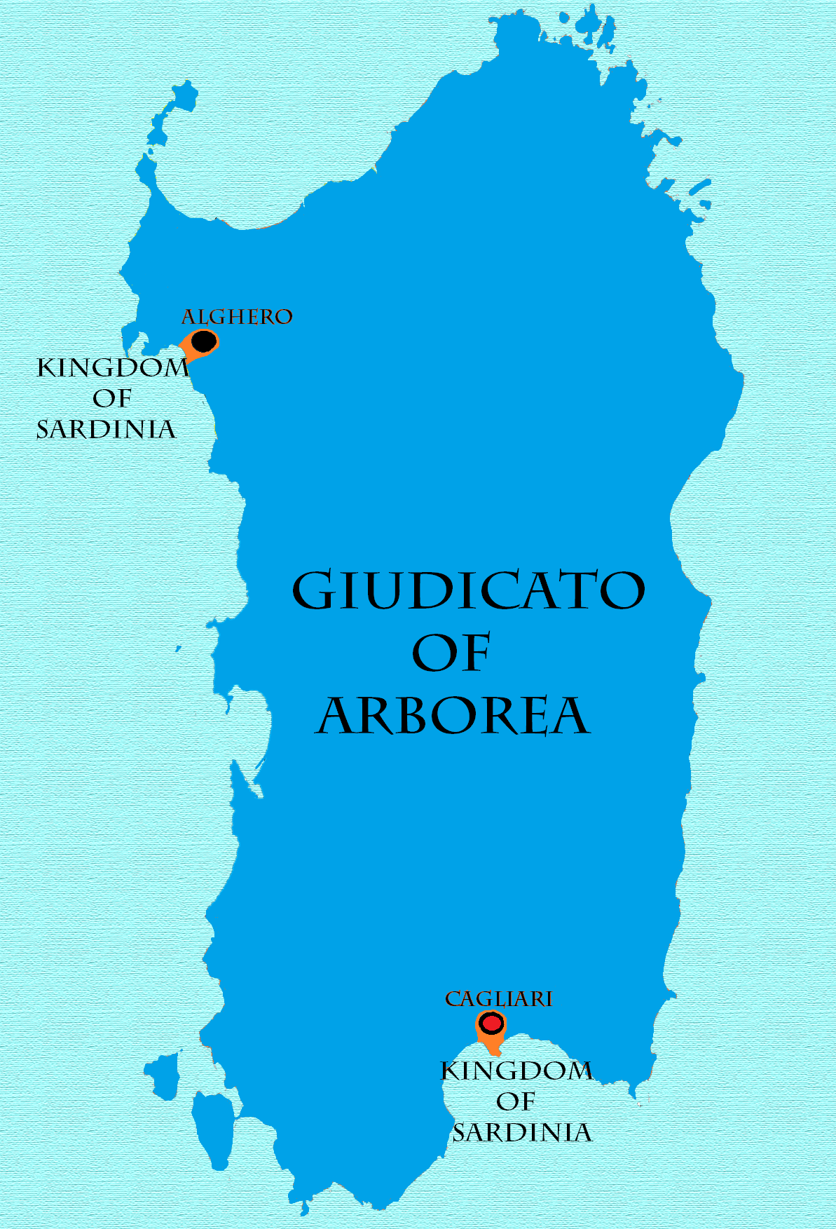
The Judicate of Arborea ( sc, Judicadu de Arbaree, it, Giudicato di Arborea, ) or the Kingdom of Arborea (, , ) was one of the four independent judicates into which the island of Sardinia was divided in the Middle Ages. It occupied the central-west portion of the island, wedged between Logudoro to the north and east, Cagliari to the south and east, and the Mediterranean Sea to the west. To the north east and beyond Logudoro was located Gallura, with which Arborea had far less interaction. Arborea outlasted her neighbours, surviving well into the 15th century. The earliest known judicial seat was Tharros. The Judicate of Arborea at the times of its maximum expansion occupied the whole island's territory, except the cities of Alghero and Cagliari. Origins In the early 9th century, when the Arabs and Berbers of North Africa became aggressive in expansion and piracy, the central authorities of the Byzantine Empire were unable to effectively defend or consistently govern the imperia ... [...More Info...] [...Related Items...] OR: [Wikipedia] [Google] [Baidu] |
Giudicato Of Torres
The Judicate of Logudoro or Torres ( sc, Judicadu de Logudoro or ''Torres'', ''Rennu de Logudoro'' or ''Logu de Torres'') was a state in northwest Sardinia from the tenth through the thirteenth century. Its original capital was Porto Torres. The region is still called Logudoro today. In the Middle Ages, Logudoro was one of four kingdoms (''iudicati'') into which the island was divided. The others were Gallura to the east, Arborea to the south, and Cagliari to the southeast. Logudoro was the largest and earliest known of the ''iudicati'' but also the second to be swallowed up by a foreign power. It was divided into twenty ''curatoriae'', ruled by ''curatores''. History In the ninth century, the Arabs and Imazighen followed aggressive policies of expansion and piracy in the Mediterranean. The conquest of Sicily by these groups in 827 effectively cut Sardinia off from the central government and military might of the Byzantine Empire. In the absence of instruction or reinforcement ... [...More Info...] [...Related Items...] OR: [Wikipedia] [Google] [Baidu] |
Sindia, Italy
Sindia ( sc, Sindìa) is a ''comune'' (municipality) in the Province of Nuoro in the Italian region Sardinia, located about northwest of Cagliari and about west of Nuoro. As of 31 December 2004, it had a population of 1,900 and an area of .All demographics and other statistics: Italian statistical institute Istat. Sindia borders the following municipalities: Macomer, Pozzomaggiore, Sagama, Scano di Montiferro, Semestene, Suni The Suni (''Nesotragus moschatus'') is a small antelope. It occurs in dense underbrush from central Kenya to KwaZulu-Natal in South Africa. Suni are around high at the shoulder and weigh . They are usually reddish brown, darker on their back t .... Demographic evolution Colors= id:lightgrey value:gray(0.9) id:darkgrey value:gray(0.8) id:sfondo value:rgb(1,1,1) id:barra value:rgb(0.6,0.7,0.8) ImageSize = width:455 height:303 PlotArea = left:50 bottom:50 top:30 right:30 DateFormat = x.y Period = from:0 till:4000 TimeAxis = orientat ... [...More Info...] [...Related Items...] OR: [Wikipedia] [Google] [Baidu] |
Sennariolo
Sennariolo is a ''comune'' (municipality) located about northwest of Cagliari and about north of Oristano in the Province of Oristano, Sardinia, Italy. As of 31 December 2004, it had a population of 185 and an area of .All demographics and other statistics: Italian statistical institute Istat. Sennariolo borders the following municipalities: Cuglieri, Flussio, Scano di Montiferro, Tresnuraghes Tresnuraghes is a ''comune'' (municipality) in the Province of Oristano in the Italian region Sardinia, located about northwest of Cagliari and about north of Oristano. The name means ''three nuraghes'' in Sardinian. Geography Tresnuraghes bor .... Demographic evolution Colors= id:lightgrey value:gray(0.9) id:darkgrey value:gray(0.8) id:sfondo value:rgb(1,1,1) id:barra value:rgb(0.6,0.7,0.8) ImageSize = width:455 height:303 PlotArea = left:50 bottom:50 top:30 right:30 DateFormat = x.y Period = from:0 till:18000 TimeAxis = orientation:vertical AlignBars = justify ... [...More Info...] [...Related Items...] OR: [Wikipedia] [Google] [Baidu] |
Santu Lussurgiu
Santu Lussurgiu (; sc, Santu Lussurzu, ) is a commune in the Province of Oristano, in the region of Sardinia, Italy, located about northwest of Cagliari and about north of Oristano. Santu Lussurgiu borders the following municipalities: Abbasanta, Bonarcado, Borore, Cuglieri, Norbello, Paulilatino, Scano di Montiferro, Seneghe. Main sights Santu Lussurgiu is surrounded by oaks and chestnut forest at above sea level, at the edge of a massive extinct volcanic mountain, the Montiferru. A rural museum features old tools for cheese production, the manufacture of iron, and related to farm work. San Pietro church, the local parish, is situated in the homonymous square, and the church of Santa Maria degli Angeli is situated near Market square. Sant'Antonio al monte (Saint Anthony of the mountain), a mountain of above sea level, is covered with various trees, including several ancient oaks. A church was built in 1944 in honor of St. Anthony, with two statues: a Madonna, and the oth ... [...More Info...] [...Related Items...] OR: [Wikipedia] [Google] [Baidu] |
Macomer
Macomer ( sc, Macumère) is a town and ''comune'' of Sardinia (Italy) in the province of Nuoro. It is situated on the southern ascent to the central plateau (the Campeda) of this part of Sardinia, at the junction of narrow-gauge lines branching from the main railroad line running east to Nuoro and west to Bosa. The district, especially the Campeda, is well suited for grazing and horse and cattle breeding, which is carried on to a considerable extent. History Macomer, known to the Greek geographer Ptolemy as "Macopsissa," has been inhabited since antiquity. In 1478 was the scene of the historical battle between the Sardinians and the Aragonese, which ended the independence of Sardinia. In 1767, under the Kingdom of Sardinia, it became the capital of the Marquisate of Marghine. The Marquisate included the nearby villages of Birori, Bolotana, Borore, Bortigali, Dualchi, Lei, Mulargia, Noragugume and Silanus. In 1949, a statue called ''The Venus of Macomer'' was discovered in ... [...More Info...] [...Related Items...] OR: [Wikipedia] [Google] [Baidu] |
Province Of Oristano
The province of Oristano ( it, provincia di Oristano, sc, provìntzia de Aristanis) is a province in the autonomous island region of Sardinia in Italy. Its capital is the city of Oristano. It has an area of , a total population of 160,746 (2016), and a population density of 53.7 people per square kilometer. There are 87 municipalities (''comuni'') in the province). It is bordered with on the north by Province of Sassari, on east by the Province of Nuoro, on south by the Province of South Sardinia and it is bathed from the Sea of Sardinia to the west. History The province of Oristano is the smallest province in Sardinia and was formed from sections of the provinces of Cagliari and Nuoro. It occupies roughly the same area as the Giudicato of Arborea of the High Middle Ages. It borders Nuoro, Cagliari and the Sea of Sardinia. A large area of the province's coastline is part of the gulf of Oristano, and the land in the province is mainly flat and there is some marshland. The province ... [...More Info...] [...Related Items...] OR: [Wikipedia] [Google] [Baidu] |
Flussio
Flussio ( sc, Frussìo) is a ''comune'' (municipality) in the Province of Oristano in the Italian region Sardinia, located about northwest of Cagliari and about north of Oristano. As of 31 December 2004, it had a population of 492 and an area of .All demographics and other statistics: National Institute of Statistics (Italy) (Istat). Flussio borders the following municipalities: Magomadas, Modolo, Sagama, Scano di Montiferro, Sennariolo, Suni, Tinnura, Tresnuraghes Tresnuraghes is a ''comune'' (municipality) in the Province of Oristano in the Italian region Sardinia, located about northwest of Cagliari and about north of Oristano. The name means ''three nuraghes'' in Sardinian. Geography Tresnuraghes bor .... Demographic evolution Colors= id:lightgrey value:gray(0.9) id:darkgrey value:gray(0.8) id:sfondo value:rgb(1,1,1) id:barra value:rgb(0.6,0.7,0.8) ImageSize = width:455 height:303 PlotArea = left:50 bottom:50 top:30 right:30 DateFormat = x.y Period = ... [...More Info...] [...Related Items...] OR: [Wikipedia] [Google] [Baidu] |

