|
Santu Lussurgiu
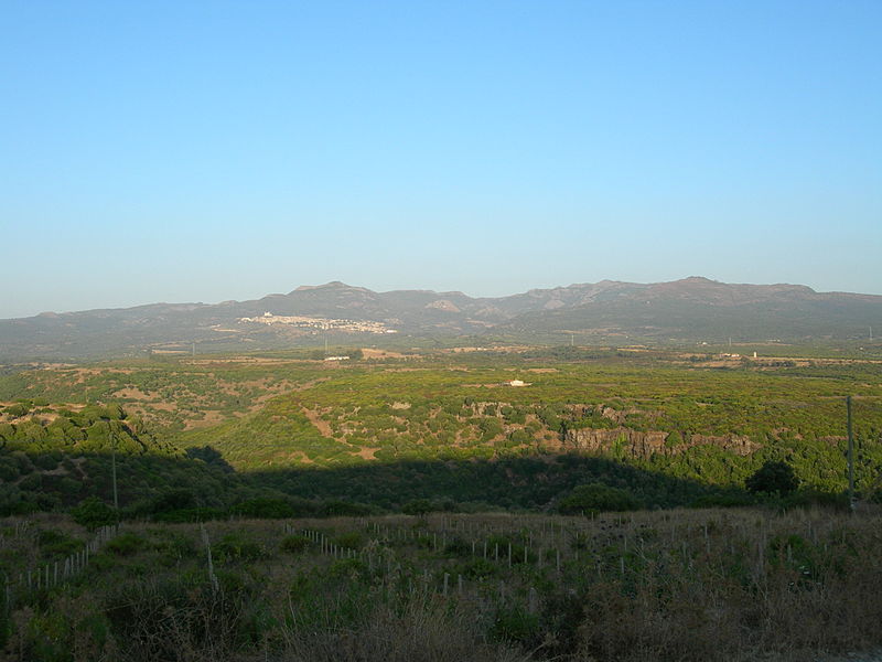
Santu Lussurgiu (; sc, Santu Lussurzu, ) is a commune in the Province of Oristano, in the region of Sardinia, Italy, located about northwest of Cagliari and about north of Oristano. Santu Lussurgiu borders the following municipalities: Abbasanta, Bonarcado, Borore, Cuglieri, Norbello, Paulilatino, Scano di Montiferro, Seneghe. Main sights Santu Lussurgiu is surrounded by oaks and chestnut forest at above sea level, at the edge of a massive extinct volcanic mountain, the Montiferru. A rural museum features old tools for cheese production, the manufacture of iron, and related to farm work. San Pietro church, the local parish, is situated in the homonymous square, and the church of Santa Maria degli Angeli is situated near Market square. Sant'Antonio al monte (Saint Anthony of the mountain), a mountain of above sea level, is covered with various trees, including several ancient oaks. A church was built in 1944 in honor of St. Anthony, with two statues: a Madonna, and the oth ... [...More Info...] [...Related Items...] OR: [Wikipedia] [Google] [Baidu] |
Sardinia
Sardinia ( ; it, Sardegna, label=Italian, Corsican and Tabarchino ; sc, Sardigna , sdc, Sardhigna; french: Sardaigne; sdn, Saldigna; ca, Sardenya, label=Algherese and Catalan) is the second-largest island in the Mediterranean Sea, after Sicily, and one of the 20 regions of Italy. It is located west of the Italian Peninsula, north of Tunisia and immediately south of the French island of Corsica. It is one of the five Italian regions with some degree of domestic autonomy being granted by a special statute. Its official name, Autonomous Region of Sardinia, is bilingual in Italian and Sardinian: / . It is divided into four provinces and a metropolitan city. The capital of the region of Sardinia — and its largest city — is Cagliari. Sardinia's indigenous language and Algherese Catalan are referred to by both the regional and national law as two of Italy's twelve officially recognized linguistic minorities, albeit gravely endangered, while the regional law provides ... [...More Info...] [...Related Items...] OR: [Wikipedia] [Google] [Baidu] |
Paulilatino
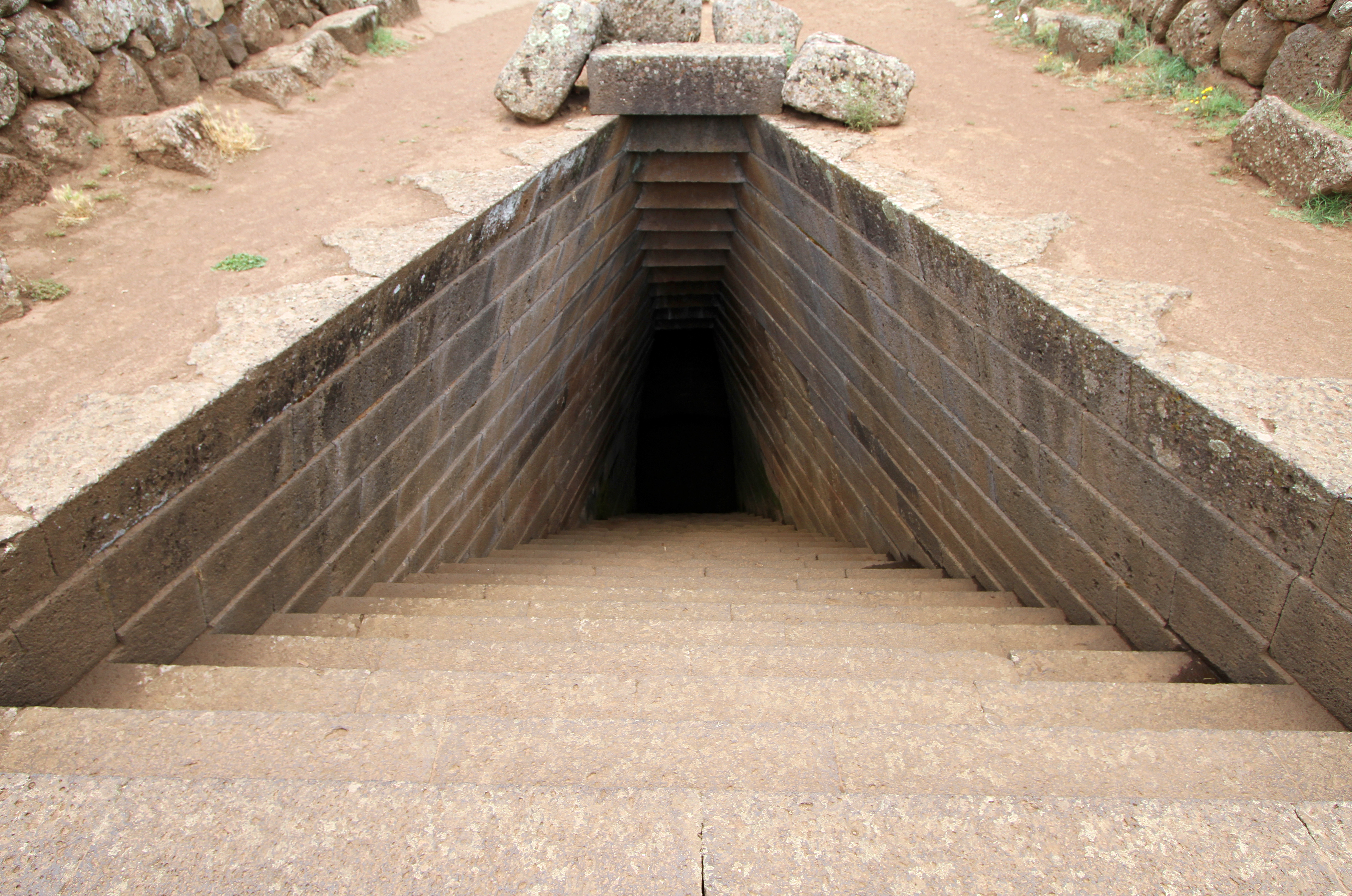
Paulilatino ( sc, Paùlle) is a ''comune'' (municipality) in the Province of Oristano in the Italian region Sardinia, located about northwest of Cagliari and about northeast of Oristano. Paulilatino borders the following municipalities: Abbasanta, Bauladu, Bonarcado, Fordongianus, Ghilarza, Santu Lussurgiu, Solarussa, Villanova Truschedu, Zerfaliu. Main sights The archaeological complex of Santa Cristina dates from the 12 century BC and consists of a well and various ceremonial buildings. It is one of the most important sites of the Nuragic civilization. Central to the facilities is a well, built with well smoothed basaltic ashlars and consisting of three architectural elements: an elliptical enclosure, stairs shaped like a trapezium and a circular chamber with an ogival ceiling that contains the water. In front of the well there are remains of Nuragic villager huts with and a gathering place. Other sights include numerous nuraghe The nuraghe (, ; plural: Logudorese S ... [...More Info...] [...Related Items...] OR: [Wikipedia] [Google] [Baidu] |
Macomer
Macomer ( sc, Macumère) is a town and ''comune'' of Sardinia (Italy) in the province of Nuoro. It is situated on the southern ascent to the central plateau (the Campeda) of this part of Sardinia, at the junction of narrow-gauge lines branching from the main railroad line running east to Nuoro and west to Bosa. The district, especially the Campeda, is well suited for grazing and horse and cattle breeding, which is carried on to a considerable extent. History Macomer, known to the Greek geographer Ptolemy as "Macopsissa," has been inhabited since antiquity. In 1478 was the scene of the historical battle between the Sardinians and the Aragonese, which ended the independence of Sardinia. In 1767, under the Kingdom of Sardinia, it became the capital of the Marquisate of Marghine. The Marquisate included the nearby villages of Birori, Bolotana, Borore, Bortigali, Dualchi, Lei, Mulargia, Noragugume and Silanus. In 1949, a statue called ''The Venus of Macomer'' was discovered in ... [...More Info...] [...Related Items...] OR: [Wikipedia] [Google] [Baidu] |
Passion Of Christ
In Christianity, the Passion (from the Latin verb ''patior, passus sum''; "to suffer, bear, endure", from which also "patience, patient", etc.) is the short final period in the life of Jesus Christ. Depending on one's views, the "Passion" may include, among other events, Jesus' triumphal entry into Jerusalem, his cleansing of the Temple, his anointing, the Last Supper, Jesus' agony in the Garden, his arrest, his Sanhedrin trial, his trial before Pontius Pilate, his crucifixion and his death on Good Friday, his burial, and the resurrection of Jesus. Those parts of the four canonical Gospels that describe these events are known as the "Passion narratives". In some Christian communities, commemoration of the Passion also includes remembrance of the sorrow of Mary, the mother of Jesus, on the Friday of Sorrows. The word ''passion'' has taken on a more general application and now may also apply to accounts of the suffering and death of Christian martyrs, sometimes using the Lati ... [...More Info...] [...Related Items...] OR: [Wikipedia] [Google] [Baidu] |
Way Of The Cross
The Stations of the Cross or the Way of the Cross, also known as the Way of Sorrows or the Via Crucis, refers to a series of images depicting Jesus Christ on the day of his crucifixion and accompanying prayers. The stations grew out of imitations of the Via Dolorosa in Jerusalem, which is a traditional processional route symbolising the actual path Jesus walked to Mount Calvary. The objective of the stations is to help the Christian faithful to make a spiritual pilgrimage through contemplation of the Passion of Christ. It has become one of the most popular devotions and the stations can be found in many Western Christian churches, including those in the Roman Catholic, Lutheran, Anglican, and Methodist traditions. Commonly, a series of 14 images will be arranged in numbered order along a path, along which worshippers—individually or in a procession—move in order, stopping at each station to say prayers and engage in reflections associated with that station. These devotions ... [...More Info...] [...Related Items...] OR: [Wikipedia] [Google] [Baidu] |
Madonna (art)
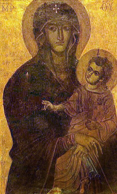
In art, a Madonna () is a representation of Mary, either alone or with her child Jesus. These images are central icons for both the Catholic and Orthodox churches. The word is (archaic). The Madonna and Child type is very prevalent in Christian iconography, divided into many traditional subtypes especially in Eastern Orthodox iconography, often known after the location of a notable icon of the type, such as the ''Theotokos of Vladimir'', ''Agiosoritissa'', ''Blachernitissa'', etc., or descriptive of the depicted posture, as in ''Hodegetria'', ''Eleusa'', etc. The term ''Madonna'' in the sense of "picture or statue of the Virgin Mary" enters English usage in the 17th century, primarily in reference to works of the Italian Renaissance. In an Eastern Orthodox context, such images are typically known as ''Theotokos''. "Madonna" may be generally used of representations of Mary, with or without the infant Jesus, is the focus and central figure of the image, possibly flanked ... [...More Info...] [...Related Items...] OR: [Wikipedia] [Google] [Baidu] |
Montiferru
Montiferru is a historical region of central-western Sardinia, Italy. It takes its name from the eponymous extinct volcano massif, whose main peak is the Monte Urtigu (1,050 m). Extending for some 700 km², the massif had originally a maximum elevation of c. 1,600/1,700 m, later reduced due to erosion. The volcanic origin of the area is testified by the basaltic rocks of the seaside. Water sources are frequent, rivers from the area including the Rio Mannu. The economy is essentially rural, based on agriculture and animal husbandry. Flora goes from the Mediterranean shrubland of the coast to olive and fruit trees in the mainland, up to pine and oaks in the more elevated parts. Wildlife include wild boar, fox, Sardinian hare, European hedgehog, least weasel, marten, the rare Sardinian wildcat, vulture, carrion crow, peregrine falcon, hoopoe, little owl, Eurasian scops owl and others. Geology The rocks of Montiferru are the remains of an extinct volcanic complex, co ... [...More Info...] [...Related Items...] OR: [Wikipedia] [Google] [Baidu] |
Seneghe
Seneghe ( sc, Sèneghe) is a ''comune'' (municipality) in the Province of Oristano in the Italian region Sardinia, located about northwest of Cagliari and about north of Oristano. As of 31 December 2004, it had a population of 1,944 and an area of .All demographics and other statistics: Italian statistical institute Istat. Seneghe borders the following municipalities: Bonarcado, Cuglieri, Milis, Narbolia Narbolia ( sc, Narabuìa) is a ''comune'' (municipality) in the Province of Oristano in the Italian region Sardinia, located about northwest of Cagliari and about north of Oristano. As of 31 December 2016, it had a population of 1,784 and an ar ..., Santu Lussurgiu. Demographic evolution Colors= id:lightgrey value:gray(0.9) id:darkgrey value:gray(0.8) id:sfondo value:rgb(1,1,1) id:barra value:rgb(0.6,0.7,0.8) ImageSize = width:455 height:303 PlotArea = left:50 bottom:50 top:30 right:30 DateFormat = x.y Period = from:0 till:3000 TimeAxis = orientation: ... [...More Info...] [...Related Items...] OR: [Wikipedia] [Google] [Baidu] |
Scano Di Montiferro
Scano di Montiferro ( sc, Iscanu) is a ''comune'' (municipality) in the Province of Oristano in the Italian region Sardinia, located about northwest of Cagliari and about north of Oristano. Scano di Montiferro borders the following municipalities: Borore, Cuglieri, Flussio, Macomer, Sagama, Santu Lussurgiu, Sennariolo, Sindia. History The municipality of Scano was populated since prehistoric times as shown by the recoveries in its territory of Domus de Janas and Giant's graves the presence of numerous nuragic installations. In the Middle Ages the villa of Scano belonged to the curatoria of the Montiferro, in the giudicato of Torres; in 1259, with the death of the giudicessa Adelasia, the curatoria was attached to the giudicato of Arborea. In 1410 the villa passed to the Aragonese and in 1421 was included in the territories subjected to the Catalan Zatrillas family. Geography The town rises to the slopes of the Montiferru, in one of the healthiest zones of the island up to ... [...More Info...] [...Related Items...] OR: [Wikipedia] [Google] [Baidu] |
Norbello
Norbello ( sc, Norghiddo) is a ''comune'' (municipality) in the Province of Oristano in the Italian region Sardinia, located about north of Cagliari and about northeast of Oristano. As of 31 December 2004, it had a population of 1,208 and an area of .All demographics and other statistics: National Institute of Statistics (Italy) (Istat). Norbello borders the following municipalities: Abbasanta, Aidomaggiore, Borore, Ghilarza Ghilarza ( sc, Ilàrtzi) is a ''comune'' (municipality) in the Province of Oristano in the Italian region Sardinia, located about north of Cagliari and about northeast of Oristano. Antonio Gramsci, political philosopher and founder of the Ita ..., Santu Lussurgiu. Demographic evolution Colors= id:lightgrey value:gray(0.9) id:darkgrey value:gray(0.8) id:sfondo value:rgb(1,1,1) id:barra value:rgb(0.6,0.7,0.8) ImageSize = width:455 height:303 PlotArea = left:50 bottom:50 top:30 right:30 DateFormat = x.y Period = from:0 till:2000 Ti ... [...More Info...] [...Related Items...] OR: [Wikipedia] [Google] [Baidu] |
Province Of Oristano
The province of Oristano ( it, provincia di Oristano, sc, provìntzia de Aristanis) is a province in the autonomous island region of Sardinia in Italy. Its capital is the city of Oristano. It has an area of , a total population of 160,746 (2016), and a population density of 53.7 people per square kilometer. There are 87 municipalities (''comuni'') in the province). It is bordered with on the north by Province of Sassari, on east by the Province of Nuoro, on south by the Province of South Sardinia and it is bathed from the Sea of Sardinia to the west. History The province of Oristano is the smallest province in Sardinia and was formed from sections of the provinces of Cagliari and Nuoro. It occupies roughly the same area as the Giudicato of Arborea of the High Middle Ages. It borders Nuoro, Cagliari and the Sea of Sardinia. A large area of the province's coastline is part of the gulf of Oristano, and the land in the province is mainly flat and there is some marshland. The province ... [...More Info...] [...Related Items...] OR: [Wikipedia] [Google] [Baidu] |
Cuglieri
Cuglieri ( sc, Cùllieri) is a ''comune'' (municipality) in the Province of Oristano in the Italian region Sardinia, located about northwest of Cagliari and about north of Oristano Oristano (; sc, Aristanis ) is an Italian city and ''comune'', and capital of the Province of Oristano in the central-western part of the island of Sardinia. It is located on the northern part of the Campidano plain. It was established as the pr .... Wildfire 2021 See also * S'Archittu References External links Cities and towns in Sardinia {{Sardinia-geo-stub ... [...More Info...] [...Related Items...] OR: [Wikipedia] [Google] [Baidu] |


.jpg)