|
Samern
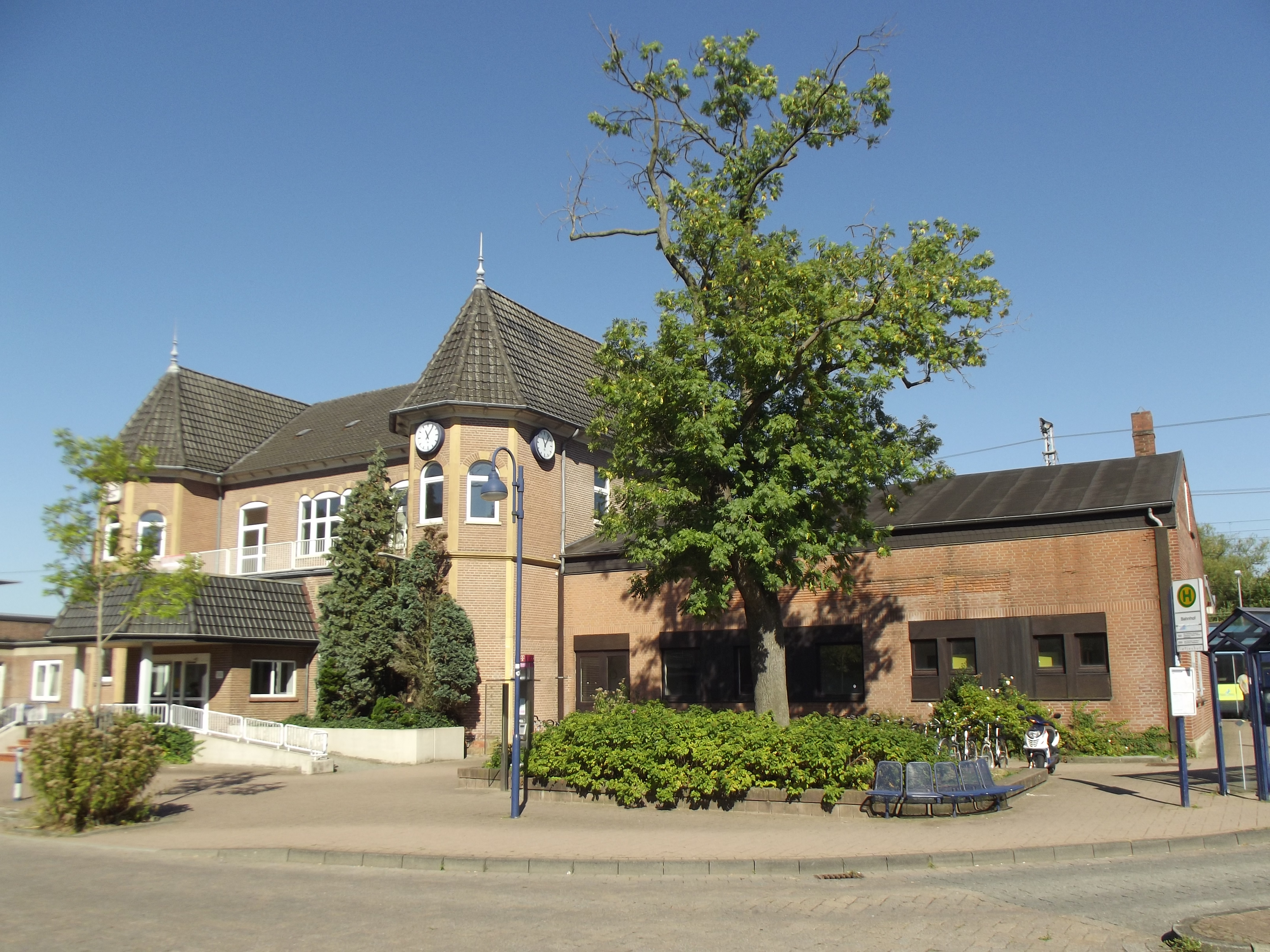
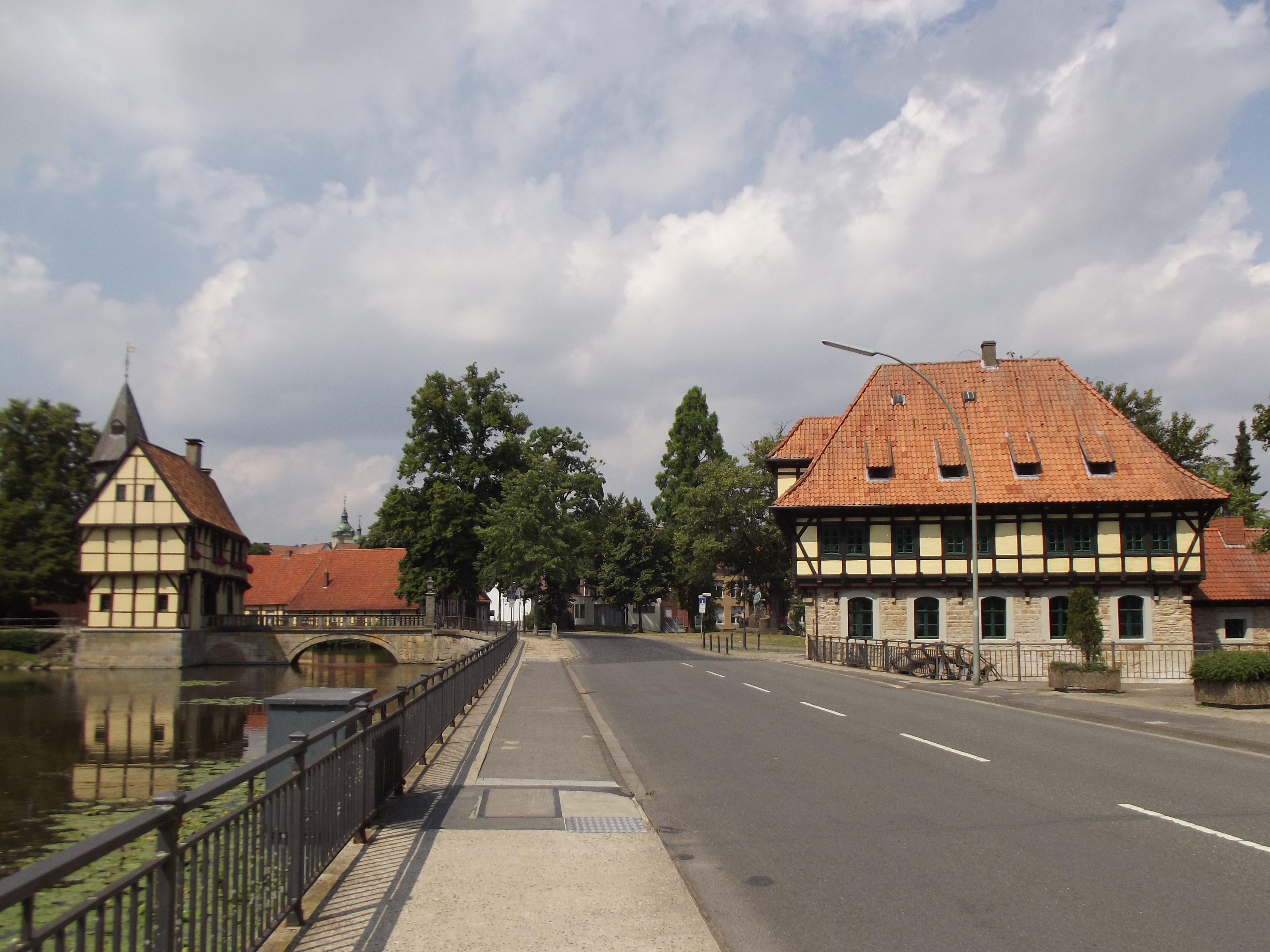
Samern is a community in the district of Grafschaft Bentheim in Lower Saxony, Germany. Geography Location Samern lies between Nordhorn and Steinfurt on the boundary with North Rhine-Westphalia. The community belongs to the Joint Community (''Samtgemeinde'') of Schüttorf whose administrative seat is in the like-named town. Politics Mayor The community’s honorary mayor is Gerhard Schepers. Culture and sightseeing The Mansbrügge watchtower, or in the local speech the ''Piggetörnken'', was once, according to local lore, a mint belonging to a count in the 14th century. Newer findings, however, show that this building was only ever used as a customs Customs is an authority or agency in a country responsible for collecting tariffs and for controlling the flow of goods, including animals, transports, personal effects, and hazardous items, into and out of a country. Traditionally, customs ... post. Sport Samern has a sport club, SV Suddendorf-Samern 1959 e.V. Econ ... [...More Info...] [...Related Items...] OR: [Wikipedia] [Google] [Baidu] |
Schüttorf
Schüttorf (Northern Low Saxon: ''Schüttrup'') is a town in the district of Grafschaft Bentheim in southwesternmost Lower Saxony near the Dutch border and the boundary with Westphalia (North Rhine-Westphalia). The town of Schüttorf forms with the surrounding communities the Joint Community (''Samtgemeinde'') of Schüttorf. It is the district's oldest town. It lies on the river Vechte, roughly 5 km east of Bad Bentheim, and 20 km southeast of Nordhorn. Geography Location and landscape description The town of Schüttorf lies in southwesternmost Lower Saxony and in the westernmost part of the Federal Republic of Germany. It is roughly 10 km to the Dutch border. With regards to the cultural makeup and to the natural environment, it lies in a transitional zone between the Emsland and Westphalia. The surroundings may be characterized as settled countryside. Middle centres in the area are, among others, Nordhorn and Rheine. The town is crossed through the middle sou ... [...More Info...] [...Related Items...] OR: [Wikipedia] [Google] [Baidu] |
Grafschaft Bentheim
County of Bentheim (german: Grafschaft Bentheim) is a district (''Landkreis'') in Lower Saxony, Germany. It is bounded by (from the west and clockwise) the Dutch provinces of Overijssel and Drenthe, the district of Emsland, and the districts of Steinfurt and Borken in North Rhine-Westphalia. History The District has roughly the same territory as the County of Bentheim, a state of the Holy Roman Empire that was dissolved in 1803. Geography The district's north-western region named (''low county'') protrudes into Dutch territory, and borders it to the north, west and south. The Vechte River (Dutch ''Vecht'') traverses the district from south to north and flows into the Netherlands. Coat of arms The arms are identical to the arms of the historic County of Bentheim The County of Bentheim (''Grafschaft Bentheim'', Low German ''Benthem'') was a state of the Holy Roman Empire, located in the south-west corner of today's Lower Saxony, Germany. The county's borders ... [...More Info...] [...Related Items...] OR: [Wikipedia] [Google] [Baidu] |
Lower Saxony
Lower Saxony (german: Niedersachsen ; nds, Neddersassen; stq, Läichsaksen) is a German state (') in northwestern Germany. It is the second-largest state by land area, with , and fourth-largest in population (8 million in 2021) among the 16 ' federated as the Federal Republic of Germany. In rural areas, Northern Low Saxon and Saterland Frisian are still spoken, albeit in declining numbers. Lower Saxony borders on (from north and clockwise) the North Sea, the states of Schleswig-Holstein, Hamburg, , Brandenburg, Saxony-Anhalt, Thuringia, Hesse and North Rhine-Westphalia, and the Netherlands. Furthermore, the state of Bremen forms two enclaves within Lower Saxony, one being the city of Bremen, the other its seaport, Bremerhaven (which is a semi-enclave, as it has a coastline). Lower Saxony thus borders more neighbours than any other single '. The state's largest cities are state capital Hanover, Braunschweig (Brunswick), Lüneburg, Osnabrück, Oldenburg, Hildesheim, Salzgitt ... [...More Info...] [...Related Items...] OR: [Wikipedia] [Google] [Baidu] |
Germany
Germany,, officially the Federal Republic of Germany, is a country in Central Europe. It is the second most populous country in Europe after Russia, and the most populous member state of the European Union. Germany is situated between the Baltic and North seas to the north, and the Alps to the south; it covers an area of , with a population of almost 84 million within its 16 constituent states. Germany borders Denmark to the north, Poland and the Czech Republic to the east, Austria and Switzerland to the south, and France, Luxembourg, Belgium, and the Netherlands to the west. The nation's capital and most populous city is Berlin and its financial centre is Frankfurt; the largest urban area is the Ruhr. Various Germanic tribes have inhabited the northern parts of modern Germany since classical antiquity. A region named Germania was documented before AD 100. In 962, the Kingdom of Germany formed the bulk of the Holy Roman Empire. During the 16th ce ... [...More Info...] [...Related Items...] OR: [Wikipedia] [Google] [Baidu] |
Nordhorn
Nordhorn (Northern Low Saxon: ''Nothoorn'' (or ''Notthoarn'', ''Netthoarn'' and ''Noordhoorn'')) is a town in Lower Saxony, Germany. It is the district seat of Grafschaft Bentheim in Lower Saxony's southwesternmost corner near the border with the Netherlands and the boundary with North Rhine-Westphalia. Etymology One story holds that the town's name – which means "North Horn" – came about when the town was under attack, in which case a horn – the so-called ''Nothorn'' or emergency horn – was blown by the watchmen to warn the Vechteinsel (Vechte Island) inhabitants and also to call for help. Since the town lay north of Bentheim (now Bad Bentheim) and its castle, it is said that this yielded the name Nordhorn. A horn, however, was also used by the boatmen on the river Vechte to warn each other of ships' movements in fog. Since the 1970s, the ''Tuter'' ("Tooter"), a bronze memorial to the beginnings of inland shipping, has stood at the old harbour. Since a settlement with a ... [...More Info...] [...Related Items...] OR: [Wikipedia] [Google] [Baidu] |
Steinfurt
Steinfurt (; Westphalian: ''Stemmert'') is a city in North Rhine-Westphalia, Germany. It is the capital of the district of Steinfurt. From roughly 1100-1806, it was the capital of the County of Steinfurt. Geography Steinfurt is situated north-west of Münster, North Rhine-Westphalia. Its name came into being in 1975 when the two hitherto independent towns Borghorst and Burgsteinfurt amalgamated. Borghorst became a prosperous city due to its flourishing textile industry, whereas Burgsteinfurt has always rather been coined by culture and administration. Tourists of the 19th century passing Burgsteinfurt praised the city as the "Paradise of Westphalia" and "Royal Diamond" (''Königsdiamant'') because of its 75 monumental buildings and moated castle. Neighbouring municipalities Steinfurt borders Ochtrup, Wettringen, Neuenkirchen, Emsdetten, Nordwalde, Altenberge, Laer, Horstmar and Metelen. City division Steinfurt consists of ''Borghorst'' and ''Burgsteinfurt'', each with thre ... [...More Info...] [...Related Items...] OR: [Wikipedia] [Google] [Baidu] |
North Rhine-Westphalia
North Rhine-Westphalia (german: Nordrhein-Westfalen, ; li, Noordrien-Wesfale ; nds, Noordrhien-Westfalen; ksh, Noodrhing-Wäßßfaale), commonly shortened to NRW (), is a States of Germany, state (''Land'') in Western Germany. With more than 18 million inhabitants, it is the List of German states by population, most populous state of Germany. Apart from the city-states, it is also the List of German states by population density, most densely populated state in Germany. Covering an area of , it is the List of German states by area, fourth-largest German state by size. North Rhine-Westphalia features 30 of the 81 German municipalities with over 100,000 inhabitants, including Cologne (over 1 million), the state capital Düsseldorf, Dortmund and Essen (all about 600,000 inhabitants) and other cities predominantly located in the Rhine-Ruhr metropolitan area, the largest urban area in Germany and the fourth-largest on the European continent. The location of the Rhine-Ruhr at the h ... [...More Info...] [...Related Items...] OR: [Wikipedia] [Google] [Baidu] |
Mint (coin)
A mint is an industrial facility which manufactures coins that can be used as currency. The history of mints correlates closely with the history of coins. In the beginning, hammered coinage or cast coinage were the chief means of coin minting, with resulting production runs numbering as little as the hundreds or thousands. In modern mints, coin dies are manufactured in large numbers and planchets are made into milled coins by the billions. With the mass production of currency, the production cost is weighed when minting coins. For example, it costs the United States Mint much less than 25 cents to make a quarter (a 25 cent coin), and the difference in production cost and face value (called seigniorage) helps fund the minting body. Conversely, a U.S. penny ($0.01) cost $0.015 to make in 2016. History The first minted coins The earliest metallic money did not consist of coins, but of unminted metal in the form of rings and other ornaments or of weapons, which were used for th ... [...More Info...] [...Related Items...] OR: [Wikipedia] [Google] [Baidu] |
Customs
Customs is an authority or agency in a country responsible for collecting tariffs and for controlling the flow of goods, including animals, transports, personal effects, and hazardous items, into and out of a country. Traditionally, customs has been considered as the fiscal subject that charges customs duties (i.e. tariffs) and other taxes on import and export. In recent decades, the views on the functions of customs have considerably expanded and now covers three basic issues: taxation, security, and trade facilitation. Each country has its own laws and regulations for the import and export of goods into and out of a country, enforced by their respective customs authorities; the import/export of some goods may be restricted or forbidden entirely. A wide range of penalties are faced by those who break these laws. Overview Taxation The traditional function of customs has been the assessment and collection of customs duties, which is a tariff or tax on the importation o ... [...More Info...] [...Related Items...] OR: [Wikipedia] [Google] [Baidu] |
Autobahn
The (; German plural ) is the federal controlled-access highway system in Germany. The official German term is (abbreviated ''BAB''), which translates as 'federal motorway'. The literal meaning of the word is 'Federal Auto(mobile) Track'. German are widely known for having no federally mandated general speed limit for some classes of vehicles. However, limits are posted and enforced in areas that are urbanised, substandard, accident-prone, or under construction. On speed-unrestricted stretches, an advisory speed limit () of applies. While driving faster is not illegal as such in the absence of a speed limit, it can cause an increased liability in the case of a collision (which mandatory auto insurance has to cover); courts have ruled that an "ideal driver" who is exempt from absolute liability for "inevitable" tort under the law would not exceed . A 2017 report by the Federal Road Research Institute reported that in 2015, 70.4% of the Autobahn network had only the advis ... [...More Info...] [...Related Items...] OR: [Wikipedia] [Google] [Baidu] |
Bundesautobahn 31
is a German Autobahn that connects the coast of the North Sea near Emden to the Ruhr area. It is also known as Emsland-Autobahn or East Frisian Skewer. It was completed in December 2004. Construction was in part made possible by a unique method of financing: individuals, companies, towns, counties and the Netherlands ) , anthem = ( en, "William of Nassau") , image_map = , map_caption = , subdivision_type = Sovereign state , subdivision_name = Kingdom of the Netherlands , established_title = Before independence , established_date = Spanish Netherl ... donated money to accelerate the project. Exit list External links 31 A031 A031 {{Germany-road-stub ... [...More Info...] [...Related Items...] OR: [Wikipedia] [Google] [Baidu] |


.jpg)

