|
Schüttorf
Schüttorf ( Northern Low Saxon: ''Schüttrup'') is a town in the district of Grafschaft Bentheim in southwesternmost Lower Saxony near the Dutch border and the boundary with Westphalia (North Rhine-Westphalia). The town of Schüttorf forms with the surrounding communities the Joint Community (''Samtgemeinde'') of Schüttorf. It is the district's oldest town. It lies on the river Vechte, roughly 5 km east of Bad Bentheim, and 20 km southeast of Nordhorn. Geography Location and landscape description The town of Schüttorf lies in southwesternmost Lower Saxony and in the westernmost part of the Federal Republic of Germany. It is roughly 10 km to the Dutch border. With regards to the cultural makeup and to the natural environment, it lies in a transitional zone between the Emsland and Westphalia. The surroundings may be characterized as settled countryside. Middle centres in the area are, among others, Nordhorn and Rheine. The town is crossed through the middle s ... [...More Info...] [...Related Items...] OR: [Wikipedia] [Google] [Baidu] |
Grafschaft Bentheim
County of Bentheim (german: Grafschaft Bentheim) is a district (''Landkreis'') in Lower Saxony, Germany. It is bounded by (from the west and clockwise) the Dutch provinces of Overijssel and Drenthe, the district of Emsland, and the districts of Steinfurt and Borken in North Rhine-Westphalia. History The District has roughly the same territory as the County of Bentheim, a state of the Holy Roman Empire that was dissolved in 1803. Geography The district's north-western region named (''low county'') protrudes into Dutch territory, and borders it to the north, west and south. The Vechte River (Dutch ''Vecht'') traverses the district from south to north and flows into the Netherlands. Coat of arms The arms are identical to the arms of the historic County of Bentheim The County of Bentheim (''Grafschaft Bentheim'', Low German ''Benthem'') was a state of the Holy Roman Empire, located in the south-west corner of today's Lower Saxony, Germany. The county's borders ... [...More Info...] [...Related Items...] OR: [Wikipedia] [Google] [Baidu] |
Nordhorn
Nordhorn ( Northern Low Saxon: ''Nothoorn'' (or ''Notthoarn'', ''Netthoarn'' and ''Noordhoorn'')) is a town in Lower Saxony, Germany. It is the district seat of Grafschaft Bentheim in Lower Saxony's southwesternmost corner near the border with the Netherlands and the boundary with North Rhine-Westphalia. Etymology One story holds that the town's name – which means "North Horn" – came about when the town was under attack, in which case a horn – the so-called ''Nothorn'' or emergency horn – was blown by the watchmen to warn the Vechteinsel (Vechte Island) inhabitants and also to call for help. Since the town lay north of Bentheim (now Bad Bentheim) and its castle, it is said that this yielded the name Nordhorn. A horn, however, was also used by the boatmen on the river Vechte to warn each other of ships' movements in fog. Since the 1970s, the ''Tuter'' ("Tooter"), a bronze memorial to the beginnings of inland shipping, has stood at the old harbour. Since a settlement w ... [...More Info...] [...Related Items...] OR: [Wikipedia] [Google] [Baidu] |
Bad Bentheim
Bad Bentheim (; nds-nl, Beantem) is a town in the southwestern part of Lower Saxony, Germany, in the district of Grafschaft Bentheim on the borders of North Rhine-Westphalia and the Netherlands roughly 15 km south of Nordhorn and 20 km northeast of Enschede. It is a state-recognized thermal brine and sulphur spa town, hence the designation ''Bad'' (“Bath”). Also to be found in Bad Bentheim is the castle Burg Bentheim, the town's emblem. Geography Extent of the municipal area The town limit is 49 km, with a north–south reach of 14 km and an east–west reach of 12 km. The area under Bad Bentheim's jurisdiction, along with all its constituent communities, has a total area of 100.16 km2. Neighbouring communities Bad Bentheim, a town shaped by the Evangelical Church, belongs to Lower Saxony's district of Bentheim. It borders on two other towns in Lower Saxony, Schüttorf and Nordhorn as well as on the more characteristically Catholic town ... [...More Info...] [...Related Items...] OR: [Wikipedia] [Google] [Baidu] |
Bundesautobahn 31
is a German Autobahn that connects the coast of the North Sea near Emden to the Ruhr area. It is also known as Emsland-Autobahn or East Frisian Skewer. It was completed in December 2004. Construction was in part made possible by a unique method of financing: individuals, companies, towns, counties and the Netherlands ) , anthem = ( en, "William of Nassau") , image_map = , map_caption = , subdivision_type = Sovereign state , subdivision_name = Kingdom of the Netherlands , established_title = Before independence , established_date = Spanish Netherl ... donated money to accelerate the project. Exit list External links 31 A031 A031 {{Germany-road-stub ... [...More Info...] [...Related Items...] OR: [Wikipedia] [Google] [Baidu] |
Vechte
The Vechte () (in German language, German and in Low German, Low Saxon (Dutch Low Saxon pronunciation: [v̯ɛxtə])The places near the Vechte in the County of Bentheim have the same pronunciation or Vecht (in Dutch language, Dutch) (), often called Overijsselse Vecht () in the Netherlands to avoid confusion with its Utrecht (province), Utrecht Vecht (Utrecht), counterpart, is a river in Germany and the Netherlands. Its total length is , of which are on German soil. The Vechte originates in Oberdarfeld in the German state of North Rhine-Westphalia near the city of Coesfeld and flows north into the state of Lower Saxony, past the towns of Nordhorn and Emlichheim, across the border and then westwards into the Dutch province of Overijssel (hence its alternate Dutch designation). There, it flows through the north part of the Salland region past Hardenberg and Ommen, taking in the water of the Regge (river), Regge stream along the way. Close to the city of Zwolle, the river suddenly b ... [...More Info...] [...Related Items...] OR: [Wikipedia] [Google] [Baidu] |
Bundesautobahn 30
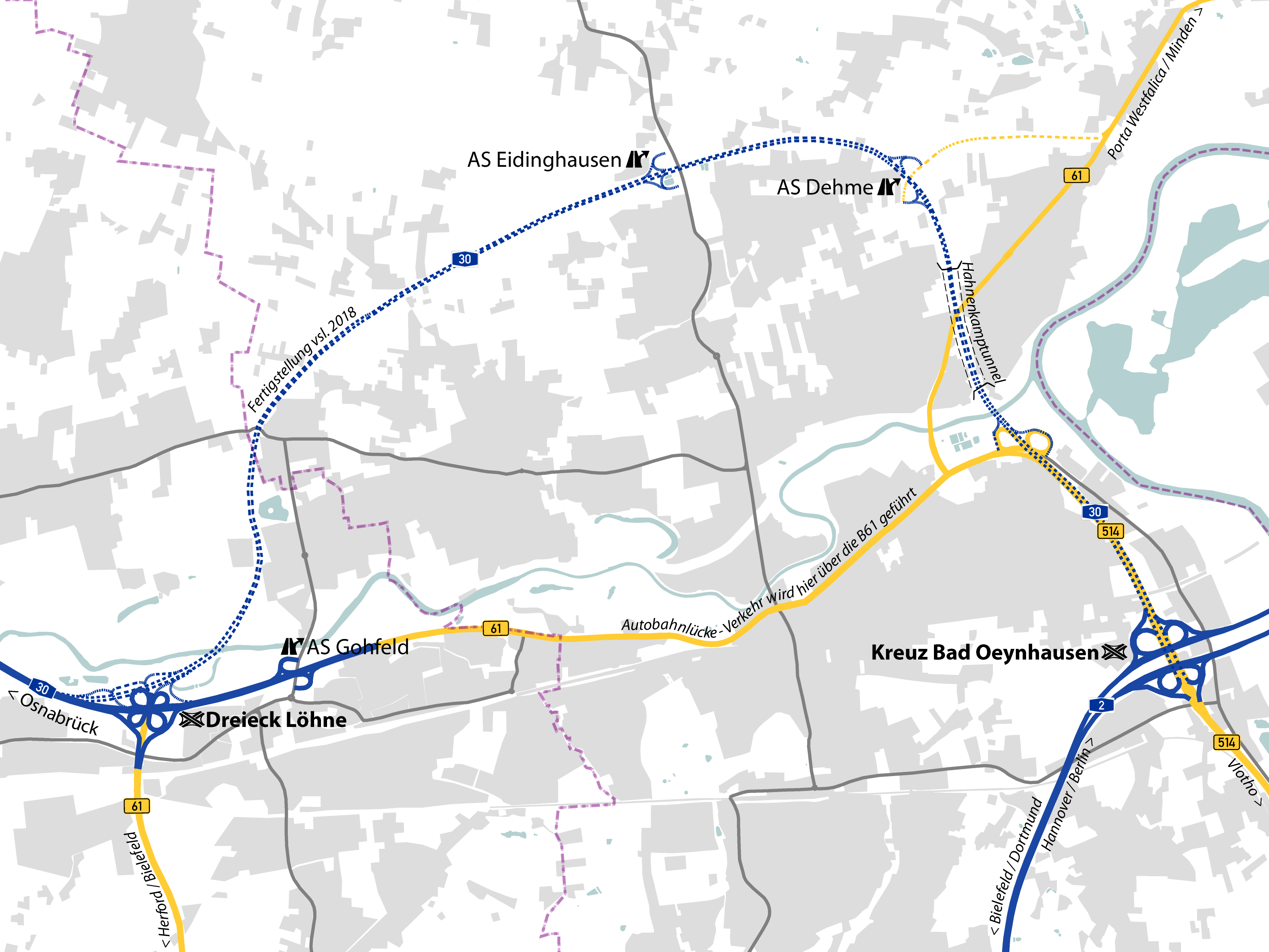
is a highway in northwestern Germany. It runs from west to east, starting at the Dutch border. On the border it connects with the Dutch A1 motorway, hence, the A 30 is part of the important European connection Berlin - Amsterdam. It is an important connection from Hannover and Minden to Osnabrück, Münster and the Netherlands, and part of European Route E 30. Course The A 30 starts as the continuation of the Dutch A1 motorway, at the Dutch border between Nordhorn and Bad Bentheim. In its course towards the east it first crosses Bundesautobahn 31 near Schüttorf, offering connections towards the Ruhr area (south) and Emden (north). It passes Rheine and near Osnabrück it crosses the A 1 and A 33, offering connections to the north in the direction of Bremen (A 1) and to the south in the direction of Münster (A 1) and Bielefeld (A 33). About 50 kilometer farther to the east the A 30 ends in Bad Oeynhausen. Traffic ... [...More Info...] [...Related Items...] OR: [Wikipedia] [Google] [Baidu] |
Cloverleaf Interchange
A cloverleaf interchange is a two-level interchange in which all turns are handled by slip roads. To go left (in right-hand traffic; reverse directions in left-driving regions), vehicles first continue as one road passes over or under the other, then exit right onto a one-way three-fourths loop ramp (270°) and merge onto the intersecting road. The objective of a cloverleaf is to allow two highways to cross without the need for any traffic to be stopped by traffic lights. The limiting factor in the capacity of a cloverleaf interchange is traffic weaving. Overview Cloverleaf interchanges, viewed from overhead or on maps, resemble the leaves of a four-leaf clover or less often a 3-leaf clover. In the United States, cloverleaf interchanges existed long before the Interstate system. They were originally created for busier interchanges that the original diamond interchange system could not handle. Their chief advantage was that they were free-flowing and did not requir ... [...More Info...] [...Related Items...] OR: [Wikipedia] [Google] [Baidu] |
Autobahn
The (; German plural ) is the federal controlled-access highway system in Germany. The official German term is (abbreviated ''BAB''), which translates as 'federal motorway'. The literal meaning of the word is 'Federal Auto(mobile) Track'. German are widely known for having no federally mandated general speed limit for some classes of vehicles. However, limits are posted and enforced in areas that are urbanised, substandard, accident-prone, or under construction. On speed-unrestricted stretches, an advisory speed limit () of applies. While driving faster is not illegal as such in the absence of a speed limit, it can cause an increased liability in the case of a collision (which mandatory auto insurance has to cover); courts have ruled that an "ideal driver" who is exempt from absolute liability for "inevitable" tort under the law would not exceed . A 2017 report by the Federal Road Research Institute reported that in 2015, 70.4% of the Autobahn network had only the advis ... [...More Info...] [...Related Items...] OR: [Wikipedia] [Google] [Baidu] |
First World War
World War I (28 July 1914 11 November 1918), often abbreviated as WWI, was one of the deadliest global conflicts in history. Belligerents included much of Europe, the Russian Empire, the United States, and the Ottoman Empire, with fighting occurring throughout Europe, the Middle East, Africa, the Pacific, and parts of Asia. An estimated 9 million soldiers were killed in combat, plus another 23 million wounded, while 5 million civilians died as a result of military action, hunger, and disease. Millions more died in genocides within the Ottoman Empire and in the 1918 influenza pandemic, which was exacerbated by the movement of combatants during the war. Prior to 1914, the European great powers were divided between the Triple Entente (comprising France, Russia, and Britain) and the Triple Alliance (containing Germany, Austria-Hungary, and Italy). Tensions in the Balkans came to a head on 28 June 1914, following the assassination of Arch ... [...More Info...] [...Related Items...] OR: [Wikipedia] [Google] [Baidu] |
Floodplain
A floodplain or flood plain or bottomlands is an area of land adjacent to a river which stretches from the banks of its channel to the base of the enclosing valley walls, and which experiences flooding during periods of high discharge.Goudie, A. S., 2004, ''Encyclopedia of Geomorphology'', vol. 1. Routledge, New York. The soils usually consist of clays, silts, sands, and gravels deposited during floods. Because the regular flooding of floodplains can deposit nutrients and water, floodplains frequently have high soil fertility; some important agricultural regions, such as the Mississippi river basin and the Nile, rely heavily on the flood plains. Agricultural regions as well as urban areas have developed near or on floodplains to take advantage of the rich soil and fresh water. However, the risk of flooding has led to increasing efforts to control flooding. Formation Most floodplains are formed by deposition on the inside of river meanders and by overbank flow. Wherev ... [...More Info...] [...Related Items...] OR: [Wikipedia] [Google] [Baidu] |
Highrise
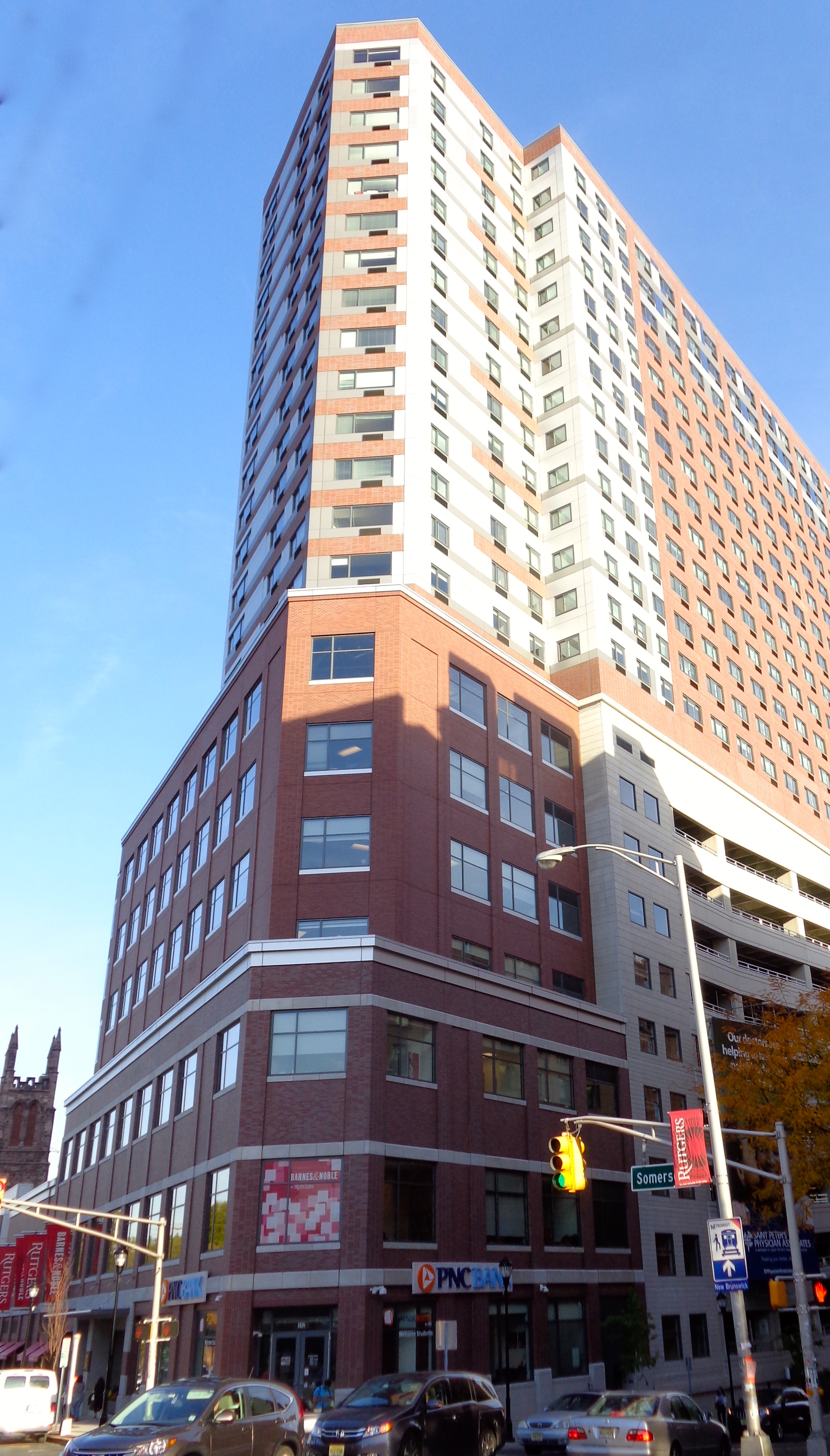
A tower block, high-rise, apartment tower, residential tower, apartment block, block of flats, or office tower is a tall building, as opposed to a low-rise building and is defined differently in terms of height depending on the jurisdiction. It is used as a residential, office building, or other functions including hotel, retail, or with multiple purposes combined. Residential high-rise buildings are also known in some varieties of English, such as British English, as tower blocks and may be referred to as MDUs, standing for multi-dwelling units. A very tall high-rise building is referred to as a skyscraper. High-rise buildings became possible to construct with the invention of the elevator (lift) and with less expensive, more abundant building materials. The materials used for the structural system of high-rise buildings are reinforced concrete and steel. Most North American-style skyscrapers have a steel frame, while residential blocks are usually constructed of concre ... [...More Info...] [...Related Items...] OR: [Wikipedia] [Google] [Baidu] |
Desert
A desert is a barren area of landscape where little precipitation occurs and, consequently, living conditions are hostile for plant and animal life. The lack of vegetation exposes the unprotected surface of the ground to denudation. About one-third of the land surface of the Earth is arid or semi-arid. This includes much of the polar regions, where little precipitation occurs, and which are sometimes called polar deserts or "cold deserts". Deserts can be classified by the amount of precipitation that falls, by the temperature that prevails, by the causes of desertification or by their geographical location. Deserts are formed by weathering processes as large variations in temperature between day and night put strains on the rocks, which consequently break in pieces. Although rain seldom occurs in deserts, there are occasional downpours that can result in flash floods. Rain falling on hot rocks can cause them to shatter, and the resulting fragments and rubble strewn over ... [...More Info...] [...Related Items...] OR: [Wikipedia] [Google] [Baidu] |


.jpg)


