|
SMSM
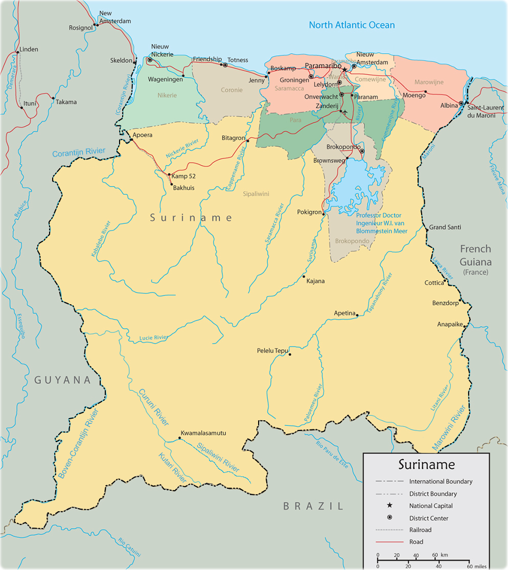
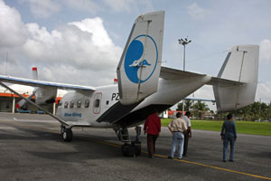
Kwamelasemoetoe Airstrip is an airport serving Kwamelasemoetoe, Suriname, a Trio Indian village in the south of Suriname in the Sipaliwini District. The name of the village means bamboo sand, named after nearby Sipaliwini River banks partly overgrown with bamboo. Kwamelasemoetoe is just east of the Tigri Area (in light grey on the map), a triangular section of land disputed with Guyana. Charters and destinations Charter Airlines serving this airport are: Accidents and incidents * On 15 October 2009, an Antonov An-28 The Antonov An-28 (NATO reporting name Cash) is a twin-engined light turboprop transport aircraft, developed from the Antonov An-14M. It was the winner of a competition against the Beriev Be-30, for use by Aeroflot as a short-range airliner. It ... of Blue Wing Airlines, registered PZ-TST, departed the runway on landing and hit an obstacle. The aircraft was substantially damaged and four people were injured, one seriously. See also * * * List of airports ... [...More Info...] [...Related Items...] OR: [Wikipedia] [Google] [Baidu] |
Kwamelasemoetoe
Kwamalasamutu, also Kwamalasamoetoe, is a Tiriyó Amerindian village in the Sipaliwini District of Suriname, and home to the granman (paramount chief) of the northern Trios. Kwamalasamutu is the biggest village of the Tiriyó tribe. History The village was built in 1971, because Alalapadu was getting too small. The population is estimated at about 1,100 as of 2020. Kwamalasamutu has a school, clinic, and a Baptist church, and since 2010 it has access to the telephone network. The economy is based on small-scale agriculture. The village is also home to small groups of the Wai Wai tribe. The last two speakers of the Mawayana language are in Kwamalasamutu as of 2015. Tourism The Werehpai archaeological site, which consists of caves containing petroglyphs of pre-Columbian origin, is located about 10 kilometres from Kwamalasamutu. Healthcare Kwamalasamutu is home to a Medische Zending healthcare centre. Energy Like most villages in the Surinamese interior, Kwamalasamutu reli ... [...More Info...] [...Related Items...] OR: [Wikipedia] [Google] [Baidu] |
Gum Air
Gum Air is a Surinamese airline based at Zorg en Hoop Airport in Paramaribo, Suriname. Gum Air cooperates with Trans Guyana Airways to provide daily flights between Zorg en Hoop Airport, Zorg en Hoop Airport (ORG) in Paramaribo, Suriname and Ogle Airport, Ogle Airport (OGL) in Georgetown, Guyana. History Gum Air was founded in 1971 by six brothers of the Gummels family. The company they started in March 1964 was agriculture airspray company named Surinam Sky Farmers and Gum Air its offspring focused more on domestic flights and regional charters. Whereas Surinam Sky Farmers has its base in the rice district of Nickerie District, Nickerie at the Wageningen Airstrip together with Overeem Air Service maintaining Grumman Ag Cat aircraft, Gum Air has set up its domestic airline at the Zorg en Hoop Airport in the city. Current operation Gum Air has its base at Zorg en Hoop airfield in the capital city Paramaribo and now mainly flies with single engine Cessna airplanes and twin-engin ... [...More Info...] [...Related Items...] OR: [Wikipedia] [Google] [Baidu] |
List Of Airports In Suriname
This is a list of airports in Suriname, sorted by location. Suriname, officially the Republic of Suriname, is a country in northern South America. It is situated between French Guiana to the east and Guyana to the west. The southern border is shared with Brazil and the northern border is the Atlantic coast. Suriname is the smallest sovereign state in terms of area and population in South America. The country is the only Dutch-speaking region in the Western Hemisphere that is not a part of the Kingdom of the Netherlands. __TOC__ Airports Airport names shown in bold indicate the airport has scheduled service on commercial airlines. Airports with unverified coordinates: Map See also * Transport in Suriname * Operation Grasshopper * List of airports by ICAO code: S#SM - Suriname * Wikipedia: WikiProject Aviation/Airline destination lists: South America#Suriname References Civil Aviation Department of Suriname* * - includes IATA codes World Aero Data: Airports ... [...More Info...] [...Related Items...] OR: [Wikipedia] [Google] [Baidu] |
Luchtvaartdienst Suriname
The Luchtvaartdienst Suriname is the Civil Aviation Department of the Suriname Ministry of Transport, Communication and Tourism. It is responsible for the regulation of all aviation activities in the country, and ensures that all activities are carried out in compliance with international standards. It is a member of the International Civil Aviation Organization The International Civil Aviation Organization (ICAO, ) is a specialized agency of the United Nations that coordinates the principles and techniques of international air navigation, and fosters the planning and development of international sc ... (ICAO). In April 2010, John Veira, the head of Luchtvaartdienst Suriname, was killed in his home by gunmen. Dutch language Airports and Airst ...
|
Suriname
Suriname (; srn, Sranankondre or ), officially the Republic of Suriname ( nl, Republiek Suriname , srn, Ripolik fu Sranan), is a country on the northeastern Atlantic coast of South America. It is bordered by the Atlantic Ocean to the north, French Guiana to the east, Guyana to the west, and Brazil to the south. At just under , it is the smallest sovereign state in South America. It has a population of approximately , dominated by descendants from the slaves and labourers brought in from Africa and Asia by the Dutch Empire and Republic. Most of the people live by the country's (north) coast, in and around its capital and largest city, Paramaribo. It is also List of countries and dependencies by population density, one of the least densely populated countries on Earth. Situated slightly north of the equator, Suriname is a tropical country dominated by rainforests. Its extensive tree cover is vital to the country's efforts to Climate change in Suriname, mitigate climate ch ... [...More Info...] [...Related Items...] OR: [Wikipedia] [Google] [Baidu] |
Sipaliwini District
Sipaliwini is the largest district of Suriname, located in the south. Sipaliwini is the only district that does not have a regional capital, as it is directly administered by the national government in Paramaribo. History Sipaliwini was created in 1983 and has a population of 37,065 and an area of The district is nearly 4 times as large as the other 9 districts of Suriname combined; however, most of the Sipaliwini is almost completely covered by rainforest. To create the district, the Nickerie District was reduced from to Sipaliwini is the tribal area inhabited by Maroons and indigenous people. Various peace treaties starting in 1686 had recognised autonomy for the tribes over their own area; however, a specific delineation of the tribal area had been lacking. The name is of Amerindian origin, refers to the Sipaliwini River, and means "river of stones or rocks". It is thought by archaeologists that hunter-gatherers lived in what is today Sipaliwini district during the Paleolith ... [...More Info...] [...Related Items...] OR: [Wikipedia] [Google] [Baidu] |
Sipaliwini River
Sipaliwini River is a river of Suriname, the main source of the Courantyne River. It gives its name to the village of Sipaliwini Savanna and to the Sipaliwini District. It flows through the village of Kwamalasamutu. The name translates to thornback ray (''sipari'') river in the local Maroon dialect. See also *List of rivers of Suriname A ''list'' is any set of items in a row. List or lists may also refer to: People * List (surname) Organizations * List College, an undergraduate division of the Jewish Theological Seminary of America * SC Germania List, German rugby unio ... References *Rand McNally, The New International Atlas, 1993. Rivers of Suriname {{Suriname-river-stub ... [...More Info...] [...Related Items...] OR: [Wikipedia] [Google] [Baidu] |
Tigri Area
The Tigri Area ( nl, Tigri-gebied) is a wooded area that has been disputed by Guyana and Suriname since around 1840. It involves the area between the Upper Corentyne River (also called the New River), the Coeroeni River, and the Kutari River. This triangular area is known as the New River Triangle in Guyana. In 1969 the conflict ran high on, and since then it has been controlled by Guyana and claimed by Suriname. In 1971, both governments agreed that they would continue talks over the border issue and withdraw their military forces from the disputed triangle. Guyana has never held upon this agreement. In Suriname it is seen as a part of the Coeroeni Resort located in the Sipaliwini District, while Guyana views it as part of the region of East Berbice-Corentyne. History The Anglo-Dutch Treaty of 1814 set the border between British Guiana and Suriname as the Courantyne River. The treaty was signed and ratified by both parties. Robert Schomburgk surveyed British Guiana's bor ... [...More Info...] [...Related Items...] OR: [Wikipedia] [Google] [Baidu] |
Guyana
Guyana ( or ), officially the Cooperative Republic of Guyana, is a country on the northern mainland of South America. Guyana is an indigenous word which means "Land of Many Waters". The capital city is Georgetown. Guyana is bordered by the Atlantic Ocean to the north, Brazil to the south and southwest, Venezuela to the west, and Suriname to the east. With , Guyana is the third-smallest sovereign state by area in mainland South America after Uruguay and Suriname, and is the second-least populous sovereign state in South America after Suriname; it is also one of the least densely populated countries on Earth. It has a wide variety of natural habitats and very high biodiversity. The region known as "the Guianas" consists of the large shield landmass north of the Amazon River and east of the Orinoco River known as the "land of many waters". Nine indigenous tribes reside in Guyana: the Wai Wai, Macushi, Patamona, Lokono, Kalina, Wapishana, Pemon, Akawaio and Warao. Histo ... [...More Info...] [...Related Items...] OR: [Wikipedia] [Google] [Baidu] |
Blue Wing Airlines
Blue Wing Airlines n.v. is an airline with its head office on the grounds of Zorg en Hoop Airport in Paramaribo, Suriname.Eight feared dead in Suriname air crash " ''''. 16 May 2010. Retrieved on 17 May 2010. The airline started operations in January 2002 and operates charter and scheduled services from to destinations in the interior of , |
Zorg En Hoop Airport
Zorg en Hoop Airport is an airport serving general aviation in the city of Paramaribo, Suriname. It is west of the Suriname River, between the city quarters of Zorg en Hoop and Flora. The runway length includes a displaced threshold on Runway 11. The airport is suitable for charters and regular services with smaller aircraft, and for helicopter flights. Connection is maintained from the airport for several smaller airports in the interior of Suriname, and for charter flights to the Caribbean. The only regular international service is to Georgetown, Guyana Georgetown is the capital (political), capital and largest city of Guyana. It is situated in Demerara-Mahaica, region 4, on the Atlantic Ocean coast, at the mouth of the Demerara River. It is nicknamed the "Garden City of the Caribbean." It is t ..., with flights operated by Trans Guyana Airways and Gum Air with smaller propeller aircraft. Airlines operating jet aircraft serve Paramaribo via Johan Adolf Pengel Internation ... [...More Info...] [...Related Items...] OR: [Wikipedia] [Google] [Baidu] |
.jpg)

.jpg)
