|
Rishton
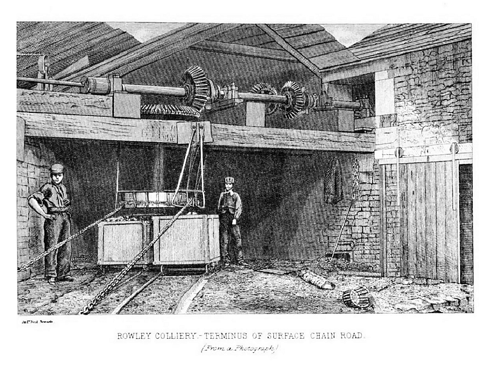
Rishton is a town in the Hyndburn district of Lancashire, England, about west of Clayton-le-Moors and north east of Blackburn. It was an urban district from about 1894 to 1974. The population at the census of 2011 was 6,625. History Its name means “village (or farmstead) where rushes grow”. In late 1776, a handloom weavers shop in Rishton, belonging to Thomas Duxbury may have been the first place that the cotton cloth calico was woven for sale in Great Britain. Rishton Colliery on the Burnley Coalfield was begun by P.W. Pickup Ltd in late November 1884 and mining continued until 1941. A tramroad from the pit connected to a coaling wharf on the canal. The National Coal Board used it as a pumping station from 1955 until 1970. Governance The two tiers of local government are Hyndburn Borough Council (a non-metropolitan district with borough status) and Lancashire County Council. Prior to the creation of Hyndburn district in 1974, Rishton had been an urban district, ... [...More Info...] [...Related Items...] OR: [Wikipedia] [Google] [Baidu] |
Hyndburn
Hyndburn is a Non-metropolitan district, local government district with borough status in the United Kingdom, borough status in Lancashire, England. Its council is based in Accrington and covers the outlying towns of Clayton-le-Moors, Great Harwood, Oswaldtwistle and Rishton. The borough was created in 1974 and takes its name from the River Hyndburn. It had a population of 80,734 at the 2011 United Kingdom census, 2011 Census. Elections to the council are held in three out of every four years, with one third of the 35 seats on the council being elected at each election. Both the Conservative Party (UK), Conservative and UK Labour Party, Labour parties have controlled the council at different times, as well as periods when no party has had a majority. History The district was created on 1 April 1974 under the Local Government Act 1972, as a non-metropolitan district covering the territory of six former districts, which were abolished at the same time, plus a single parish from a ... [...More Info...] [...Related Items...] OR: [Wikipedia] [Google] [Baidu] |
Hyndburn Borough Council
Hyndburn is a local government district with borough status in Lancashire, England. Its council is based in Accrington and covers the outlying towns of Clayton-le-Moors, Great Harwood, Oswaldtwistle and Rishton. The borough was created in 1974 and takes its name from the River Hyndburn. It had a population of 80,734 at the 2011 Census. Elections to the council are held in three out of every four years, with one third of the 35 seats on the council being elected at each election. Both the Conservative and Labour parties have controlled the council at different times, as well as periods when no party has had a majority. History The district was created on 1 April 1974 under the Local Government Act 1972, as a non-metropolitan district covering the territory of six former districts, which were abolished at the same time, plus a single parish from a seventh district: * Accrington Municipal Borough * Altham parish from Burnley Rural District *Church Urban District *Clayton-le ... [...More Info...] [...Related Items...] OR: [Wikipedia] [Google] [Baidu] |
Accrington
Accrington is a town in the Hyndburn borough of Lancashire, England. It lies about east of Blackburn, west of Burnley, east of Preston, north of Manchester and is situated on the culverted River Hyndburn. Commonly abbreviated by locals to "Accy", the town has a population of 35,456 according to the 2011 census. Accrington is a former centre of the cotton and textile machinery industries. The town is famed for manufacturing the hardest and densest building bricks in the world, "The Accrington NORI" (iron), which were used in the construction of the Empire State Building and for the foundations of Blackpool Tower; famous for Accrington Stanley F.C. and the Haworth Art Gallery which holds Europe's largest collection of Tiffany glass. History Origin of the name The name Accrington appears to be Anglo-Saxon in origin. The earliest citing appears in the Parish of Whalley records of 850; where it is written ''Akeringastun''. In later records, the name variously appears as ... [...More Info...] [...Related Items...] OR: [Wikipedia] [Google] [Baidu] |
Burnley Coalfield
The Burnley Coalfield is the most northerly portion of the Lancashire Coalfield. Surrounding Burnley, Nelson, Blackburn and Accrington, it is separated from the larger southern part by an area of Millstone Grit that forms the Rossendale anticline. Occupying a syncline, it stretches from Blackburn past Colne to the Yorkshire border where its eastern flank is the Pennine anticline. Geography and geology The Burnley Coalfield which surrounds Burnley, Nelson, Blackburn and Accrington is the most northerly portion of the Lancashire Coalfield. The Rossendale anticline, an area of Millstone Grit, separates it from the larger southern part of the coalfield. Occupying a syncline bounded by the Pendle monocline to the north, the coalfield stretches from Blackburn, eastwards past Colne to the Pennine anticline on the border with Yorkshire. The coalfield's seams are the Westphalian Coal Measures of the Carboniferous period, laid down from the vegetation of tropical swampy forests more t ... [...More Info...] [...Related Items...] OR: [Wikipedia] [Google] [Baidu] |
Clayton-le-Moors
Clayton-le-Moors is an industrial town in the borough of Hyndburn in the county of Lancashire, England. located two miles north of Accrington. The town has a population of 8,522 according to the 2011 census. To the west lies Rishton, to the north Great Harwood, and two miles to the south, Accrington. Clayton-le-Moors is situated on the A680 road alongside the M65 motorway. History It is thought that the town developed with the fusion of the two hamlets of Oakenshaw (bottom end) and Enfield (top end) which began during the construction of the Leeds Liverpool Canal, which pre-dated the railways. The merger continued with the development of the cotton textile industry, particularly that of weaving and cloth finishing. The stretch of canal between Burnley and Enfield Wharf (now alongside the Enfield Bridge on Blackburn Road) was opened in 1801. By 1808 it had been extended to Church. The final link up between Leeds and Liverpool was completed 1816. Clayton-le-Moors now lies ... [...More Info...] [...Related Items...] OR: [Wikipedia] [Google] [Baidu] |
Blackburn
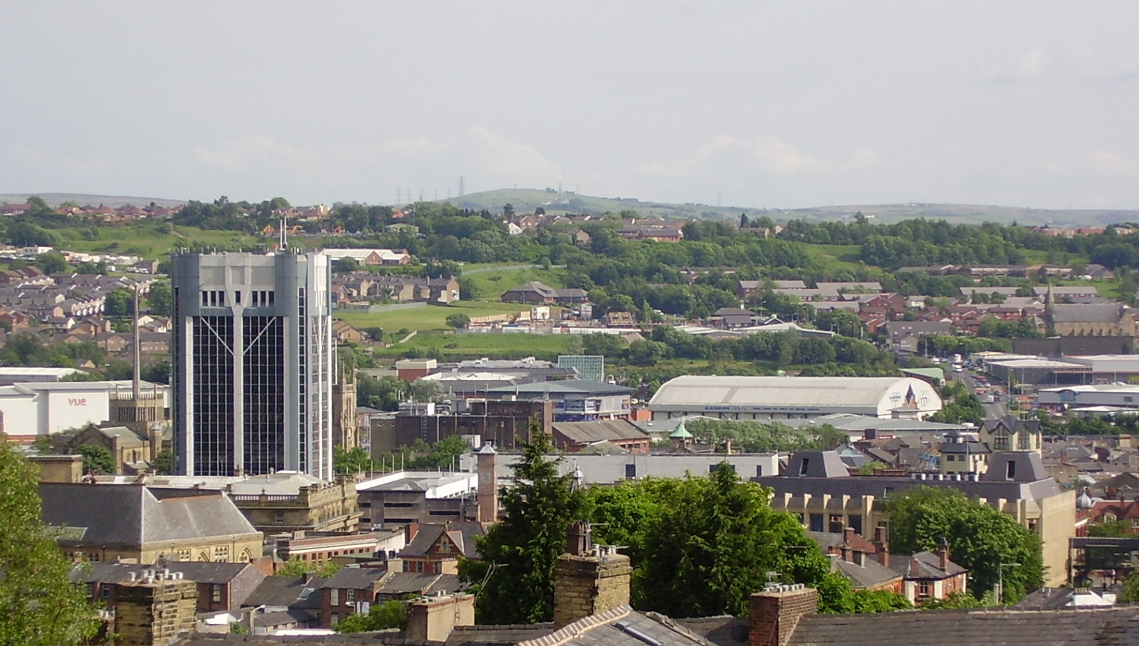
Blackburn () is an industrial town and the administrative centre of the Blackburn with Darwen borough in Lancashire, England. The town is north of the West Pennine Moors on the southern edge of the Ribble Valley, east of Preston and north-northwest of Manchester. Blackburn is the core centre of the wider unitary authority area along with the town of Darwen. It is one of the largest districts in Lancashire, with commuter links to neighbouring cities of Manchester, Salford, Preston, Lancaster, Liverpool, Bradford and Leeds. At the 2011 census, Blackburn had a population of 117,963, whilst the wider borough of Blackburn with Darwen had a population of 150,030. Blackburn had a population of 117,963 in 2011, with 30.8% being people of ethnic backgrounds other than white British. A former mill town, textiles have been produced in Blackburn since the middle of the 13th century, when wool was woven in people's houses in the domestic system. Flemish weavers who settled in t ... [...More Info...] [...Related Items...] OR: [Wikipedia] [Google] [Baidu] |
Lancashire
Lancashire ( , ; abbreviated Lancs) is the name of a historic county, ceremonial county, and non-metropolitan county in North West England. The boundaries of these three areas differ significantly. The non-metropolitan county of Lancashire was created by the Local Government Act 1972. It is administered by Lancashire County Council, based in Preston, and twelve district councils. Although Lancaster is still considered the county town, Preston is the administrative centre of the non-metropolitan county. The ceremonial county has the same boundaries except that it also includes Blackpool and Blackburn with Darwen, which are unitary authorities. The historic county of Lancashire is larger and includes the cities of Manchester and Liverpool as well as the Furness and Cartmel peninsulas, but excludes Bowland area of the West Riding of Yorkshire transferred to the non-metropolitan county in 1974 History Before the county During Roman times the area was part of th ... [...More Info...] [...Related Items...] OR: [Wikipedia] [Google] [Baidu] |
River Hyndburn
The River Hyndburn is a minor river in Lancashire, England. Beginning as Woodnook Water on the slopes of Goodshaw Hill, it passes through Stone Fold, Rising Bridge and Baxenden where it is augmented by streams from Thirteen Stone Hill and continues to the Woodnook area of Accrington. Near St James Church, it collects Broad Oak Water (recorded in 1800 as the River Grange), becoming the River Hyndburn. It heads northward through the town centre, collecting Pleck Brook and turning west, flowing under the East Lancashire railway line viaduct and continuing to Church. Here it turns northward again, meeting Hyndburn Brook just before it passes under the M65 motorway bridge to the south of Dunkenhalgh, which continues past Clayton-le-Moors and Great Harwood, ultimately joining the River Calder. Today, much of the course of the river and parts of its tributaries run underground through culverts. The Hyndburn borough of Lancashire is named after the river. Meaning of the river name ... [...More Info...] [...Related Items...] OR: [Wikipedia] [Google] [Baidu] |
Hyndburn (UK Parliament Constituency)
Hyndburn is a constituency represented in the House of Commons of the UK Parliament since 2019 by Sara Britcliffe of the Conservative Party. History and profile The seat was created in 1983, from parts of the former seats of Accrington and Clitheroe. In its ambit is much terraced ( freehold) owner occupied housing and surrounding villages, that may have helped to win the constituency for a Conservative in 1983, by 21 votes. The Conservative majority in 1983 was the second smallest achieved by any party in a seat in the United Kingdom at that election, only being beaten by the Conservatives 7 vote majority in Leicester South In 1987, against the national trend, the Conservative vote share increased by 2.1% while Labour's vote share fell by 2.4%. Consequently, the Conservatives increased their majority to 2,220 votes, a higher majority than it achieved in 31 other seats. Labour won it in 1992, and chose a new candidate for 2010, Graham Jones, who was elected. Part of Labour's ... [...More Info...] [...Related Items...] OR: [Wikipedia] [Google] [Baidu] |
White British
White British is an ethnicity classification used for the native white population identifying as English, Scottish, Welsh, Cornish, Northern Irish, or British in the United Kingdom Census. In the 2011 census, the White British population was 51,736,290, 81.88% of the UK total population (NB: This total includes the population estimate for Northern Ireland, where only the term 'White' is used in ethnic classification. National identity is listed separately in NI, where 40% classified themselves as British, making up a significant portion of the population, along with those specifying their national identity as Irish). Census classifications For the 2011 census, in England and Wales, the White self-classification option included a subcategory of " English/ Welsh/ Scottish/ Northern Irish/British". [...More Info...] [...Related Items...] OR: [Wikipedia] [Google] [Baidu] |
Office For National Statistics
The Office for National Statistics (ONS; cy, Swyddfa Ystadegau Gwladol) is the executive office of the UK Statistics Authority, a non-ministerial department which reports directly to the UK Parliament. Overview The ONS is responsible for the collection and publication of statistics related to the economy, population and society of the UK; responsibility for some areas of statistics in Scotland, Northern Ireland and Wales is devolved to the devolved governments for those areas. The ONS functions as the executive office of the National Statistician, who is also the UK Statistics Authority's Chief Executive and principal statistical adviser to the UK's National Statistics Institute, and the 'Head Office' of the Government Statistical Service (GSS). Its main office is in Newport near the United Kingdom Intellectual Property Office and Tredegar House, but another significant office is in Titchfield in Hampshire, and a small office is in London. ONS co-ordinates data collection ... [...More Info...] [...Related Items...] OR: [Wikipedia] [Google] [Baidu] |
United Kingdom Census, 2011
A census of the population of the United Kingdom is taken every ten years. The 2011 census was held in all countries of the UK on 27 March 2011. It was the first UK census which could be completed online via the Internet. The Office for National Statistics (ONS) is responsible for the census in England and Wales, the General Register Office for Scotland (GROS) is responsible for the census in Scotland, and the Northern Ireland Statistics and Research Agency (NISRA) is responsible for the census in Northern Ireland. The Office for National Statistics is the executive office of the UK Statistics Authority, a non-ministerial department formed in 2008 and which reports directly to Parliament. ONS is the UK Government's single largest statistical producer of independent statistics on the UK's economy and society, used to assist the planning and allocation of resources, policy-making and decision-making. ONS designs, manages and runs the census in England and Wales. In its capacity as ... [...More Info...] [...Related Items...] OR: [Wikipedia] [Google] [Baidu] |


