|
River Dee, Galloway
The River Dee ( gd, Dè / Uisge Dhè), in south-west Scotland, flows from its source in Loch Dee amongst the Galloway Hills, firstly to Clatteringshaws Loch, then into Loch Ken, where it joins the Water of Ken. From there, the Dee flows southwards to Kirkcudbright, and into Kirkcudbright Bay to reach the Solway Firth. The distance is just over in total. Together with its tributaries, the Dee's total catchment area is over . The river is dammed at Tongland, two miles (3 km) upriver from Kirkcudbright. This was constructed as part of the Galloway hydro-electric power scheme in the 1930s. Also at this site is Tongland Bridge, built in 1806 by Thomas Telford. The ruins of Threave Castle stand on an island on the lower part of the Dee. In Ptolemy's 2nd century work ''Geography'' it is recorded as ''Dēoúa''. This form represents a development of Proto-Indo-European'' *deiueh2-'' 'a goddess', which occurs in many Celtic river-names. The Dee has also been known as the ... [...More Info...] [...Related Items...] OR: [Wikipedia] [Google] [Baidu] |
Scotland
Scotland (, ) is a country that is part of the United Kingdom. Covering the northern third of the island of Great Britain, mainland Scotland has a border with England to the southeast and is otherwise surrounded by the Atlantic Ocean to the north and west, the North Sea to the northeast and east, and the Irish Sea to the south. It also contains more than 790 islands, principally in the archipelagos of the Hebrides and the Northern Isles. Most of the population, including the capital Edinburgh, is concentrated in the Central Belt—the plain between the Scottish Highlands and the Southern Uplands—in the Scottish Lowlands. Scotland is divided into 32 administrative subdivisions or local authorities, known as council areas. Glasgow City is the largest council area in terms of population, with Highland being the largest in terms of area. Limited self-governing power, covering matters such as education, social services and roads and transportation, is devolved from the Scott ... [...More Info...] [...Related Items...] OR: [Wikipedia] [Google] [Baidu] |
Ptolemy
Claudius Ptolemy (; grc-gre, Πτολεμαῖος, ; la, Claudius Ptolemaeus; AD) was a mathematician, astronomer, astrologer, geographer, and music theorist, who wrote about a dozen scientific treatises, three of which were of importance to later Byzantine, Islamic, and Western European science. The first is the astronomical treatise now known as the '' Almagest'', although it was originally entitled the ''Mathēmatikē Syntaxis'' or ''Mathematical Treatise'', and later known as ''The Greatest Treatise''. The second is the ''Geography'', which is a thorough discussion on maps and the geographic knowledge of the Greco-Roman world. The third is the astrological treatise in which he attempted to adapt horoscopic astrology to the Aristotelian natural philosophy of his day. This is sometimes known as the ''Apotelesmatika'' (lit. "On the Effects") but more commonly known as the '' Tetrábiblos'', from the Koine Greek meaning "Four Books", or by its Latin equivalent ''Quadrip ... [...More Info...] [...Related Items...] OR: [Wikipedia] [Google] [Baidu] |
Cognate
In historical linguistics, cognates or lexical cognates are sets of words in different languages that have been inherited in direct descent from an etymology, etymological ancestor in a proto-language, common parent language. Because language change can have radical effects on both the sound and the meaning of a word, cognates may not be obvious, and often it takes rigorous study of historical sources and the application of the comparative method to establish whether lexemes are cognate or not. Cognates are distinguished from Loanword, loanwords, where a word has been borrowed from another language. The term ''cognate'' derives from the Latin noun '':wikt:cognatus, cognatus blood relative'. Characteristics Cognates need not have the same meaning, which semantic drift, may have changed as the languages developed independently. For example English language, English ''wikt:starve#English, starve'' and Dutch language, Dutch ''wikt:sterven#Dutch, sterven'' 'to die' or German languag ... [...More Info...] [...Related Items...] OR: [Wikipedia] [Google] [Baidu] |
Cumbric
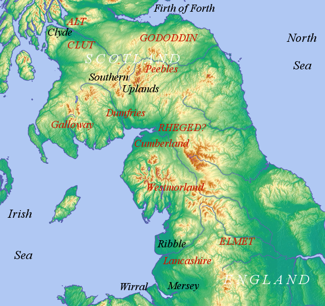
Cumbric was a variety of the Common Brittonic language spoken during the Early Middle Ages in the ''Hen Ogledd'' or "Old North" in what is now the counties of Westmorland, Cumberland and northern Lancashire in Northern England and the southern Scottish Lowlands. It was closely related to Old Welsh and the other Brittonic languages. Place name evidence suggests Cumbric may also have been spoken as far south as Pendle and the Yorkshire Dales. The prevailing view is that it became extinct in the 12th century, after the incorporation of the semi-independent Kingdom of Strathclyde into the Kingdom of Scotland. Problems with terminology Dauvit Broun sets out the problems with the various terms used to describe the Cumbric language and its speakers.Broun, Dauvit (2004): 'The Welsh identity of the kingdom of Strathclyde, ca 900-ca 1200', ''Innes Review'' 55, pp 111–80. The people seem to have called themselves the same way that the Welsh called themselves (most likely from recon ... [...More Info...] [...Related Items...] OR: [Wikipedia] [Google] [Baidu] |
Scottish Gaelic
Scottish Gaelic ( gd, Gàidhlig ), also known as Scots Gaelic and Gaelic, is a Goidelic language (in the Celtic branch of the Indo-European language family) native to the Gaels of Scotland. As a Goidelic language, Scottish Gaelic, as well as both Irish and Manx, developed out of Old Irish. It became a distinct spoken language sometime in the 13th century in the Middle Irish period, although a common literary language was shared by the Gaels of both Ireland and Scotland until well into the 17th century. Most of modern Scotland was once Gaelic-speaking, as evidenced especially by Gaelic-language place names. In the 2011 census of Scotland, 57,375 people (1.1% of the Scottish population aged over 3 years old) reported being able to speak Gaelic, 1,275 fewer than in 2001. The highest percentages of Gaelic speakers were in the Outer Hebrides. Nevertheless, there is a language revival, and the number of speakers of the language under age 20 did not decrease between the 2001 and ... [...More Info...] [...Related Items...] OR: [Wikipedia] [Google] [Baidu] |
Aurochs
The aurochs (''Bos primigenius'') ( or ) is an extinct cattle species, considered to be the wild ancestor of modern domestic cattle. With a shoulder height of up to in bulls and in cows, it was one of the largest herbivores in the Holocene; it had massive elongated and broad horns that reached in length. The aurochs was part of the Pleistocene megafauna. It probably evolved in Asia and migrated west and north during warm interglacial periods. The oldest known aurochs fossils found in India and North Africa date to the Middle Pleistocene and in Europe to the Holstein interglacial. As indicated by fossil remains in Northern Europe, it reached Denmark and southern Sweden during the Holocene. The aurochs declined during the late Holocene due to habitat loss and hunting, and became extinct when the last individual died in 1627 in Jaktorów forest in Poland. The aurochs is depicted in Paleolithic cave paintings, Neolithic petroglyphs, Ancient Egyptian reliefs and Bronze ... [...More Info...] [...Related Items...] OR: [Wikipedia] [Google] [Baidu] |
Bull
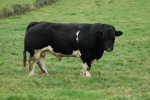
A bull is an intact (i.e., not castrated) adult male of the species ''Bos taurus'' (cattle). More muscular and aggressive than the females of the same species (i.e., cows), bulls have long been an important symbol in many religions, including for sacrifices. These animals play a significant role in beef ranching, dairy farming, and a variety of sporting and cultural activities, including bullfighting and bull riding. Due to their temperament, handling requires precautions. Nomenclature The female counterpart to a bull is a cow, while a male of the species that has been castrated is a ''steer'', '' ox'', or ''bullock'', although in North America, this last term refers to a young bull. Use of these terms varies considerably with area and dialect. Colloquially, people unfamiliar with cattle may refer to both castrated and intact animals as "bulls". A wild, young, unmarked bull is known as a ''micky'' in Australia.Sheena Coupe (ed.), ''Frontier Country, Vol. 1'' (Weldon R ... [...More Info...] [...Related Items...] OR: [Wikipedia] [Google] [Baidu] |
River Bladnoch
The Bladnoch is a river in Wigtownshire in the Machars of Galloway in southwest Scotland. One of the earliest descriptions of it is given by Sir Andrew Agnew of Lochnaw and Sir David Dunbar in an appendix to Andrew Symson's work "A Large Description of Galloway" written in the 17th century. In this they state that: Course The river Bladnoch rises at Loch Maberry in the parish of Kirkcowan, through which it runs south to Polbae. On its journey south it is joined by Reoch Burn as it passes through Carseriggan Moor. Continuing its journey it passes Isle-na-Gower and becomes a border between the afforested land at Hopeless Howe and the Ring of Barfad. Shortly after this it is met and joined by Black Burn. At this point the river is bordered on its east side by Barnley Plantation. Crossing the river at the stepping stones is a single-track road which links Mark of Shennanton with Little Eldrig. Shortly after this point the river widens briefly at Broad Wheel. Continuing on its journey ... [...More Info...] [...Related Items...] OR: [Wikipedia] [Google] [Baidu] |
Tarf Water, Wigtownshire
The Tarf Water is a river in the former county of Wigtownshire in south-west Scotland. It rises on the Ayrshire border and flows in a generally southeastward direction to meet the River Bladnoch near the village of Kirkcowan It has no major tributaries but is fed by several burns that drain an area characterised by drumlins and much of which has been afforested.Ordnance Survey 1:50,000 scale Landranger map sheets 76 ''Girvan'' and 82 ''Stranraer & Glenluce'' The name Tarf derives from the Proto-Indo-European root ''*tauro-'' 'bull, aurochs'. Bulls occur frequently in Celtic river names, and these names may have had a mythological rather than literal referent. Like other examples of this name in southern Scotland, 'Tarf' is Gaelic in form but is likely to derive in turn from an earlier Cumbric Cumbric was a variety of the Common Brittonic language spoken during the Early Middle Ages in the ''Hen Ogledd'' or "Old North" in what is now the counties of Westmorland, Cumberla ... [...More Info...] [...Related Items...] OR: [Wikipedia] [Google] [Baidu] |
Loch Mannoch
''Loch'' () is the Scottish Gaelic, Scots and Irish word for a lake or sea inlet. It is cognate with the Manx lough, Cornish logh, and one of the Welsh words for lake, llwch. In English English and Hiberno-English, the anglicised spelling lough is commonly found in place names; in Lowland Scots and Scottish English, the spelling "loch" is always used. Many loughs are connected to stories of lake-bursts, signifying their mythical origin. Sea-inlet lochs are often called sea lochs or sea loughs. Some such bodies of water could also be called firths, fjords, estuaries, straits or bays. Background This name for a body of water is Insular CelticThe current form has currency in the following languages: Scottish Gaelic, Irish, Manx, and has been borrowed into Lowland Scots, Scottish English, Irish English and Standard English. in origin and is applied to most lakes in Scotland and to many sea inlets in the west and north of Scotland. The word comes from Proto-Indo-European ... [...More Info...] [...Related Items...] OR: [Wikipedia] [Google] [Baidu] |
Ringford
Ringford is a village in the historical county of Kirkcudbrightshire in Dumfries and Galloway located at beside the Tarff Water. It is about north of the fishing town of Kirkcudbright. It has a war memorial and a village hall. The Kirkcudbright Railway The Kirkcudbright Railway was a railway branch line linking Kirkcudbright to the Castle Douglas and Dumfries Railway at Castle Douglas. It opened in 1864, and closed in 1965. Formation and construction By 1861 railways were at last being co ... used to run past the village, the nearest stop being Tarff. Villages in Dumfries and Galloway {{DumfriesGalloway-geo-stub ... [...More Info...] [...Related Items...] OR: [Wikipedia] [Google] [Baidu] |


