|
Quapaw Agency
The Quapaw Indian Agency was a territory that included parts of the present-day Oklahoma counties of Ottawa and Delaware. Established in the late 1830s as part of lands allocated to the Cherokee Nation, this area was later leased by the federal government and known as the Leased District. The area that became known as the Quapaw Agency Lands contained 220,000 acres and was located in the northeastern corner of Oklahoma where that state adjoins Missouri and Kansas. After the Civil War, the Cherokee were forced to cede the land and the US assigned it to several other tribes. This area was settled prior to 1874 by 24 Indian groups. These range from full Indian tribes down to the remnants of several larger Indian groups whose main body settled elsewhere. The agency was disbanded in 1890 by the Oklahoma Organic Act, which was designed to extinguish tribal communal land claims. The land was attached to an Indian Territory prior to passage of the Dawes Act and distribution of plots to in ... [...More Info...] [...Related Items...] OR: [Wikipedia] [Google] [Baidu] |
Ottawa County, Oklahoma
Ottawa County is a county located in the northeastern corner of the U.S. state of Oklahoma. As of the 2020 census, the population was 30,285. Its county seat is Miami. The county was named for the Ottawa Tribe of Oklahoma. O'Dell, Larry. ''Encyclopedia of Oklahoma History & Culture''. "Ottawa County." Retrieved March 6, 2015. It is also the location of the federally recognized Modoc Nation and the , which is based in |
Ohio
Ohio () is a state in the Midwestern region of the United States. Of the fifty U.S. states, it is the 34th-largest by area, and with a population of nearly 11.8 million, is the seventh-most populous and tenth-most densely populated. The state's capital and largest city is Columbus, with the Columbus metro area, Greater Cincinnati, and Greater Cleveland being the largest metropolitan areas. Ohio is bordered by Lake Erie to the north, Pennsylvania to the east, West Virginia to the southeast, Kentucky to the southwest, Indiana to the west, and Michigan to the northwest. Ohio is historically known as the "Buckeye State" after its Ohio buckeye trees, and Ohioans are also known as "Buckeyes". Its state flag is the only non-rectangular flag of all the U.S. states. Ohio takes its name from the Ohio River, which in turn originated from the Seneca word ''ohiːyo'', meaning "good river", "great river", or "large creek". The state arose from the lands west of the Appalachian Mountai ... [...More Info...] [...Related Items...] OR: [Wikipedia] [Google] [Baidu] |
Mississippi River
The Mississippi River is the second-longest river and chief river of the second-largest drainage system in North America, second only to the Hudson Bay drainage system. From its traditional source of Lake Itasca in northern Minnesota, it flows generally south for to the Mississippi River Delta in the Gulf of Mexico. With its many tributaries, the Mississippi's watershed drains all or parts of 32 U.S. states and two Canadian provinces between the Rocky and Appalachian mountains. The main stem is entirely within the United States; the total drainage basin is , of which only about one percent is in Canada. The Mississippi ranks as the thirteenth-largest river by discharge in the world. The river either borders or passes through the states of Minnesota, Wisconsin, Iowa, Illinois, Missouri, Kentucky, Tennessee, Arkansas, Mississippi, and Louisiana. Native Americans have lived along the Mississippi River and its tributaries for thousands of years. Most were hunter-ga ... [...More Info...] [...Related Items...] OR: [Wikipedia] [Google] [Baidu] |
Arkansas
Arkansas ( ) is a landlocked state in the South Central United States. It is bordered by Missouri to the north, Tennessee and Mississippi to the east, Louisiana to the south, and Texas and Oklahoma to the west. Its name is from the Osage language, a Dhegiha Siouan language, and referred to their relatives, the Quapaw people. The state's diverse geography ranges from the mountainous regions of the Ozark and Ouachita Mountains, which make up the U.S. Interior Highlands, to the densely forested land in the south known as the Arkansas Timberlands, to the eastern lowlands along the Mississippi River and the Arkansas Delta. Arkansas is the 29th largest by area and the 34th most populous state, with a population of just over 3 million at the 2020 census. The capital and most populous city is Little Rock, in the central part of the state, a hub for transportation, business, culture, and government. The northwestern corner of the state, including the Fayetteville–Springdale� ... [...More Info...] [...Related Items...] OR: [Wikipedia] [Google] [Baidu] |
Quapaw
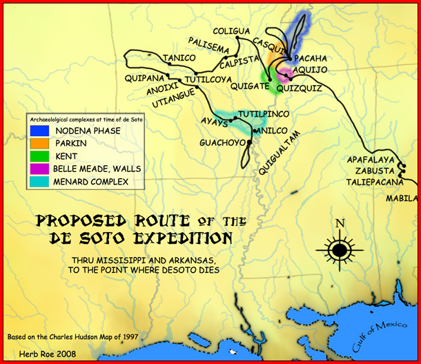
The Quapaw ( ; or Arkansas and Ugahxpa) people are a tribe of Native Americans that coalesced in what is known as the Midwest and Ohio Valley of the present-day United States. The Dhegiha Siouan-speaking tribe historically migrated from the Ohio Valley area to the west side of the Mississippi River in what is now the state of Arkansas; their name for themselves (or autonym) refers to this migration and to traveling downriver. The Quapaw are federally recognized as the Quapaw Nation. The US federal government forcibly removed them to Indian Territory in 1834, and their tribal base has been in present-day Ottawa County in northeastern Oklahoma. The number of members enrolled in the tribe was 3,240 in 2011. Name Algonquian-speaking people called the Quapaw ''akansa''. French explorers and colonists learned this term from Algonquians and adapted it in French as ''Arcansas''. The French named the Arkansas River and the territory of Arkansas for them. Government The Quapaw Natio ... [...More Info...] [...Related Items...] OR: [Wikipedia] [Google] [Baidu] |
Illinois Confederation
The Illinois Confederation, also referred to as the Illiniwek or Illini, were made up of 12 to 13 tribes who lived in the Mississippi River Valley. Eventually member tribes occupied an area reaching from Lake Michicigao (Michigan) to Iowa, Illinois, Missouri, and Arkansas. The five main tribes were the Cahokia, Kaskaskia, Michigamea, Peoria, and Tamaroa. The name of the confederation was derived from the transliteration by French explorers of to ''Illinois'', more in keeping with the sounds of their own language. The tribes are estimated to have had tens of thousands of members, before the advancement of European contact in the 17th century that inhibited their growth and resulted in a marked decline in population. The Illinois, like many Native American groups, sustained themselves through agriculture, hunting, and fishing. A partially nomadic group, the Illinois often lived in longhouses and wigwams, according to the season and resources that were available to them in the s ... [...More Info...] [...Related Items...] OR: [Wikipedia] [Google] [Baidu] |
Peoria Tribe
The Peoria, also Peouaroua, are a Native American people. They are enrolled in the federally recognized Peoria Tribe of Indians of Oklahoma headquartered in Miami, Oklahoma. The Peoria people are descendants of the Illinois Confederation. The Peoria Tribe were located east of the Mississippi River and north of the Ohio River. In the colonial period, they traded with French colonists in that territory. After 1763, when the British took over those lands following victory in the Seven Years' War, the Peoria were moved west across the Mississippi. In 1867 their descendants moved to Indian Territory with remnants of related tribes and were assigned land in present-day Ottawa County, Oklahoma, which was primarily occupied by the Quapaw. Language and name The Peoria spoke a dialect of the Miami-Illinois language, a Central Algonquian language in which these two dialects are mutually intelligible. The name ''Peoria'' derives from their autonym, or name for themselves in the Illin ... [...More Info...] [...Related Items...] OR: [Wikipedia] [Google] [Baidu] |
Michigan
Michigan () is a state in the Great Lakes region of the upper Midwestern United States. With a population of nearly 10.12 million and an area of nearly , Michigan is the 10th-largest state by population, the 11th-largest by area, and the largest by area east of the Mississippi River.''i.e.'', including water that is part of state territory. Georgia is the largest state by land area alone east of the Mississippi and Michigan the second-largest. Its capital is Lansing, and its largest city is Detroit. Metro Detroit is among the nation's most populous and largest metropolitan economies. Its name derives from a gallicized variant of the original Ojibwe word (), meaning "large water" or "large lake". Michigan consists of two peninsulas. The Lower Peninsula resembles the shape of a mitten, and comprises a majority of the state's land area. The Upper Peninsula (often called "the U.P.") is separated from the Lower Peninsula by the Straits of Mackinac, a channel that joins Lak ... [...More Info...] [...Related Items...] OR: [Wikipedia] [Google] [Baidu] |
Ottawa Tribe Of Oklahoma
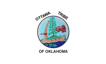
The Ottawa Tribe of Oklahoma is one of four federally recognized Native American tribes of Odawa people in the United States. Its Algonquian-speaking ancestors had migrated gradually from the Atlantic coast and Great Lakes areas, reaching what are now the states of Michigan and Ohio in the 18th century. In the late 1830s the United States removed the Ottawa to west of the Mississippi River, first to Iowa, then to Kansas in what was Indian Territory. Following the United States Civil War, in 1867 they sold their land in Kansas to move again, to purchase land in another section of Indian Territory, in what would become northeast Oklahoma. They were authorized by Congress to buy land from the Quapaw, the predominant tribe in this area. The other three Ottawa tribes are located in the state of Michigan, part of the traditional Odawa territory. They are the Grand Traverse Band of Ottawa and Chippewa Indians, Little River Band of Ottawa Indians and the Little Traverse Bay Bands of Oda ... [...More Info...] [...Related Items...] OR: [Wikipedia] [Google] [Baidu] |
Oregon
Oregon () is a U.S. state, state in the Pacific Northwest region of the Western United States. The Columbia River delineates much of Oregon's northern boundary with Washington (state), Washington, while the Snake River delineates much of its eastern boundary with Idaho. The 42nd parallel north, 42° north parallel delineates the southern boundary with California and Nevada. Oregon has been home to many Indigenous peoples of the Americas, indigenous nations for thousands of years. The first European traders, explorers, and settlers began exploring what is now Oregon's Pacific coast in the early-mid 16th century. As early as 1564, the Spanish expeditions to the Pacific Northwest, Spanish began sending vessels northeast from the Philippines, riding the Kuroshio Current in a sweeping circular route across the northern part of the Pacific. In 1592, Juan de Fuca undertook detailed mapping and studies of ocean currents in the Pacific Northwest, including the Oregon coast as well as ... [...More Info...] [...Related Items...] OR: [Wikipedia] [Google] [Baidu] |
California
California is a U.S. state, state in the Western United States, located along the West Coast of the United States, Pacific Coast. With nearly 39.2million residents across a total area of approximately , it is the List of states and territories of the United States by population, most populous U.S. state and the List of U.S. states and territories by area, 3rd largest by area. It is also the most populated Administrative division, subnational entity in North America and the 34th most populous in the world. The Greater Los Angeles area and the San Francisco Bay Area are the nation's second and fifth most populous Statistical area (United States), urban regions respectively, with the former having more than 18.7million residents and the latter having over 9.6million. Sacramento, California, Sacramento is the state's capital, while Los Angeles is the List of largest California cities by population, most populous city in the state and the List of United States cities by population, ... [...More Info...] [...Related Items...] OR: [Wikipedia] [Google] [Baidu] |


.jpg)