|
NH48
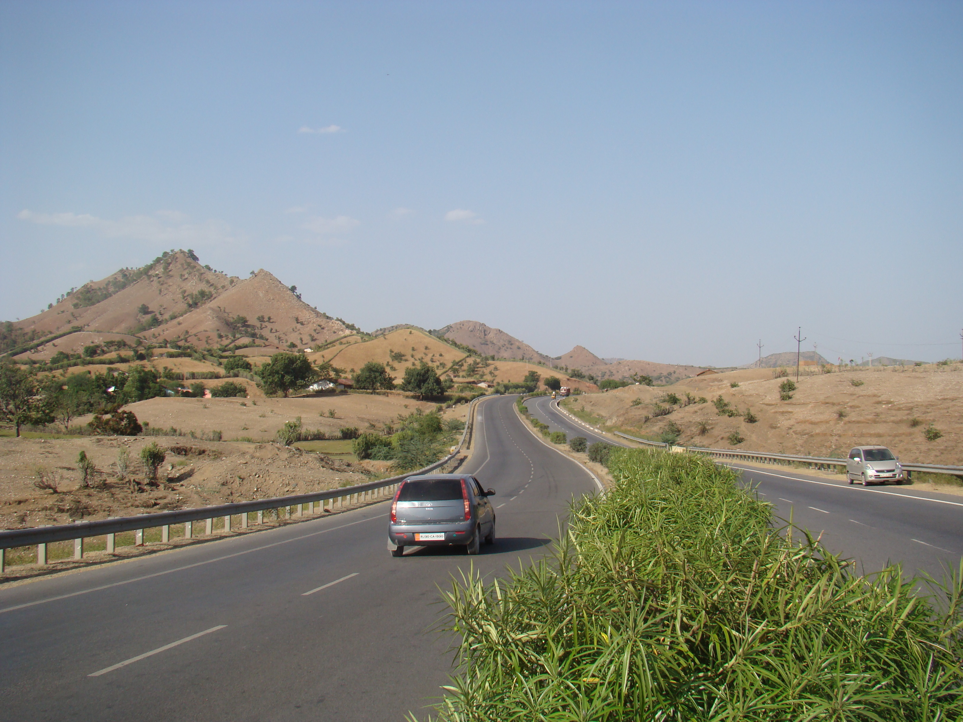
National Highway 48 (NH 48) is a National Highway of India that starts at Delhi and terminates at Chennai traversing through seven states of India. It has a total length of 2807 km (1744 miles). NH 48 passes through the states of Delhi, Haryana, Rajasthan, Gujarat, Maharashtra, Karnataka and Tamil Nadu. Its stretch from Delhi to Mumbai was earlier designated NH 8 and the stretch between Mumbai and Chennai was designated NH 4 before all the national highways were renumbered in the year 2010. Route The NH 48 bypasses through these important cities and towns that are given below: * Delhi * Gurugram * Rewari * Behror * Kotputli * Shahpura * Jaipur * Ajmer * Rajsamand * Udaipur * Himatnagar *Gandhinagar * Ahmedabad * Kheda * Nadiad * Anand * Vadodara * Bharuch *Ankleshwar * Surat * Navsari * Valsad *Vapi *Palghar * Vasai-Virar * Mumbai * Thane *Navi Mumbai *Lonavala * Pune * Satara *Karad * Kolhapur *Nipani *Sankeshwar * Belgaum *Kittur *Dharwad * Hubli * Hav ... [...More Info...] [...Related Items...] OR: [Wikipedia] [Google] [Baidu] |
List Of National Highways In India By Highway Number
On 28 April 2010, the Ministry of Road Transport and Highways officially published a new numbering system for the National Highway network in the Gazette of the Government of India. It is a systematic numbering scheme based on the orientation and the geographic location of the highway. This was adopted to ensure more flexibility and consistency in the numbering of existing and new national highways. As per the new numbering system: * All north-south oriented highways will have even numbers increasing from the east to the west. * All east-west oriented highways will have odd numbers increasing from the north to the south. * All major Highways will be single digit or double digit in number. * Three-digit numbered highways are secondary routes or branches of a main highway. The secondary route number is prefixed to the number of the main highway. For example 244, 344 etc. will be the branches of the main NH44. * Suffixes A, B, C, D etc. are added to the three-digit sub highways ... [...More Info...] [...Related Items...] OR: [Wikipedia] [Google] [Baidu] |
Behror
Behror () is a city in the Alwar district of Rajasthan. It serves as the administrative headquarters of the eponymous Behror Tehsil. Situated 120 km south-west of national capital, New Delhi, and part of the National Capital Region, it also comes under National Capital Region Planning Board, a federal authority for urban planning purposes in the region. It is clubbed under Shahjahanpur-Neemrana-Behror Complex in the National Capital Region, which includes 137 revenue villages. In this cluster, Behror municipality is the largest urban conglomeration. This region is also known as 'Ahirwal region' and serves as an industrial hub for the state of Rajasthan. Behror municipality, spread out in an area of 15 km2, is divided into four revenue villages, namely Behror tarf Gangabishan, Behror tarf Doongrasi, Behror tarf Nainsukh, and Behror tarf Balram. Economy Behror has an economy that supports more than 225,000 jobs and features industrial areas like Keshwana Industrial Ar ... [...More Info...] [...Related Items...] OR: [Wikipedia] [Google] [Baidu] |
National Highway 8 (India, Old Numbering)
National Highway 8 (NH 8) is a 4-lane (6-lane in most parts) National Highway in India. According to estimates, it is the busiest highway in the subcontinent, as it connects the national capital Delhi to the financial capital Mumbai, as well as important cities Gurgaon, Jaipur, Ajmer, Udaipur, Ahmedabad, Vadodara, Surat, Nadiad, Anand and Kheda. The total length is 1428km. Under the new numbering it has become part of the NH48. The highway is part of the Golden Quadrilateral project undertaken by National Highways Authority of India (NHAI) and was the first section to be completed. The Delhi-Gurgaon Expressway, Jaipur-Kishangarh Expressway, and Ahmedabad Vadodara Expressway are part of NH 8. Before entering downtown Mumbai, NH 8 passes through nearly all the suburbs on the western line of Mumbai Suburban Railway, where it is popularly known as Western Express Highway. Route * Delhi * Gurgaon * Manesar * Bawal * Shahjahanpur * Neemrana * Behror * Kotputli * Paota * Sha ... [...More Info...] [...Related Items...] OR: [Wikipedia] [Google] [Baidu] |
Gurugram
Gurgaon (pronunciation: ¡ÊɽɡãËw, officially named Gurugram (pronunciation: ¡ÊɾÊɡɾaËm, is a city located in the northern Indian state of Haryana. It is situated near the DelhiâHaryana border, about southwest of the national capital New Delhi and south of Chandigarh, the state capital. It is one of the major satellite cities of Delhi and is part of the National Capital Region of India. , Gurgaon had a population of 1,153,000. Gurgaon is India's second largest information technology hub and third largest financial and banking hub. Gurgaon is also home to India's largest medical tourism industry. Despite being India's 56th largest city in terms of population, Gurgaon is the 8th largest city in the country in terms of total wealth. Gurgaon serves as the headquarters of many of India's largest companies, is home to thousands of startup companies and has local offices for more than 250 Fortune 500 companies. It accounts for almost 70% of the total annual econ ... [...More Info...] [...Related Items...] OR: [Wikipedia] [Google] [Baidu] |
Delhi
Delhi, officially the National Capital Territory (NCT) of Delhi, is a city and a union territory of India containing New Delhi, the capital of India. Straddling the Yamuna river, primarily its western or right bank, Delhi shares borders with the state of Uttar Pradesh in the east and with the state of Haryana in the remaining directions. The NCT covers an area of . According to the 2011 census, Delhi's city proper population was over 11 million, while the NCT's population was about 16.8 million. Delhi's urban agglomeration, which includes the satellite cities of Ghaziabad, Faridabad, Gurgaon and Noida in an area known as the National Capital Region (NCR), has an estimated population of over 28 million, making it the largest metropolitan area in India and the second-largest in the world (after Tokyo). The topography of the medieval fort Purana Qila on the banks of the river Yamuna matches the literary description of the citadel Indraprastha in the Sanskrit ... [...More Info...] [...Related Items...] OR: [Wikipedia] [Google] [Baidu] |
Jaipur
Jaipur (; Hindi Language, Hindi: ''Jayapura''), formerly Jeypore, is the List of state and union territory capitals in India, capital and largest city of the Indian States and union territories of India, state of Rajasthan. , the city had a population of 3.1 million, making it the List of cities in India by population, tenth most populous city in the country. Jaipur is also known as the ''Pink City'', due to the dominant colour scheme of its buildings. It is also known as the Paris of India, and C. V. Raman called it the ''Island of Glory''. It is located from the national capital New Delhi. Jaipur was founded in 1727 by the Kachhwaha Rajput ruler Jai Singh II, the ruler of Amer, India, Amer, after whom the city is named. It was one of the earliest planned cities of modern India, designed by Vidyadhar Bhattacharya. During the British Colonial period, the city served as the capital of Jaipur State. After independence in 1947, Jaipur was made the capital of the newly formed s ... [...More Info...] [...Related Items...] OR: [Wikipedia] [Google] [Baidu] |
Ajmer
Ajmer is one of the major and oldest cities in the Indian state of Rajasthan and the centre of the eponymous Ajmer District. It is located at the centre of Rajasthan. It is also known as heart of Rajasthan. The city was established as "''Ajayameru''" (translated as "Invincible Hills") by a Chahamana ruler, either Ajayaraja I or Ajayaraja II, and served as their capital until the 12th century CE. Home to the dargah of Moinuddin Chishti, Ajmer is one of the most important destinations of Islamic pilgrimage in South Asia. Ajmer is surrounded by the Aravalli Mountains. Ajmer had been a municipality since 1869. Ajmer has been selected as one of the heritage cities for the HRIDAY and Smart City Mission schemes of the Government of India. History Ajmer was originally known as ''Ajayameru''. The city was founded by an 11th-century Chahamana king Ajaydeva. Historian Dasharatha Sharma notes that the earliest mention of the city's name occurs in Palha's ''Pattavali'', which was ... [...More Info...] [...Related Items...] OR: [Wikipedia] [Google] [Baidu] |
Rajsamand
Rajsamand is a city, located in Rajsamand district of Rajasthan, western India. The city is named for Rajsamand Lake, an artificial lake created in the 17th century by Rana Raj Singh of Mewar. It is the administrative headquarters of Rajsamand District. Geography Rajsamand is located at . It has an average elevation of 547 metres (1794 ft). Demographics Total population of the Rajsamand district is 987,024 (493,459 male and 493,565 female). This district has a male to female ratio of nearly 1:1. Rajsamand has an average literacy rate of 67%, male literacy is 77%, and female literacy is 57%. In Rajsamand, 15% of the population is under 6 years of age. Economy Although most of the economy of Rajasthan is based on agriculture, this part of the state is rich in mineral resources. The area is one of the prime Indian suppliers of marble, granite and other valuable varieties of stone. The Dariba,Sindesar khurd and Zawar mines are the principal Indian sources of ores for ... [...More Info...] [...Related Items...] OR: [Wikipedia] [Google] [Baidu] |
Himatnagar
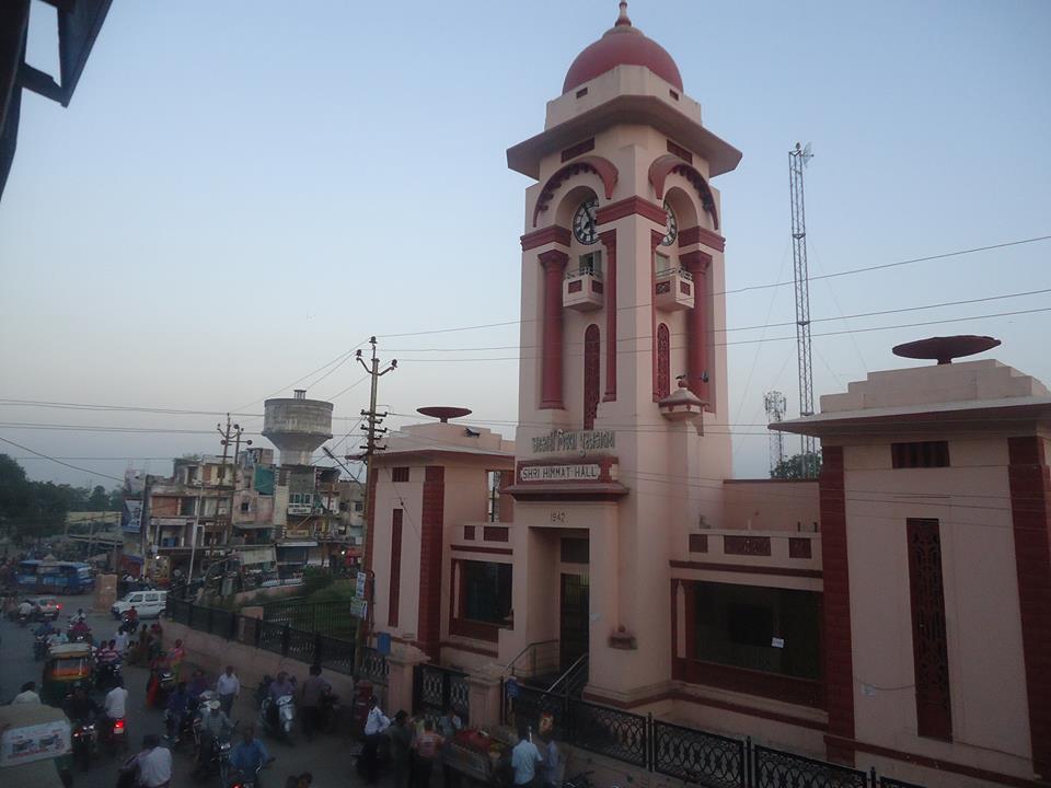
Himatnagar or Himmatnagar is a municipality in Sabarkantha district in the Indian state of Gujarat. It is the administrative headquarters of the district. The city is on the bank of the river Hathmati. History Himatnagar was founded in 1426 by Ahmed Shah I of Gujarat Sultanate and named it Ahmednagar after himself. He founded the town to keep Raos of Idar State in check. In 1658, Aurangzeb became emperor and reintroduced jizya. Through his ferman of 1665 he prohibited Jains and Hindus from closing their shops on 'Pachusan' (paryushan), last day of the month and eleventh day; ordered that arrangements be made to ensure that Kolis of Himmatnagar do not disturb Muslims when they recite their Friday prayers. When the Rao dynasty took Idar in 1728, Ahmednagar soon fell into their hands. After the death of Maharaja Shivsing, in 1792, his brother Sangramsing took Ahmednagar and the country around; and, in spite of the efforts of his nephew Gambhirsing, became an independent chief. ... [...More Info...] [...Related Items...] OR: [Wikipedia] [Google] [Baidu] |
Udaipur
Udaipur () (ISO 15919: ''Udayapura''), historically named as Udayapura, is a city and municipal corporation in Udaipur district of the state of Rajasthan, India. It is the administrative headquarter of Udaipur district. It is the historic capital of the kingdom of Mewar in the former Rajputana Agency. It was founded in 1559 by Udai Singh II of the Sisodia clan of Rajput, when he shifted his capital from the city of Chittorgarh to Udaipur after Chittorgarh was besieged by Akbar. It remained as the capital city till 1818 when it became a British princely state, and thereafter the Mewar province became a part of Rajasthan when India gained independence in 1947. The city is located in the southernmost part of Rajasthan, near the Gujarat border. It is surrounded by the Aravali Range, which separates it from the Thar Desert. It is placed almost in the middle of two major Indian metro cities, around 660 km from Delhi and 800 km from Mumbai. Besides, connectivity with Gujar ... [...More Info...] [...Related Items...] OR: [Wikipedia] [Google] [Baidu] |
Gandhinagar
Gandhinagar (, ) is the capital of the state of Gujarat in India. Gandhinagar is located approximately 23 km north of Ahmedabad, on the west central point of the Industrial corridor between Delhi, the political capital of India, and Mumbai, the financial capital of India. Gandhinagar lies on the west bank of the Sabarmati River, about 545 km (338 miles) north of Mumbai and 901 km (560 miles) southwest of Delhi. The Akshardham temple is located in Gandhinagar. There was a determination to make Gandhinagar a purely Indian enterprise, partly because the state of Gujarat was the birthplace of Mahatma Gandhi. For this reason, the planning was done by two Indian town planners: Prakash M Apte and H. K. Mewada, who had apprenticed with Le Corbusier in Chandigarh. History The city was planned by Chief Architect H.K. Mewada, a Cornell University graduate, and his assistant Prakash M Apte. Demographics census of India, Gandhinagar had a population of 208,299. Males ... [...More Info...] [...Related Items...] OR: [Wikipedia] [Google] [Baidu] |
Ahmedabad
Ahmedabad ( ; Gujarati: Amdavad ) is the most populous city in the Indian state of Gujarat. It is the administrative headquarters of the Ahmedabad district and the seat of the Gujarat High Court. Ahmedabad's population of 5,570,585 (per the 2011 population census) makes it the fifth-most populous city in India, and the encompassing urban agglomeration population estimated at 6,357,693 is the seventh-most populous in India. Ahmedabad is located near the banks of the Sabarmati River, from the capital of Gujarat, Gandhinagar, also known as its twin city. Ahmedabad has emerged as an important economic and industrial hub in India. It is the second-largest producer of cotton in India, due to which it was known as the 'Manchester of India' along with Kanpur. Ahmedabad's stock exchange (before it was shut down in 2018) was the country's second oldest. Cricket is a popular sport in Ahmedabad; a newly built stadium, called Narendra Modi Stadium, at Motera can accommodate 132,0 ... [...More Info...] [...Related Items...] OR: [Wikipedia] [Google] [Baidu] |
.jpg)


