|
Mount Gilbert (Nevada)
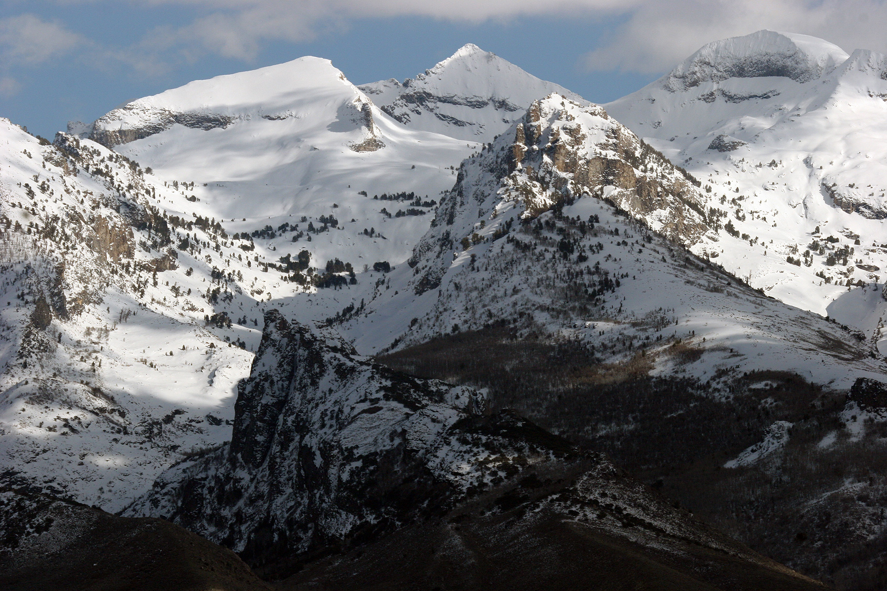
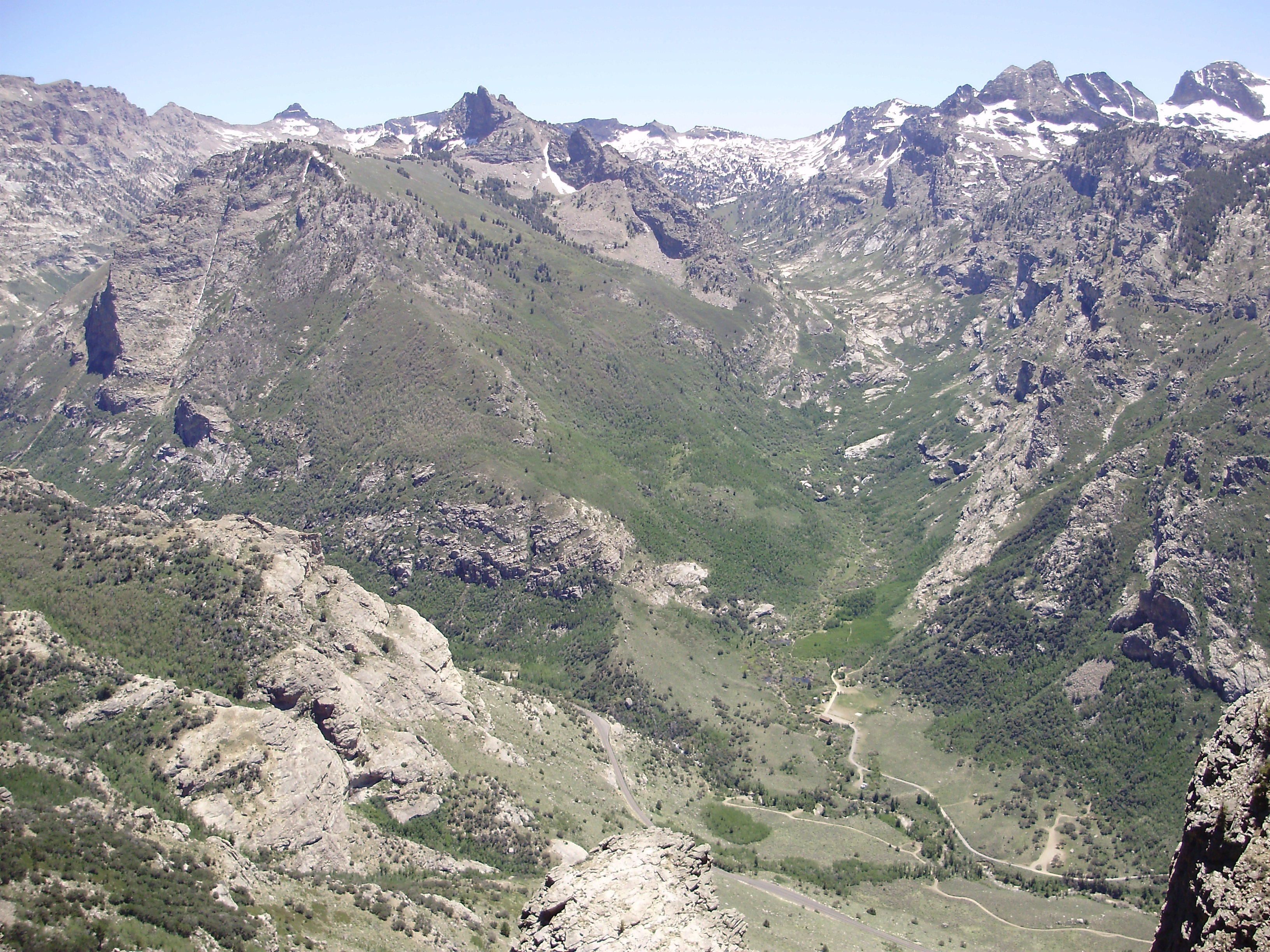
Mount Gilbert is the sixth-highest named mountain of the Ruby Mountains and the eighth-highest in Elko County, in Nevada, United States. It is the forty-third-highest mountain in the state. The peak is a spectacular part of the view from State Route 227 in Lamoille Valley, rising over above the valley floor at Lamoille. It rises from the head of Seitz Canyon, and is part of the west wall of Right Fork Canyon (a branch of Lamoille Canyon). The summit is a high glacial horn A pyramidal peak, sometimes called a glacial horn in extreme cases, is an angular, sharply pointed mountain peak which results from the cirque erosion due to multiple glaciers diverging from a central point. Pyramidal peaks are often examples o ..., located about southeast of the community of Elko within the Ruby Mountains Ranger District of the Humboldt-Toiyabe National Forest. References Ruby Mountains Mountains of Elko County, Nevada Mountains of Nevada Humboldt–Toiyabe National Forest< ... [...More Info...] [...Related Items...] OR: [Wikipedia] [Google] [Baidu] |
Elko County, Nevada
Elko County is a county in the northeastern corner of Nevada, United States. As of the 2020 census, the population was 53,702. Its county seat is Elko. The county was established on March 5, 1869, from Lander County. Elko County is the fourth-largest county by area in the contiguous United States, ranking lower when the boroughs of Alaska are included. It is one of only 10 counties in the U.S. with more than of area. Elko County is part of the Elko, NV Micropolitan Statistical Area. It contains 49.8 percent of the Duck Valley Indian Reservation, set up in the late 19th century for the Shoshone-Paiute peoples; they are a federally recognized tribe. Although slightly more than 50% of the reservation is across the border in Owyhee County, Idaho, the majority of tribal members live on the Nevada side. The reservation's land area is . History This area was long inhabited by Native American tribes of the Plateau, particularly the Western Shoshone, Northern Paiute, and Bannock p ... [...More Info...] [...Related Items...] OR: [Wikipedia] [Google] [Baidu] |
Nevada
Nevada ( ; ) is a U.S. state, state in the Western United States, Western region of the United States. It is bordered by Oregon to the northwest, Idaho to the northeast, California to the west, Arizona to the southeast, and Utah to the east. Nevada is the List of U.S. states and territories by area, 7th-most extensive, the List of U.S. states and territories by population, 32nd-most populous, and the List of U.S. states and territories by population density, 9th-least densely populated of the U.S. states. Nearly three-quarters of Nevada's people live in Clark County, Nevada, Clark County, which contains the Las Vegas–Paradise, NV MSA, Las Vegas–Paradise metropolitan area, including three of the state's four largest incorporated cities. Nevada's capital is Carson City, Nevada, Carson City. Las Vegas is the largest city in the state. Nevada is officially known as the "Silver State" because of the importance of silver to its history and economy. It is also known as the "Battle ... [...More Info...] [...Related Items...] OR: [Wikipedia] [Google] [Baidu] |
Ruby Mountains
The Ruby Mountains are a mountain range, primarily located within Elko County with a small extension into White Pine County, in Nevada, United States. Most of the range is included within the Humboldt-Toiyabe National Forest. The range reaches a maximum elevation of on the summit of Ruby Dome. To the north is Secret Pass and the East Humboldt Range, and from there the Rubies run south-southwest for about . To the east lies Ruby Valley, and to the west lie Huntington and Lamoille Valleys. The Ruby Mountains are the only range of an introduced bird, the Himalayan snowcock, in North America. The 'Rubies' were named after the garnets found by early explorers. The central core of the range shows extensive evidence of glaciation during recent ice ages, including U-shaped canyons, moraines, hanging valleys, and steeply carved granite mountains, cliffs, and cirques. All of these features can be seen from 12-mile Lamoille Canyon Road, a National Forest Scenic Byway which traverses L ... [...More Info...] [...Related Items...] OR: [Wikipedia] [Google] [Baidu] |
United States Geological Survey
The United States Geological Survey (USGS), formerly simply known as the Geological Survey, is a scientific agency of the United States government. The scientists of the USGS study the landscape of the United States, its natural resources, and the natural hazards that threaten it. The organization's work spans the disciplines of biology, geography, geology, and hydrology. The USGS is a fact-finding research organization with no regulatory responsibility. The agency was founded on March 3, 1879. The USGS is a bureau of the United States Department of the Interior; it is that department's sole scientific agency. The USGS employs approximately 8,670 people and is headquartered in Reston, Virginia. The USGS also has major offices near Lakewood, Colorado, at the Denver Federal Center, and Menlo Park, California. The current motto of the USGS, in use since August 1997, is "science for a changing world". The agency's previous slogan, adopted on the occasion of its hundredt ... [...More Info...] [...Related Items...] OR: [Wikipedia] [Google] [Baidu] |
Mountain
A mountain is an elevated portion of the Earth's crust, generally with steep sides that show significant exposed bedrock. Although definitions vary, a mountain may differ from a plateau in having a limited Summit (topography), summit area, and is usually higher than a hill, typically rising at least 300 metres (1,000 feet) above the surrounding land. A few mountains are Monadnock, isolated summits, but most occur in mountain ranges. Mountain formation, Mountains are formed through Tectonic plate, tectonic forces, erosion, or volcanism, which act on time scales of up to tens of millions of years. Once mountain building ceases, mountains are slowly leveled through the action of weathering, through Slump (geology), slumping and other forms of mass wasting, as well as through erosion by rivers and glaciers. High elevations on mountains produce Alpine climate, colder climates than at sea level at similar latitude. These colder climates strongly affect the Montane ecosystems, ecosys ... [...More Info...] [...Related Items...] OR: [Wikipedia] [Google] [Baidu] |
Nevada State Route 227
State Route 227 (SR 227), most of which is more commonly known locally as Lamoille Highway, is a state highway in Elko County in northeastern Nevada. Route description SR 227 starts at SR 535/Interstate 80 Business Loop (Idaho Street) in the center of downtown Elko. From there, it follows 5th Street southeast, which at this point is 4 lanes wide with a center turn lane and a 25 mph speed limit. After passing Silver Street, it loses the center turning lane and crosses a bridge over the Union Pacific Railroad and the Humboldt River. It narrows down to 2 lanes after passing Wilson Avenue, then loses the center turning lane beyond Carlin Court, all the while turning towards a northeasterly direction and becoming known as Lamoille Highway. After passing 12th Street, it regains 2 additional lanes and begins to gradually turn back towards the south as it begins ascending Lamoille Summit. The speed limit, 35 mph at 12th Street, gradually increases to 55 mph by the time ... [...More Info...] [...Related Items...] OR: [Wikipedia] [Google] [Baidu] |
Lamoille, Nevada
Lamoille is a rural census-designated place in Elko County in the northeastern section of the state of Nevada in the western United States. As of the 2020 census it had a population of 276. It is located southeast of Elko at the base of the Ruby Mountains at an elevation of and is part of the Elko Micropolitan Statistical Area. Demographics History The early history of the community and surrounding area is summarized in a nearby highway marker:Sebesta, Paul. "HM 109 - Lamoille Valley." Nevada-Landmarks. 23 Sept. 2007. Web. 09 June 2012. . ''LAMOILLE VALLEY - Because heavy use denuded the grass from the main Fort Hall route of the California Emigrant Trail along the Humboldt River, many emigrants left the river near Starr Valley. They skirted the East Humboldt Range and the Ruby Mountains along a Shoshone Indian path, rested their livestock in Lamoille Valley, and returned to the Humboldt River.'' ''John Walker and Thomas Waterman first settled the area in 1865. Waterman n ... [...More Info...] [...Related Items...] OR: [Wikipedia] [Google] [Baidu] |
Seitz Canyon
Seitz Canyon is one of the major canyons and valleys within the Ruby Mountains of Elko County, in the northeastern section of the state of Nevada in the western United States. Approximately in length, it was extensively sculptured by glaciers in previous ice ages. Remote, scenic, and ecologically diverse, it is protected in both the Ruby Mountains Wilderness Area and the ''Seitz-Echo Research Natural Area''. The main branch of Seitz Canyon begins at the summit of Mt. Silliman, at an elevation of . This high ridge also includes Mt. Gilbert at , and an unnamed peak at . The canyon then drops to the north as a spectacular headwall of over to a nearly level basin that includes Seitz Lake. It is here that the greatest evidence for glacial sculpturing can be found. The canyon shows a classic U-shaped cross section, and many patches of bare granite still retain the dark patina and striations caused by direct contact with the lower surface of the glacier that once filled this va ... [...More Info...] [...Related Items...] OR: [Wikipedia] [Google] [Baidu] |
Right Fork Canyon
Right Fork Canyon is a major branch of Lamoille Canyon, located in the Ruby Mountains of Elko County, in the northeastern section of the state of Nevada in the western United States. Approximately 5 miles (8 km) in length, it was extensively sculpted by glaciers in previous ice ages. none, 450px, Mt. Fitzgerald and Upper Right Fork Canyon The canyon begins at the summit of Mount Fitzgerald at an elevation of 11,215 feet (3418 m), and quickly descends to its nearly level upper section. It is here that the greatest evidence for glacial sculpturing can be found. The canyon shows a classic U-shaped cross section, and many patches of bare granite still retain the dark patina and striations caused by direct contact with the lower surface of the glacier that once filled this valley. left, 350px, Glacial patina and striations in Upper Right Fork Canyon Far below the summit of Mt. Gilbert, the canyon then makes a dramatic drop and sharp turn to enter its lower section. Nea ... [...More Info...] [...Related Items...] OR: [Wikipedia] [Google] [Baidu] |
Lamoille Canyon
Lamoille Canyon is the largest valley in the Ruby Mountains, located in the central portion of Elko County in the northeastern section of the state of Nevada, in the western United States. Approximately in length, it was extensively sculpted by glaciers in previous ice ages. Lamoille Canyon begins at Liberty Peak at an elevation of . It quickly descends to a glacial basin now occupied by Lamoille Lake. A nearby granite shelf contains the picturesque Dollar Lakes. Further down the canyon is a large stand of Whitebark pine and the Road's End Trailhead, the high point () of Lamoille Canyon Road, which is a National Forest Scenic Byway. This is also the northern terminus of the Ruby Crest National Recreation Trail, and the start of the much shorter trail to Island Lake. Road's End is where Lamoille Canyon begins a sweeping turn around the flanks of Thomas Peak, . The glaciers have deeply carved the canyon, leaving a U-shaped cross section and, high on the side of Thomas Peak, f ... [...More Info...] [...Related Items...] OR: [Wikipedia] [Google] [Baidu] |
Glacial Horn
A pyramidal peak, sometimes called a glacial horn in extreme cases, is an angular, sharply pointed mountain peak which results from the cirque erosion due to multiple glaciers diverging from a central point. Pyramidal peaks are often examples of nunataks. Formation Glaciers, typically forming in drainages on the sides of a mountain, develop bowl-shaped basins called cirques (sometimes called ‘corries’ - from Scottish Gaelic ʰəɾə(a bowl) - or s). Cirque glaciers have rotational sliding that abrades the floor of the basin more than walls and that causes the bowl shape to form. As cirques are formed by glaciation in an alpine environment, the headwall and ridges between parallel glaciers called arêtes become more steep and defined. This occurs due to freeze/thaw and mass wasting beneath the ice surface. It is widely held that a common cause for headwall steepening and extension headward is the crevasses known as bergschrund that occur between the moving ice and the he ... [...More Info...] [...Related Items...] OR: [Wikipedia] [Google] [Baidu] |
Elko, Nevada
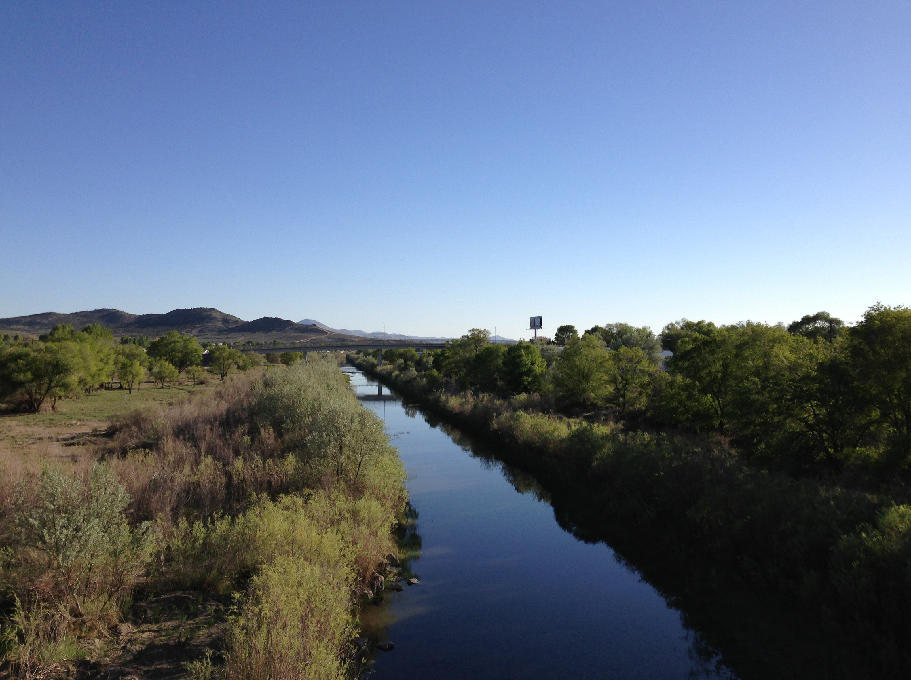
Elko (Shoshoni: Natakkoa, "Rocks Piled on One Another") is the largest city in and county seat of Elko County, Nevada, United States. With a 2020 population of 20,564, Elko is currently growing at a rate of 0.31% annually and its population has increased by 11.86% since the 2010 Census, which recorded a population of 18,297. Elko serves as the economic hub of the Ruby Valley, a region with a population of over 55,000. Elko is from Lamoille Canyon and the Ruby Mountains, dubbed the Swiss Alps of Nevada, providing year round access to recreation including hiking, skiing, hunting, and more than 20 alpine lakes. The city straddles the Humboldt River. Most of the residents in Elko live within the Tree Streets, houses lined with trees and greenery. Spring Creek, Nevada, serves as a bedroom community from the city with a population of 13,805. Elko is the principal city of the Elko Micropolitan Statistical Area, a micropolitan area that covers Elko and Eureka counties. It is the la ... [...More Info...] [...Related Items...] OR: [Wikipedia] [Google] [Baidu] |

.png)


