|
Ruby Mountains
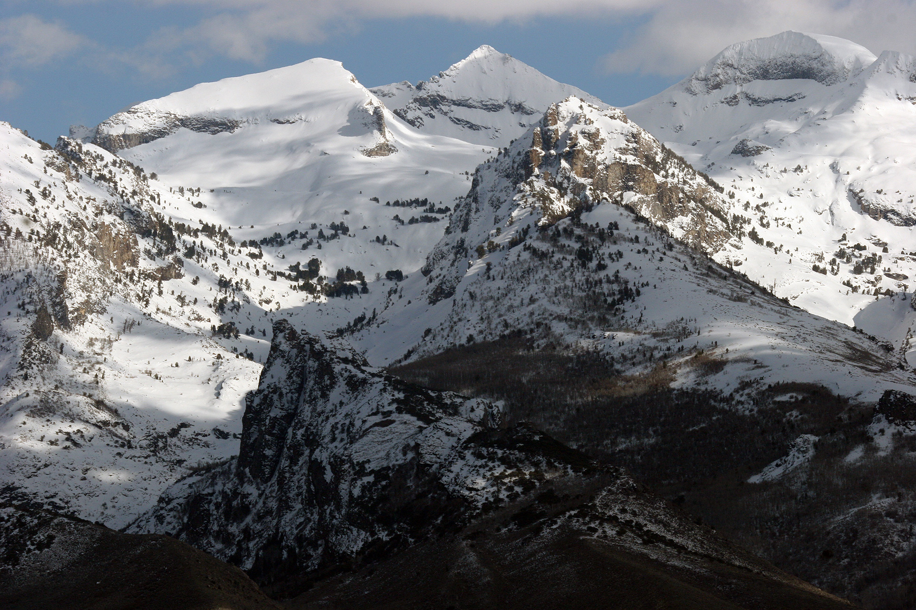
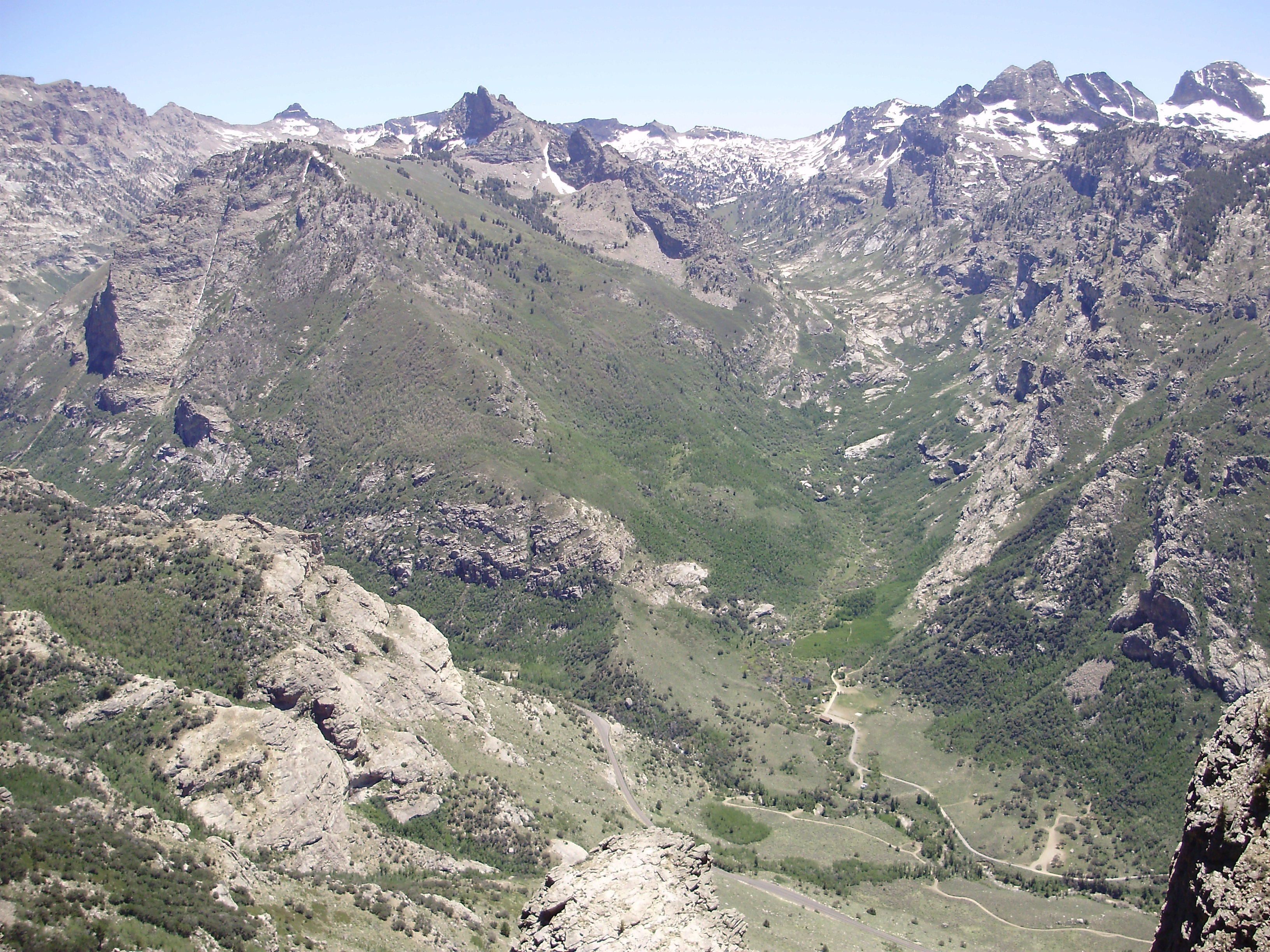
The Ruby Mountains are a mountain range, primarily located within Elko County with a small extension into White Pine County, in Nevada, United States. Most of the range is included within the Humboldt-Toiyabe National Forest. The range reaches a maximum elevation of on the summit of Ruby Dome. To the north is Secret Pass and the East Humboldt Range, and from there the Rubies run south-southwest for about . To the east lies Ruby Valley, and to the west lie Huntington and Lamoille Valleys. The Ruby Mountains are the only range of an introduced bird, the Himalayan snowcock, in North America. The 'Rubies' were named after the garnets found by early explorers. The central core of the range shows extensive evidence of glaciation during recent ice ages, including U-shaped canyons, moraines, hanging valleys, and steeply carved granite mountains, cliffs, and cirques. All of these features can be seen from 12-mile Lamoille Canyon Road, a National Forest Scenic Byway which traverse ... [...More Info...] [...Related Items...] OR: [Wikipedia] [Google] [Baidu] |
Elko County, Nevada
Elko County is a county in the northeastern corner of Nevada, United States. As of the 2020 census, the population was 53,702. Its county seat is Elko. The county was established on March 5, 1869, from Lander County. Elko County is the fourth-largest county by area in the contiguous United States, ranking lower when the boroughs of Alaska are included. It is one of only 10 counties in the U.S. with more than of area. Elko County is part of the Elko, NV Micropolitan Statistical Area. It contains 49.8 percent of the Duck Valley Indian Reservation, set up in the late 19th century for the Shoshone-Paiute peoples; they are a federally recognized tribe. Although slightly more than 50% of the reservation is across the border in Owyhee County, Idaho, the majority of tribal members live on the Nevada side. The reservation's land area is . History This area was long inhabited by Native American tribes of the Plateau, particularly the Western Shoshone, Northern Paiute, and Bannock ... [...More Info...] [...Related Items...] OR: [Wikipedia] [Google] [Baidu] |
Cirque
A (; from the Latin word ') is an amphitheatre-like valley formed by glacial erosion. Alternative names for this landform are corrie (from Scottish Gaelic , meaning a pot or cauldron) and (; ). A cirque may also be a similarly shaped landform arising from fluvial erosion. The concave shape of a glacial cirque is open on the downhill side, while the cupped section is generally steep. Cliff-like slopes, down which ice and glaciated debris combine and converge, form the three or more higher sides. The floor of the cirque ends up bowl-shaped, as it is the complex convergence zone of combining ice flows from multiple directions and their accompanying rock burdens. Hence, it experiences somewhat greater erosion forces and is most often overdeepened below the level of the cirque's low-side outlet (stage) and its down-slope (backstage) valley. If the cirque is subject to seasonal melting, the floor of the cirque most often forms a tarn (small lake) behind a dam, which marks the d ... [...More Info...] [...Related Items...] OR: [Wikipedia] [Google] [Baidu] |
Snow Lake Peak
Snow Lake Peak is the fifth-highest named mountain of the Ruby Mountains and the seventh-highest in Elko County, in Nevada, United States. It is the forty-second-highest mountain in the state. It rises from the head of Box Canyon (above Snow Lake), is part of the headwall of Thomas Canyon (with Mount Fitzgerald), and is a prominent part of the west wall of Lamoille Canyon above Lamoille and Dollar Lakes. The peak is located within the Ruby Mountains Wilderness of the Ruby Mountains Ranger District in the Humboldt-Toiyabe National Forest. Geography The summit is a high glacial horn A pyramidal peak, sometimes called a glacial horn in extreme cases, is an angular, sharply pointed mountain peak which results from the cirque erosion due to multiple glaciers diverging from a central point. Pyramidal peaks are often examples o ... located about southeast of the community of Elko. It is the only major peak of the Ruby Mountains that cannot be reached via a scramble. Refe ... [...More Info...] [...Related Items...] OR: [Wikipedia] [Google] [Baidu] |
Verdi Peak (Nevada)
The Verdi Peaks, officially just Verdi Peak, are a group of three mountain peaks in the Ruby Mountains of Elko County, Nevada, United States. The highest peak is the fiftieth-highest in the state. The peaks are located on the edge of the Ruby Mountains Wilderness, within the Ruby Mountains Ranger District of the Humboldt-Toiyabe National Forest. They rise from the head of Talbot Canyon above Verdi Lake, and are a prominent part of the east wall of Lamoille Canyon above the Terraces Picnic Area. The two southern summits are directly on the Ruby Crest above the Ruby Valley {{coord, 40.400, -115.300, display=title Ruby Valley is a large basin located in south-central Elko and northern White Pine counties in the northeastern section of the state of Nevada in the western United States. From Secret Pass it runs south- ... to the east. The central summit is the highest of the three and is located about southeast of the city of Elko. Summit panoramas References Exter ... [...More Info...] [...Related Items...] OR: [Wikipedia] [Google] [Baidu] |
Mount Fitzgerald (Nevada)
Mount Fitzgerald is the fourth-highest named mountain in the Ruby Mountains and the fifth-highest in Elko County, in the U.S. state of Nevada. It is the thirty-ninth-highest mountain in the state. It rises from the heads of both Thomas and Right Fork Canyons (branches of Lamoille Canyon), and is also part of the north wall of Box Canyon, making it a true glacial horn A pyramidal peak, sometimes called a glacial horn in extreme cases, is an angular, sharply pointed mountain peak which results from the cirque erosion due to multiple glaciers diverging from a central point. Pyramidal peaks are often examples o .... The summit is a high-level ridge and is located about southeast of the community of Elko, within the Ruby Mountains Wilderness of the Ruby Mountains Ranger District in the Humboldt-Toiyabe National Forest. References External links * Mountains of Elko County, Nevada Ruby Mountains Mountains of Nevada Humboldt–Toiyabe National Forest {{ElkoCo ... [...More Info...] [...Related Items...] OR: [Wikipedia] [Google] [Baidu] |
Liberty Peak
Liberty Peak is the name given to the officially unnamed mountain peak west of Liberty Pass in the Ruby Mountains of Elko County, Nevada, United States. It is located within the Ruby Mountains Wilderness of the Humboldt-Toiyabe National Forest. The peak rises from the head of Lamoille Canyon Lamoille Canyon is the largest valley in the Ruby Mountains, located in the central portion of Elko County in the northeastern section of the state of Nevada, in the western United States. Approximately in length, it was extensively sculpted by ..., and is a major part of the view at the Road's End Trailhead. To the southeast are Liberty Lake and Kleckner Canyon, while to the northwest is Box Canyon. It is located about southeast of the community of Elko. Summit panorama References External links * Ruby Mountains Mountains of Nevada Mountains of Elko County, Nevada Humboldt–Toiyabe National Forest {{ElkoCountyNV-geo-stub ... [...More Info...] [...Related Items...] OR: [Wikipedia] [Google] [Baidu] |
Thomas Peak
Thomas Peak is the second highest named mountain in both the Ruby Mountains and Elko County, in Nevada, United States. It is the thirty-fourth highest mountain in the state. The peak is located about southeast of the city of Elko in the Ruby Mountains Wilderness, within the Ruby Mountains Ranger District of the Humboldt-Toiyabe National Forest. One of the most voluminous mountains in the range, its base makes up most of the east wall of Thomas Canyon, as well as the west wall of the long curved section of upper Lamoille Canyon Lamoille Canyon is the largest valley in the Ruby Mountains, located in the central portion of Elko County in the northeastern section of the state of Nevada, in the western United States. Approximately in length, it was extensively sculpted by .... Thomas Peak and the adjacent canyon and campground is named after Raymond Thomas, a teacher at Elko High School, who led a group of hikers into the canyon in October 1916. Caught in an early snowstorm, ... [...More Info...] [...Related Items...] OR: [Wikipedia] [Google] [Baidu] |
Te-Moak Tribe Of Western Shoshone Indians Of Nevada
The Te-Moak Tribe of Western Shoshone Indians of Nevada is a federally recognized tribe of Western Shoshone Indians in northeastern Nevada. History The tribe organized under the 1934 Indian Reorganization Act. Western Shoshone elected a traditional council, led by Chief Muchach Temoak and his descendants, to create the new governments; however, the United States refused to recognize the traditional council and created the Te-Moaks Bands Council. Traditionalists did not feel adequately represented by this council and created the United Western Shoshone Legal Defense and Education Association, now known as the Sacred Lands Association in 1974. The traditionalists argued before the Indian Claims Commission (ICC) that the Te-Moak Bands Council did not speak for them and the tribe never gave up their title to their traditional lands. Their claims and appeal were rejected in 1979, when the ICC ruled that the Western Shoshone lost title to their lands in the Treaty of Ruby Valley in 1863. ... [...More Info...] [...Related Items...] OR: [Wikipedia] [Google] [Baidu] |
Seitz Canyon
Seitz Canyon is one of the major canyons and valleys within the Ruby Mountains of Elko County, in the northeastern section of the state of Nevada in the western United States. Approximately in length, it was extensively sculptured by glaciers in previous ice ages. Remote, scenic, and ecologically diverse, it is protected in both the Ruby Mountains Wilderness Area and the ''Seitz-Echo Research Natural Area''. The main branch of Seitz Canyon begins at the summit of Mt. Silliman, at an elevation of . This high ridge also includes Mt. Gilbert at , and an unnamed peak at . The canyon then drops to the north as a spectacular headwall of over to a nearly level basin that includes Seitz Lake. It is here that the greatest evidence for glacial sculpturing can be found. The canyon shows a classic U-shaped cross section, and many patches of bare granite still retain the dark patina and striations caused by direct contact with the lower surface of the glacier that once filled this ... [...More Info...] [...Related Items...] OR: [Wikipedia] [Google] [Baidu] |
Right Fork Canyon
Right Fork Canyon is a major branch of Lamoille Canyon, located in the Ruby Mountains of Elko County, in the northeastern section of the state of Nevada in the western United States. Approximately 5 miles (8 km) in length, it was extensively sculpted by glaciers in previous ice ages. none, 450px, Mt. Fitzgerald and Upper Right Fork Canyon The canyon begins at the summit of Mount Fitzgerald at an elevation of 11,215 feet (3418 m), and quickly descends to its nearly level upper section. It is here that the greatest evidence for glacial sculpturing can be found. The canyon shows a classic U-shaped cross section, and many patches of bare granite still retain the dark patina and striations caused by direct contact with the lower surface of the glacier that once filled this valley. left, 350px, Glacial patina and striations in Upper Right Fork Canyon Far below the summit of Mt. Gilbert, the canyon then makes a dramatic drop and sharp turn to enter its lower section. ... [...More Info...] [...Related Items...] OR: [Wikipedia] [Google] [Baidu] |
Ruby Mtns With Ruby Dome
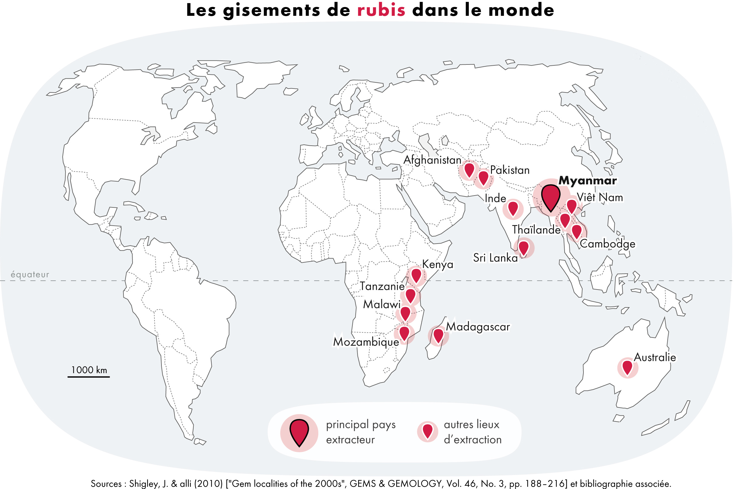
A ruby is a pinkish red to blood-red colored gemstone, a variety of the mineral corundum ( aluminium oxide). Ruby is one of the most popular traditional jewelry gems and is very durable. Other varieties of gem-quality corundum are called sapphires. Ruby is one of the traditional cardinal gems, alongside amethyst, sapphire, emerald, and diamond. The word ''ruby'' comes from ''ruber'', Latin for red. The color of a ruby is due to the element chromium. Some gemstones that are popularly or historically called rubies, such as the Black Prince's Ruby in the British Imperial State Crown, are actually spinels. These were once known as "Balas rubies". The quality of a ruby is determined by its color, cut, and clarity, which, along with carat weight, affect its value. The brightest and most valuable shade of red, called blood-red or pigeon blood, commands a large premium over other rubies of similar quality. After color follows clarity: similar to diamonds, a clear stone will ... [...More Info...] [...Related Items...] OR: [Wikipedia] [Google] [Baidu] |
Lamoille, Nevada
Lamoille is a rural census-designated place in Elko County in the northeastern section of the state of Nevada in the western United States. As of the 2020 census it had a population of 276. It is located southeast of Elko at the base of the Ruby Mountains at an elevation of and is part of the Elko Micropolitan Statistical Area. Demographics History The early history of the community and surrounding area is summarized in a nearby highway marker:Sebesta, Paul. "HM 109 - Lamoille Valley." Nevada-Landmarks. 23 Sept. 2007. Web. 09 June 2012. . ''LAMOILLE VALLEY - Because heavy use denuded the grass from the main Fort Hall route of the California Emigrant Trail along the Humboldt River, many emigrants left the river near Starr Valley. They skirted the East Humboldt Range and the Ruby Mountains along a Shoshone Indian path, rested their livestock in Lamoille Valley, and returned to the Humboldt River.'' ''John Walker and Thomas Waterman first settled the area in 1865. Waterman ... [...More Info...] [...Related Items...] OR: [Wikipedia] [Google] [Baidu] |


