|
Mewat
Mewat is a historical region of Haryana and Rajasthan states in northwestern India. The loose boundaries of Mewat generally include Hathin tehsil and Nuh district of Haryana, Alwar ( Tijara, Kishangarh, Bas, Ramgarh, Laxmangarh, Kathumar tehsils and Aravalli hills tract), Mahwa, Rajasthan and Mandawar, Rajasthan in Dausa district and Bharatpur districts (Pahari, Nagar, Deeg, Nadbai, Bhusawar, Weir and Kaman tehsils) of Rajasthan, and Chhata Tehsil of Mathura district in Uttar Pradesh. The main centre areas of Mewat are Firozpur Jhirka, Nuh, Ramgarh, Paharisikri and Punahana. Mewat region lies in between Delhi-Jaipur-Agra. In simple words Mewat region consists of Nuh district, eastern part of Alwar district and western part of Bharatpur district. Mandawar, Rajasthan and Mahwa, Rajasthan is in Dausa district but there are many Meos villages near Mahwa, Mandawar, Garhi sawairam, Pinan. [...More Info...] [...Related Items...] OR: [Wikipedia] [Google] [Baidu] |
Alwar District
Alwar is a district in the state of Rajasthan in northern India, whose district headquarters is Alwar city. The district covers 8,380 km2. It is bound on the north by Rewari district of Haryana, on the east by Bharatpur district of Rajasthan and Nuh district of Haryana, on the south by Dausa district, and on the west by Jaipur district. As of 2011 it is the third most populous district of Rajasthan (out of 33) after Jaipur and Jodhpur. Topography The district is a fairly regular quadrilateral in shape with its central northern portion consisting of tahsil Mandawar hemmed in by the protruding north of tahsil Behror on the west and tahsil Tijara on the east and its south eastern corner consisting of Lachhmangarh tahsil slightly flapping outward into Bharatpur district. Ridges of rocky and precipitous hills, for the most part parallel, are a feature observable throughout the whole district which, however, is generally open to the north and east. The conspicuous ... [...More Info...] [...Related Items...] OR: [Wikipedia] [Google] [Baidu] |
Nuh District
Nuh district (formerly known as Mewat district) is one of the 22 districts in the Indian state of Haryana. There are four sub-divisions in this district: Nuh, Ferozepur Jhirka, Punahana, and Taoru. It has an area of and had a population of 1.09 million in 2011. It is bounded by Gurugram District to the north, Palwal District of Haryana to the east and Alwar District of Rajasthan to the south and west. Its boundaries also touch Bharatpur District of Rajasthan and Mathura District of Uttar Pradesh near Bichhor Village and Nai Village of Punhana Tehsil. It is predominantly populated by farmers of Meo ethnicity. In 2018, the Government of India's premier policy think tank Niti Aayog named erstwhile Mewat district as the most underdeveloped of India's 739 districts. Despite bordering Gurgaon District, Haryana's rich industrial and financial heartland, this district had the worst health and nutrition, education, agriculture and water resources, financial inclusion and skill dev ... [...More Info...] [...Related Items...] OR: [Wikipedia] [Google] [Baidu] |
Rajasthan
Rajasthan (; lit. 'Land of Kings') is a state in northern India. It covers or 10.4 per cent of India's total geographical area. It is the largest Indian state by area and the seventh largest by population. It is on India's northwestern side, where it comprises most of the wide and inhospitable Thar Desert (also known as the Great Indian Desert) and shares a border with the Pakistani provinces of Punjab to the northwest and Sindh to the west, along the Sutlej- Indus River valley. It is bordered by five other Indian states: Punjab to the north; Haryana and Uttar Pradesh to the northeast; Madhya Pradesh to the southeast; and Gujarat to the southwest. Its geographical location is 23.3 to 30.12 North latitude and 69.30 to 78.17 East longitude, with the Tropic of Cancer passing through its southernmost tip. Its major features include the ruins of the Indus Valley civilisation at Kalibangan and Balathal, the Dilwara Temples, a Jain pilgrimage site at Rajasthan's only hi ... [...More Info...] [...Related Items...] OR: [Wikipedia] [Google] [Baidu] |
Mewati
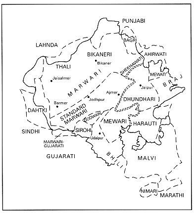
Mewati (Devanagri:मेवाती; Perso-Arabic:میواتی) is an Indo-Aryan language spoken by about three million speakers in the Mewat Region (Alwar and Bharatpur, districts of Rajasthan, Nuh district of Haryana). While other people groups in the region also speak the Mewati language, it is one of the defining characteristics of the Meo culture. There are 9 vowels, 31 consonants, and two diphthongs. Suprasegmentals are not so prominent as they are in the other dialects of Rajasthani. There are two numbers—singular and plural, two genders—masculine and feminine; and three cases—direct, oblique, and vocative. The nouns decline according to their final segments. Case marking is postpositional. Pronouns are traditional in nature and are inflected for number and case. Gender is not distinguished in pronouns. There are two types of adjectives. There are three tenses: past, present, and future. Participles function as adjectives. Phonology There are twenty plosives ... [...More Info...] [...Related Items...] OR: [Wikipedia] [Google] [Baidu] |
Haryana
Haryana (; ) is an Indian state located in the northern part of the country. It was carved out of the former state of East Punjab on 1 Nov 1966 on a linguistic basis. It is ranked 21st in terms of area, with less than 1.4% () of India's land area. The state capital is Chandigarh, which it shares with the neighboring state of Punjab, and the most populous city is Faridabad, which is a part of the National Capital Region. The city of Gurugram is among India's largest financial and technology hubs. Haryana has 6 administrative divisions, 22 districts, 72 sub-divisions, 93 revenue tehsils, 50 sub-tehsils, 140 community development blocks, 154 cities and towns, 7,356 villages, and 6,222 villages panchayats. Haryana contains 32 special economic zones (SEZs), mainly located within the industrial corridor projects connecting the National Capital Region. Gurgaon is considered one of the major information technology and automobile hubs of India. Haryana ranks 11th among ... [...More Info...] [...Related Items...] OR: [Wikipedia] [Google] [Baidu] |
Aravalli Range
The Aravalli Range (also spelled ''Aravali'') is a mountain range in Northern- Western India, running approximately in a south-west direction, starting near Delhi, passing through southern Haryana, Rajasthan, and ending in Ahmedabad Gujarat. The highest peak is Guru Shikhar on Mount Abu at . The Aravalli Range is arguably the oldest geological feature on Earth, having its origin in the Proterozoic era. The Aravalli Range is rich in natural resources and serves as check to the growth of the western desert. Etymology Aravalli, a composite Sanskrit word from the roots ''"ara"'' and ''"vali"'', literally means the ''"line of peaks"''. Natural history Geology The Aravalli Range, an eroded stub of ancient mountains, is believed to be the oldest range of fold mountains in India.Roy, A. B. (1990). Evolution of the Precambrian crust of the Aravalli Range. Developments in Precambrian Geology, 8, 327–347. The natural history of the Aravalli Range dates back to ti ... [...More Info...] [...Related Items...] OR: [Wikipedia] [Google] [Baidu] |
Tijara
Tijara is a city and a municipality in Alwar district of the Indian state of Rajasthan. Tijara comes under the NCR area and is situated 48 km to the northeast of Alwar. The nearest railway station to Tijara is Khairthal. Bhiwadi is a census town in Tijara. It is the biggest industrial area of Rajasthan and part of the historical Ahirwal region. Tijara is dominated by Yadav and Meo community. History Tijara was founded by Rao Tej Pal, Raja of Sarahata. As a scion of the Yadava family, he built palaces at Tijara. The city was largely inhabited by Ahirs or Yadavas since ancient times. The Yadav's from Tijara are settled in villages of Delhi. In 850 Vikram Samvat, Yadav King Charu Rao was the king of Tijara. His 9 descendants up to Rao Chandrabhanu Singh ruled tijara till 1040s. In around 1043 A.D, the family of Rao Harpal of tijara, son of chandrabhanu, settled his family in the Dabur area of modern Delhi, with its headquarters at Surhera. Rao Inderjit Singh is a descend ... [...More Info...] [...Related Items...] OR: [Wikipedia] [Google] [Baidu] |
Firozpur Jhirka
Ferozepur Jhirka, also known as Ferojpur Jhirka, is a town, near Nuh city in Nuh district in the state of Haryana, India. History Ferozepur Jhirka was founded in 1419 by Wali (patriarch) of Mewat, Khanzada Feroz Khan who styled himself as Raja (king). Mughal Era Choudry Mohammad Hayat Khan Numberdar and his brother Choudry Burkat Ullah Khan were landlord zamidar in Ferozepur Jhirka. Abu Mohammad along with Makhdoom Tahir(from Jhumrawat) turned this into larger estate (land)">estate (riyasat). Qazi Ghulam Mustafa from Ferozepur Jhirka, and who was honoured By Bahadur Shah I was close relative to these two and he was married to Bibi Rasti (died Dhu al-Qi'dah 1147 AH / 1734 AD), the daughter of Qazi Syed Rafi Mohammad. Khan Zaman Khan Ali Asghar, who built the Ferozepur Jhirka Fort was a courtier of Mughal Emperor Farrukhsiyar of Delhi. He was the son of Bibi Rasti and Nawab Kar Talab Khan Qazi Ghulam Mustafa. He was Panj Hazari Mansabdar Emir (a courtier with a militar ... [...More Info...] [...Related Items...] OR: [Wikipedia] [Google] [Baidu] |
Punahana
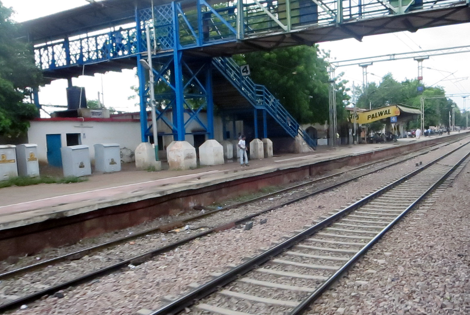
Punhana is a town in Punhana sub-division in the Nuh district in the Indian state of Haryana. Geography Punahana is the largest town of Mewat, at an average elevation of 187 metres (613 feet). Demographics India census, Punahana had a population of 13,178. Males constitute 52% of the population and females 48%. Punahana has an average literacy rate of 53%, lower than the national average of 59.5%: male literacy is 63% and female literacy is 41%. In Punahana, 21% of the population is under 6 years of age. The district has a low population when compared to the population density of India. Nearby towns * Pinangwan * Indana * Gurgaon * Ferozepur Jhirka * Hodal * Palwal Palwal is a city and a municipal council. It is the headquarters of Palwal district, the 21st district of Haryana state in northern India. It is a centre of the cotton trade in the area. It is also a part of National Capital Region. Etymo ... * Bichhor * Nuh * Hathin * Lohinga Kalan Referenc ... [...More Info...] [...Related Items...] OR: [Wikipedia] [Google] [Baidu] |
Kherli
Kherli is a city and a municipality in Alwar district in the Indian state of Rajasthan.Kherli mandi(Grain Market) is the second largest mandi in Rajasthan. Once upon a time it was so much famous that till now old jaipur people knows this as ganj kherli i.e. kherli mandi. Kherli is between the golden triangle where it is nearest to Agra(125 km) Jaipur(150 km) and Delhi(175 km).This area also comes under NCR but still they are not getting benefit of close proximity to these 3 big cities. History Kherli is located at 27.2065° N, 77.0338° E. Topography is mainly plains, except some low hills found in western part from this region but those hills are not so big and mainly this area is plain. Elevation of kherli is 210m above sea level. Demographics census of India, Kherli has a population of 15,506. Males constitute 53.1% (8,311/15,506) of the population and females 46.4% (7,195/15,506). Kherli has an average literacy rate of 73%, higher than the national average ... [...More Info...] [...Related Items...] OR: [Wikipedia] [Google] [Baidu] |
Hathin
Hathin is a City and a Municipal Committee, nearby Palwal city in Palwal district of Haryana in India. Geography It lies in NCR region, located south of Delhi, west from NH19 ( Delhi-Mathura Highway) and 10 kilometres south from KMP (Kundli-Manesar-Palwal Expressway) and the upcoming Haryana Orbital Rail Corridor (HORC) and also 10 kilometres east from longest expressway in India (Delhi-Vadodara-Mumbai Expressway). Governance Hathin is a Haryana Legislative Assembly constituency segment, within the Faridabad Lok Sabha constituency. History Circa 150 BCE to 100 CE Shunga Empire or Kushan Empire era Hindu temple guard rail pillars were excavated from a filled well of Bhadas village and from Hathin. The pillars are exhibited in the Haryana State Museum.Chander Pal Singh, 2003, "Early Medieval Art Of Haryana", Koshal Book Depot, page 6.1985, Journal of the Indian Society of Oriental Art, Volume 15, Page 1. The railing pillars have images of Yaksha and three morti ... [...More Info...] [...Related Items...] OR: [Wikipedia] [Google] [Baidu] |
Nagar Rajasthan
Brij Nagar (Commonly known as Nagar) is town and tehsil in Bharatpur district in the Indian state of Rajasthan. It is situated equidistant among Bharatpur, Alwar & Mathura. Nagar is famous for the sweets called ''Jaleba'', a bigger version of jalebi. Geography Brij Nagar is located at . It has an average elevation of 201 metres (662 feet) from the sea level. Geographically, Nagar is a town in district Bharatpur but the closest bigger city one can think about is Alwar which is roughly at a same distance as Bharatpur is but more convenient for the people as we have higher and frequent connectivity to Alwar. Distance from Delhi is roughly around 165 km and from Jaipur it is 175 km. Fairs Nagar hosts a famous fair in the month of April on the occasion of Ram Navami. Devotees come to see the Ram Rath Yatra (Procession) which passes through town's main market to 'Ram Temple'. Along with the Rathyatra, many other cultural events and competitions are also organize ... [...More Info...] [...Related Items...] OR: [Wikipedia] [Google] [Baidu] |


