|
Margareten
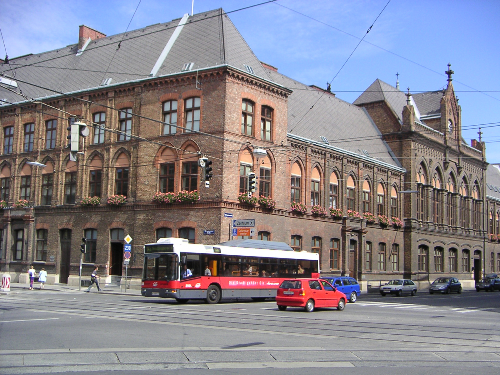
Margareten (; bar, Magredn) is the fifth district of Vienna (german: 5. Bezirk, Margareten). It is near the old town of Vienna and was established as a district in 1850, but borders changed later.Vienna official web site Margareten is a residential urban area, with over 25,000 inhabitants per km2, one of the most densely populated districts in Vienna. Description The district of Margareten was formed from six s. The former city of Margareten itself developed from an estate with the same name and was later built into a castle. It was destroyed in both Turkish sieges of Vienna, but rebuilt each time. Nearby lay |
Hundsturm
Hundsturm was an independent municipality (''Gemeinde'') of Austria until 1850 and is today a suburb of Vienna the city's 5th District, Margareten. The Hundsturm coat of arms shows, on a blue background, a castle tower on a green meadow. From the open door of the golden tower jumps a dog. History In 1600, Archduke Matthias, who later became Emperor, built a Rüdenhausen in Hundsturm. The name ''Hundsturm'' ("Hounds Tower") might come from this Rüdenhausen. It is more likely, however, that the name goes back to the former mill, which was occupied in 1408 as the first time in the disk Hunczmühle Ried. In 1632, the first documented mention of Hundsturm was made. The Rüdenhausen was demolished in 1672, when Hundsturm Castle was built in its place. During the 17th Century, the settlement grew around the castle, especially along the present Schönbrunnerstraße between Spengergasse and Margaretengürtel. The castle was later demolished during the 19th Century. The last parts of the ... [...More Info...] [...Related Items...] OR: [Wikipedia] [Google] [Baidu] |
Gürtel, Vienna
The Gürtel () is a substantial city road of Vienna. Running parallel to the famous Vienna Ring Road, it encompasses the inner city districts (''Innenbezirke'') and follows the route of the former ''Linienwall'' outer fortification. The city's red-light district is situated around the Gürtel. History The Gürtel was laid out from 1873 at the site of the former ''Linienwall'' fortification, built under Emperor Leopold I at the beginning of the 18th century to protect his residence from kuruc invasions in the course of Rákóczi's War for Independence. After World War I, the road became the construction site for several public housing estates (''Gemeindebauten'') in the era of Red Vienna. As in most parts of Austria-Hungary, vehicles formerly moved on the left, like in Britain, until after the Anschluss in 1938. According to German regulations, traffic in Vienna was redirected to pass on the right as elsewhere on the Continent. Plans developed in the 1960s and 70s to rebuild t ... [...More Info...] [...Related Items...] OR: [Wikipedia] [Google] [Baidu] |
Wienerberg
Favoriten (; Central Bavarian: ''Favoritn''), the 10th Districts of Vienna, district of Vienna, Austria (german: 10. Bezirk, Favoriten), is located south of the central districts. It is south of Innere Stadt, Wieden and Margareten. Favoriten is a heavily populated urban area with many residential buildings, but also large recreational areas and parks. Wien-Vienna.at webpage (see below: References). Wien.gv.at webpage (see below: References). The name comes from ''Favorita'', a semi-baroque palace complex that once served as a hunting castle but today is the Theresianum a Gymnasium (school), Gymnasium (middle and high school) in the 4th district (Wieden). The customs facilities at the original southern border of Vienna were known as the ''Favoriten-Linie'' (Favoriten Line) while nearby houses were known as the ''Siedlung vor der Favoriten-Linie'' (Settlement in front of the Favoriten Line). District sections The Favoriten District includes 6 sections: Katastralgemeinden ... [...More Info...] [...Related Items...] OR: [Wikipedia] [Google] [Baidu] |
Favoriten
Favoriten (; Central Bavarian: ''Favoritn''), the 10th district of Vienna, Austria (german: 10. Bezirk, Favoriten), is located south of the central districts. It is south of Innere Stadt, Wieden and Margareten. Favoriten is a heavily populated urban area with many residential buildings, but also large recreational areas and parks. Wien-Vienna.at webpage (see below: References). Wien.gv.at webpage (see below: References). The name comes from ''Favorita'', a semi- baroque palace complex that once served as a hunting castle but today is the Theresianum a Gymnasium (middle and high school) in the 4th district (Wieden). The customs facilities at the original southern border of Vienna were known as the ''Favoriten-Linie'' (Favoriten Line) while nearby houses were known as the ''Siedlung vor der Favoriten-Linie'' (Settlement in front of the Favoriten Line). District sections The Favoriten District includes 6 sections: Katastralgemeinden Favoriten, Inzersdorf-Stadt, Rothneusi ... [...More Info...] [...Related Items...] OR: [Wikipedia] [Google] [Baidu] |
Vienna
en, Viennese , iso_code = AT-9 , registration_plate = W , postal_code_type = Postal code , postal_code = , timezone = CET , utc_offset = +1 , timezone_DST = CEST , utc_offset_DST = +2 , blank_name = Vehicle registration , blank_info = W , blank1_name = GDP , blank1_info = € 96.5 billion (2020) , blank2_name = GDP per capita , blank2_info = € 50,400 (2020) , blank_name_sec1 = HDI (2019) , blank_info_sec1 = 0.947 · 1st of 9 , blank3_name = Seats in the Federal Council , blank3_info = , blank_name_sec2 = GeoTLD , blank_info_sec2 = .wien , website = , footnotes = , image_blank_emblem = Wien logo.svg , blank_emblem_size = Vienna ( ; german: Wien ; ba ... [...More Info...] [...Related Items...] OR: [Wikipedia] [Google] [Baidu] |
Wieden
Wieden (; Central Bavarian: ''Wiedn'') is the 4th municipal district of Vienna, Austria (german: 4. Bezirk). It is near the centre of Vienna and was established as a district in 1850, but its borders were changed later. Wieden is a small region near the city centre. Wien.gv.at webpage (see below: References). After World War II, Wieden was part of the Soviet sector of Vienna for 10 years. __TOC__ History The name Wieden was first recorded in 1137, and is thus the oldest '' Vorstadt'' (former municipality within the ''Linienwall'') of Vienna. The main street ( Wiedner Hauptstraße) is certainly even older. The district was the site of the former royal Summer residence, which was completed under Ferdinand II, and was expanded many times until Maria Theresa sold it to the Jesuits. Today it is the Theresianum, a prestigious private boarding school, while the Diplomatic Academy of Vienna resides in a wing of the building. In the beginning of the 18th century, the development o ... [...More Info...] [...Related Items...] OR: [Wikipedia] [Google] [Baidu] |
Vienna River
The Wien is a river that flows through Austria's capital Vienna. Geography The river Wien is long, of which are within the city. Its drainage basin covers an area of , both in the city and in the neighbouring Vienna Woods. Its source lies in the western Vienna Woods near Rekawinkel and its mouth at the eastern end of the city centre of Vienna, next to the Urania, where it flows into the Donaukanal ("Danube Canal"), a branch of the Danube. The Wien is subject to huge variations in flow. In its headwaters in the Vienna Woods, the soil is underlain by sandstone. Because of this, during heavy rain the soil quickly saturates, resulting in substantial runoff. Thus, the flow of the Wien can quickly increase from a creek-like to in the heaviest rains or during the spring snowmelt in the Vienna Woods, a ratio of over 1:2000. The Wien River and the city of Vienna Within the city limits, the river bed consists almost entirely of concrete, which was installed between 1895 and 1899 i ... [...More Info...] [...Related Items...] OR: [Wikipedia] [Google] [Baidu] |
Wien Margaretenplatz Margaretenhof
en, Viennese , iso_code = AT-9 , registration_plate = W , postal_code_type = Postal code , postal_code = , timezone = CET , utc_offset = +1 , timezone_DST = CEST , utc_offset_DST = +2 , blank_name = Vehicle registration , blank_info = W , blank1_name = GDP , blank1_info = € 96.5 billion (2020) , blank2_name = GDP per capita , blank2_info = € 50,400 (2020) , blank_name_sec1 = HDI (2019) , blank_info_sec1 = 0.947 · 1st of 9 , blank3_name = Seats in the Federal Council , blank3_info = , blank_name_sec2 = GeoTLD , blank_info_sec2 = .wien , website = , footnotes = , image_blank_emblem = Wien logo.svg , blank_emblem_size = Vienna ( ; german: Wien ; ba ... [...More Info...] [...Related Items...] OR: [Wikipedia] [Google] [Baidu] |
Austria
Austria, , bar, Östareich officially the Republic of Austria, is a country in the southern part of Central Europe, lying in the Eastern Alps. It is a federation of nine states, one of which is the capital, Vienna, the most populous city and state. A landlocked country, Austria is bordered by Germany to the northwest, the Czech Republic to the north, Slovakia to the northeast, Hungary to the east, Slovenia and Italy to the south, and Switzerland and Liechtenstein to the west. The country occupies an area of and has a population of 9 million. Austria emerged from the remnants of the Eastern and Hungarian March at the end of the first millennium. Originally a margraviate of Bavaria, it developed into a duchy of the Holy Roman Empire in 1156 and was later made an archduchy in 1453. In the 16th century, Vienna began serving as the empire's administrative capital and Austria thus became the heartland of the Habsburg monarchy. After the dissolution of the H ... [...More Info...] [...Related Items...] OR: [Wikipedia] [Google] [Baidu] |
Meidling
Meidling () is the 12th district of Vienna (german: 12. Bezirk, Meidling). It is located just southwest of the central districts, south of the Wienfluss, west of the Gürtel belt, and east and southeast of Schönbrunn palace. Meidling is a heavily populated urban area with many residential buildings, but also large recreational areas and parks. Vienna Districts data, wien.gv.at, 2008, webpage: wien.gv.at-portraets08-PDF. Wien.gv.at webpage (see below: References). In sports, it is represented by the FC Dynamo Meidling. Former Chancellor of Austria Sebastian Kurz was raised in Meidling and his private residence is there. Geography Location The 12th District lies in southwest Vienna, about 5–10 km (3–6 mi) from the Innere Stadt. It stretches from Wiental south of the Vienna River in the region between the Wienerberg hill in the 10th District and the Grünen Berg hill, of Schönbrunn Castle in the 13th District. District parts The former suburb, after which ... [...More Info...] [...Related Items...] OR: [Wikipedia] [Google] [Baidu] |


