|
Machias Seal Island
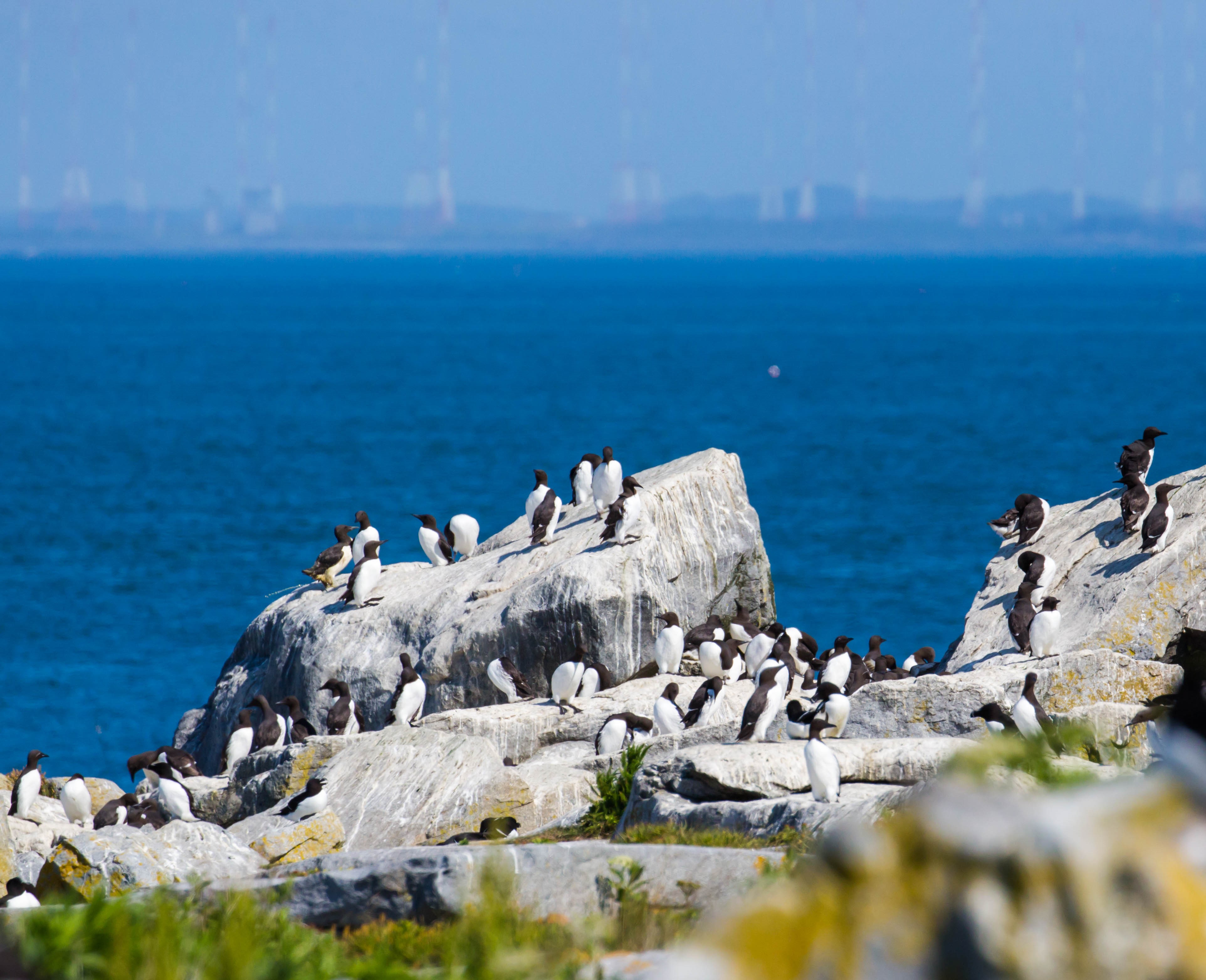
Machias Seal Island is an island in disputed water between the Gulf of Maine and the Bay of Fundy, about southeast from Cutler, Maine, and southwest of Grand Manan Island, New Brunswick. Sovereignty of the island is disputed by the United States and Canada. The Canadian Coast Guard continues to staff a lighthouse on the island; the first lighthouse was constructed there in 1832. Geography The relationship of Machias Seal Island to the Grand Manan archipelago is a source of some dispute among geologists. The island is considered to be a possible continuation of the series of exposed shoals, rocks, and islets strewn south and west of Grand Manan Island. The deeper Grand Manan Channel lies to the north and west of the island, separating it from the coast of Washington County, Maine. Machias Seal Island is a barren island and devoid of trees. Because of its location at the boundary between the Gulf of Maine and the Bay of Fundy, Machias Seal Island is fog-bound for many days of t ... [...More Info...] [...Related Items...] OR: [Wikipedia] [Google] [Baidu] |
Gulf Of Maine
The Gulf of Maine is a large gulf of the Atlantic Ocean on the east coast of North America. It is bounded by Cape Cod at the eastern tip of Massachusetts in the southwest and by Cape Sable Island at the southern tip of Nova Scotia in the northeast. The gulf includes the entire coastlines of the U.S. states of New Hampshire and Maine, as well as Massachusetts north of Cape Cod, and the southern and western coastlines of the provinces and territories of Canada, Canadian provinces of New Brunswick and Nova Scotia, respectively. The gulf was named for the adjoining English colonial Province of Maine, which was in turn likely named by early explorers after the Maine (province), province of Maine in France. Massachusetts Bay, Penobscot Bay, Passamaquoddy Bay, and the Bay of Fundy are all arms of the Gulf of Maine. Geography and hydrography The Gulf of Maine is a roughly rectangular depression with a surface area of around , enclosed to the west and north by the North American mainland ... [...More Info...] [...Related Items...] OR: [Wikipedia] [Google] [Baidu] |
Arctic Tern
The Arctic tern (''Sterna paradisaea'') is a tern in the family Laridae. This bird has a circumpolar breeding distribution covering the Arctic and sub-Arctic regions of Europe (as far south as Brittany), Asia, and North America (as far south as Massachusetts). The species is strongly migratory, seeing two summers each year as it migrates along a convoluted route from its northern breeding grounds to the Antarctic coast for the southern summer and back again about six months later. Recent studies have shown average annual round-trip lengths of about for birds nesting in Iceland and Greenland and about for birds nesting in the Netherlands. These are by far the longest migrations known in the animal kingdom. The Arctic tern nests once every one to three years (depending on its mating cycle). Arctic terns are medium-sized birds. They have a length of and a wingspan of . They are mainly grey and white plumaged, with a red/orange beak and feet, white forehead, a black nape and ... [...More Info...] [...Related Items...] OR: [Wikipedia] [Google] [Baidu] |
War Of 1812
The War of 1812 (18 June 1812 – 17 February 1815) was fought by the United States of America and its indigenous allies against the United Kingdom and its allies in British North America, with limited participation by Spain in Florida. It began when the United States declared war on 18 June 1812 and, although peace terms were agreed upon in the December 1814 Treaty of Ghent, did not officially end until the peace treaty was ratified by Congress on 17 February 1815. Tensions originated in long-standing differences over territorial expansion in North America and British support for Native American tribes who opposed US colonial settlement in the Northwest Territory. These escalated in 1807 after the Royal Navy began enforcing tighter restrictions on American trade with France and press-ganged men they claimed as British subjects, even those with American citizenship certificates. Opinion in the US was split on how to respond, and although majorities in both the House and ... [...More Info...] [...Related Items...] OR: [Wikipedia] [Google] [Baidu] |
Moose Island, Maine
Moose Island is an island in Eastport, Maine located at the entrance to Cobscook Bay from Passamaquoddy Bay in the Bay of Fundy. It is part of Shackford Head State Park. Connected to the mainland portion of Washington County at Passamaquoddy Pleasant Point Reservation by a causeway, the city of Eastport occupies several islands, including its major land mass, Moose Island. Other islands comprising the city include Carlow Island, Spectacle Island, Goose Island, and Treat Island, along with other islets. Quoddy Village lies at the north-western end of Moose Island, while the city's downtown lies at the eastern end of the island. The Eastport Municipal Airport lies between Quoddy Village and downtown Eastport. History During the War of 1812, British naval forces seized Moose Island while taking control of the entire Maine coast from Penobscot Bay to the St. Croix River. Following the war, the United States relinquished its claim in 1817 on several larger islands in the Bay of Fun ... [...More Info...] [...Related Items...] OR: [Wikipedia] [Google] [Baidu] |
Sir William Alexander
William Alexander, 1st Earl of Stirling (c. 1567 in Menstrie, Clackmannanshire12 February 1640) was a Scottish courtier and poet who was involved in the Scottish colonisation of Charles Fort, later Port-Royal, Nova Scotia in 1629 and Long Island, New York. His literary works include ''Aurora'' (1604), ''The Monarchick Tragedies'' (1604) and ''Doomes-Day'' (1614, 1637). Biography Early life William Alexander was the son of Alexander of Menstrie and Marion, daughter of an Allan Couttie. He was born at Menstrie Castle, near Stirling. The family was old and claimed to be descended from Somerled, Lord of the Isles, through John of Islay. Because his father died in 1580, and William was entrusted to the care of his great-uncle James in Stirling, he was probably educated at Stirling grammar school. There is a tradition that he was at the University of Glasgow; and, according to his friend the poet William Drummond of Hawthornden, he was a student at Leiden University. As a young ... [...More Info...] [...Related Items...] OR: [Wikipedia] [Google] [Baidu] |
Jay's Treaty
The Treaty of Amity, Commerce, and Navigation, Between His Britannic Majesty and the United States of America, commonly known as the Jay Treaty, and also as Jay's Treaty, was a 1794 treaty between the United States and Great Britain that averted war, resolved issues remaining since the Treaty of Paris of 1783 (which ended the American Revolutionary War), and facilitated ten years of peaceful trade between the United States and Britain in the midst of the French Revolutionary Wars, which began in 1792. The Treaty was designed by Alexander Hamilton and supported by President George Washington. It angered France and bitterly divided Americans. It inflamed the new growth of two opposing parties in every state, the pro-Treaty Federalists and the anti-Treaty Jeffersonian Republicans. The Treaty was negotiated by John Jay and gained many of the primary American goals. This included the withdrawal of British Army units from forts in the Northwest Territory that it had refused to relinqu ... [...More Info...] [...Related Items...] OR: [Wikipedia] [Google] [Baidu] |
Canada–United States Border
The border between Canada and the United States is the longest international border in the world. The terrestrial boundary (including boundaries in the Great Lakes, Atlantic, and Pacific coasts) is long. The land border has two sections: Canada's border with the contiguous United States to its south, and with the U.S. state of Alaska to its west. The bi-national International Boundary Commission deals with matters relating to marking and maintaining the boundary, and the International Joint Commission deals with issues concerning boundary waters. The agencies currently responsible for facilitating legal passage through the international boundary are the Canada Border Services Agency (CBSA) and U.S. Customs and Border Protection (CBP). History 18th century The Treaty of Paris of 1783 ended the American Revolutionary War between Great Britain and the United States. In the second article of the Treaty, the parties agreed on all boundaries of the United States, including, but ... [...More Info...] [...Related Items...] OR: [Wikipedia] [Google] [Baidu] |
History Of New Brunswick
The history of New Brunswick covers the period from the arrival of the Paleo-Indians thousands of years ago to the present day. Prior to European colonization, the lands encompassing present-day New Brunswick were inhabited for millennia by the several First Nations groups, most notably the Maliseet, Mi'kmaq, and the Passamaquoddy. French explorers first arrived to the area during the 16th century, and began to settle the region in the following century, as a part of the colony of Acadia. By the early 18th century, the region experienced an influx of Acadian refugees moving into the area, after the French surrendered their claim to Nova Scotia in 1713. Many of these Acadians were later forcibly expelled from the region by the British during the Seven Years' War. The resulting conflict also saw the French cede its remaining claims to continental North America to the British, including present-day New Brunswick. In the first two decades under British-rule, the region was administ ... [...More Info...] [...Related Items...] OR: [Wikipedia] [Google] [Baidu] |
British North America
British North America comprised the colonial territories of the British Empire in North America from 1783 onwards. English overseas possessions, English colonisation of North America began in the 16th century in Newfoundland (island), Newfoundland, then further south at Roanoke Colony, Roanoke and Jamestown, Virginia, and more substantially with the founding of the Thirteen Colonies along the Atlantic coast of North America. The British Empire's colonial territories in North America were greatly expanded in connection with the Treaty of Paris (1763), which formally concluded the Seven Years' War, referred to by the English colonies in North America as the French and Indian War, and by the French colonies as . With the ultimate acquisition of most of New France (), Territorial evolution of North America since 1763, British territory in North America was more than doubled in size, and the exclusion of France also dramatically altered the political landscape of the continent. The ... [...More Info...] [...Related Items...] OR: [Wikipedia] [Google] [Baidu] |
Treaty Of Paris (1783)
The Treaty of Paris, signed in Paris by representatives of George III, King George III of Kingdom of Great Britain, Great Britain and representatives of the United States, United States of America on September 3, 1783, officially ended the American Revolutionary War and overall state of conflict between the two countries. The treaty set the Demarcation line, boundaries between the British North America (later called Canada) and the United States, United States of America, on lines "exceedingly generous" to the latter. Details included fishing rights and restoration of property and Prisoners of war in the American Revolutionary War, prisoners of war. This treaty and the separate peace treaties between Great Britain and the nations that supported the American cause—France in the American Revolutionary War, France, Spain in the American Revolutionary War, Spain, and the Dutch Republic—are known collectively as the Peace of Paris (1783), Peace of Paris. Only Article 1 of the tr ... [...More Info...] [...Related Items...] OR: [Wikipedia] [Google] [Baidu] |
American Revolutionary War
The American Revolutionary War (April 19, 1775 – September 3, 1783), also known as the Revolutionary War or American War of Independence, was a major war of the American Revolution. Widely considered as the war that secured the independence of the United States, fighting began on April 19, 1775, followed by the Lee Resolution on July 2, 1776, and the Declaration of Independence on July 4, 1776. The American Patriots were supported by the Kingdom of France and, to a lesser extent, the Dutch Republic and the Spanish Empire, in a conflict taking place in North America, the Caribbean, and the Atlantic Ocean. Established by royal charter in the 17th and 18th centuries, the American colonies were largely autonomous in domestic affairs and commercially prosperous, trading with Britain and its Caribbean colonies, as well as other European powers via their Caribbean entrepôts. After British victory over the French in the Seven Years' War in 1763, tensions between the motherland and he ... [...More Info...] [...Related Items...] OR: [Wikipedia] [Google] [Baidu] |
Passamaquoddy
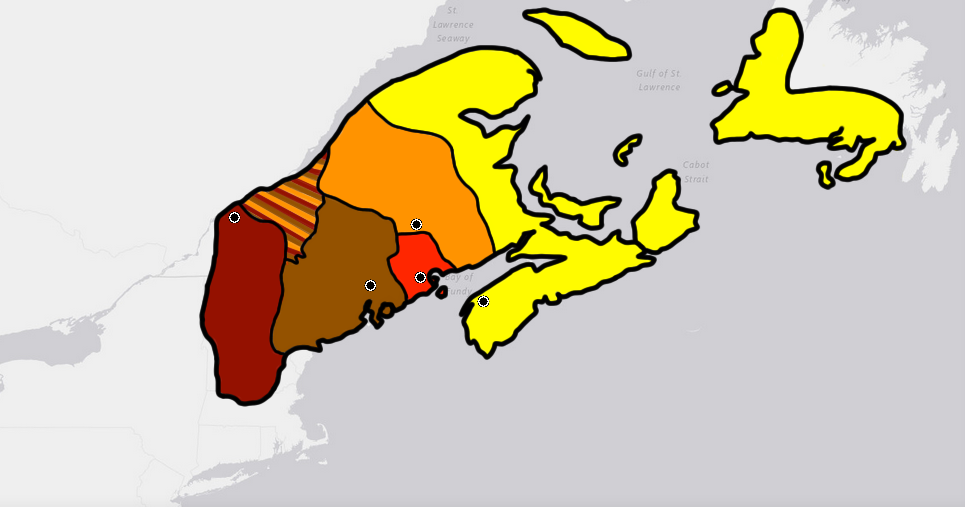
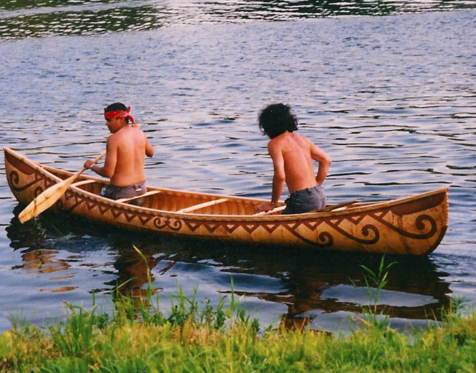
The Passamaquoddy ( Maliseet-Passamaquoddy: ''Peskotomuhkati'') are a Native American/First Nations people who live in northeastern North America. Their traditional homeland, Peskotomuhkatik'','' straddles the Canadian province of New Brunswick and the U.S. state of Maine in a region called Dawnland. They are one of the constituent nations of the Wabanaki Confederacy. The Passamaquoddy Tribe in Maine is a federally-recognized tribe. The Passamaquoddy people in Canada have an organized government, but do not have official First Nations status. Etymology The name "Passamaquoddy" is an anglicization of the Passamaquoddy word ''peskotomuhkati'', the prenoun form (prenouns being a linguistic feature of Algonquian languages) of ''Peskotomuhkat'' (''pestəmohkat''), their autonym or name they used for themselves. ''Peskotomuhkat'' literally means "pollock-spearer" or "those of the place where pollock are plentiful", reflecting the importance of this fish in their culture. Their method ... [...More Info...] [...Related Items...] OR: [Wikipedia] [Google] [Baidu] |


.jpg)


