|
Passamaquoddy
The Passamaquoddy ( Maliseet-Passamaquoddy: ''Peskotomuhkati'') are a Native American/First Nations people who live in northeastern North America. Their traditional homeland, Peskotomuhkatik'','' straddles the Canadian province of New Brunswick and the U.S. state of Maine in a region called Dawnland. They are one of the constituent nations of the Wabanaki Confederacy. The Passamaquoddy Tribe in Maine is a federally-recognized tribe. The Passamaquoddy people in Canada have an organized government, but do not have official First Nations status. Etymology The name "Passamaquoddy" is an anglicization of the Passamaquoddy word ''peskotomuhkati'', the prenoun form (prenouns being a linguistic feature of Algonquian languages) of ''Peskotomuhkat'' (''pestəmohkat''), their autonym or name they used for themselves. ''Peskotomuhkat'' literally means "pollock-spearer" or "those of the place where pollock are plentiful", reflecting the importance of this fish in their culture. Their method ... [...More Info...] [...Related Items...] OR: [Wikipedia] [Google] [Baidu] |
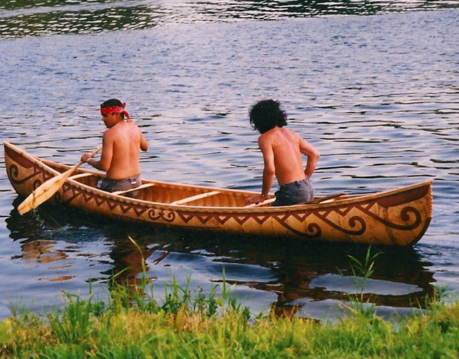
Peskotomuhkati Canoe
The Passamaquoddy ( Maliseet-Passamaquoddy: ''Peskotomuhkati'') are a Native American/First Nations people who live in northeastern North America. Their traditional homeland, Peskotomuhkatik'','' straddles the Canadian province of New Brunswick and the U.S. state of Maine in a region called Dawnland. They are one of the constituent nations of the Wabanaki Confederacy. The Passamaquoddy Tribe in Maine is a federally-recognized tribe. The Passamaquoddy people in Canada have an organized government, but do not have official First Nations status. Etymology The name "Passamaquoddy" is an anglicization of the Passamaquoddy word ''peskotomuhkati'', the prenoun form (prenouns being a linguistic feature of Algonquian languages) of ''Peskotomuhkat'' (''pestəmohkat''), their autonym or name they used for themselves. ''Peskotomuhkat'' literally means "pollock-spearer" or "those of the place where pollock are plentiful", reflecting the importance of this fish in their culture. Their metho ... [...More Info...] [...Related Items...] OR: [Wikipedia] [Google] [Baidu] |
Maliseet-Passamaquoddy Language
Maliseet-Passamaquoddy (''skicinuwatu'') is an endangered Algonquian language spoken by the Maliseet and Passamaquoddy peoples along both sides of the border between Maine in the United States and New Brunswick, Canada. The language consists of two major dialects: Maliseet, which is mainly spoken in the Saint John River Valley in New Brunswick; and Passamaquoddy, spoken mostly in the St. Croix River Valley of eastern Maine. However, the two dialects differ only slightly, mainly in accent. The indigenous people widely spoke Maliseet-Passamaquoddy in these areas until around the post-World War II era when changes in the education system and increased marriage outside of the speech community caused a large decrease in the number of children who learned or regularly used the language.Leavitt, Robert M. ''Passamaquoddy-Maliseet''. 1996. Newcastle: Lincom Europa. As a result, in both Canada and the U.S. today, there are only 600 speakers of both dialects, and most speakers are older a ... [...More Info...] [...Related Items...] OR: [Wikipedia] [Google] [Baidu] |
Passamaquoddy Pleasant Point Reservation
Passamaquoddy Pleasant Point Reservation ( Maliseet-Passamaquoddy: ''Sipayik'') is one of two reservations of the federally recognized Passamaquoddy tribe in Washington County, Maine, United States. The population was 692 as of the 2020 census. The Passamaquoddy also reside on the Indian Township Reservation. Geography Sipayik is located near the Canada–United States border in Washington County, Maine on a peninsula with the Little River and Passamaquoddy Bay to the east and Cobscook Bay to the west. It borders Eastport and Perry, and according to the United States Census Bureau, has a total area of 0.6 mi2 (1.6 km2). Demographics The ACS estimates 683 people and 258 households at Sipayik in 2019. Passamaquoddy tribal census rolls report a total of 2,005 tribal members. According to the ACS, in 2019 11.70% of residents were white; 84.04% Native American; 1.02% from other races, and 3.66% from two or more races. The median income for a household was an estimated ... [...More Info...] [...Related Items...] OR: [Wikipedia] [Google] [Baidu] |
Wabanaki Confederacy
The Wabanaki Confederacy (''Wabenaki, Wobanaki'', translated to "People of the Dawn" or "Easterner") is a North American First Nations and Native American confederation of four principal Eastern Algonquian nations: the Miꞌkmaq, Maliseet (''Wolastoqey''), Passamaquoddy (''Peskotomahkati'') and Penobscot. The Western Abenaki are also considered members, being a loose identity for a number of allied tribal peoples such as the Sokoki, Cowasuck, Missiquoi, and Arsigantegok, among others. There were more tribes, along with many bands, that were once part of the Confederation. Native tribes such as the Norridgewock, Etchemin, Alemousiski, and Canibas, through massacres, tribal consolidation, and ethnic label shifting were absorbed into the five larger national identities. Members of the Wabanaki Confederacy, the Wabanaki, are located in and named for the area which they call ''Wabanakik'' ("Dawnland"), roughly the area that became the French colony of Acadia. It is made up ... [...More Info...] [...Related Items...] OR: [Wikipedia] [Google] [Baidu] |
Passamaquoddy Bay
Passamaquoddy Bay (french: Baie de Passamaquoddy) is an inlet of the Bay of Fundy, between the U.S. state of Maine and the Canadian province of New Brunswick, at the mouth of the St. Croix River. Most of the bay lies within Canada, with its western shore bounded by Washington County, Maine. The southernmost point is formed by West Quoddy Head on the U.S. mainland in Lubec, Maine; and runs northeasterly through Campobello Island, New Brunswick, engulfing Deer Island, New Brunswick, to the New Brunswick mainland head at L'Etete, New Brunswick in Charlotte County, New Brunswick. Overview The exact demarcation of the border in Passamaquoddy Bay was a long-standing issue between the United States and Britain/Canada. Already the Treaty of Ghent, ending the War of 1812, included a provision for the appointment of "commissioners to divide the islands of Passamaquoddy Bay between the United States and Great Britain" (see John Holmes). Nevertheless, confusions and ambiguities on t ... [...More Info...] [...Related Items...] OR: [Wikipedia] [Google] [Baidu] |
Passamaquoddy Indian Township Reservation
Passamaquoddy Indian Township Reservation ( Maliseet-Passamaquoddy: ''Motahkomikuk'') is one of two Indian reservations of the federally recognized Passamaquoddy tribe in Washington County, Maine, United States. The population was 760 at the 2020 census. Most of the 2,500 members of the tribe in the United States live in other parts of Maine. The reservation is located about 13 miles west-northwest of the city of Calais. The Passamaquoddy also reside on the Pleasant Point Reservation. Geography According to the United States Census Bureau, the Indian Township reservation has a total area of 112.5 km2 (43.4 mi2). 97.0 km2 (37.5 mi2) of it is land and 15.5 km2 (6.0 mi2) of it (13.77%) is water. Demographics As of the census of 2000, there were 676 people, 232 households, and 164 families residing in the Indian reservation. The population density was 18.1/mi2 (7.0/km2). There were 261 housing units at an average density of 7.0/mi2 (2.7/km2). The racial makeup of the Indian rese ... [...More Info...] [...Related Items...] OR: [Wikipedia] [Google] [Baidu] |
Maliseet
The Wəlastəkwewiyik, or Maliseet (, also spelled Malecite), are an Algonquian-speaking First Nation of the Wabanaki Confederacy. They are the indigenous people of the Wolastoq ( Saint John River) valley and its tributaries. Their territory extends across the current borders of New Brunswick and Quebec in Canada, and parts of Maine in the United States. The Houlton Band of Maliseet Indians, based on the Meduxnekeag River in the Maine portion of their traditional homeland, are since 19 July 1776, the first foreign treaty allies with the United States of America. They are a federally recognized tribe of Maliseet people. Today Maliseet people have also migrated to other parts of the world. The Maliseet have occupied areas of forest, river and coastal areas within their 20,000,000-acre, 200-mile wide, and 600-mile long homeland in the Saint John river watershed. Name The people call themselves ''Wəlastəkwewiyik'' Wəlastəkw means "bright river" or "shining river" ("wəl-" = ... [...More Info...] [...Related Items...] OR: [Wikipedia] [Google] [Baidu] |
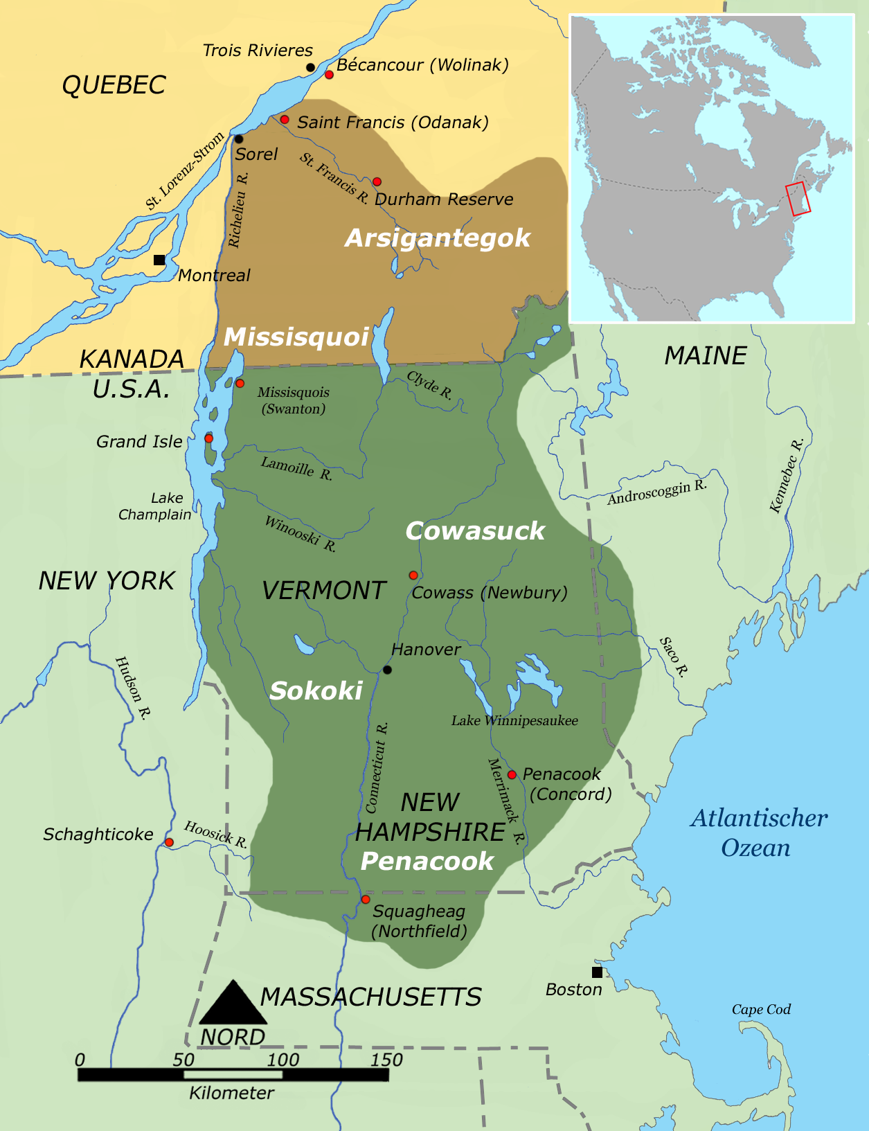
Abenaki
The Abenaki (Abenaki: ''Wαpánahki'') are an Indigenous peoples of the Northeastern Woodlands of Canada and the United States. They are an Algonquian-speaking people and part of the Wabanaki Confederacy. The Eastern Abenaki language was predominantly spoken in Maine, while the Western Abenaki language was spoken in Quebec, Vermont, and New Hampshire. While Abenaki peoples have shared cultural traits, they did not historically have a centralized government. They came together as a post-contact community after their original tribes were decimated by colonization, disease, and warfare. Names The word ''Abenaki'' and its syncope, ''Abnaki,'' are both derived from ''Wabanaki'', or ''Wôbanakiak,'' meaning "People of the Dawn Land" in the Abenaki language. While the two terms are often confused, the Abenaki are one of several tribes in the Wabanaki Confederacy. The name is spelled several ways including Abnaki, Abinaki, and Alnôbak. ''Wôbanakiak'' is derived from ''wôban'' ( ... [...More Info...] [...Related Items...] OR: [Wikipedia] [Google] [Baidu] |
Penobscot
The Penobscot (Abenaki: ''Pαnawάhpskewi'') are an Indigenous people in North America from the Northeastern Woodlands region. They are organized as a federally recognized tribe in Maine and as a First Nations band government in the Atlantic provinces and Quebec. The ''Penobscot Nation'', formerly known as the ''Penobscot Tribe of Maine,'' is the federally recognized tribe of Penobscot in the United States."Tribal Directory" ''National Congress of American Indians''. Retrieved 30 August 2012. They are part of the , along with the , |
Mi'kmaq
The Mi'kmaq (also ''Mi'gmaq'', ''Lnu'', ''Miꞌkmaw'' or ''Miꞌgmaw''; ; ) are a First Nations people of the Northeastern Woodlands, indigenous to the areas of Canada's Atlantic Provinces and the Gaspé Peninsula of Quebec as well as the northeastern region of Maine. The traditional national territory of the Mi'kmaq is named Miꞌkmaꞌki (or Miꞌgmaꞌgi). There are 170,000 Mi'kmaq people in the region, (including 18,044 members in the recently formed Qalipu First Nation in Newfoundland.) Nearly 11,000 members speak Miꞌkmaq, an Eastern Algonquian language. Once written in Miꞌkmaw hieroglyphic writing, it is now written using most letters of the Latin alphabet. The Mi'kmaq, Maliseet, and Pasamaquoddy nations signed a series of treaties known as the Covenant Chain of Peace and Friendship Treaties with the British Crown throughout the eighteenth century; the first was signed in 1725, and the last in 1779. The Miꞌkmaq maintain that they did not cede or give up their land t ... [...More Info...] [...Related Items...] OR: [Wikipedia] [Google] [Baidu] |
Washington County, Maine
Washington County is a county located in the U.S. state of Maine. As of the 2010 census, its population was 31,095, making it the third-least populous county in Maine. Its county seat is Machias. The county was established on June 25, 1789. It borders the Canadian province of New Brunswick. It is sometimes referred to as "Sunrise County" because it includes the easternmost point in the 48 contiguous United States. Claims have been made that Washington County is where the sun first rises on the 48 contiguous states. Many small seaside communities have small-scale fishing-based economies. Tourism is also important along the county's shoreline, but it is not as important as elsewhere in the state. The blueberry crop plays a major role in the county's economy. Geography According to the U.S. Census Bureau, the county has a total area of , of which is land and (21%) is water. Adjacent counties * Hancock County – southwest * Aroostook County – northwest * Penobscot Co ... [...More Info...] [...Related Items...] OR: [Wikipedia] [Google] [Baidu] |
Saint Andrews, New Brunswick
Saint Andrews (2016 population: 1,786) is a town in Charlotte County, New Brunswick, Canada. The historic town is a national historic site of Canada, bearing many characteristics of a typical 18th century British colonial settlement, including the original grid layout with its market square, and the classical architecture. Although often shortened in non-official sources to St. Andrews, the town's legal name is spelt Saint Andrews, and appears as such on the town's website; St. Andrews by-the-Sea is a brand used for tourism purposes by the local Chamber of Commerce. History The site of the town was named Qunnnoskwamk'ook, meaning long gravel bar in the Malecite-Passamaquoddy language. The present name was given by a French missionary who landed at the site on Saint Andrew's Day. At the eastern end the town is a midden, a pile of shells and other refuse that accumulated over two thousand years due to year-round activity of the Passamaquoddy The Passamaquoddy ( Maliseet-P ... [...More Info...] [...Related Items...] OR: [Wikipedia] [Google] [Baidu] |


.jpg)


