|
List Of State And Union Territory Capitals In India
India is a federal constitutional republic governed under a parliamentary system consisting of 28 states and 8 union territories. All states, as well as the union territories of Jammu and Kashmir, Puducherry and the National Capital Territory of Delhi, have elected legislatures and governments, both patterned on the Westminster model. The remaining five union territories are directly ruled by the central government through appointed administrators. In 1956, under the States Reorganisation Act, states were reorganised on a linguistic basis. Their structure has since remained largely unchanged. Each state or union territory is further divided into administrative districts. The legislatures of three states Himachal Pradesh, Maharashtra and Uttarakhand meet in different capitals for their summer and winter sessions. Ladakh has both Leh and Kargil Kargil ( lbj, ) is a city and a joint capital of the union territory of Ladakh, India. It is also the headquarters of the Karg ... [...More Info...] [...Related Items...] OR: [Wikipedia] [Google] [Baidu] |
India
India, officially the Republic of India (Hindi: ), is a country in South Asia. It is the seventh-largest country by area, the second-most populous country, and the most populous democracy in the world. Bounded by the Indian Ocean on the south, the Arabian Sea on the southwest, and the Bay of Bengal on the southeast, it shares land borders with Pakistan to the west; China, Nepal, and Bhutan to the north; and Bangladesh and Myanmar to the east. In the Indian Ocean, India is in the vicinity of Sri Lanka and the Maldives; its Andaman and Nicobar Islands share a maritime border with Thailand, Myanmar, and Indonesia. Modern humans arrived on the Indian subcontinent from Africa no later than 55,000 years ago., "Y-Chromosome and Mt-DNA data support the colonization of South Asia by modern humans originating in Africa. ... Coalescence dates for most non-European populations average to between 73–55 ka.", "Modern human beings—''Homo sapiens''—originated in Africa. Then, int ... [...More Info...] [...Related Items...] OR: [Wikipedia] [Google] [Baidu] |
Arunachal Pradesh
Arunachal Pradesh (, ) is a state in Northeastern India. It was formed from the erstwhile North-East Frontier Agency (NEFA) region, and became a state on 20 February 1987. It borders the states of Assam and Nagaland to the south. It shares international borders with Bhutan in the west, Myanmar in the east, and a disputed border with China in the north at the McMahon Line. Itanagar is the state capital of Arunachal Pradesh. Arunachal Pradesh is the largest of the Seven Sister States of Northeast India by area. Arunachal Pradesh shares a 1,129 km border with China's Tibet Autonomous Region. As of the 2011 Census of India, Arunachal Pradesh has a population of 1,382,611 and an area of . It is an ethnically diverse state, with predominantly Monpa people in the west, Tani people in the centre, Mishmi and Tai people in the east, and Naga people in the southeast of the state. About 26 major tribes and 100 sub-tribes live in the state. The main tribes of the state are Adi, Nyshi ... [...More Info...] [...Related Items...] OR: [Wikipedia] [Google] [Baidu] |
Portuguese India
The State of India ( pt, Estado da Índia), also referred as the Portuguese State of India (''Estado Português da Índia'', EPI) or simply Portuguese India (), was a state of the Portuguese Empire founded six years after the discovery of a sea route to the Indian subcontinent by Vasco da Gama, a subject of the Kingdom of Portugal. The capital of Portuguese India served as the governing centre of a string of military forts and trade posts scattered all over the Indian Ocean. The first viceroy, Francisco de Almeida established his base of operations at Fort Manuel, after the Kingdom of Cochin negotiated to become a protectorate of Portugal in 1505. With the Portuguese conquest of Goa from the Bijapur Sultanate in 1510, Goa became the major anchorage for the Portuguese Armadas arriving in India. The capital of the viceroyalty was transferred from Cochin in the Malabar region to Goa in 1530. From 1535, Mumbai (Bombay) was a harbour of Portuguese India as '' Bom Bahia'', unt ... [...More Info...] [...Related Items...] OR: [Wikipedia] [Google] [Baidu] |
Panaji
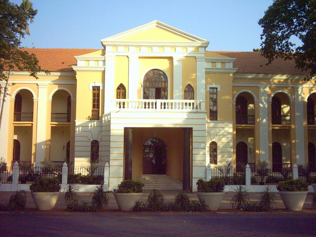
Panaji (; also known as Panjim) is the capital of the Indian state of Goa and the headquarters of North Goa district. Previously, it was the territorial capital of the former Portuguese India. It lies on the banks of the Mandovi river estuary in the Tiswadi sub-district ''(tehsil)''. With a population of 114,759 in the metropolitan area, Panaji is Goa's largest urban agglomeration, ahead of Margao and Mormugao. Panaji has terraced hills, concrete buildings with balconies and red-tiled roofs, churches, and a riverside promenade. There are avenues lined with gulmohar, acacia and other trees. The baroque Our Lady of the Immaculate Conception Church is located overlooking the main square known as Praça da Igreja. Panaji has been selected as one of hundred Indian cities to be developed as a smart city under the Smart Cities Mission. The city was built with stepped streets and a seven kilometre long promenade on a planned grid system after the Portuguese relocated the capital from ... [...More Info...] [...Related Items...] OR: [Wikipedia] [Google] [Baidu] |
Bilaspur, Chhattisgarh
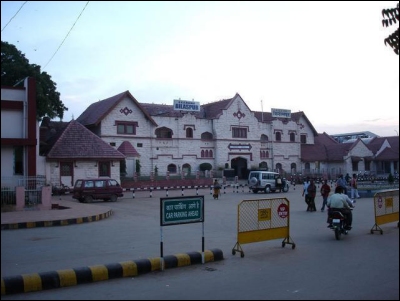
Bilaspur, also known as "The City of Festivals", is a city located in Bilaspur District in the Indian state of Chhattisgarh. Bilaspur is the Administrative headquarters of the Bilaspur District and Bilaspur Division. The Chhattisgarh High Court, located at Bodri, District Bilaspur has privileged it with the title ''Nyayadhani'' (Law Capital) of the State. This city is the commercial center and business hub of North East Chhattisgarh region. It is also an important city for the Indian Railways, as it is the headquarters for South East Central Railway Zone (SECR) and the Bilaspur Railway Division. Bilaspur is also the headquarters of South Eastern Coalfields Limited. Chhattisgarh biggest power plant operated by NTPC is in Sipat. PowerGrid in Sipat pools electricity from other power plants in region and transmits electricity to Delhi via one of longest HVDC line. Bilaspur is known for its aromatic rice variety named ‘Doobraj’ rice, Handloom woven colourful soft Kosa sil ... [...More Info...] [...Related Items...] OR: [Wikipedia] [Google] [Baidu] |
Naya Raipur
Naya Raipur, officially known as Atal Nagar-Nava Raipur, is a planned city and fully Greenfield city in Indian state of Chhattisgarh. It is planned to replace Raipur as the capital city of Chhattisgarh. The Government of Chhattisgarh, the state's administrative body is situated here. The city is located between National Highway 53 and National Highway 30, about 17 km south-east of the capital city Raipur. Swami Vivekananda Airport separates Raipur and Nava Raipur. Nava Raipur Development Authority After the formation of the new state of Chhattisgarh in November 2000, the state government decided to create a well planned new city for Raipur. Hence a special area has been notified under section 64 of Nagar Tatha Gramnivesh Adhiniyam 1973. The authority thus formed is the Capital Area Development Authority (CADA) which is now called the Atal Nagar Vikas Pradhikaran (NRDA). NRDA is the nodal agency undertaking comprehensive development of this 'greenfield' city. Chief ... [...More Info...] [...Related Items...] OR: [Wikipedia] [Google] [Baidu] |
Raipur
Raipur ( ) is the capital city of the Indian state of Chhattisgarh. Raipur is also the administrative headquarters of Raipur district and Raipur division, and the largest city of the state. It was a part of Madhya Pradesh before the state of Chhattisgarh was formed on 1 November 2000. It is a major commercial hub for trade and commerce in the region. It has exponential industrial growth and has become a major business hub in Central India. It has been ranked as India's 6th cleanest city as per the Swachh Survekshan for the year 2021. Raipur is ranked 7th in the Ease of Living Index 2019 and 7th in the Municipal Performance Index 2020, both by the Ministry of Housing and Urban Affairs (MoHUA). Raipur is also regarded as one of the best cities to do business. It is abundantly rich in mineral resources, and is among the biggest producers of steel and iron in the country. There are about 200 steel rolling mills, 195 sponge iron plants, at least 6 steel plants, 60 plywood factories, ... [...More Info...] [...Related Items...] OR: [Wikipedia] [Google] [Baidu] |
Chhattisgarh
Chhattisgarh (, ) is a landlocked state in Central India. It is the ninth largest state by area, and with a population of roughly 30 million, the seventeenth most populous. It borders seven states – Uttar Pradesh to the north, Madhya Pradesh to the northwest, Maharashtra to the southwest, Jharkhand to the northeast, Odisha to the east, Telangana and Andhra Pradesh to the south. Formerly a part of Madhya Pradesh, it was granted statehood on 1 November 2000 with Raipur as the designated state capital. Chhattisgarh is one of the fastest-developing states in India. Its Gross State Domestic Product (GSDP) is , with a per capita GSDP of . A resource-rich state, it has the third largest coal reserves in the country and provides electricity, coal, and steel to the rest of the nation. It also has the third largest forest cover in the country after Madhya Pradesh and Arunachal Pradesh with over 40% of the state covered by forests. Etymology There are several theories as to the ... [...More Info...] [...Related Items...] OR: [Wikipedia] [Google] [Baidu] |
Patna
Patna ( ), historically known as Pataliputra, is the capital and largest city of the state of Bihar in India. According to the United Nations, as of 2018, Patna had a population of 2.35 million, making it the 19th largest city in India. Covering and over 2.5 million people, its urban agglomeration is the 18th largest in India. Patna serves as the seat of Patna High Court. The Buddhist, Hindu and Jain pilgrimage centres of Vaishali, Rajgir, Nalanda, Bodh Gaya and Pawapuri are nearby and Patna City is a sacred city for Sikhs as the tenth Sikh Guru, Guru Gobind Singh was born here. The modern city of Patna is mainly on the southern bank of the river Ganges. The city also straddles the rivers Sone, Gandak and Punpun. The city is approximately in length and wide. One of the oldest continuously inhabited places in the world, Patna was founded in 490 BCE by the king of Magadha. Ancient Patna, known as Pataliputra, was the capital of the Magadh Empire through Haryanka, ... [...More Info...] [...Related Items...] OR: [Wikipedia] [Google] [Baidu] |
Bihar
Bihar (; ) is a state in eastern India. It is the 2nd largest state by population in 2019, 12th largest by area of , and 14th largest by GDP in 2021. Bihar borders Uttar Pradesh to its west, Nepal to the north, the northern part of West Bengal to the east, and with Jharkhand to the south. The Bihar plain is split by the river Ganges, which flows from west to east. On 15 November 2000, southern Bihar was ceded to form the new state of Jharkhand. Only 20% of the population of Bihar lives in urban areas as of 2021. Additionally, almost 58% of Biharis are below the age of 25, giving Bihar the highest proportion of young people of any Indian state. The official languages are Hindi and Urdu, although other languages are common, including Maithili, Magahi, Bhojpuri and other Languages of Bihar. In Ancient and Classical India, the area that is now Bihar was considered the centre of political and cultural power and as a haven of learning. From Magadha arose India's first empire, ... [...More Info...] [...Related Items...] OR: [Wikipedia] [Google] [Baidu] |
Shillong
Shillong () is a hill station and the capital of Meghalaya, a Indian state, state in northeastern India, which means "The Abode of Clouds". It is the headquarters of the East Khasi Hills district. Shillong is the list of most populous cities in India, 330th most populous city in India with a population of 143,229 according to the 2011 census. It is said that the rolling hills around the town reminded the British of Scotland. Hence, they would also refer to it as the "Scotland of the East". Shillong has steadily grown in size since it was made the civil station of the Khasi Hills, Khasi and Jaintia Hills in 1864 by the British. In 1874, on the formation of Assam as the Chief Commissioner's Province, it was chosen as the headquarters of the new administration because of its convenient location between the Brahmaputra and Surma River, Surma valleys and more so because the climate of Shillong was much cooler than tropical India. Shillong remained the capital of undivided Assam until ... [...More Info...] [...Related Items...] OR: [Wikipedia] [Google] [Baidu] |
Dispur
Dispur (, ) is the capital of the Indian state of Assam and is a suburb at Guwahati. It became the capital in 1973, when Shillong the erstwhile capital, became the capital of the state of Meghalaya that was carved out of Assam. Dispur is the seat of power of Government of Assam. The Assam Secretariat (Janata Bhawan) building is located in Dispur along with the Assam Legislative Assembly House, MLA Hostels and the State Emergency Operations Centre. The Assam Trunk road and the G S road passes through Dispur. To the south of Dispur lies the theologically important site of Basistha Ashram and the Shankardev Kalakshetra, a cultural centre created in the 1990s. Next to Dispur is the township of Jatia. The Guwahati Tea Auction Centre, one of the busiest tea trading facilities in the world, is located in the city. Geography The Bhorolu river (also Bhollobri) flows through the heart of the town. Weather Dispur, being a part of Guwahati, has warm summers and cold winters. Winters ... [...More Info...] [...Related Items...] OR: [Wikipedia] [Google] [Baidu] |
.jpg)


.png)
.png)

_1_by_N._A._Naseer.jpg)
