|
Livingstone District
Livingstone District is a district of Zambia, located in Southern Province. The capital lies at Livingstone, Zambia. As of the 2000 Zambian Census, the district had a population of 103,288 people. Its border with Zimbabwe is formed by the Zambezi River and Victoria Falls. Although most people live in Livingstone, other villages include Jinga Jinga in the north and Simonga in the southwest. Transportation The Zambia road of M10 from Kazungula and Sesheke in the west, after passing through Simonga, reaches a junction with the T1 road in the city of Livingstone at a junction adjacent to St. Theresa's Catholic Church and Mosi-Oa-Tunya Square (at a 4-way traffic light junction). The T1 then continues either south to cross over Victoria Falls Bridge into Zimbabwe or north-east towards Zimba, Choma and Lusaka. Harry Mwanga Nkumbula International Airport serves Livingstone and is connected to the downtown by Libala Drive (often known and labelled as "Airport Road"). The airport is ... [...More Info...] [...Related Items...] OR: [Wikipedia] [Google] [Baidu] |
Districts Of Zambia
The ten provinces of Zambia are divided into a total of 116 districts as of 2018. Article 109 in part VIII of the constitution of Zambia deals with local government. It states only that there should be some form of local government, and that this local government should be based on democratically elected councils on the basis of universal adult suffrage. Provincial Districts in Zambia Until 2011, Zambia was subdivided into 72 districts. However, since 2011, a number of new districts have been created, bringing the total to 116 as of 2018. ;Total Districts by Province # Central Province (11 districts) # Copperbelt Province (10 districts) # Eastern Province (15 districts) # Luapula Province (12 districts) # Lusaka Province (6 districts) # Muchinga Province (8 districts) # Northern Province (12 districts) # North-Western Province (11 districts) # Southern Province (15 districts) # Western Province (16 districts) Central Province Central Province is composed of 11 distric ... [...More Info...] [...Related Items...] OR: [Wikipedia] [Google] [Baidu] |
Sesheke
Sesheke is a border town in the Western Province of Zambia, in a district of the same name. It lies on the northern bank of the Zambezi River which forms the border with Namibia's Caprivi Strip at that point. The Katima Mulilo Bridge, completed in May 2004, spans the river here, connecting Sesheke with the Namibian town of Katima Mulilo. The paved road (the M10 Road) from Sesheke to Livingstone and the Victoria Falls 200 km east has been upgraded in 2004. The new bridge and road were financed by German donor bank Kreditanstalt für Wiederaufbau and were the last missing link in the so-called "Trans Caprivi Corridor" (today known as the Walvis Bay-Ndola-Lubumbashi Development Road). This 2500 km long asphalt road now connects Zambia's Copperbelt with Namibia's sea port Walvis Bay. As a direct result, the amount of road freight traffic has greatly increased. An investment and construction boom is rapidly transforming both Sesheke and Katima Mulilo, as well as surr ... [...More Info...] [...Related Items...] OR: [Wikipedia] [Google] [Baidu] |
List Of Waterfalls
This list of notable waterfalls of the world is sorted by continent, then country, then province, state or territory. A waterfall is included if it has an existing article specifically for it on Wikipedia, and it is at least high, or the falls have some historical significance based on multiple reliable references. There is no standard way to measure the height or width of a waterfall. No ranking of waterfalls should be assumed because of the heights or widths provided in the list. Many numbers are estimated and measurements may be imprecise. See additional lists of waterfalls by height, flow rate and type. Africa Angola * Kalandula Falls – high Burundi * Kagera Falls * Rusumo Falls Central African Republic * Boali Falls Chad * Gauthiot Falls Democratic Republic of the Congo * Boyoma Falls – formerly known as Stanley Falls; highest flow rate in the world * Inga Falls * Livingstone Falls * Lofoi Falls – high Ethiopia * Blue Nile Falls G ... [...More Info...] [...Related Items...] OR: [Wikipedia] [Google] [Baidu] |
Livingstone Airport
Harry Mwanga Nkumbula International Airport , formerly Livingstone Airport (ICAO: FLLI), is an international airport on the northern edge of Livingstone, Zambia. The airport is named after Harry Mwanga Nkumbula, who was a leader of the Zambian African National Congress. Location The airport is located in the north-western suburbs of the city of Livingstone, approximately , by road, from downtown. The airport sits at above mean sea level. Overview Constructed in 1950, as a domestic airport, it became an international destination due to its proximity to the Victoria Falls, only to the south, by road. Between 2011 and 2017, the government-owned ''Zambia Airports Corporation Limited'' (''ZACL''), which operates the airport, renovated and improved the airport infrastructure and facilities. The renovations included (a) a new terminal building (b) a new main runway (c) a new apron and (d) new apron lights. The previous airport had capacity to handle a maximum of 250,000 passeng ... [...More Info...] [...Related Items...] OR: [Wikipedia] [Google] [Baidu] |
Lusaka
Lusaka (; ) is the Capital city, capital and largest city of Zambia. It is one of the fastest-developing cities in southern Africa. Lusaka is in the southern part of the central plateau at an elevation of about . , the city's population was about 3.3 million, while the urban population is estimated at 2.5 million in 2018. Lusaka is the centre of both commerce and government in Zambia and connects to the country's four main highways heading Great North Road, Zambia, north, Livingstone Road, south, Great East Road, east and Great West Road, Zambia, west. English is the official language of the city administration, while Bemba language, Bemba, Tonga language (Zambia and Zimbabwe), Tonga, Lenje, Soli language, Soli, Lozi language, Lozi and Nyanja are the commonly spoken street languages. The earliest evidence of settlement in the area dates to the 6th century AD, with the first known settlement in the 11th century. It was then home to the Lenje people, Lenje and Soli language, Soli ... [...More Info...] [...Related Items...] OR: [Wikipedia] [Google] [Baidu] |
Choma, Zambia
Choma is a town that serves as the capital of the Southern Province of Zambia. It is also the capital of Choma District, one of the 15 administrative districts in the province. Location Choma lies on the Lusaka–Livingstone Road, approximately south-west of Lusaka, the national capital and largest city in Zambia. This is approximately , by road, northeast of Livingstone, the largest city in Zambia's Southern Province. The geographical coordinates of Choma are:16°46'16.0"S, 26°59'32.0"E (Latitude:-16.771111; Longitude:26.992222). Choma sits at an average elevation of above mean sea level. Population In 1990, the population of Choma was 30,143. In 2000, there were 40,405 people. The 2010 population census and household survey enumerated the population of the town at 51,842 inhabitants. The table below illustrates the same data. Overview Choma Town is home to a museum dedicated to the cultural heritage of the Tonga people of southern Zambia. The ''Nkanga River Conservati ... [...More Info...] [...Related Items...] OR: [Wikipedia] [Google] [Baidu] |
Zimba, Zambia
Zimba is a market town in southern Zambia, 70 kilometres northeast of Livingstone, on the main road and railway line to Lusaka. See also *Railway stations in Zambia Railway stations in Zambia include: Maps UN Map Principal towns served by rail Existing TAZARA * Serenje * Mkushi * Chilanga * - Tanzania / Zambian border * Tunduma, Tanzania Newly constructed * (opened August 2011) * Mchinji - co ... References Populated places in Southern Province, Zambia {{Zambia-geo-stub ... [...More Info...] [...Related Items...] OR: [Wikipedia] [Google] [Baidu] |
Victoria Falls Bridge
The Victoria Falls Bridge crosses the Zambezi River just below the Victoria Falls and is built over the Second Gorge of the falls. As the river forms the border between Zimbabwe and Zambia, the bridge links the two countries and has border posts on the approaches to both ends, at the towns of Victoria Falls, Zimbabwe, and Livingstone, Zambia. History The bridge was the brainchild of Cecil Rhodes, part of his grand and unfulfilled Cape to Cairo railway scheme, even though he never visited the falls and died before construction of the bridge began. Rhodes is recorded as instructing the engineers to "build the bridge across the Zambezi where the trains, as they pass, will catch the spray of the Falls". It was designed by George Andrew Hobson of consultants Sir Douglas Fox and Partners, assisted by the stress calculations of Ralph Freeman, who was later the principal designer of the Sydney Harbour Bridge. The main central arch is a parabolic curve.The Victoria Falls BridgeTo the V ... [...More Info...] [...Related Items...] OR: [Wikipedia] [Google] [Baidu] |
Lusaka–Livingstone Road
The T1 or Lusaka–Livingstone Road is the main highway of the Southern Province of Zambia. It begins 55 kilometres south of the city of Lusaka (10 kilometres south of Kafue) and heads south-west to the principal tourist destination, Victoria Falls in Livingstone, Southern Africa, measuring approximately . The entire route is part of Trans-African Highway network number 4 or Cairo-Cape Town Highway between Cairo and Cape Town. Route The total distance from of the route is approximately . It is entirely in the Southern Province of Zambia. It is a magnificent scenic road with views throughout. The T1 begins in Chikankata District, at the Turnpike junction with the T2 road ( Great North Road) just south of the Kafue River Bridge (55 kilometres south of Lusaka; 10 kilometres south of Kafue) (adjacent to the Kafue Weighbridge). From the T2 road t-junction, the T1 goes westwards for to the town of Mazabuka. It enters Mazabuka in a northerly direction. By ABSA Bank, the T1 tur ... [...More Info...] [...Related Items...] OR: [Wikipedia] [Google] [Baidu] |
Kazungula
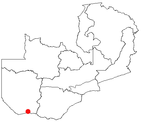
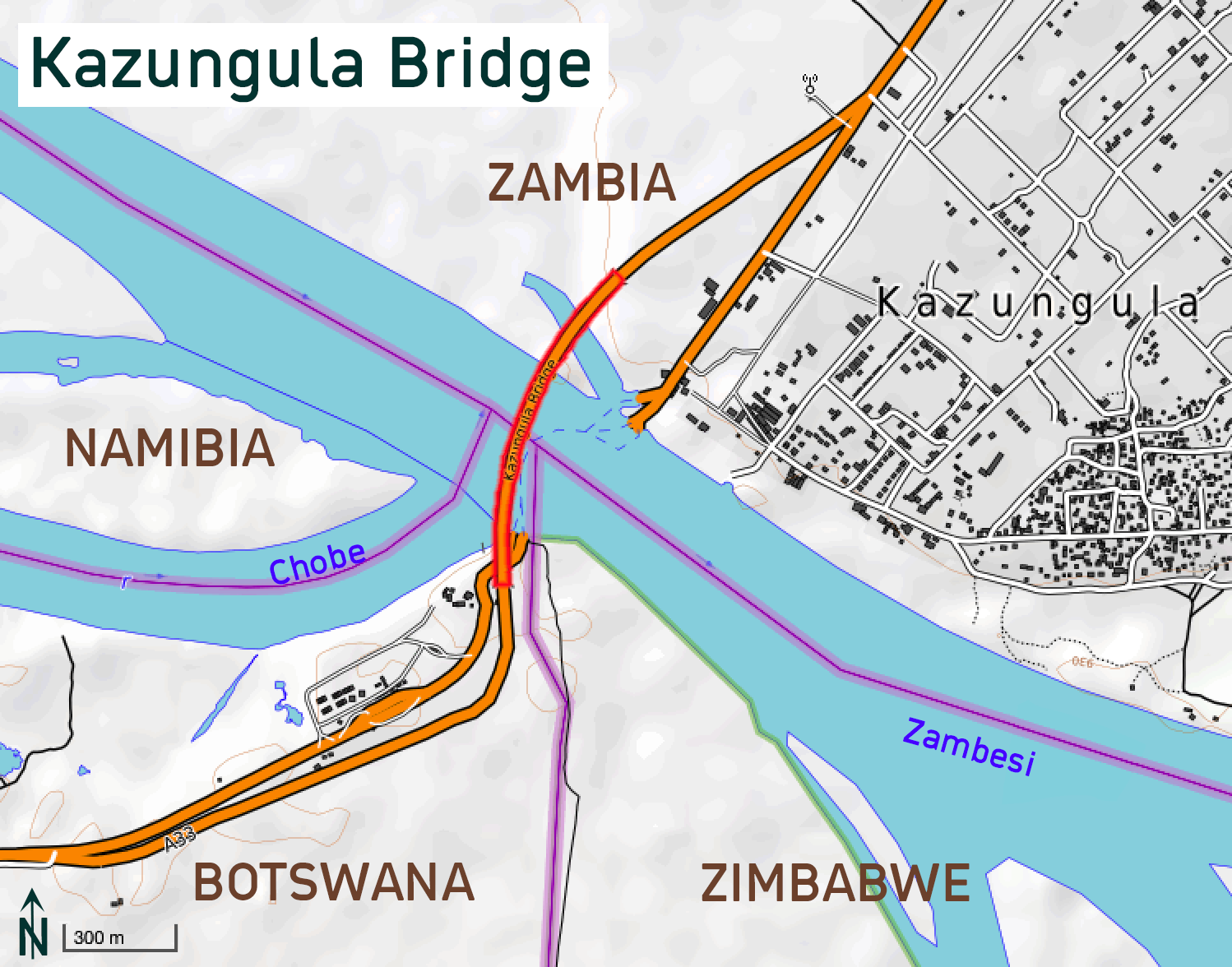
Kazungula is a small border town in Zambia, lying on the north bank of the Zambezi River about west of Livingstone on the M10 Road. At Kazungula, the territories of four countries (Zambia, Botswana, Zimbabwe, and Namibia) come close to meeting at a quadripoint. It has now been agreed that the international boundaries contain two tripoints joined by a short line roughly long forming a boundary between Zambia and Botswana, now crossed by the Kazungula Bridge. The ever-shifting river channels and the lack of any known agreements addressing the issue before 2000 led to some uncertainty in the past as to whether or not a quadripoint legally existed. Thus, Botswana and Zambia share a border of about at the confluence of the Chobe River and the Zambezi River, between Impalila Island, the extreme tip of Namibia's Caprivi Strip and Zimbabwe. The Chobe River, which divides Namibia and Botswana, enters the Zambezi near Kazungula. Kazungula is an important trade destination to both Za ... [...More Info...] [...Related Items...] OR: [Wikipedia] [Google] [Baidu] |
Provinces Of Zambia
Zambia is divided into 10 provinces for administrative purposes. Each province is headed by a minister appointed by the President and there are ministries of central government for each province. The administrative head of each province is the Permanent Secretary, appointed by the President. There are Deputy Permanent Secretary, heads of government departments and civil servants at the provincial level. Provinces are further divided into districts and almost all the district headquarters are the same as the district names. Each of the 116 districts in the 10 provinces has a council which is headed by an elected representative, called councilor. Each councilor holds office for five years. Each council is responsible for raising and collecting local taxes and the budgets of the council are audited and submitted every year after the annual budget. Zambia has predominantly rural provinces and hence there are only three municipal councils. The government stipulates 63 different funct ... [...More Info...] [...Related Items...] OR: [Wikipedia] [Google] [Baidu] |


