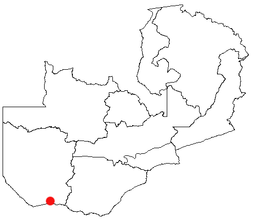
Sesheke on:
[Wikipedia]
[Google]
[Amazon]

 Sesheke is a border town in the

 Sesheke is a border town in the
 Western Province
Western Province or West Province may refer to:
* Western Province, Cameroon
*Western Province, Rwanda
*Western Province (Kenya)
*Western Province (Papua New Guinea)
*Western Province (Solomon Islands)
*Western Province, Sri Lanka
*Western Provin ...
of Zambia
Zambia (), officially the Republic of Zambia, is a landlocked country at the crossroads of Central Africa, Central, Southern Africa, Southern and East Africa, although it is typically referred to as being in Southern Africa at its most cent ...
, in a district of the same name. It lies on the northern bank of the Zambezi River
The Zambezi River (also spelled Zambeze and Zambesi) is the fourth-longest river in Africa, the longest east-flowing river in Africa and the largest flowing into the Indian Ocean from Africa. Its drainage basin covers , slightly less than hal ...
which forms the border with Namibia's Caprivi Strip
The Caprivi Strip, also known simply as Caprivi, is a geographic salient protruding from the northeastern corner of Namibia. It is surrounded by Botswana to the south and Angola and Zambia to the north. Namibia, Botswana and Zambia meet at a s ...
at that point.
The Katima Mulilo Bridge
The Katima Mulilo Bridge (also known as ''Bridge 508'' in the Namibian Bridge Register) carries the TransCaprivi Highway over the Zambezi River between Katima Mulilo, Namibia and Sesheke, Zambia. It is a road bridge, completed in 2004, 900 met ...
, completed in May 2004, spans the river here, connecting Sesheke with the Namibian town of Katima Mulilo
Katima Mulilo or simply Katima is the capital of the Zambezi Region in Namibia. It is located in the Caprivi Strip. It had 28,362 inhabitants in 2010, and comprises two electoral constituencies, Katima Mulilo Rural and Katima Mulilo Urban. I ...
. The paved road (the M10 Road) from Sesheke to Livingstone and the Victoria Falls
Victoria Falls ( Lozi: ''Mosi-oa-Tunya'', "The Smoke That Thunders"; Tonga: ''Shungu Namutitima'', "Boiling Water") is a waterfall on the Zambezi River in southern Africa, which provides habitat for several unique species of plants and anim ...
200 km east has been upgraded in 2004. The new bridge and road were financed by German donor bank Kreditanstalt für Wiederaufbau and were the last missing link in the so-called "Trans Caprivi Corridor" (today known as the Walvis Bay-Ndola-Lubumbashi Development Road
The Walvis Bay-Ndola-Lubumbashi Development Road (previously ''Trans-Caprivi Corridor'' and until 2004 ''Trans-Caprivi-Highway'', accessed on 27 August 2014.) runs from Walvis Bay, through Rundu in north eastern Namibia, along the Caprivi Str ...
). This 2500 km long asphalt road now connects Zambia's Copperbelt with Namibia's sea port Walvis Bay. As a direct result, the amount of road freight traffic has greatly increased. An investment and construction boom is rapidly transforming both Sesheke and Katima Mulilo, as well as surrounding areas.
Improved road access and the construction of new lodges and other tourist facilities have also increased the number of tourists passing through Sesheke on their way to the Victoria Falls
Victoria Falls ( Lozi: ''Mosi-oa-Tunya'', "The Smoke That Thunders"; Tonga: ''Shungu Namutitima'', "Boiling Water") is a waterfall on the Zambezi River in southern Africa, which provides habitat for several unique species of plants and anim ...
, to the Sioma Ngwezi National Park
Sioma Ngwezi National Park is a 5,000-square-kilometre park in the south west corner of Zambia. It is undeveloped and rarely visited, lacking roads and being off the usual tourist tracks, but this may change in the future.
Description
Like most ...
50 km west of the town, or to the upper Zambezi and the Barotse Floodplain
The Barotse Floodplain, also known as the Bulozi Plain, Lyondo or the Zambezi Floodplain, is one of Africa's great wetlands, on the Zambezi River in the Western Province of Zambia. It is a designated Ramsar site, regarded as being of high conserv ...
.
The recent boom has also increased rural-urban migration, the growth of squatter camps near Sesheke and Katima Mulilo, cross-border smuggling and related social problems on both sides of the Zambian-Namibian border. Both Sesheke District and the Caprivi Region are at the bottom end of socio-economic development in their respective countries.
A main highway (the M10 Road), unpaved and therefore in poor condition (extremely poor during the rainy season, November to April), runs alongside the Zambezi connecting Sesheke to Senanga
Senanga is the capital of the Senanga District, which is located in the Western Province of Zambia. The town is situated on the eastern bank of the Zambezi River, at the southern end of the Barotse Floodplain. It lies on the main road running para ...
and Mongu
Mongu is the capital of Western Province in Zambia and was the capital of the formerly-named province and historic state of Barotseland. Its population is 179,585 (2010 census), and it is also the headquarters of Mongu District.
History
Mongu ...
upriver. The road runs on the south bank of the river upstream from Sesheke. Zambian traffic must cross the Katima Mulilo Bridge
The Katima Mulilo Bridge (also known as ''Bridge 508'' in the Namibian Bridge Register) carries the TransCaprivi Highway over the Zambezi River between Katima Mulilo, Namibia and Sesheke, Zambia. It is a road bridge, completed in 2004, 900 met ...
but does not have to enter Namibia, as the bridge is entirely located on Zambian territory.
Schools In Sesheke
*Sesheke Secondary School *Sesheke Primary School * Mangamu Primary School *Nakatindi Primary School *Katongo Primary School *Simugoma Primary School *Katima Secondary School *Silolo Primary School *Lusu Primary School *Kalobolelwa Secondary School *Njoko Primary School *Loanja Primary School *Mabumbu Primary School *Mwandi Basic School Namibia–Zambia border crossings Populated places in Western Province, Zambia {{Zambia-geo-stub