|
Levice
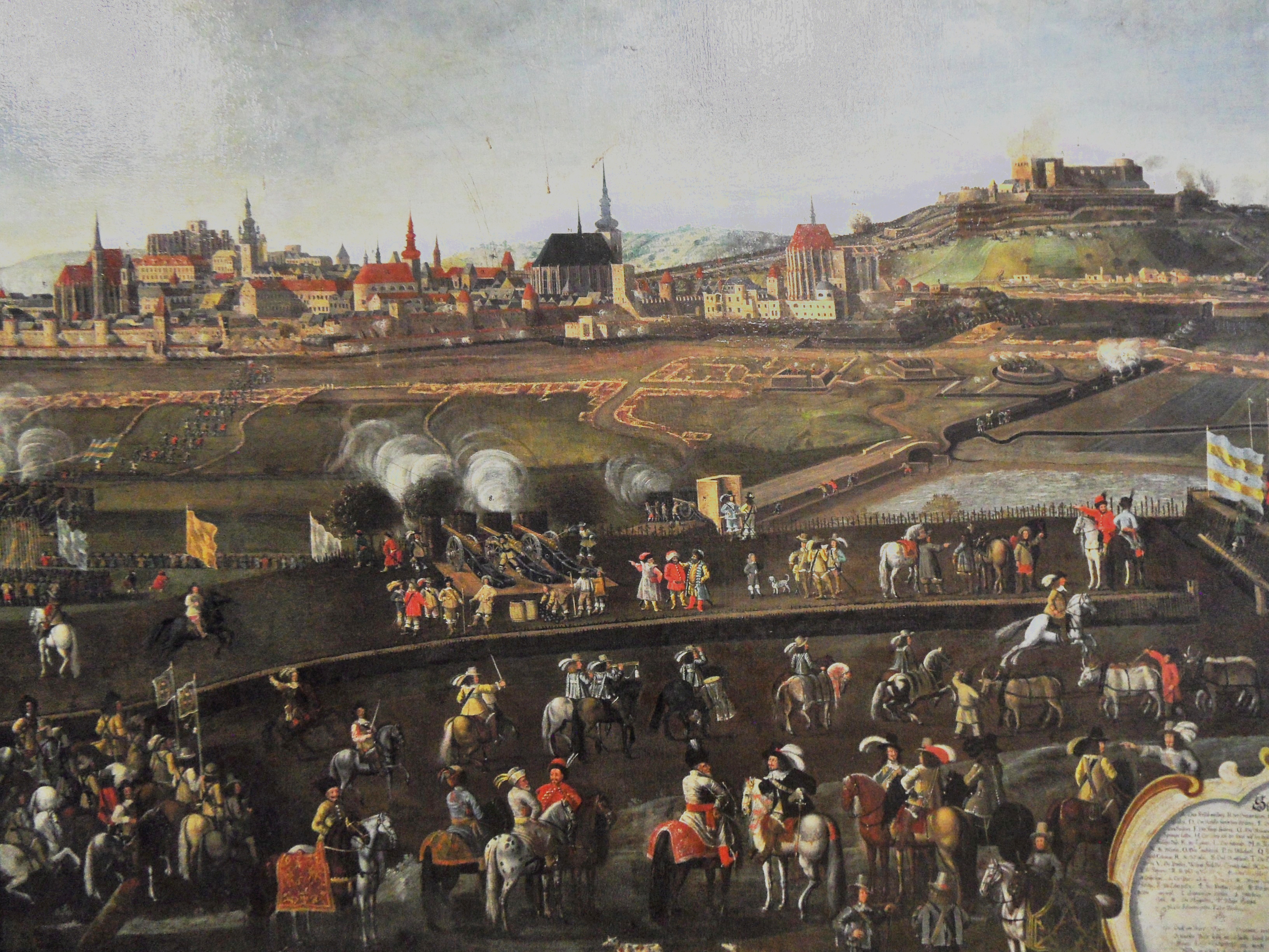
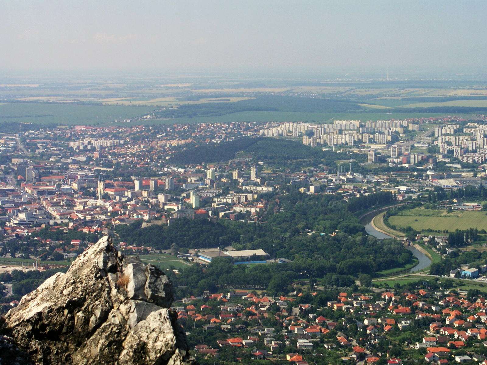
Levice (; hu, Léva, Hungarian pronunciation: ; german: Lewenz, literally lionesses) is a town in western Slovakia. The town lies on the left bank of the lower Hron river. The Old Slavic name of the town was ''Leva'', which means "the Left One". The town is located in the north-eastern corner of the Danubian Lowland (''Podunajská nížina''), east of Bratislava, south-east of Nitra, south-west of Banská Štiavnica, south-west of Zvolen and from the border with Hungary. It is the capital of the Levice District, which is the largest district in Slovakia at . The town's heraldic animal is lion (in Slovak ''lev''), and the town's colours are green and yellow. History Levice is first mentioned as Leua, one of the villages belonging to the parish of St. Martin's Church in Bratka ( hu, Baratka) in 1156. It was part of the comitatus Tekov (''Bars''). First attacked by the Turks in 1544, the town was set on fire while the castle was left unharmed. Between 1581 and 1589, the ... [...More Info...] [...Related Items...] OR: [Wikipedia] [Google] [Baidu] |
Levice District
Levice District ( sk, okres Levice; hu, Lévai járás) is a district in the Nitra Region of western Slovakia. It is the largest of Slovakia's 79 districts. The west of the district was in the Hungarian county of Bars until 1918, while the east of the district was in Hont County: Farná Farná ( hu, Farnad) is a village and municipality in the Levice District in the Nitra Region of Slovakia. History In historical records the village was first mentioned in 1156. Geography The village lies at an altitude of 159 metres and c ... in the south was in the county of Esztergom (Ostrihom). Municipalities ''Source'': References Districts of Slovakia {{Nitra-geo-stub ... [...More Info...] [...Related Items...] OR: [Wikipedia] [Google] [Baidu] |
Tekov
Tekov ungarian: ''Bars''is the traditional name of a region situated in southern and central Slovakia. Its territory encompasses the former Bars county, existing in the Kingdom of Hungary from the 11th century until 1918, though it is now administratively divided between the Nitra and Banská Bystrica regions (districts Žiar nad Hronom, Žarnovica, Zlaté Moravce, and partly Levice). Tekov is situated along the Hron river, between the Hont region in the east, (including) Kremnica and Hronská Dúbrava in the north, the Žitava river in the west, Bešeňov and (excluding) Bíňa in the south. The rivers Hron and Žitava flow through the region. The original seat of the count was the Tekov Castle (since 1321), then Levice Castle. The capital moved in the late 1580 to Topoľčianky and in the late 18th century to Zlaté Moravce. See also: Bars county Bars (Latin: ''comitatus Barsiensis'', Hungarian: ''Bars'', Slovak: ''Tekov'', German: ''Barsch'') was an administrat ... [...More Info...] [...Related Items...] OR: [Wikipedia] [Google] [Baidu] |
Slovak Car Registration Plates
Vehicles registered in Slovakia are generally assigned to one of the districts (''okres'') and since 1997, the licence plate coding ( sk, EČV, evidenčné číslo vozidla) generally consists of seven characters and takes the form XX-NNNLL, where XX is a two letter code corresponding to the district, NNN is three digit number and LL are two letters (assigned alphabetically). Appearance There are three design varieties that are in valid use. * Between 1 April 1997 and 30 April 2004, the plates contained the Coat of Arms of Slovakia in the top left corner and the country code SK in the bottom left. The two district identifiers were separated from the serials by a dash. * On 1 May 2004, Slovakia joined the European Union. In order to harmonise the visual look of the plates with the rest of the EU, the Slovak Coat of Arms was replaced by the so-called euroband, a vertical blue bar with representing the Flag of the EU. The country code SK was inserted into the euroband. The number 0 ... [...More Info...] [...Related Items...] OR: [Wikipedia] [Google] [Baidu] |
Jean-Louis Raduit De Souches
Jean-Louis Raduit de Souches (16 August 1608 to 12 August 1682), also known as Ludwig de Souches, was a French-born professional soldier who spent a number of years in the Swedish Army before switching to Imperial service in 1642. Although he was a capable officer who reached the rank of Field Marshal, his career was marred by a tendency to quarrel with his colleagues and superiors. Born into a family of minor French Protestant nobility, de Souches went into exile after the Siege of La Rochelle in 1629. He served in the Swedish army when it entered the Thirty Years' War against Emperor Ferdinand III and by 1642 was colonel of an infantry regiment. However, he fell out with his superior officer and switched sides, joining the Imperial army. He established his reputation in the defence of Brno against the Swedes in 1645 and was promoted Field Marshal in 1664. When Emperor Leopold joined the Franco-Dutch War in 1673, de Souches was appointed commander of Imperial forces in the Low ... [...More Info...] [...Related Items...] OR: [Wikipedia] [Google] [Baidu] |
Nitra Region
The Nitra Region ( sk, Nitriansky kraj, ; hu, Nyitrai kerület) is one of the administrative regions of Slovakia. It was first established in 1923 and from 1996 exists in its present borders. It consists of seven districts ( sk, okres) and 354 municipalities, from which 16 have a town status. The economy of the region focuses more on agriculture, than in other Slovak regions. Nitra is its seat, largest city, and cultural and economic center. Geography This region with a long history is situated in the southwest of Slovakia, mostly in the eastern part of the Danubian Lowland. It is divided into two sub-units: the Danubian Flat in the south-west, with eastern part of the Žitný ostrov island, and the Danubian Hills in the north, centre and east. Mountain ranges reaching into the region are: Považský Inovec in the north-west, where the region's highest point, Veľký Inovec, is located, Tribeč in the north from Nitra, Pohronský Inovec in the north-east and Štiavnické v ... [...More Info...] [...Related Items...] OR: [Wikipedia] [Google] [Baidu] |
Captaincies Of The Kingdom Of Hungary
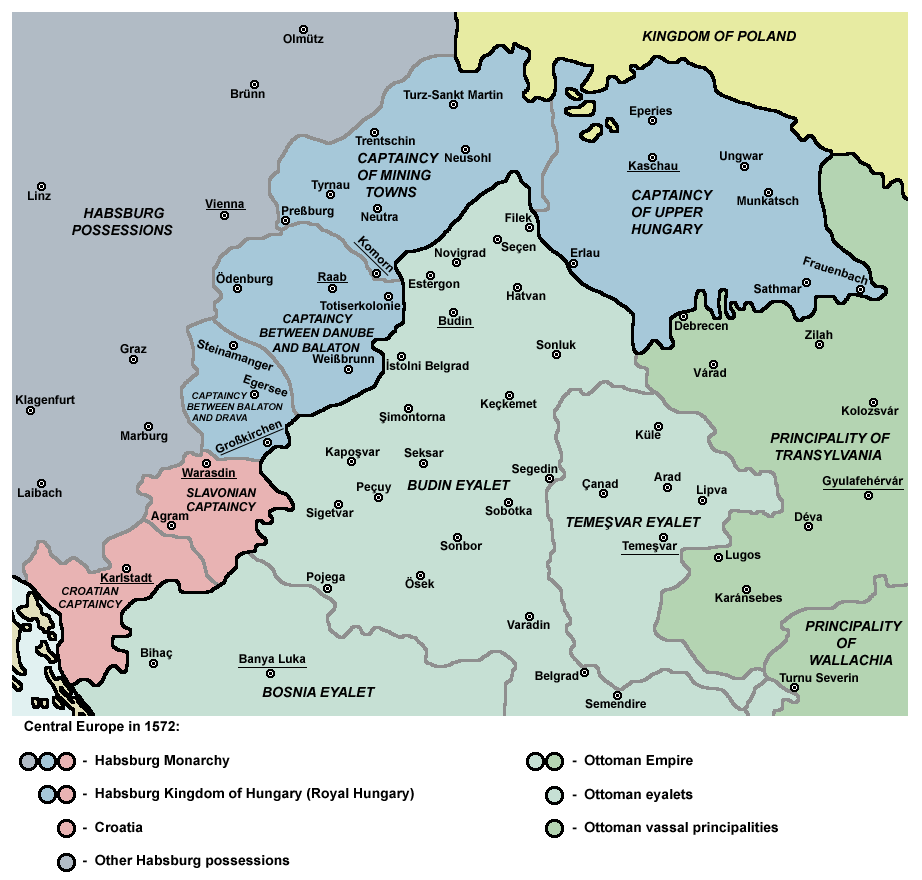
The Captaincies of the Kingdom of Hungary ( hu, Magyar királyi főkapitányságok) were administrative divisions, military districts in the 16th and 17th centuries. The Ottoman Empire meant a constant threat to the kingdom, therefore the Habsburg Hungarian kings needed to establish a well-working military administration. The captaincy (''főkapitányság'') was administered by the Royal Captain-general of the Captaincy. In 1542, the Hungarian kingdom, primarily for military and administrative purposes, was divided into two captaincies, Captaincy of Cisdanubia (mostly Upper Hungary) and Captaincy of Transdanubia (the remaining territories). Captaincy of Győr was founded in 1556. In 1563 Captaincy of Lower Hungary was established (today approx. the present-day regions of western and central Slovakia). By 1566, Kanizsa at southwestern Transdanubia also evolved into a new captaincy.Pálffy 1999, p. 92. Irrespective of the military districts, there were coexistent superior (''nemesi' ... [...More Info...] [...Related Items...] OR: [Wikipedia] [Google] [Baidu] |
Nitra
Nitra (; also known by other #Etymology, alternative names) is a city in western Slovakia, situated at the foot of Zobor Mountain in the valley of the river Nitra (river), Nitra. It is located 95 km east of Bratislava. With a population of about 78,353, it is the fifth largest city in Slovakia. Nitra is also one of the oldest cities in Slovakia; it was the political center of the Principality of Nitra. Today, it is a seat of a ''Regions of Slovakia, kraj'' (Nitra Region), and an ''Districts of Slovakia, okres'' (Nitra District). Etymology The first mention of Nitra dates back to the 9th century. The name of the city is derived from the Nitra river. The name is Indo-European languages, Indo-European, but the question of its History of Proto-Slavic#Pre-Slavic, pre-Slavic or Slavic people, Slavic origin has not been satisfactorily answered. Nitra might be derived from the old Indo-European root ''neit-'', ''nit-'' meaning "to cut" or "to burn" using a derivation element ''-r-'' (see ... [...More Info...] [...Related Items...] OR: [Wikipedia] [Google] [Baidu] |
Danubian Lowland
::''The Serbian lowland is treated under Danube Plain (Serbia)'' The Danubian Lowland or Danube Lowland () is the name of the part of Little Alföld (Slovak: ''Malá dunajská kotlina'') situated in Slovakia, located between the Danube, the Little Carpathians and all other parts of the Western Carpathians. In terms of geomorphology, it forms one unit together with the Neusiedl Basin (''Neusiedler Becken'') in Austria and the Győr Basin (''Győri-medence'') in Hungary. It is an extensive tectonic depression filled with layers of Neogene Quaternary to a height of between 100 and 350 meters. It consist of the following two parts: * Danubian Hills (also translated as Danubian Upland) in the north * Danubian Flat (also translated as Danubian Plain) in the south Many urban and other settlements can be found in this primarily agricultural area. The towns Topoľčany, Nové Zámky, Komárno, Levice, Dunajská Streda and Galanta are administrative centers. They are centers of industry ... [...More Info...] [...Related Items...] OR: [Wikipedia] [Google] [Baidu] |
Hron
The Hron ( sk, Hron; german: Gran; hu, Garam; la, Granus) is a long left tributary of the DanubePlán manažmentu povodňového rizikavčiastkovom povodí Hrona p. 38 and the second-longest river in . It flows from its source in the Low Tatra Mountains (below Kráľova hoľa) through central and southern Slovakia, emptying into the Danube near and |
Slovakia
Slovakia (; sk, Slovensko ), officially the Slovak Republic ( sk, Slovenská republika, links=no ), is a landlocked country in Central Europe. It is bordered by Poland to the north, Ukraine to the east, Hungary to the south, Austria to the southwest, and the Czech Republic to the northwest. Slovakia's mostly mountainous territory spans about , with a population of over 5.4 million. The capital and largest city is Bratislava, while the second largest city is Košice. The Slavs arrived in the territory of present-day Slovakia in the fifth and sixth centuries. In the seventh century, they played a significant role in the creation of Samo's Empire. In the ninth century, they established the Principality of Nitra, which was later conquered by the Principality of Moravia to establish Great Moravia. In the 10th century, after the dissolution of Great Moravia, the territory was integrated into the Principality of Hungary, which then became the Kingdom of Hungary in 1000. In 124 ... [...More Info...] [...Related Items...] OR: [Wikipedia] [Google] [Baidu] |
Kuruc
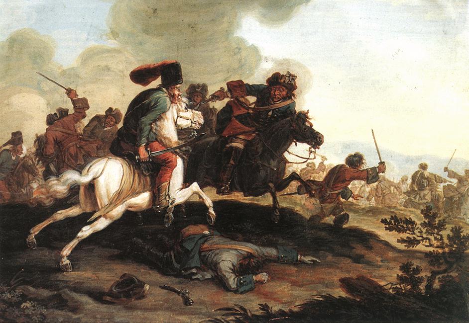
Kuruc (, plural ''kurucok''), also spelled kurutz, refers to a group of armed anti- Habsburg insurgents in the Kingdom of Hungary between 1671 and 1711. Over time, the term kuruc has come to designate Hungarians who advocate strict national independence and the term labanc to designate Hungarians who advocate cooperating with outside powers. The term kuruc is used in both a positive sense to mean “patriotic” and in a negative sense to mean “chauvinistic.” The term labanc is almost always used in a negative sense to mean “disloyal” or “traitorous.” The kuruc army was composed mostly of impoverished lower Hungarian nobility and serfs, including Hungarian Protestant peasants and Slavs. They managed to conquer large parts of Hungary in several uprisings from Transylvania before they were defeated by Habsburg imperial troops. Name The word ''kuruc'' was first used in 1514 for the armed peasants led by György Dózsa. 18th-century scholar Matthias Bel supposed ... [...More Info...] [...Related Items...] OR: [Wikipedia] [Google] [Baidu] |
Habsburg
The House of Habsburg (), alternatively spelled Hapsburg in Englishgerman: Haus Habsburg, ; es, Casa de Habsburgo; hu, Habsburg család, it, Casa di Asburgo, nl, Huis van Habsburg, pl, dom Habsburgów, pt, Casa de Habsburgo, la, Domus Habsburg, french: Maison des Habsbourg and also known as the House of Austriagerman: link=no, Haus Österreich, ; es, link=no, Casa de Austria; nl, Huis van Oostenrijk, pl, dom Austrii, la, Domus Austriæ, french: Maison d'Autriche; hu, Ausztria Háza; it, Casa d'Austria; pt, Casa da Áustria is one of the most prominent and important dynasties in European history. The house takes its name from Habsburg Castle, a fortress built in the 1020s in present-day Switzerland by Radbot of Klettgau, who named his fortress Habsburg. His grandson Otto II was the first to take the fortress name as his own, adding "Count of Habsburg" to his title. In 1273, Count Radbot's seventh-generation descendant Rudolph of Habsburg was elected King of the R ... [...More Info...] [...Related Items...] OR: [Wikipedia] [Google] [Baidu] |
.jpg)

