|
Lambri
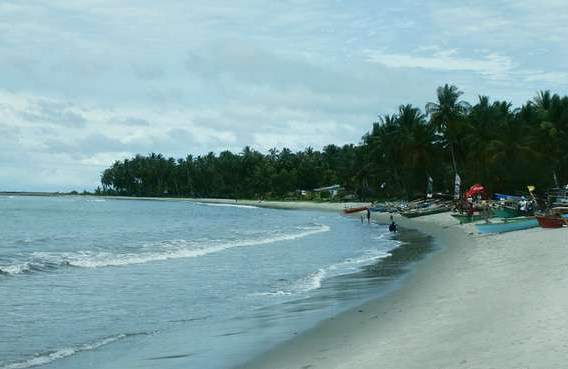
Lamuri or Lambri was a kingdom in northern Sumatra, Indonesia from the Srivijaya period until the early 16th century. The area was inhabited by Hindu population around the seventh century. There is also evidence of Buddhism. The region is also thought to be one of the earliest places of arrival of Islam in the Indonesian archipelago, and in its later period its rulers were Muslims. Lambri is generally considered to be located in the Aceh province near Banda Aceh. Its location has been suggested to be in today's Lambaro to the west of Bandar Aceh where submerged ruins of buildings and tombstones have been found, although some now associate Lambri with Lam Reh to the east of Aceh where there are ancient tombstones. Accounts of Lambri have been given in various sources from the 9th century onwards, and it is thought to have become absorbed into the Aceh Sultanate by the early 16th century. Names The Kingdom of Lamuri or Lambri was known to the Arabs from the 9th century onward, and ... [...More Info...] [...Related Items...] OR: [Wikipedia] [Google] [Baidu] |
Aceh
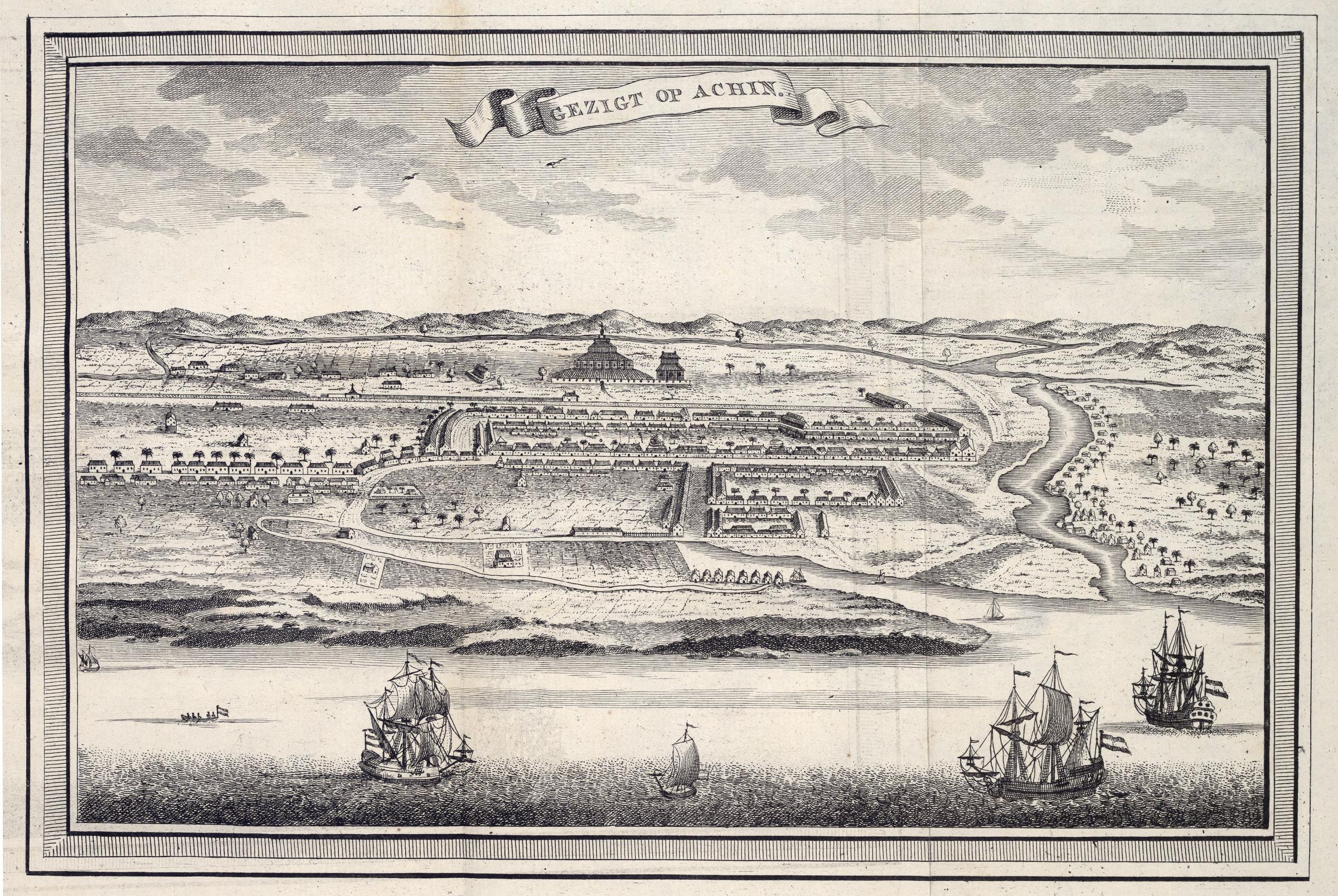
Aceh ( ), officially the Aceh Province ( ace, Nanggroë Acèh; id, Provinsi Aceh) is the westernmost province of Indonesia. It is located on the northernmost of Sumatra island, with Banda Aceh being its capital and largest city. Granted a special autonomous status, Aceh is a religiously conservative territory and the only Indonesian province practicing the Sharia law officially. There are ten indigenous ethnic groups in this region, the largest being the Acehnese people, accounting for approximately 80% to 90% of the region's population. Aceh is where the spread of Islam in Indonesia began, and was a key factor of the spread of Islam in Southeast Asia. Islam reached Aceh (Kingdoms of Fansur and Lamuri) around 1250 AD. In the early 17th century the Sultanate of Aceh was the most wealthy, powerful and cultivated state in the Malacca Straits region. Aceh has a history of political independence and resistance to control by outsiders, including the former Dutch colonists and ... [...More Info...] [...Related Items...] OR: [Wikipedia] [Google] [Baidu] |
Srivijaya Empire
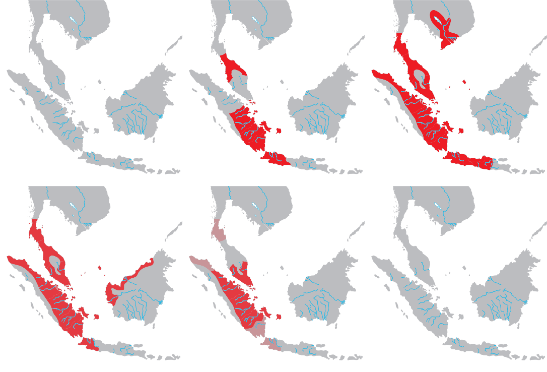
Srivijaya ( id, Sriwijaya) was a Buddhist thalassocratic empire based on the island of Sumatra (in modern-day Indonesia), which influenced much of Southeast Asia. Srivijaya was an important centre for the expansion of Buddhism from the 7th to the 12th century AD. Srivijaya was the first polity to dominate much of western Maritime Southeast Asia. Due to its location, the Srivijaya developed complex technology utilizing maritime resources. In addition, its economy became progressively reliant on the booming trade in the region, thus transforming it into a prestige goods-based economy. The earliest reference to it dates from the 7th century. A Tang dynasty Chinese monk, Yijing, wrote that he visited Srivijaya in year 671 for six months. The earliest known inscription in which the name Srivijaya appears also dates from the 7th century in the Kedukan Bukit inscription found near Palembang, Sumatra, dated 16 June 682. Between the late 7th and early 11th century, Srivijaya rose ... [...More Info...] [...Related Items...] OR: [Wikipedia] [Google] [Baidu] |
Sumatra
Sumatra is one of the Sunda Islands of western Indonesia. It is the largest island that is fully within Indonesian territory, as well as the sixth-largest island in the world at 473,481 km2 (182,812 mi.2), not including adjacent islands such as the Simeulue, Nias, Mentawai, Enggano, Riau Islands, Bangka Belitung and Krakatoa archipelago. Sumatra is an elongated landmass spanning a diagonal northwest–southeast axis. The Indian Ocean borders the northwest, west, and southwest coasts of Sumatra, with the island chain of Simeulue, Nias, Mentawai, and Enggano off the western coast. In the northeast, the narrow Strait of Malacca separates the island from the Malay Peninsula, which is an extension of the Eurasian continent. In the southeast, the narrow Sunda Strait, containing the Krakatoa Archipelago, separates Sumatra from Java. The northern tip of Sumatra is near the Andaman Islands, while off the southeastern coast lie the islands of Bangka and Belitung, Karim ... [...More Info...] [...Related Items...] OR: [Wikipedia] [Google] [Baidu] |
Barus
Barus is a town and ''kecamatan'' (district) in Central Tapanuli Regency, North Sumatra Province, Sumatra, Indonesia. Historically, Barus was well known as a port town or kingdom on the western coast of Sumatra where it was a regional trade center from around the 7th or earlier until the 17th century. It was also known by other names, namely Fansur and possibly Barusai. The name Fansur or Pansur means "spring of water" in the local Batak language. Barus was well known for its produce camphor. In the 16th century, Barus came under attack from the rising power of Aceh, and became absorbed into the Aceh Sultanate. The earliest known Malay poet Hamzah Fansuri may be from Barus as indicated by his name. Historical records Barus was a significant settlement on the west coast of Sumatra widely recorded in many historical documents. Other related sites in Sumatra includes Lamuri in Aceh and Pannai in North Sumatra. The second century Greek geographer Claudius Ptolemy in his work ''Geo ... [...More Info...] [...Related Items...] OR: [Wikipedia] [Google] [Baidu] |
Banda Aceh
Banda Aceh ( Acehnese: ''Banda Acèh'', Jawoë: كوتا بند اچيه) is the capital and largest city in the province of Aceh, Indonesia. It is located on the island of Sumatra and has an elevation of . The city covers an area of and had a population of 223,446 people at the 2010 Census,Biro Pusat Statistik, Jakarta, 2011. rising to 252,899 at the 2020 Census. The official estimate as at mid 2021 was 255,029.Badan Pusat Statistik, Jakarta, 2022. Banda Aceh is located on the northwestern tip of Indonesia at the mouth of the Aceh River. Banda Aceh itself is a semi-enclave within Aceh Besar Regency, as Banda Aceh is surrounded by Aceh Besar to the south, east, and west, while it borders with the Strait of Malacca to the north. The city was originally established as Bandar Aceh Darussalam Kandang and served as a capital and hub for the Sultanate of Aceh upon its foundation in the late 15th century. Later its name was changed to ''Bandar Aceh Darussalam'', and then it became p ... [...More Info...] [...Related Items...] OR: [Wikipedia] [Google] [Baidu] |
Tamil Inscriptions In The Malay World
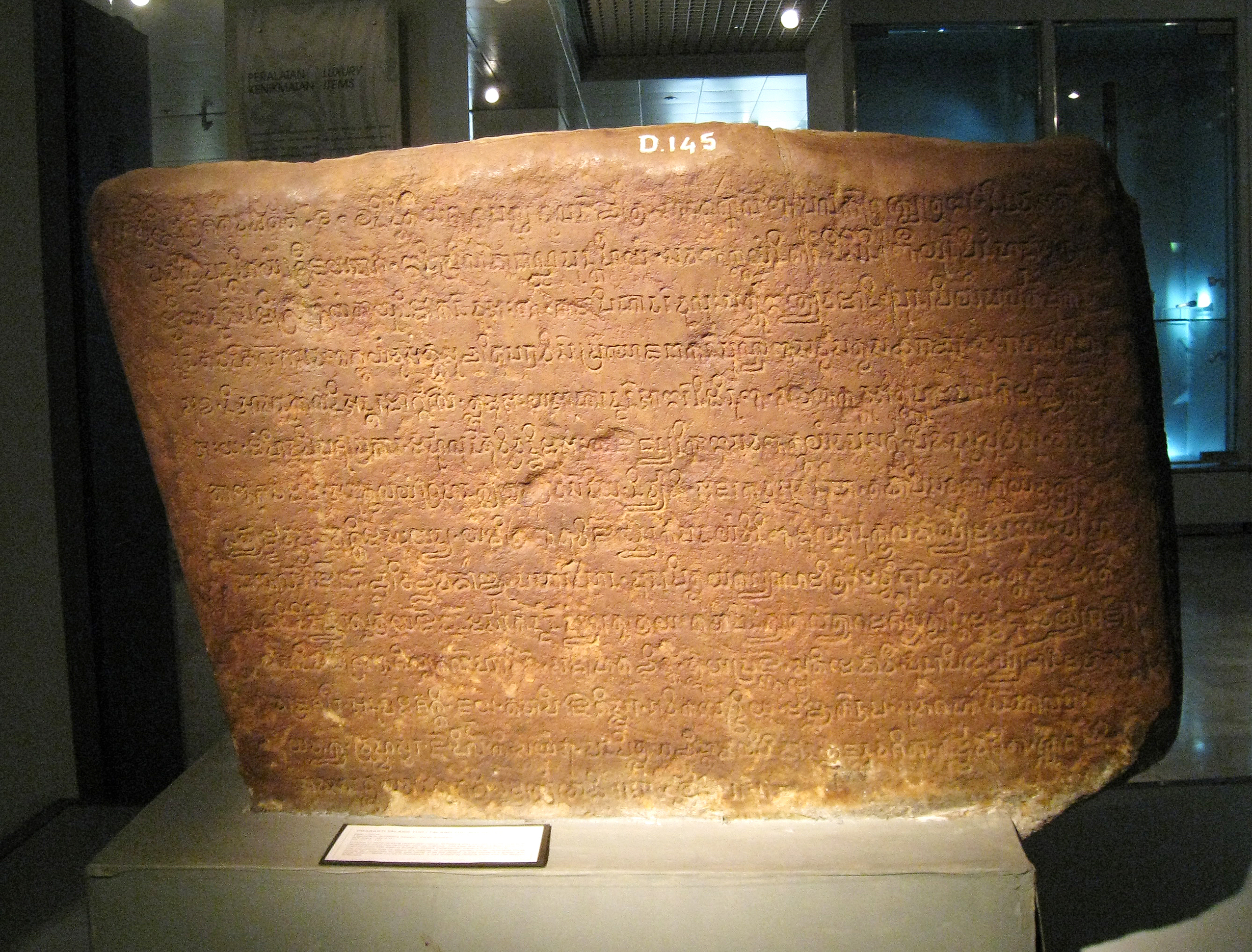
A number of medieval inscriptions written in Tamil language and script that have been found in Southeast Asia and China, mainly in Sumatra and peninsular Thailand. These texts arose directly from trade links between south India and certain parts of Southeast Asia and China, which involved the residence in those regions of Tamil-speaking Indians. Several of these overseas Tamil inscriptions mention well-known medieval Indian merchant associations. A good number of Tamil inscriptions, as well as Hindu and Buddhist icons emanating from South India, have been found in Southeast Asia (and even in Quanzhou in China). On the Malay Peninsula, inscriptions have been found at Takuapa, not far from the Vishnuite statues of Khao Phra Narai in Southern Thailand. It is a short inscription indicating that an artificial lake named ''Avani-naranam'' was dug by ''Nangur-Udaiyan'', which is the name of an individual who possessed a military fief at Nangur, being famous for his abilities as a warrio ... [...More Info...] [...Related Items...] OR: [Wikipedia] [Google] [Baidu] |
Srivijaya
Srivijaya ( id, Sriwijaya) was a Buddhist thalassocratic empire based on the island of Sumatra (in modern-day Indonesia), which influenced much of Southeast Asia. Srivijaya was an important centre for the expansion of Buddhism from the 7th to the 12th century AD. Srivijaya was the first polity to dominate much of western Maritime Southeast Asia. Due to its location, the Srivijaya developed complex technology utilizing maritime resources. In addition, its economy became progressively reliant on the booming trade in the region, thus transforming it into a prestige goods-based economy. The earliest reference to it dates from the 7th century. A Tang dynasty Chinese monk, Yijing, wrote that he visited Srivijaya in year 671 for six months. The earliest known inscription in which the name Srivijaya appears also dates from the 7th century in the Kedukan Bukit inscription found near Palembang, Sumatra, dated 16 June 682. Between the late 7th and early 11th century, Srivijaya rose t ... [...More Info...] [...Related Items...] OR: [Wikipedia] [Google] [Baidu] |
Monsoon
A monsoon () is traditionally a seasonal reversing wind accompanied by corresponding changes in precipitation but is now used to describe seasonal changes in atmospheric circulation and precipitation associated with annual latitudinal oscillation of the Intertropical Convergence Zone (ITCZ) between its limits to the north and south of the equator. Usually, the term monsoon is used to refer to the rainy phase of a seasonally changing pattern, although technically there is also a dry phase. The term is also sometimes used to describe locally heavy but short-term rains. The major monsoon systems of the world consist of the West African, Asia–Australian, the North American, and South American monsoons. The term was first used in English in British India and neighboring countries to refer to the big seasonal winds blowing from the Bay of Bengal and Arabian Sea in the southwest bringing heavy rainfall to the area. Etymology The etymology of the word monsoon is not wholl ... [...More Info...] [...Related Items...] OR: [Wikipedia] [Google] [Baidu] |
Trade Winds
The trade winds or easterlies are the permanent east-to-west prevailing winds that flow in the Earth's equatorial region. The trade winds blow mainly from the northeast in the Northern Hemisphere and from the southeast in the Southern Hemisphere, strengthening during the winter and when the Arctic oscillation is in its warm phase. Trade winds have been used by captains of sailing ships to cross the world's oceans for centuries. They enabled colonial expansion into the Americas, and trade routes to become established across the Atlantic Ocean and the Pacific Ocean. In meteorology, they act as the steering flow for tropical storms that form over the Atlantic, Pacific, and southern Indian oceans and make landfall in North America, Southeast Asia, and Madagascar and East Africa. Shallow cumulus clouds are seen within trade wind regimes and are capped from becoming taller by a trade wind inversion, which is caused by descending air aloft from within the subtropical ridge. The weak ... [...More Info...] [...Related Items...] OR: [Wikipedia] [Google] [Baidu] |
Camphor
Camphor () is a waxy, colorless solid with a strong aroma. It is classified as a terpenoid and a cyclic ketone. It is found in the wood of the camphor laurel ('' Cinnamomum camphora''), a large evergreen tree found in East Asia; and in the kapur tree ( ''Dryobalanops'' sp.), a tall timber tree from South East Asia. It also occurs in some other related trees in the laurel family, notably '' Ocotea usambarensis''. Rosemary leaves (''Rosmarinus officinalis'') contain 0.05 to 0.5% camphor, while camphorweed (''Heterotheca'') contains some 5%. A major source of camphor in Asia is camphor basil (the parent of African blue basil). Camphor can also be synthetically produced from oil of turpentine. The compound is chiral, existing in two possible enantiomers as shown in the structural diagrams. The structure on the left is the naturally occurring (+)-camphor ((1''R'',4''R'')-bornan-2-one), while its mirror image shown on the right is the (−)-camphor ((1''S'',4''S'')-bornan-2-one). ... [...More Info...] [...Related Items...] OR: [Wikipedia] [Google] [Baidu] |
Ibn Khurdadhbih
Abu'l-Qasim Ubaydallah ibn Abdallah ibn Khordadbeh ( ar, ابوالقاسم عبیدالله ابن خرداذبه; 820/825–913), commonly known as Ibn Khordadbeh (also spelled Ibn Khurradadhbih; ), was a high-ranking Persian bureaucrat and geographer in the Abbasid Caliphate. He is the author of the earliest surviving Arabic book of administrative geography. Biography Ibn Khordadbeh was the son of Abdallah ibn Khordadbeh, who had governed the northern Iranian region of Tabaristan under the Abbasid caliph al-Mamun (), and in 816/17 conquered the neighbouring region of Daylam, as well as repelled the Bavandid ''ispahbadh'' (ruler) Shahriyar I () from the highlands of Tabaristan. Ibn Khordadbeh's grandfather was Khordadbeh, a former Zoroastrian who was convinced by the Barmakids to convert to Islam. He may have been the same person as Khordadbeh al-Razi, who had provided Abu'l-Hasan al-Mada'ini (died 843) the details regarding the flight of the last Sasanian emperor Yazde ... [...More Info...] [...Related Items...] OR: [Wikipedia] [Google] [Baidu] |
Al-Masudi
Al-Mas'udi ( ar, أَبُو ٱلْحَسَن عَلِيّ ٱبْن ٱلْحُسَيْن ٱبْن عَلِيّ ٱلْمَسْعُودِيّ, '; –956) was an Arab historian, geographer and traveler. He is sometimes referred to as the "Herodotus of the Arabs". A polymath and prolific author of over twenty works on theology, history (Islamic and universal), geography, natural science and philosophy, his celebrated magnum opus '' Murūj al-Dhahab wa-Ma'ādin al-Jawhar'' ( ar, مُرُوج ٱلذَّهَب وَمَعَادِن ٱلْجَوْهَر, link=no), combines universal history with scientific geography, social commentary and biography, and is published in English in a multi-volume series as '' The Meadows of Gold and Mines of Gems''. Birth, travels and literary output Apart from what Al-Mas'udi writes of himself little is known. Born in Baghdad, he was descended from Abdullah Ibn Mas'ud, a companion of Muhammad. He mentions many scholar associates met on his travels thr ... [...More Info...] [...Related Items...] OR: [Wikipedia] [Google] [Baidu] |


