|
Karatiyya
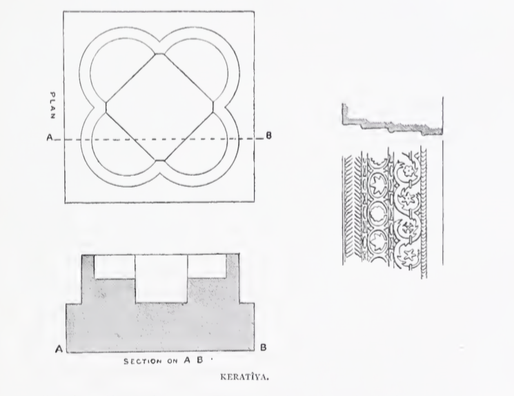
Karatiyya ( ar, كرتيا) was a Palestinian Arab village of 1,370, located northeast of Gaza, situated in a flat area with an elevation of along the coastal plain of Palestine and crossed by Wadi al-Mufrid. History Byzantine ceramics have been found here. In the 12th century, a castle called ''Galatie'' was built on the village site by the Crusaders, it was subsequently captured by the Ayyubids under Saladin in 1187,Khalidi, 1992, p.118 and destroyed in September 1191. The place called ''Kulat el Fenish'' by the village was apparently once a church. The remains were seen in 1875: "The tower on the mound is called Kulat el Fenish. It is a solid block of masonry, standing some 20 or 30 feet in height. Near it lie shafts and bases of white marble, and an elaborate cornice, well and deeply cut. There is also a font, like that at Beit 'Auwa (Sheet XXI.), formed by four intersecting circles, and measuring 37 feet along the diameter, and 2 feet high." In 1226, Arab geogra ... [...More Info...] [...Related Items...] OR: [Wikipedia] [Google] [Baidu] |
Nehora
Nehora ( he, נְהוֹרָה) is a moshav in southern Israel. Located on the Israeli coastal plain, coastal plain about 5 km west Kiryat Gat in south-central Israel and just to the east of Route 352, across the road from Noga (moshav), Noga, it falls under the jurisdiction of Lakhish Regional Council. In it had a population of . History Nehora was founded in 1955 as part of the program to inhabit Hevel Lakhish and was intended to serve as a center of services for surrounding communities. A shopping center, regional school and the offices of the Lakhish Regional Council are located there. It is built on the land of the depopulated Palestinian people, Palestinian villages of Karatiyya and al-Faluja. References {{Lakhish Moshavim Populated places established in 1955 1955 establishments in Israel Populated places in Southern District (Israel) ... [...More Info...] [...Related Items...] OR: [Wikipedia] [Google] [Baidu] |
Gaza Subdistrict, Mandatory Palestine
The Gaza Subdistrict ( ar, قضاء غزة, he, נפת עזה) was one of the subdistricts of Mandatory Palestine. It was situated in the southern Mediterranean coastline of the British Mandate of Palestine. After the 1948 Arab-Israeli War, the district disintegrated, with Israel controlling the northern and eastern portions while Egypt held control of the southern and central parts – which became the Gaza Strip, under Egyptian military between 1948 and 1967, Israeli military rule between 1967 and 2005, part of the Palestinian National Authority (with some aspects of retained Israeli rule until the 2005 withdrawal) after the Oslo Accords until 2007, and is currently ruled by the Hamas as a de facto separate entity from the Palestinian National Authority. The parts which Israel held since 1948 were merged into Israeli administrative districts, their connection with Gaza severed. Borders * Beersheba Subdistrict (Southeast) * Ramle Subdistrict (Northeast) * Hebron Subdistrict ... [...More Info...] [...Related Items...] OR: [Wikipedia] [Google] [Baidu] |
Komemiyut
Komemiyut ( he, קוֹמְמִיּוּת, lit="sovereignty") is an Hasidic moshav in south-central Israel. Located in the southern Shephelah near Kiryat Gat, it falls under the jurisdiction of Shafir Regional Council. In it had a population of . History The group which established the village was formed as a youth group by Agudat Israel in August 1949, composed mainly of demobilized soldiers from a religious unit that had fought in the area during the 1948 Arab–Israeli War. The name is take from a biblical passage, Leviticus 26:13: After training in Nahalat Yehuda, the group founded the moshav in 1950 on land given to it by the Jewish National Fund. The village was built over the depopulated Palestinian village of Karatiyya. The moshav was built as an agricultural village, but to ensure a livelihood during the shmita year, industries were also established. The moshav has two bakeries including a matzo bakery, a dairy, a shingles factory, a marble factory, and a tefillin ... [...More Info...] [...Related Items...] OR: [Wikipedia] [Google] [Baidu] |
Revaha
Revaha ( he, רְוָחָה, ''lit.'' prosperity) is a religious moshav in south-central Israel. Located in the southern Shephelah near Kiryat Gat, it falls under the jurisdiction of Shafir Regional Council. In it had a population of . History Revaha was established in 1953 by Jewish immigrants from Kurdistan on lands which had formerly belonged to the depopulated Palestinian village of Karatiyya Karatiyya ( ar, كرتيا) was a Palestinian Arab village of 1,370, located northeast of Gaza, situated in a flat area with an elevation of along the coastal plain of Palestine and crossed by Wadi al-Mufrid. History Byzantine ceramics have b .... It is located close to Hatta, but not on its village land. The majority of residents are national-religious. References {{Shafir Regional Council Kurdish-Jewish culture in Israel Moshavim Religious Israeli communities Populated places established in 1953 Populated places in Southern District (Israel) 1953 establishments in ... [...More Info...] [...Related Items...] OR: [Wikipedia] [Google] [Baidu] |
Mamluk
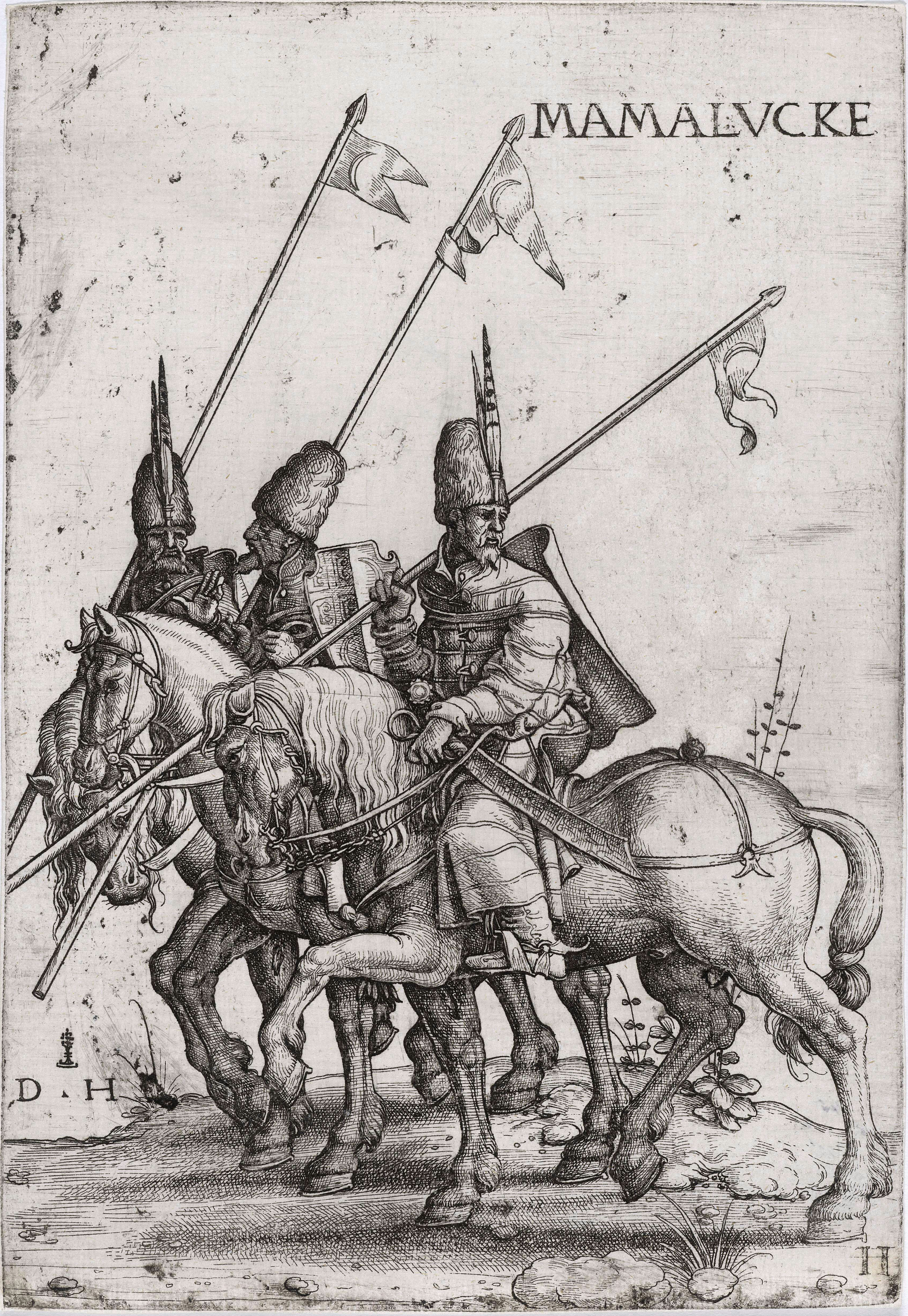
Mamluk ( ar, مملوك, mamlūk (singular), , ''mamālīk'' (plural), translated as "one who is owned", meaning " slave", also transliterated as ''Mameluke'', ''mamluq'', ''mamluke'', ''mameluk'', ''mameluke'', ''mamaluke'', or ''marmeluke'') is a term most commonly referring to non-Arab, ethnically diverse (mostly Southern Russian, Turkic, Caucasian, Eastern and Southeastern European) slave-soldiers and freed slaves who were assigned military and administrative duties, serving the ruling Arab dynasties in the Muslim world. The most enduring Mamluk realm was the knightly military class in Egypt in the Middle Ages, which developed from the ranks of slave-soldiers. Originally the Mamluks were slaves of Turkic origin from the Eurasian Steppe, but the institution of military slavery spread to include Circassians, Abkhazians, Georgians,"Relations of the Georgian Mamluks of Egypt with Their Homeland in the Last Decades of the Eighteenth Century". Daniel Crecelius and Gotcha ... [...More Info...] [...Related Items...] OR: [Wikipedia] [Google] [Baidu] |
Yaqut Al-Hamawi
Yāqūt Shihāb al-Dīn ibn-ʿAbdullāh al-Rūmī al-Ḥamawī (1179–1229) ( ar, ياقوت الحموي الرومي) was a Muslim scholar of Byzantine Greek ancestry active during the late Abbasid period (12th-13th centuries). He is known for his , an influential work on geography containing valuable information pertaining to biography, history and literature as well as geography. Life ''Yāqūt'' (''ruby'' or ''hyacinth'') was the '' kunya'' of Ibn Abdullāh ("son of Abdullāh"). He was born in Constantinople, and as his ''nisba'' "al-Rumi" ("from Rūm") indicates he had Byzantine Greek ancestry. Yāqūt was "mawali" to ‘Askar ibn Abī Naṣr al-Ḥamawī, a trader of Baghdad, Iraq, the seat of the Abbasid Caliphate, from whom he received the ''laqab'' "Al-Hamawī". As ‘Askar's apprentice, he learned about accounting and commerce, becoming his envoy on trade missions and travelling twice or three times to Kish in the Persian Gulf. In 1194 ‘Askar stopped his salary ov ... [...More Info...] [...Related Items...] OR: [Wikipedia] [Google] [Baidu] |
Bayt Jibrin
Bayt Jibrin or Beit Jibrin ( ar, بيت جبرين; he, בית גוברין, translit=Beit Gubrin) was a Palestinians, Palestinian village located northwest of the city of Hebron. The village had a total land area of 56,185 dunams or , of which were built-up while the rest remained farmland.''Village Statistics'', Government of Palestine. 1945. Quoted in Hadawi, 1970, p143 During the 8th century BCE, the village, then known as Maresha, was part of the Kingdom of Judah. During the days of Herod the Great, a Jews, Jewish ruler of the Herodian Kingdom of Judea, Herodian Kingdom, the town was the administrative center for the district of Edom#Classical Idumaea, Idumea. After the turmoil of the First Jewish–Roman War and the Bar Kokhba revolt, the town became a thriving Colonia (Roman), Roman colony and a major administrative centre of the Roman Empire under the name of Eleutheropolis. With the rise of Islam in the early 7th century CE, Bayt Jibrin was conquered by Rashidu ... [...More Info...] [...Related Items...] OR: [Wikipedia] [Google] [Baidu] |
Jund Filastin
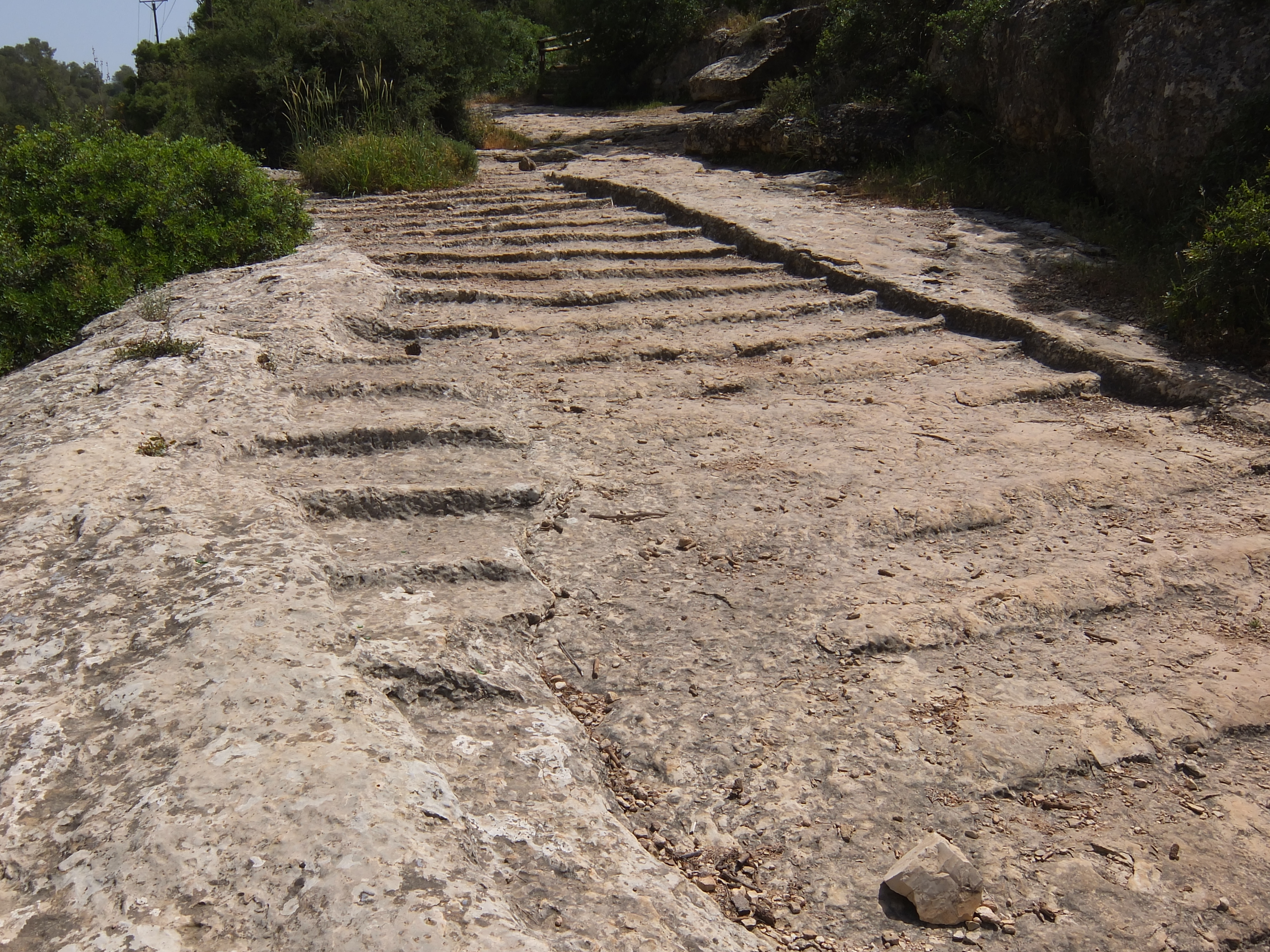
Jund Filasṭīn ( ar, جُنْد فِلَسْطِيْن, "the military district of Palestine") was one of the military districts of the Umayyad and Abbasid province of Bilad al-Sham (Levant), organized soon after the Muslim conquest of the Levant in the 630s. Jund Filastin, which encompassed most of Palaestina Prima and Palaestina Tertia, included the newly established city of Ramla as its capital and eleven administrative districts (''kura''), each ruled from a central town. History Muslim conquest The Muslim conquest of Palestine is difficult to reconstruct, according to the historian Dominique Sourdel. It is generally agreed that the Qurayshite commander Amr ibn al-As was sent to conquer the area by Caliph Abu Bakr, likely in 633. Amr traversed the Red Sea coast of the Hejaz (western Arabia), reached the port town of Ayla at the head of the Gulf of Aqaba, then crossed into the Negev Desert or further west into the Sinai Peninsula. He then arrived to the villages of Dathin a ... [...More Info...] [...Related Items...] OR: [Wikipedia] [Google] [Baidu] |
Jerusalem
Jerusalem (; he, יְרוּשָׁלַיִם ; ar, القُدس ) (combining the Biblical and common usage Arabic names); grc, Ἱερουσαλήμ/Ἰεροσόλυμα, Hierousalḗm/Hierosóluma; hy, Երուսաղեմ, Erusałēm. is a city in Western Asia. Situated on a plateau in the Judaean Mountains between the Mediterranean Sea, Mediterranean and the Dead Sea, it is one of the List of oldest continuously inhabited cities, oldest cities in the world and is considered to be a holy city for the three major Abrahamic religions: Judaism, Christianity, and Islam. Both Israelis and Palestinians claim Jerusalem as their Capital city, capital, as Israel maintains its primary governmental institutions there and the State of Palestine ultimately foresees it as its seat of power. Because of this dispute, Status of Jerusalem, neither claim is widely recognized internationally. Throughout History of Jerusalem, its long history, Jerusalem has been destroyed at least twice, Sie ... [...More Info...] [...Related Items...] OR: [Wikipedia] [Google] [Baidu] |
Mandatory Palestine
Mandatory Palestine ( ar, فلسطين الانتدابية '; he, פָּלֶשְׂתִּינָה (א״י) ', where "E.Y." indicates ''’Eretz Yiśrā’ēl'', the Land of Israel) was a geopolitical entity established between 1920 and 1948 in the region of Palestine under the terms of the League of Nations Mandate for Palestine. During the First World War (1914–1918), an Arab uprising against Ottoman rule and the British Empire's Egyptian Expeditionary Force under General Edmund Allenby drove the Ottoman Turks out of the Levant during the Sinai and Palestine Campaign. The United Kingdom had agreed in the McMahon–Hussein Correspondence that it would honour Arab independence if the Arabs revolted against the Ottoman Turks, but the two sides had different interpretations of this agreement, and in the end, the United Kingdom and France divided the area under the Sykes–Picot Agreementan act of betrayal in the eyes of the Arabs. Further complicating the issue was t ... [...More Info...] [...Related Items...] OR: [Wikipedia] [Google] [Baidu] |
Al-Nasir Muhammad
Al-Malik an-Nasir Nasir ad-Din Muhammad ibn Qalawun ( ar, الملك الناصر ناصر الدين محمد بن قلاوون), commonly known as an-Nasir Muhammad ( ar, الناصر محمد), or by his kunya: Abu al-Ma'ali () or as Ibn Qalawun (1285–1341) was the ninth Bahri Mamluk sultan of Egypt who ruled between 1293–1294, 1299–1309, and 1310 until his death in 1341. During his first reign he was dominated by Kitbugha and al-Shuja‘i, while during his second reign he was dominated by Baibars and Salar. Not wanting to be dominated or deprived of his full rights as a sultan by his third reign, an-Nasir executed Baibars and accepted the resignation of Salar as vice Sultan. An-Nasir was known to appoint non-Mamluks loyal to himself to senior military positions and remove capable officers of their duty whose loyalty he doubted. Although, he did annul taxes and surcharges that were imposed on commoners for the benefit of the emirs and officials. Also, he employ ... [...More Info...] [...Related Items...] OR: [Wikipedia] [Google] [Baidu] |
Mongols
The Mongols ( mn, Монголчууд, , , ; ; russian: Монголы) are an East Asian ethnic group native to Mongolia, Inner Mongolia in China and the Buryatia Republic of the Russian Federation. The Mongols are the principal member of the large family of Mongolic peoples. The Oirats in Western Mongolia as well as the Buryats and Kalmyks of Russia are classified either as distinct ethno-linguistic groups or subgroups of Mongols. The Mongols are bound together by a common heritage and ethnic identity. Their indigenous dialects are collectively known as the Mongolian language. The ancestors of the modern-day Mongols are referred to as Proto-Mongols. Definition Broadly defined, the term includes the Mongols proper (also known as the Khalkha Mongols), Buryats, Oirats, the Kalmyk people and the Southern Mongols. The latter comprises the Abaga Mongols, Abaganar, Aohans, Baarins, Chahars, Eastern Dorbets, Gorlos Mongols, Jalaids, Jaruud, Kharchins, Khishig ... [...More Info...] [...Related Items...] OR: [Wikipedia] [Google] [Baidu] |


