|
Keeten-Mastgat
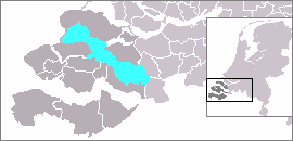
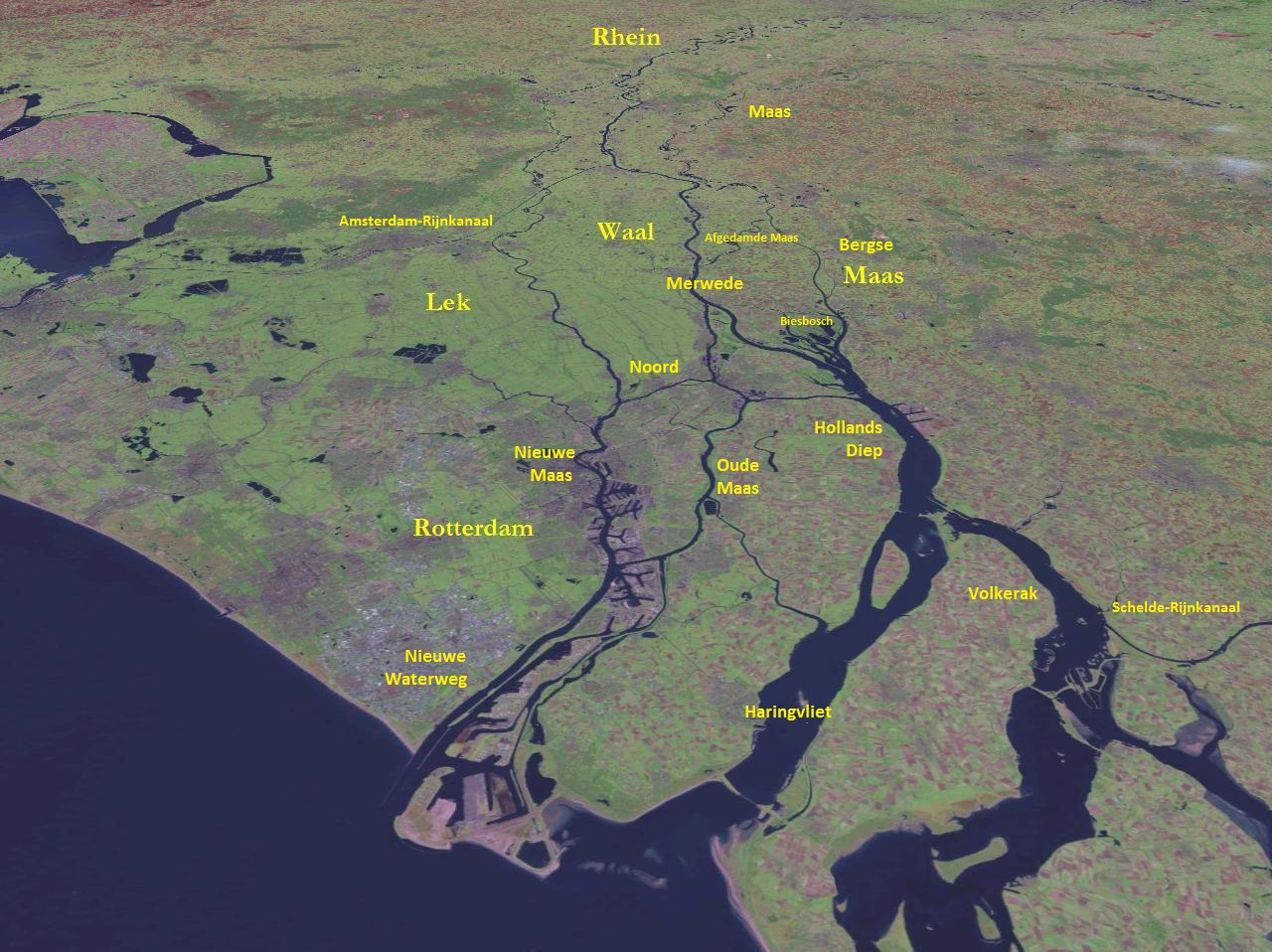
The Keeten-Mastgat is a body of water in the Dutch province of Zeeland. It used to be an estuary of the Rhine and Meuse rivers, but today it is only connected to the Oosterschelde. It still receives some water from its former tributaries, but only when the Krammer-Volkerak receives too much water from the Hollands Diep. It lies between the islands of Schouwen-Duiveland and Tholen Tholen () is a 25,000 people municipality in the southwest of the Netherlands. The municipality of Tholen takes its name from the town of Tholen, which is the largest population center in the municipality. The municipality consists of two peninsu .... Landforms of Zeeland Schouwen-Duiveland Tholen {{Zeeland-geo-stub ... [...More Info...] [...Related Items...] OR: [Wikipedia] [Google] [Baidu] |
Tholen
Tholen () is a 25,000 people municipality in the southwest of the Netherlands. The municipality of Tholen takes its name from the town of Tholen, which is the largest population center in the municipality. The municipality consists of two peninsulas, formerly islands, the larger one on the south also called Tholen, the smaller one on the north called Sint Philipsland. The two are separated by the former strait, now bay, of Krabbenkreek. The municipality is bordered on the east by the Eendracht, once a Scheldt branch but now part of the Scheldt-Rhine Canal, crossed by three road bridges, by the Oosterschelde estuary to the south, the straits of Keeten- Mastgat to the west and the Krammer strait to the north. The town has a small historical center partly surrounded by a "gracht" and partly bordered by a harbour for fishing boats and yachts. Population centers On the island Sint Philipsland there are three villages: On the island Tholen there are seven population centers: ... [...More Info...] [...Related Items...] OR: [Wikipedia] [Google] [Baidu] |
Schouwen-Duiveland
Schouwen-Duiveland () is a municipality and an island in the southwestern Netherlands province of Zeeland. The municipality has 33,737 inhabitants (1 January 2016) and covers an area of (of which is water). The northside of the island has two fixed connections to Goeree-Overflakkee, the Brouwersdam and the Grevelingen. The southside has two fixed connections to cross the Oosterschelde to North Beveland, the Stormvloed Kering or Oosterscheldedam, part of the Delta Works and the Zeeland Bridge. The island is mostly flat and is, besides a small area, below the sea level. On the western tip is a dune whose highest point is about 42 meters above sea level. The island is, in the summer, very popular with (German) tourists. The Renesse area is a popular holiday destination for young people. The Brouwersdam is a dam, part of the Delta Works, from Schouwen-Duiveland to Goedereede, the west part of the island of Goeree-Overflakkee in South Holland. History The island of Schouwen-Duivel ... [...More Info...] [...Related Items...] OR: [Wikipedia] [Google] [Baidu] |
Netherlands
) , anthem = ( en, "William of Nassau") , image_map = , map_caption = , subdivision_type = Sovereign state , subdivision_name = Kingdom of the Netherlands , established_title = Before independence , established_date = Spanish Netherlands , established_title2 = Act of Abjuration , established_date2 = 26 July 1581 , established_title3 = Peace of Münster , established_date3 = 30 January 1648 , established_title4 = Kingdom established , established_date4 = 16 March 1815 , established_title5 = Liberation Day (Netherlands), Liberation Day , established_date5 = 5 May 1945 , established_title6 = Charter for the Kingdom of the Netherlands, Kingdom Charter , established_date6 = 15 December 1954 , established_title7 = Dissolution of the Netherlands Antilles, Caribbean reorganisation , established_date7 = 10 October 2010 , official_languages = Dutch language, Dutch , languages_type = Regional languages , languages_sub = yes , languages = , languages2_type = Reco ... [...More Info...] [...Related Items...] OR: [Wikipedia] [Google] [Baidu] |
Zeeland
, nl, Ik worstel en kom boven("I struggle and emerge") , anthem = "Zeeuws volkslied"("Zeelandic Anthem") , image_map = Zeeland in the Netherlands.svg , map_alt = , map_caption = Location of Zeeland in the Netherlands , pushpin_map = , pushpin_label_position = , pushpin_map_alt = , pushpin_map_caption = , coordinates = , coor_pinpoint = , coordinates_footnotes = , subdivision_type = Country , subdivision_name = Netherlands , established_title = , established_date = , founder = , seat_type = Capital , seat = Middelburg, Zeeland, Middelburg , seat1_type = Largest city , seat1 = Ter ... [...More Info...] [...Related Items...] OR: [Wikipedia] [Google] [Baidu] |
Rhine
), Surselva, Graubünden, Switzerland , source1_coordinates= , source1_elevation = , source2 = Rein Posteriur/Hinterrhein , source2_location = Paradies Glacier, Graubünden, Switzerland , source2_coordinates= , source2_elevation = , source_confluence = Reichenau , source_confluence_location = Tamins, Graubünden, Switzerland , source_confluence_coordinates= , source_confluence_elevation = , mouth = North Sea , mouth_location = Netherlands , mouth_coordinates = , mouth_elevation = , progression = , river_system = , basin_size = , tributaries_left = , tributaries_right = , custom_label = , custom_data = , extra = The Rhine ; french: Rhin ; nl, Rijn ; wa, Rén ; li, Rien; rm, label= Sursilvan, Rein, rm, label= Sutsilvan and Surmiran, Ragn, rm, label=Rumantsch Grischun, Vallader and Puter, Rain; it, Reno ; gsw, Rhi(n), inclu ... [...More Info...] [...Related Items...] OR: [Wikipedia] [Google] [Baidu] |
Meuse
The Meuse ( , , , ; wa, Moûze ) or Maas ( , ; li, Maos or ) is a major European river, rising in France and flowing through Belgium and the Netherlands before draining into the North Sea from the Rhine–Meuse–Scheldt delta. It has a total length of . History From 1301 the upper Meuse roughly marked the western border of the Holy Roman Empire with the Kingdom of France, after Count Henry III of Bar had to receive the western part of the County of Bar (''Barrois mouvant'') as a French fief from the hands of King Philip IV. In 1408, a Burgundian army led by John the Fearless went to the aid of John III against the citizens of Liège, who were in open revolt. After the battle which saw the men from Liège defeated, John ordered the drowning in the Meuse of suspicious burghers and noblemen in Liège. The border remained stable until the annexation of the Three Bishoprics Metz, Toul and Verdun by King Henry II in 1552 and the occupation of the Duchy of Lorraine by the ... [...More Info...] [...Related Items...] OR: [Wikipedia] [Google] [Baidu] |
Oosterschelde
The Eastern Scheldt ( nl, Oosterschelde) is a former estuary in the province of Zeeland, Netherlands, between Schouwen-Duiveland and Tholen on the north and Noord-Beveland and Zuid-Beveland on the south. It also features the largest national park in the Netherlands, founded in 2002. Landscape and history During the Roman Era it was the major mouth of the Scheldt River. Before the St. Felix's Flood of 1530, it flowed north as a river from the east end of the Westerschelde, turned west a little west of Bergen op Zoom, and then west along the north edge of what is now the Verdronken Land van Reimerswaal, and after that widened into an estuary. Later parts of that lost land were reclaimed, restricting part of the connection to the Scheldt River to a narrow channel called the Kreekrak, which silted up and became unnavigable. In 1867 the Kreekrak was closed off with a railway embankment, connecting in the process the island of Zuid-Beveland to the mainland of North Brabant. From ... [...More Info...] [...Related Items...] OR: [Wikipedia] [Google] [Baidu] |
Krammer
The Krammer is a body of fresh water located in the western part of Volkerak in the Netherlands. It is part of the Rhine–Meuse–Scheldt delta, and is situated between the islands Goeree-Overflakkee and Sint Philipsland. To the west, it continues into the Grevelingen, from which it is separated by the Grevelingendam. Before 1967, it was a tidal river, but it was closed off as part of the Delta Works The Delta Works ( nl, Deltawerken) is a series of construction projects in the southwest of the Netherlands to protect a large area of land around the Rhine–Meuse–Scheldt delta from the sea. Constructed between 1954 and 1997, the works con .... Goeree-Overflakkee Tholen Delta Works Landforms of South Holland Landforms of Zeeland {{Netherlands-geo-stub ... [...More Info...] [...Related Items...] OR: [Wikipedia] [Google] [Baidu] |
Volkerak
The Volkerak is a body of water in the Netherlands. It is part of the Rhine–Meuse–Scheldt delta, and is situated between the island Goeree-Overflakkee to the north-west and the Dutch mainland to the south and east. The western part of the Volkerak is also called Krammer. Tributaries of the Volkerak are the Dintel and Steenbergse Vliet. Before 1987, it was a tidal river open to the North Sea, but it was closed off as part of the Delta Works; it is now a fresh water lake. Delta Works The Volkerak is navigable by sea-going ships. On the eastern end are the Volkerak Locks (''Volkeraksluizen'') connecting it to the Hollands Diep. At the western end is the Philipsdam and Krammer Locks (''Krammersluizen'') connecting it to the Eastern Scheldt (''Oosterschelde''), and also the Grevelingendam and Grevelingen Lock (''Grevelingensluis'') connecting it to the Grevelingen Grevelingen. Finally, the Scheldt–Rhine Canal connects it to the port of Antwerp and thus the North Sea, providi ... [...More Info...] [...Related Items...] OR: [Wikipedia] [Google] [Baidu] |
Hollands Diep
Hollands Diep ( pre-1947 spelling: Hollandsch Diep) is a wide river in the Netherlands and an estuary of the Rhine and Meuse rivers. Through the Scheldt-Rhine Canal it connects to the Scheldt river and Antwerp. The Bergse Maas river and the Nieuwe Merwede river join near Lage Zwaluwe to form the Hollands Diep. The Dordtsche Kil connects to it near Moerdijk. Near Numansdorp it splits into the Haringvliet and the Volkerak. History The Hollands Diep was formed as a result of the extensive flood of 1216, which breached the dunes of Voorne-Putten, Voorne and created a deep saltwater inlet (the current Haringvliet). During a second flood, the St. Elizabeth floods, this inlet connected to the Merwede and became an important estuary of the Rhine and Meuse rivers. From that moment on, the freshwater part of the estuary (east of the Hellegatsplein) was renamed Hollands Diep. The former river Striene, that used to connect the Meuse with the Scheldt The Scheldt (french: Escaut ; nl ... [...More Info...] [...Related Items...] OR: [Wikipedia] [Google] [Baidu] |
Landforms Of Zeeland
A landform is a natural or anthropogenic land feature on the solid surface of the Earth or other planetary body. Landforms together make up a given terrain, and their arrangement in the landscape is known as topography. Landforms include hills, mountains, canyons, and valleys, as well as shoreline features such as bays, peninsulas, and seas, including submerged features such as mid-ocean ridges, volcanoes, and the great ocean basins. Physical characteristics Landforms are categorized by characteristic physical attributes such as elevation, slope, orientation, stratification, rock exposure and soil type. Gross physical features or landforms include intuitive elements such as berms, mounds, hills, ridges, cliffs, valleys, rivers, peninsulas, volcanoes, and numerous other structural and size-scaled (e.g. ponds vs. lakes, hills vs. mountains) elements including various kinds of inland and oceanic waterbodies and sub-surface features. Mountains, hills, plateaux, and plains are the fo ... [...More Info...] [...Related Items...] OR: [Wikipedia] [Google] [Baidu] |


.jpg)


.jpg)